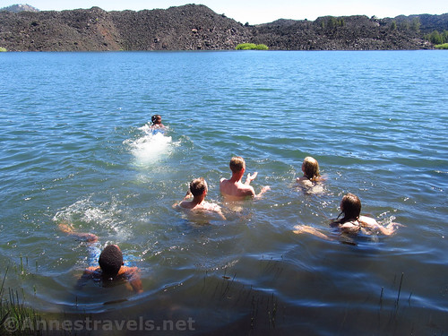
Swimming in Butte Lake
Have you ever wanted to swim in a lava flow? Not in the lava, I mean, but in water among the remains of the hardened lava rock?
It’s a big thing in Hawaii to swim or at least walk on the black cinder beaches, or to see the volcanic remains so close to the swimming areas. I’ve never personally been to Hawaii (making it one of the two US states I haven’t visited), but I have swum quite close to volcanic remains, in California last summer, in Butte Lake in Lassen Volcanic National Park. Others were kayaking or canoeing even closer than we were swimming. That would be an even better way to experience the lava flow, but swimming was pretty great.
Quick Stats
It’s also quite refreshing after hiking the trail to the Cinder Cone, which begins on the other side of the parking area from the lake.
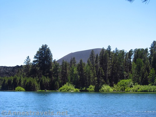
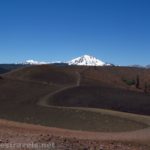
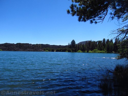
The Cinder Cone from the north shore of Butte Lake
To find a nice place to swim, from the parking area, walk along the north side of the lake. A path does lead in that general direction, though it’s pretty cindery and dusty.
There are several places for a dip. We finally found a secluded spot near the end of a promontory. The bank here was a step down and into the lake, which wasn’t either too muddy or too rocky for our tastes. A fallen log not too far away gave us a fun place to jump off (not dive; it’s not deep enough), even if it was a bit slippery.
To the south and east
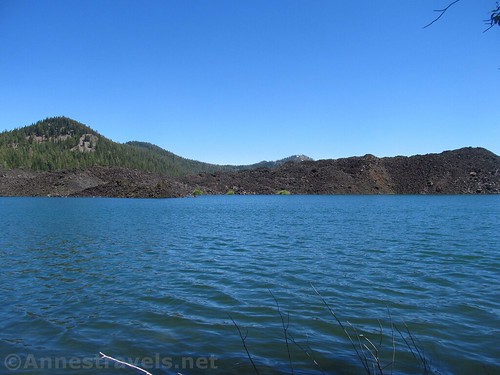
Across the lake rose a wall of the old lava flow, black and very rocky, and exceedingly volcanic. It was so cool, swimming there, and having the cindery flow so close by!
Overall? Swim at your own risk, but it worked pretty well for us, who just needed a place to swim after far too many sweaty hikes. And the view is great!
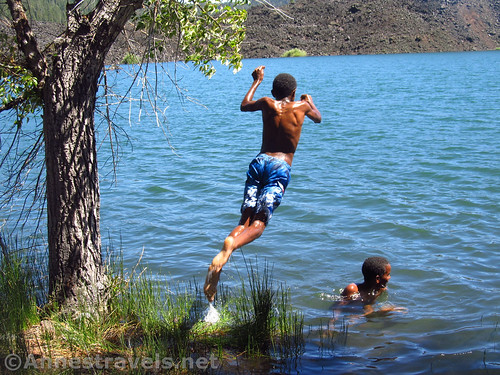
Jumping into Butte Lake (don’t worry; they didn’t land on each other)
Round Trip Length: About 0.25 miles, depending on how far you go to find the perfect swimming spot
Net Elevation Change: Negligible. You’ll have to get down to the lakeshore at some point.
Facilities: Restrooms (either full-service or pit toilets, depending on the time of year), picnic tables in the parking area, a campground up the road
Fees: $20/vehicle, valid 7 days. Lassen / Whiskeytown Annual and Federal Lands & Recreation Passes also accepted
Notes: The water was none too warm when I visited in early July after a very snowy winter. I would guess it’s warmer by the end of August. Also, it appears that Butte Lake is somewhat drained some times of year – or maybe it was just full because of snowmelt.
Trail 
Road
Signs
Scenery
Fun Factor
Ease of access / walking
Would I go 100 miles out of my way for this?
Overall Rating:
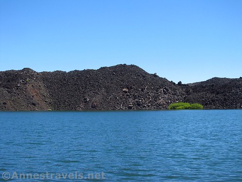
Closer up of the cinder fields
Key GPS Coordinates for Butte Lake
Butte Lake Parking Area: 40.5650590°, -121.3007960° (40°33.90354′, -121°18.04776′ / 40°33’54.2124″, -121°18’02.8656″)
General Trailhead: 40.5649590°, -121.3007710° (40°33.89754′, -121°18.04626′ / 40°33’53.8524″, -121°18’02.7756″)
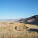
Views to the south and west across Butte Lake to the Cinder Cone
Getting to Butte Lake
From Manzanita Lake (main part of Lassen National Park), drive back down the road to CA-44 and turn right (east). Take CA-44E 13.5 miles, then turn right to continue on CA-44E, following signs for Susanville and Reno. After 11.0 miles, turn right onto Forest Road 32N21. A sign will indicate Butte Lake. After 6.6 miles, the road will end at the parking area; turning right will take you down to the boat launch and the trailhead for the Cinder Cone.
From Susanville, take CA-36W, up into the mountains. After about 5 miles, take the exit-like turn right on CA-44W. A small sign should indicate Redding and Mt. Shasta. Drive almost 35 miles to the left turn for Forest Road 32N21 and Butte Lake. Turn left. After 6.6 miles, the road will end at the parking area; turning right will take you down to the boat launch and the trailhead for the Cinder Cone.
Zoom map out to browse nearby hikes & places of interest
This Week’s Featured Product!
If Lassen National Park is your day hiking destination, check out this book for most of the existing trails in the park!
[forecast location=”Susanville, CA” caption=”Weather for Butte Lake” measurement=’F’ todaylabel=”Today” datelabel=”date(‘D M d’)” highlow=’%%high%%°/%%low%%°’ numdays=”5″ iconset=”Default”]