
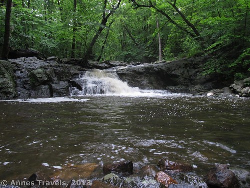
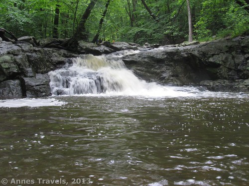
Buttermilk Falls in Mendham, New Jersey
On a hot day when there’s rain (but no thunder) in the forecast, it’s nice to stay near home and find a cool place to get wet, right? That’s why I visited Buttermilk Falls last week when I was visiting relatives in northern NJ over the 4th of July weekend. We figured we’d take a little stroll around the Buttermilk Falls Natural Area and India Brook Natural Area (in bathing suits so it wouldn’t matter if we got wet) and then wade in India Brook to get cool (and maybe even sit down and get really wet). As it turned out, the mine we wanted to walk to was a rather pathetic excuse for a destination, but Buttermilk Falls is lovely and the pool beneath the falls was also deep enough for real swimming, so it was a great place to hang out on a hot summer day!
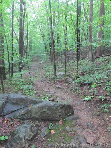
One of the trails – note the yellow blaze on the tree
We parked in the new parking lot (not visible on Google Maps yet) above the soccer fields near the old Seeing Eye breeding facilities. (The facility is closed and the buildings are not open to the public, but I suspect pets would still go crazy if they caught the scents of all the dogs that once lived here!) There are two ways from here to access the trails: out across the soccer fields, or down the hill to the left of the parking area (sort of behind the sign board – the sign board does have a map, but it’s pretty illegible due to fading). We took the left trail simply because it was mowed and easy to find. If you want to take the soccer field trail, head across the field, staying to the left of the soccer area. Over in the far left corner, a well-hidden trail goes into the woods. Two maps of the area could be found at http://hikemendham.org/media/ButtermilkFallsBlueWoodchip.pdf and http://hikemendham.org/media/IndiaBrook1MileLoop.pdf. (Note: the day I put up this post the site was having issues, so hopefully these links will continue to work in the future!) If the above links don’t work, here’s another: http://www.makkamappa.com/system/maps/228/large/Combs_Hollow_Buttermilk_Falls.PNG.jpg
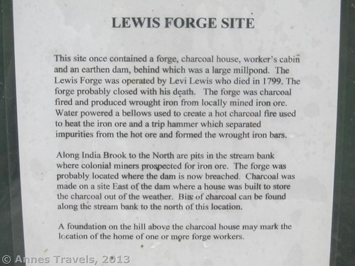
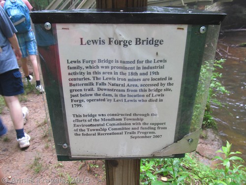
Sign about the Lewis Forge Site – click for larger photo
We headed off down the mown trail and entered the forest – even from up close, this forest entrance is easy to miss. However, it’s also easy to find because the trail goes straight to the entrance. The path quickly switchbacks down to the main trail along the India Brook. Heading slightly right at the trail junction, you will come to a sign that talks about the Lewis Forge, which once stood in this area. The funny thing about the sign is that the authors obviously knew very little about the forge, so the text is full of “likely”s, “probably”s, and the like. Still, it’s interesting, especially since you can see the remains of the earthen dam that once held the water used to power the forge.
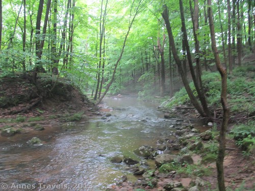
The Lewis Forge Site, as seen from upstream
We turned left down the trail, partially because we wanted a nice hike, and partially because we’d heard of an old mine entrance along the trail in this direction. We didn’t want to go into the mine (we didn’t have any flashlights with us, for one thing), but we did want to discover the entrance and take some pictures. Before long we came to a massive bridge over the brook. On closer inspection, however, the overkill metal turned out to be plastic! It’s still massive, just not as overkill as we first thought. After this, the trail continues to follow India Brook for a while, then turns away from the brook to climb out of the valley bottom. I found this section of the trail very pleasant (if hot and slightly buggy) simply because it was so green, still, and damp with the recent rain. After 0.5 miles (0.8 km), the trail finally breaks out of the woods into a grassy, bushy area and ends at a signboard. Turn left to go to the mine site.
Sign about the bridge near Lewis Forge
Fairly quickly, we came to another sign, and again we turned left. We knew we were looking for a “green trail”; a sign at the bridge explained that the trail to the mine was marked with green blazes. When we finally came to the mine trail junction, it wasn’t hard to miss: besides the sign, the green blazes had recently been repainted. The mine trail wound through the forest for about 0.1 miles (0.16 km) until – suddenly – it ended at…what? A pile of stones? The foundation of what had once been an ore terminal? Several depressions in the ground? Even though there was a sign about the mine, it wasn’t very impressive, especially since we’d seen much more impressive pictures on the internet. Oh, well, it was a nice hike; however, unless you’re in it for the hike, I don’t recommend going out of your way for this destination!
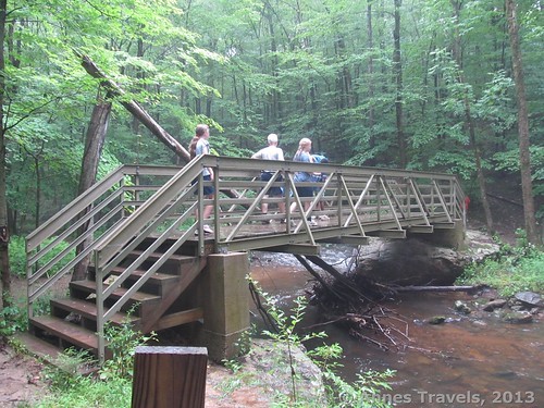
The bridge
We quickly retraced our steps back to the Lewis Forge Site. From the map, we’d been able to tell that Buttermilk Falls was downstream on the trail that follows India Brook. This was straight past the Lewis Forge Site; if you’re coming from the parking area this would be right (downstream). (I believe that you could also follow a trail on the other side of the brook and get to the waterfall; you could follow this trail by not recrossing the bridge.) Not long after, we passed a trail on our right that (we discovered later) goes up to the soccer fields. About 0.25 miles (0.4 km) from the Forge Site, we spotted a fire chimney perched on the edge of the brook; a few steps further and we could see the top of Buttermilk Falls itself. Swollen with the recent rain, it tumbled headlong down a series of cascades.
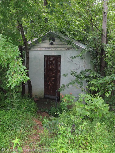
An old building near the two left turns on the trail
Now scrambling over rocks and boulders, we made our way down to the bottom of the falls. We were already dressed in bathing suits (we’d figured it would rain while we were hiking, so there was no sense in getting our both our clothes and bathing suites wet), so we pulled off our socks and shoes, slid into our water sandals, and splashed into the pool beneath Buttermilk Falls. The water was surprisingly cold, colder than Hacklebarny State Park where we’d gone wading the day before (no swimming allowed at Hacklebarney, per a sign in the parking lot). As we waded in, the bottom seemed to drop away and we suddenly found ourselves swimming – but as the pool isn’t more than about 20 feet (6 m) wide, we didn’t have to swim long before we hit the ledges next to the waterfall. The pool wasn’t more than 8 feet deep (2.5 m); it’s likely more shallow than this most of the time because the river was swollen due to an inordinate amount of recent rain.
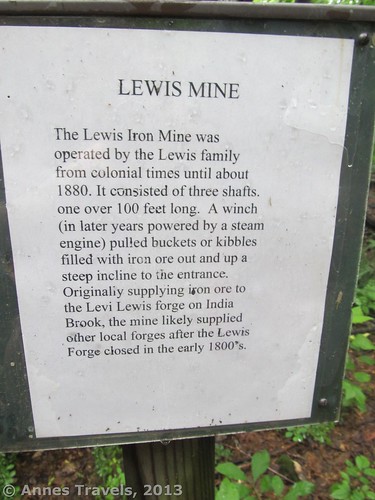
Sign about the Lewis Mine – click for larger image
We spent the next 30-50 minutes splashing around, dunking under the waterfall, and waving at a couple moms and their children who came to play in the brook above Buttermilk Falls (the only people we saw outside of the soccer fields). I found that if I stayed on the left (as you face the waterfall) side of the pool the bottom was sandy; over toward the right the bottom was rocky/stony. The rocks didn’t bother me too much because I was wearing sandals, but others were very thankful for the sand. I didn’t see any poison ivy in the area, but you should still be careful and on the lookout if you’re allergic. I guess the most important thing is that no one in my group broke out (and there are some of them who see poison ivy and begin itching!) Also, if you’re worried about whether or not you can legally swim in the pool, I won’t say that you can, but signs in the area don’t forbid it and mention that “generations of children” have enjoyed swimming under Buttermilk Falls. (This was to the consternation of my aunt, who grew up about 5 miles away, knew every place in the area there was to know, and had never heard of Buttermilk Falls!)
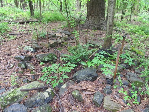
The old mine site – the exciting part of it
Return to your vehicle the way you came, or take the trail up to the soccer fields. It was a lovely way to spend a grey, hot day, and I’m sure I’ll be back another hot day to cool off!
Round Trip Trail Length: Going to Buttermilk Falls, maybe about 0.5 miles (0.8 km); going to the mine and Buttermilk Falls, around 1.5 miles (2.5 km) (I forgot my GPS that day)
Facilities: Port-a-Potty in the parking area; otherwise, none
Fees: None
Key GPS Coordinates for Buttermilk Falls Natural Area, NJ:
Parking Area: 40.801165, -74.623730 (+40° 48′ 4.19″, -74° 37′ 25.43″)
Getting to Buttermilk Falls Natural Area, NJ:
Buttermilk Falls
From I-80: Exit I-80 at Exit 28 and head south onto US-46. About a mile (1.6 km) from the I-80, continue onto NJ-10E for another 2.8 miles (4.5 km). Turn right onto canfield avenue for 0.4 miles (0.6 km); turn left onto Morris County Route 617/Sussex Turnpike and drive 0.5 miles (0.8 km). Take the second right onto Country Road 513S/Dover Chester Road. 1.5 miles (2.4 km) later, take a slight left onto South Road. In another 1.8 miles (2.8 km), turn left onto Ironia Road and drive 0.3 miles (0.4 km). A house and official-looking driveway will be on the left.
From US-206 in Chester: Turn east onto Main Street (Route 24) (this will be a right turn if you’re coming from the south and I-287; left if you’re coming from the north and Flanders). Drive 1 mile (1.6 km), then continue straight when the road changes names to Country Road 513/North Road. After another mile (1.6 km), turn right onto South Road; drive 2.1 miles (3.3 km), then turn onto Ironia Road for 0.3 miles (0.4 km). A house and official-looking driveway will be on the left.
Approximate Address of Parking Area (per Google Maps): 99 Ironia Road, Mendham, NJ 17945
Trail 
Road
Signs
Scenery
Would I go 100 miles out of my way for this?
Overall Rating:
This Week’s Featured Product!
This useful little book offers New Jersey hikers many different types of hikes. I’ve found it very helpful while looking for places to hike near relative’s homes. The hikes are organized by geographic region and also appear on a map of the state, so it’s fairly easy to choose one near where I want to be.
More Related Posts:
 Columbia Bike Trail: Beautiful Trail in Beautiful NJ
 Historic Flume Trail: Beartooth Highway Side Trip
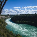 Devils Hole, Whirlpool, and Niagara Gorge Railroad Grade
 How to Visit the Golden Gate for Less
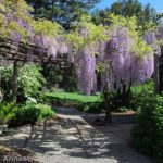 Willowwood Arboretum: One of the Nice Kind of Arboretums!
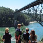 How to Visit the Deception Pass Bridge for Free
Pingback: Anne's Travels » Visiting High Point State Park, NJ, for Free
Pingback: Anne's Travels » How I Plan a Trip
Pingback: Anne's Travels » Top 10 Pages on Anne’s Travels in 2014
Pingback: The 12 Most Popular Pictures on Anne's Travels