
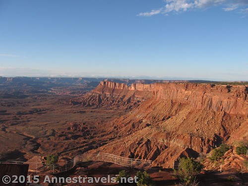
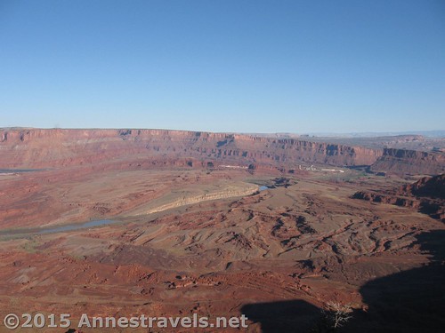
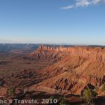
Views toward Dead Horse Point State Park from Canyonlands Overlook in Canyon Rims Recreation Area
Wow! It’s so hard to believe that it’s been 5 whole years since I started this blog. Yep, I started posting about my crazy adventures hiking the wilderness and not-so-wilderness of the US in March of 2010. Since then, we’ve traveled so far, shared so many memories, and began posting so many more pictures (would you believe that my first post originally didn’t include any pictures at all?!?) Over 265 posts later, I don’t think I’ve completely run out of material…yet…but to celebrate, I thought I’d repost my very first blog entry. It’s about a fun little wilderness park south of Moab, Utah called Canyon Rims Recreation Area. I’ll also post a whole lot more pictures than the original and add a few comments, too 🙂
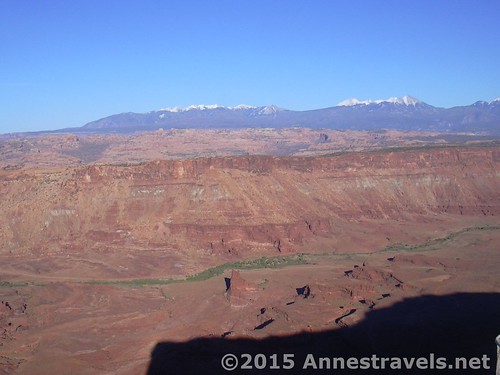
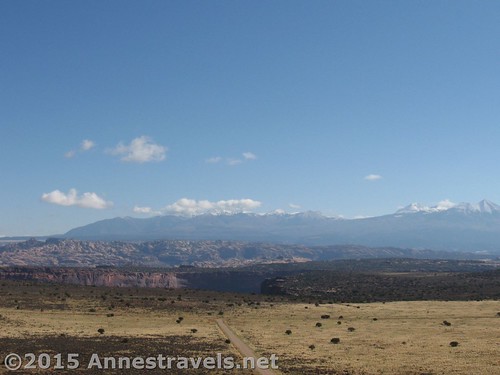
The La Sal Mountains from Anticline Overlook
Canyon Rims Recreation Area (now Canyon Rims Special Recreation Management Area) is a fairly small, fairly undeveloped park that overlooks Canyonlands National Park. It can be compared to Dead Horse State Park and Island in the Sky (Canyonlands National Park), but this is better than either one, offering stunning views of the Colorado and Green rivers and the heart of Canyonlands itself. (Canyon Rims also lacks the crowds of Canyonlands and Dead Horse State Park.) The park is located about thirty two miles south of Moab on Utah 191. (Six miles north of entrance to the Needles district of Canyonlands, and twenty miles north of Monticello on Utah 191.)
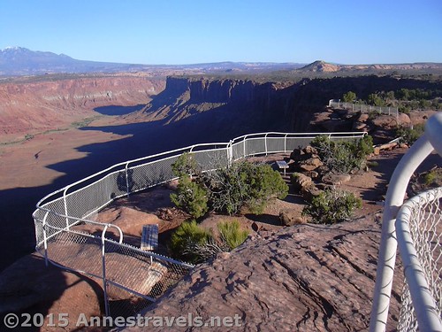
One of the viewing areas at Anticline Overlook
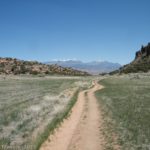
The road into Canyon Rims is paved, unlike many (ok, the rest) of the roads in the park. The rest of the roads are gravel, and which are readily accessible by a low clearance vehicle, although some sections of the road have quite a bit of washboard, which makes for slower driving, and a few roads are dirt and accessible only to those with 4×4. Follow the paved road past one of the campgrounds (Windwhistle Campground) and to a Y in the road. If you take the left fork, it will take you on a paved road to the Needles Overlook.
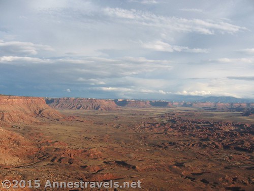
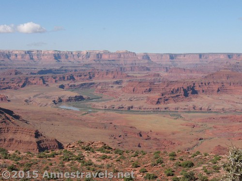
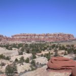
Views toward the Needles District of Canyonlands National Park from the Needles Overlook
This is a spectacular overlook with a paved parking lot, port-a-potties, and a picnic area overlooking the Needles District of Canyonlands. It also has some nice trails that take you around the edge of the canyon, giving you a very nice view of the needles and the rest of that part of the canyon. It’s totally spectacular, especially around sunset. One word of caution is that there are also a lot of steep drop offs at this overlook, with only a fence to keep you away from the edge—somehow those fences look awfully flimsy on the edge of such a drop!
Sunset at Needles Overlook – the fences, as sturdy as they are, look pretty flimsy on the edge of the dropoff!
If you go back and take the right fork of the road, it goes down a good gravel road to some other overlooks. The first road off the main dirt road is on the right and goes to Hatch Point Campground (which is pretty primitive by national park standards, but not too terrible if you like the security of sleeping in a campground).
The road to Miner Overlook from the top of the butte. The La Sal Mountains are on the horizon.
The next road off the main road is on the left and goes to Canyonlands Overlook. This road in not as good as the main road, and is likely to be impassable to two wheel drive low clearance vehicles. We made it most of the way down the road in a two-wheel-drive high-clearance van, but about a mile from the end of the road, the road became impassible to two wheel drive vehicles, so we walked the last mile to the overlook.
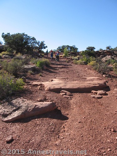
The road to Canyonlands Overlook…we decided walking was safer than driving!
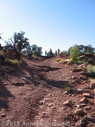
Another picture of the road to Canyonlands Overlook…
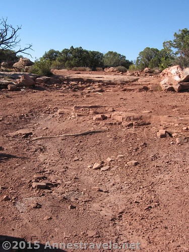
And even more pictures of the road to Canyonlands Overlook!
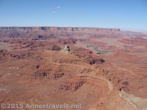
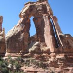
Even though it is a bad road, if you can make it out to the overlook you will be rewarded with one of the most beautiful views in the entire park (which I still agree with!). The view allows you to see all the way from The Needles in the south to Island in the Sky to the north and The Maze to the west. You can also see further north beyond Island in the Sky, and if you look a little bit to the northwest you can see Dead Horse Point State Park. This overlook does not have any fences around the edges of the canyon, and it is a very long way down. The only facility at the end of this road is a small dirt parking area and a port-a-potty.
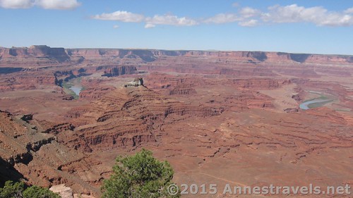
Views from near the road before arriving at Canyonlands Overlook – we’re looking into Dead Horse Point State Park from the other side of the canyon.
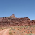
The next overlook off the main road is on the left and goes to Miner Overlook. This overlook is a road that goes to the edge of the canyon and loops around a butte and gives more nice views of a part of the canyon that looks more like the Grand Canyon. It’s a great little stop with some really rewarding views. If you climb (scramble) up onto the top of the butte that the road circles, you can look east and have a nice view of the La Sal Mountains and other rock formations to the east.
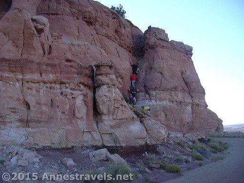
Scrambling up the butte at Miner Overlook
The next marked road off the main road is on the right and goes to Trough Springs, which is a hiking trial (a hiking trial? No court of law here!) trail that descends into Kane Creek Canyon on an old cattle road. It is 2.5 miles long and descends 1100 feet.
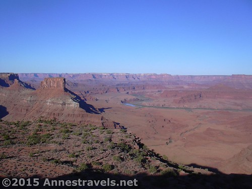
Views from on top of the butte at Miner Overlook
At the end of the main road is Anticline Overlook. This overlook gives you a look at beautiful views of a different part of the canyon that has different rock formations than at the other end of the canyon. It is a must-do for anyone who likes crazy roads: from the overlook we saw ATVs and jeeps going up and down a road that would give an engineer the shivers (and certainly inspired the aspiring engineers in the group!). It twists and turns, and eventually crosses a butte. You can also see the potash plant that is on the other side of Moab, and there are some educational signs about the forming of the canyon and how potash is made. Anticline Overlook also has picnic tables and port-a-potties at it.
The view toward Potash from Anticline Overlook
Canyon Rims Recreation Area is not very well known, but it is a must do for anyone traveling between Moab and Monticello—the views won’t let you down.
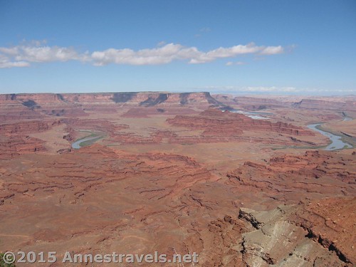
Views from near the road on the way to Canyonlands Overlook
Entrance Fee: None
Open: All year
Closed: Some of the dirt roads may be impassible after it rains
Camping: The park has two campgrounds, one on the paved road and one on the unpaved part of the road. Fees are $12/night (3/10) (now they’re up to $15/night), and both campgrounds have toilets, water (mid-April through late-September), and picnic tables. Windwhistle campground has 15 sites, Hatch Point, 10.
Lodging: None. The closest lodging is in Monticello, over 20 miles away.
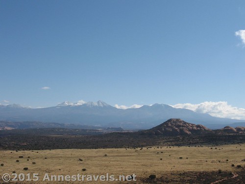
The La Sal Mountains from the top of the butte over Miner Overlook
And now for some little gadgets I’ve added over the years…
Road 
Signs
Scenery
Would I go 100 miles out of my way for this?
Overall Rating:
Zoom map out to browse nearby hikes & places of interest
Views from Miner Overlook
This Week’s Featured Product!
Love scenic drives? This book covers 25 itineraries through (what I would consider) some of the most extraordinary scenery in the US.

Pingback: 15 of the Best Day Hikes in Southern Utah - Anne's Travels
Pingback: Alternate Views of Famous American Wilderness Areas
Pingback: The Top 15 Pages on Anne's Travels in 2016 - Anne's Travels
Pingback: Out of the Creativity of God's Heart - Anne's Travels