
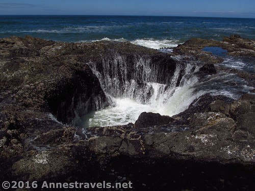
Thor’s Well at Cape Perpetua about 30 minutes after high tide
If you’re going to visit just one beach in Oregon, I highly recommend it be Cape Perpetua. Why? Well, it’s already overrun, so one more visitor (or ten more visitors) won’t make much difference. Second, you get bragging rights to say that you’ve personally seen Thor’s Well, which is often spectacularly portrayed by aspiring photographers. And third, you can explore old lava flows, tide pools, and nearby forests and see sea life, incredible waves and volcanic oddities, and a truly inspiring view from the top of a headland. And all of that in less than 4 miles of hiking. Can you see why I loved visiting this place?
Quick Stats
Waves along the old lava flow near Thor’s Well
We began our visit very, very early one misty morning in August (living on Eastern Time and visiting Oregon has its perks, like beating out the crowds!) From the parking area, take the crosswalk across the road, then follow the paved trail downward past the old CCC camp to the tunnel under US-101 (thank you – I appreciate not having to dodge traffic!)
The mist begins to clear
On the other side of the highway, turn left (I recommend doing this first, but of course you can turn right if you want – we’ll get to that later) to walk down the paved pathway to the Spouting Horn Overlook, about 0.4 miles from the trailhead. I hear that in stormy weather the water comes up through the horn and spouts impressively, but that day it wasn’t even glubbing, so it was unimpressive to say the least.
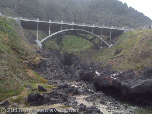
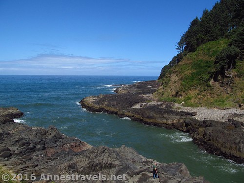
Perhaps the most impressive thing about the Spouting Horn Overlook at low tide is the US-101 bridge
From near the Spouting Horn Overlook – and no one will tell you this – drop down off the pavement to walk across the old lava flow to Thor’s Well (the place with a whole lot of people standing around looking down past their feet). I’d guess the reason the Well is so well hidden is that, first, you can’t see it until you’re on top of it, and second, it’s so dangerous – there’s nothing to keep someone from falling in. So keep your distance, and if the waves are even looking like they might possibly, on some crazy whim, come up over the rocks, just stay far, far, far away, ok?
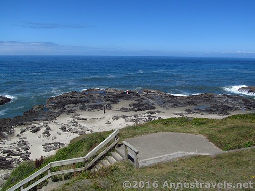
Looking down from the Spouting Horn Overlook – Thor’s Well is where all those specks of people are standing around
The day we visited, the weather was less than stormy, and the tides were fairly low, so we really weren’t in much danger. We came back at high tide and really enjoyed watching the Well glub and swish as the tide rushed in to fill it, then sucked itself out again, leaving the water streaming off of the sea life attached to the sides of the Well. The Well itself is part of an old lava tube. Part of the roof collapsed, but the tube still goes out into the sea and so water can flow in and out of it at will – pretty neat!
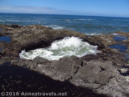
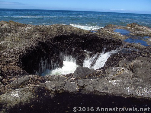
Thor’s Well is pretty unimpressive at low tide
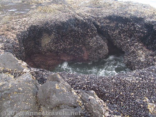
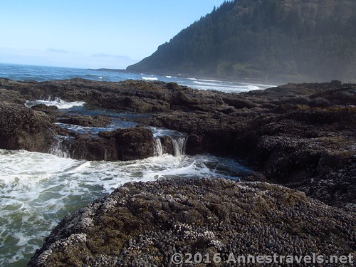
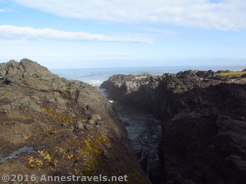
Because it was low tide, we wandered around for a bit looking at the tide pools in the old lava flow. That was really cool, especially the canyons through the rock where the waves serge in, then out again, often with impressive spray as the waves hit the volcanic walls. Some of the tide pools “glub” as water rushes in from some under-rock source – that was pretty cool! The sea life in the tide pools was also fascinating.
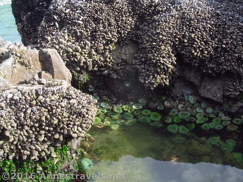
Tide pools
After wandering around for a bit, we walked back up to the tunnel under the highway again (by the way, there is more than one way up back to the paved path, so you don’t necessarily have to retrace your steps the whole way). By this time we’d walked about 1.75 miles, and that we quite a bit of exploring, and (oh hurray!) the sun had broken through the mist. We bypassed the tunnel and continued straight (what would be right if you’re coming out of the tunnel).
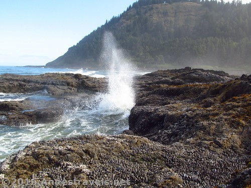
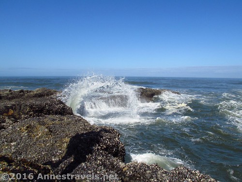
A wave hits the lava flow
From an overlook not far along the trail, we ended up seeing what none of the eight of us have ever seen, even with all our visits to both the Atlantic and Pacific Oceans: We saw our very first whale in the wild, spouting as it came up for air! Oh, how exciting was that!?!
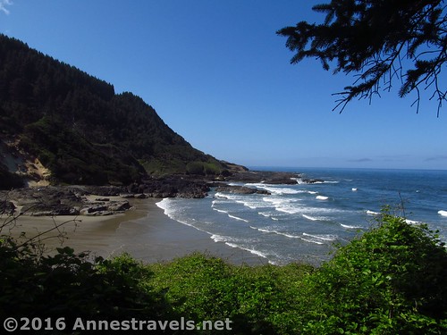
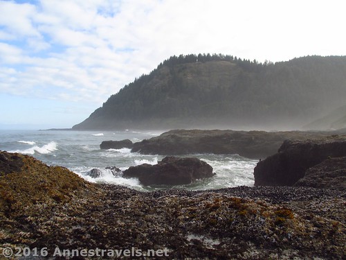
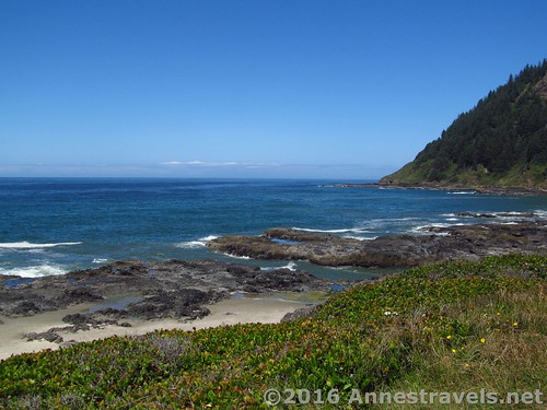
Cove Beach
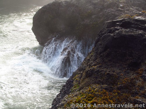
Continuing along the trail, we bypassed the Cove Beach Trail and continued along to the Churn, which is down about a quarter mile of stairs (that trail is steep!) and about 0.75 miles from the tunnel under the highway. But the views are worth it – waves rush into a volcanic chasm, then shoot upward as they encounter the sides and end of the Churn. And the water certainly does churn!
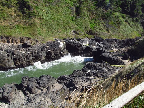
A picture of The Churn that really doesn’t capture how interesting it is to watch
As we sat nearby, eating lunch and enjoying the show, a seal poked its head up and observed the phenomena for a bit before swimming back out to sea.
The entrance to the Churn
We walked back to enjoy Thor’s Well at high tide (the Well is definitely best in the hour following high tide), then drove up to the top of the nearby headland to take in the view from above… but that’s the topic of another post!
Water drains off the lava flow after being struck by a wave
Round Trip Trail Length: I hiked a total of 3.75 miles; you could do it in much less (probably see Thor’s Well and the Churn in around 2.5 miles)
Net Elevation Change: 148ft. (153ft. at the parking area to 5ft. near the tide pools)
Facilities: Restrooms at both the visitor center and the “parking area” sort of near the Churn; visitor information at the visitor center; picnic area atop the headland
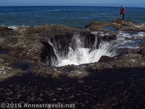
Thor’s Well around high tide
Fees: $5 per day; Northwest Forest Passes & Interagency Passes also accepted (Note – this is enforced. I had written our information on a fee envelope and left it in the windshield, but apparently they didn’t see it because they very kindly left us another fee envelope under our windshield wiper. Sigh.)
Trail Notes: Be extremely careful with the ocean – waves can come up at any time and wash you right off the rock (which would be fatal, by the way). Also be careful on the uneven rocks around the tide pools and Churn. The trails in the area are almost all paved, so that makes for easier walking.
Water rushes back into the sea
Trail 
Road
Signs
Scenery
Would I go 100 miles out of my way for this?
Overall Rating:
The lava flow at high tide
Key GPS Coordinates for Cape Perpetua
Cape Perpetua Parking: 44.28038N / -124.10809W (44° 16′ 49.3680″ / -124° 6′ 29.1240″) (8ft.)
Trail beginning: 44.28083N / -124.10854W (44° 16′ 50.9880″ / -124° 6′ 30.7440″) (153ft.) (0.0; ended 3.75)
CCC camp: 44.28001N / -124.10870W (44° 16′ 48.0354″ / -124° 6′ 31.3194″) (104ft.) (500ft.)
Horn Overlook: 44.27789N / -124.11259W (44° 16′ 40.4034″ / -124° 6′ 45.3234″) (56ft.) (0.4)
Thor’s Well: 44.27845N / -124.11346W (44° 16′ 42.4194″ / -124° 6′ 48.4560″) (12ft.) (0.55)
Thor’s Well fills with water…
Spout Hole in a Tide Pool: 44.27980N / -124.11237W (44° 16′ 47.2800″ / -124° 6′ 44.5314″) (5ft.) (0.92)
Trail Up from Beach: 44.27948N / -124.11170W (44° 16′ 46.1274″ / -124° 6′ 42.1194″) (22ft.) (1.05)
Trail under the highway / trail split: 44.27964N / -124.10989W (44° 16′ 46.7040″ / -124° 6′ 35.6034″) (74ft.) (1.17) (return 3.57)
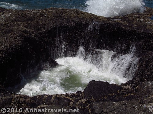
…then the water is sucked out…
Cove Beach Trail Junction: 44.28191N / -124.10854W (44° 16′ 54.8760″ / -124° 6′ 30.7440″) (38ft.) (1.51)
Up to Parking: 44.28291N / -124.10992W (44° 16′ 58.4760″ / -124° 6′ 35.7120″) (45ft.) (1.66; return 2.40)
Churn: 44.28408N / -124.11102W (44° 17′ 2.6880″ / -124° 6′ 39.6714″) (19ft.) (1.87; left 2.01)
Upper Viewpoint: 44.28388N / -124.11114W (44° 17′ 1.9680″ / -124° 6′ 40.1040″) (98ft.) (2.08)
Churn Trail: 44.28152N / -124.10902W (44° 16′ 53.4720″ / -124° 6′ 32.4720″) (99ft.) (2.59)
…and the water rushing out leaves streams of water flowing down the sides of the Well. Pretty cool, huh?
The gpx file for this part of Cape Perpetua & Thor’s Well can be downloaded – please note that this and the GPS Coordinates are for reference only and should not be used as a sole resource when hiking this trail.
Download GPS File size: 109.2 KB Downloaded 112 times
(Note: I do my best to ensure that all downloads, the webpage, etc. are virus-free and accurate; however, I cannot be held responsible for any damage that might result, including but not limited to loss of data, damages to hardware, harm to users, from use of files, information, etc. from this website. Thanks!)
A chasm in the lava flow
Getting to Cape Perpetua
From Yachats, OR, drive south on US-101S about 3 miles. Turn left near the sign for the Cape Perpetua Visitor Center. Drive up the road 0.25 miles, then turn right to enter the parking area.
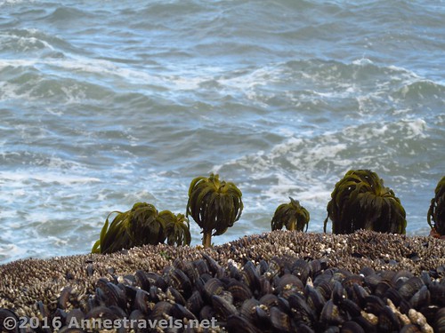
An interesting perspective on the sea life that lives on the old lava flow
Or from Florence, OR, drive north on US-101N 22 miles. Turn right near the sign for the Cape Perpetua Visitor Center. Drive up the road 0.25 miles, then turn right to enter the parking area.
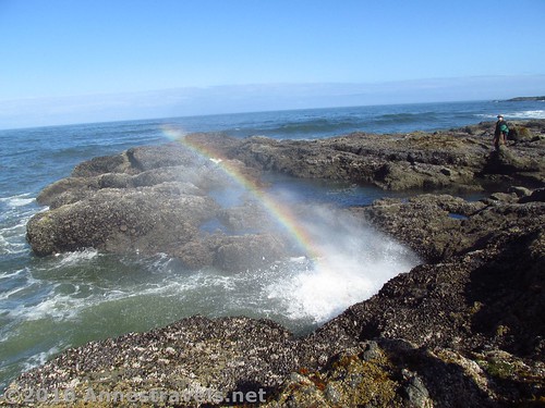
A rainbow in the waves
Note: This parking area will fill up quickly; more parking is available back north up the road nearer to the Churn.
Zoom map out to browse nearby hikes & places of interest
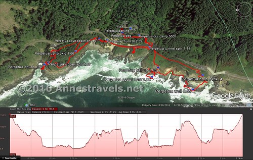
Visual trail map of my trek around Cape Perpetua, from Thor’s Well (right) to the Churn (left)
This Week’s Featured Product!
If you want a book about hiking the Oregon Coast, look no further! This guide covers 120 hikes along the Oregon Coastline, from the Columbia River to hikes just north of California, including both day hikes and multi-day treks.
More Related Posts:
 The Natural Bridges of Samuel H. Boardman
 Floras Lake Beach – An Sand Beach with English Cliffs
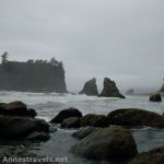 Sea Stacks, Sea Arches, & Wilderness on Ruby Beach
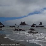 Hiking Third Beach to Strawberry Point: Rain Forests and Sea Stacks
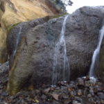 Hug Point: Wayside Beach with a Waterfall & Sea Cave
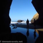 Exploring the Punchbowl: Above and Within
Pingback: Sneak Peak: A Land of Volcanos and Oceans - Anne's Travels
Pingback: Incredible Coastal Views from Cape Perpetua's Stone Shelter - Anne's Travels
Pingback: Out of the Creativity of God's Heart - Anne's Travels