
The Tillamook Head Light, views accessible from the Clatsop Loop Trail
The Clatsop Loop Trail in Ecola State Park, Oregon, is certainly a trail of diversity. Starting out are views of surfers on the nearby beach, with sea stacks a short distance away. Then the hike winds upward through a true rain forest to a semi-modern hiker’s camp. A side trail takes you to views of the ocean and an old lighthouse (which for a while was used as a columbarium) and some old WWII-era bunkers. Finish off the loop by walking down an old road through the rain forest, and you have yourself a hike that may not have the most glorious views on the planet, but one you won’t quickly forget.
Quick Stats for the Clatsop Loop
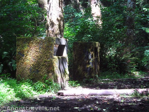
Moss-covered ventilation ports in the bunker
The only reason I hiked the trail (well, besides the WWII bunkers) was because we could get credit for it as part of the Fort Clatsop Junior Ranger booklet – we downloaded the books off the internet and had them half completed by the time we got to the fort (that’s what I call both extremely educational and time-efficient!) Still, I enjoyed the hike as a hike in itself, and it was worth the $5 entrance fee (waived only with passes that cover Oregon state parks, aka not covered by the America the Beautiful passes).
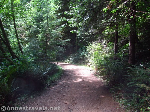
Road / trail through the rain forest
The trail begins as a wide track near the signboards above Indian Beach (the parking area is the same as for the beach). About 400ft. from the signboard, the trail will split (or more like it, a somewhat non-descript path goes off to the left while the wide trail / road continues straight). We opted to turn left on the path (technically doing the loop backwards) for a couple reasons: First and foremost, it meant that we’d be hiking more steeply upward, then taking the less-steep road back down (easier on the knees), and secondly, most of the people ahead of us were heading up the road, so we figured we’d get a little privacy going left (it worked out pretty well, too).
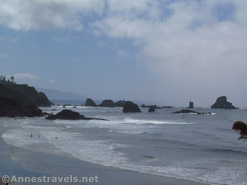
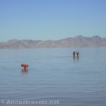
Views over Indian Beach
At 0.1 miles, a viewpoint allows for views over Indian Beach. Pause here to enjoy the view; it really is quite nice. A bit further up, the views are even more stunning of the nearby headlands.
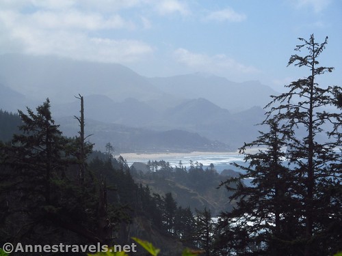
Views across the nearby headlands further up the trail
From here, the trail begins climbing upward through spruce trees and occasional low bushes with views out to the ocean. The forest sections are definitely rain forests; in many ways, they’re better than what I’ve found further north in, say, the Hoh Rain Forest in Olympic National Park (my current data point for the best rain forest I’ve been in – I think it’s diminished in recent years due to over visitation, though). It’s kind of cool to walk through all the moss and ferns and undiminished greenery everywhere.
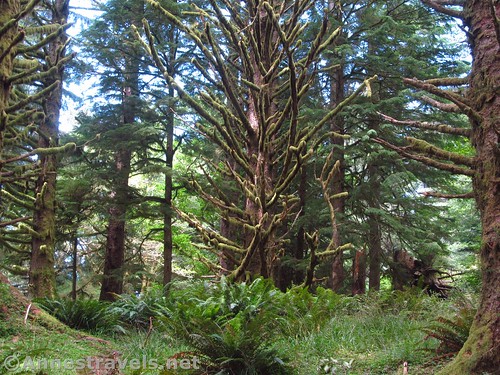
Rain forest around the Clatsop Loop Trail
At 1.5 miles from the parking area, the trail splits 4 ways. Turn left for now; a tenth of a mile later you’ll come across the hiker camp (a few cabins and a small shelter, all made of wood). I haven’t heard that they are left over from the military occupation of the headland, but it would make sense.
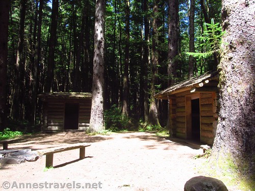
The Hiker’s Camp
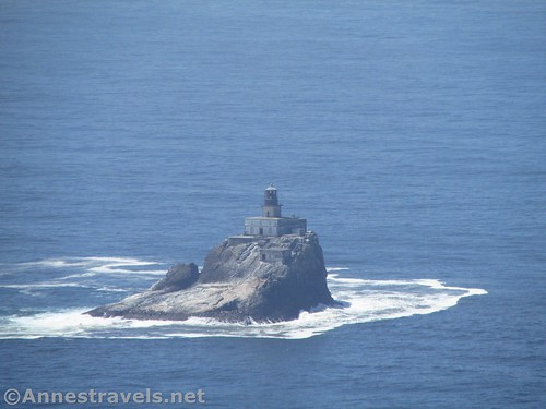
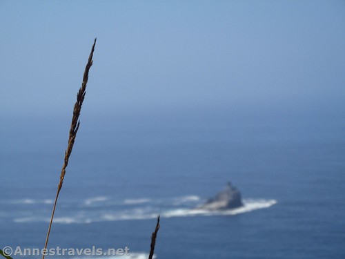
Continue down the trail (which becomes more and more social – be ready for mud and tree roots) another 0.2 miles to the viewpoint out toward the Tillamook Head Lighthouse, which sits about 1.2 miles offshore.
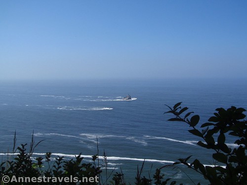
This is about how close the lighthouse really is. You might want to bring binoculars…
Constructed in 1880, the 62-ft. tall lighthouse was the most expensive built on the West Coast. Storms constantly took its toll on the lighthouse, and lighthouse keepers regularly complained of its lonely location (earning it the name “Terrible Tilly”). In 1934, a severe storm with 109mph winds launched boulders and debris into the tower, destroying the lens and flooding the lantern room. All communication between the keeper and shore were severed until the keeper built a makeshift radio using the damaged foghorn and telephone. Although the lighthouse was repaired and updated, it was shut down in 1957 and replaced with a whistle buoy. A few years later, it was sold to a group of investors who created the Eternity at Sea Columbarium. Only 30 urns were interred before the group’s license was revoked. Today it’s mostly home to nesting birds.
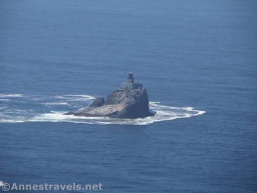
Tillamook Head Light, full zoom on my camera
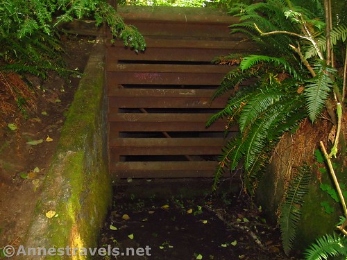
We hung out for a bit here to have a snack, then set out to find the WWII-era anti-aircraft bunkers. It wasn’t difficult, except that everything is so covered in moss it was hard to see! Basically, just walk back up the path and take one of the social trails on the south (right if you’re returning to the hiker’s camp) side of the trail – you’ll find them. Actually, I ended up walking on top of one without even seeing it until I found the air / gun holes. That was a slight shock. They’re well hidden, all right.

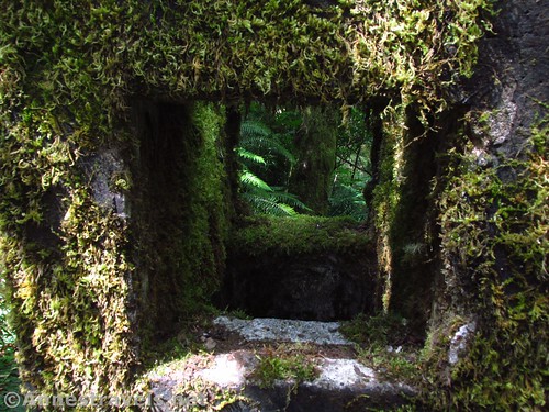
The entrance is much harder to miss on the way back
After enjoying exploring (don’t go inside; they’re gated off), head back to the four-way trail split. Near the primitive restroom, start walking downhill on what is obviously an old road. The road winds its way through the rain forest at a good slope. About 1.3 miles later, arrive back at the parking area.
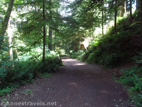
The trail / road back down to the parking area
Overall, I really enjoyed the hike, especially since it was short! We then drove over to the picnic area for dinner, but took some time out to hike all the Ecola Head trails that weren’t closed. I’d guess you used to be able to see something, but now, everything is pretty much closed…
Artsy picture of the Tillamook Head Light
Round Trip Trail Length: About 3.4 miles
Elevation Change: 737ft. (26ft. at the junction of the loop trails to 763ft. at the Hiker’s Camp)
Facilities: Primitive restrooms near the Hiker’s Camp (actually right at the trail split) and at Indian Beach.
Fees: $5 per day, waived by the Oregon State Parks pass (not covered by America the Beautiful or national forest passes)
Trail Notes: The road is in much better condition than the path, which can be narrow and winding. Still, they both offer a great rain forest experience, and the trail has some nice views of the surrounding area (sea stacks, headlands, ocean, etc.). Be sure to stay out of the WWII bunker. The view to Tillamook Light makes the trail have a destination – something I find my group needs…
Old entrance to the WWII era bunker
Trail 
Road
Signs
Scenery
Would I go 100 miles out of my way for this?
Overall Rating:
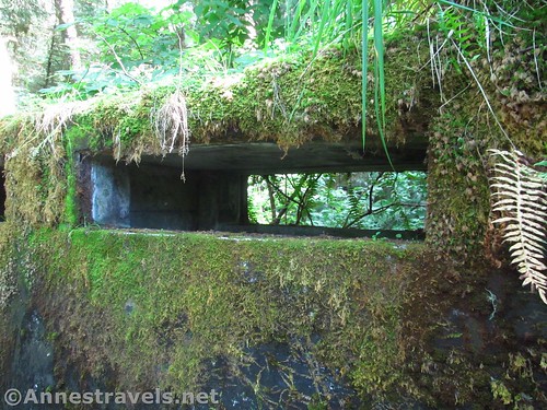
Moss-covered ventilation port on the bunker
Key GPS Coordinates for the Clatsop Loop Trail
Indian Beach / Clatsop Loop Parking: 45.93112N / -123.97640W (45° 55′ 52.0314″ / -123° 58′ 35.0394″) (36ft.)
Trail beginning: 45.93110N / -123.97848W (45° 55′ 51.9600″ / -123° 58′ 42.5280″) (29ft.) (0.0; ended 3.47)
Loop Trail Junction: 45.93171N / -123.97902W (45° 55′ 54.1560″ / -123° 58′ 44.4720″) (26ft.) (400ft.; return 3.4)
Viewpoint #1: 45.93124N / -123.97932W (45° 55′ 52.4640″ / -123° 58′ 45.5520″) (42ft.) (0.12)
Viewpoint Junction: 45.94277N / -123.98460W (45° 56′ 33.9720″ / -123° 59′ 4.5600″) (749ft.) (1.5)
Camp: 45.94272N / -123.98515W (45° 56′ 33.7920″ / -123° 59′ 6.5400″) (763ft.) (1.6)
Tillamook Head Lightouse Viewpoint: 45.94222N / -123.98780W (45° 56′ 31.9914″ / -123° 59′ 16.0794″) (678ft.) (1.80)
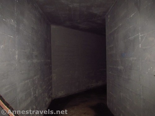
We wanted to see what the inside of the bunker looked like, so we poked the camera lens through the grate…
The gpx file for the Clatsop Loop Trail can be downloaded – please note that this and the GPS Coordinates are for reference only and should not be used as a sole resource when hiking this trail.
Download GPX File size: 73.2 KB Downloaded 227 times
(Note: I do my best to ensure that all downloads, the webpage, etc. are virus-free and accurate; however, I cannot be held responsible for any damage that might result, including but not limited to loss of data, damages to hardware, harm to users, from use of files, information, etc. from this website. Thanks!)
Mossy concrete on the bunker
Getting to the Clatsop Loop Trail
From Seaside, OR, drive south on US-101S about 7 miles. Take the exit toward N Alt Route Hwy 101 / Fir Street (the exit is also signed for Ecola State Park). Merge onto the road at the bottom of the ramp. After 0.1 miles, turn right onto E 5th Street. Another 0.1 miles later, take a slight right onto Ecola State Park Road (well signed for Ecola State Park). After 1.7 miles, turn right to bypass Ecola Head and continue toward Indian Beach. The trailhead is only 1.4 miles away, but it feels much more because the paved road is very narrow, winding, and dark in the rain forest. Strategically placed pullouts may be necessary for passing oncoming vehicles.
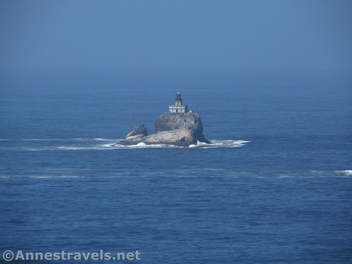
Full-zoom of the Tillamook Head Light from along the lower reaches of the Clatsop Loop Trail
From the south, exit US-101N by turning right, following the signs for Cannon Beach and Ecola State Park. After 0.4 miles, turn right onto S Hemlock Street for 0.8 miles. After the curve in the road, turn left onto N Spruce Street for 150ft., then turn right onto E 3rd Street. The road will curve and become Elm Avenue / Fir Street. After 0.2 miles, turn left onto E 5th Street for 0.1 miles; take a slight right toward Ecola State Park and follow the directions above to Indian Beach.
Zoom map out to browse nearby hikes & places of interest
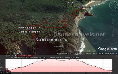
Visual trail map of the Clatsop Loop Trail (note that the trailhead is at the far end of this map)
This Week’s Featured Product!
For even more hikes in general area and along the Oregon coast, check out this book by a local author.


Thanks for a great informative post! I write mysteries set on public lands so I’m always looking for new locations with interesting features, and I can actually drive to this one.
Pingback: Sneak Peak: A Land of Volcanos and Oceans - Anne's Travels