
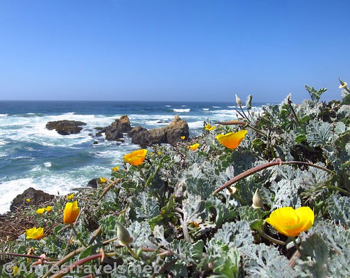
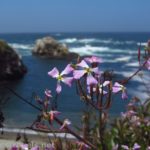
California poppies and sea stacks along the trail
If you want a rustic, realistic coastal trail experience near Fort Bragg (or want a more natural, realistic walk from Glass Beach), I highly recommend the near-social trail that extends north from Glass Beach along the bluff tops to the Pudding Creek Trestle. Or, you can park at the trestle and then walk down to Glass Beach. Either way, it’s a natural, rustic walk, and oh, so beautiful!
Quick Stats for Glass Beach Trail (North)
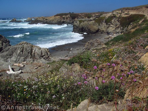
Wildflowers and cliffs
Beginning at the Glass Beach Trailhead, take the right (narrow) fork of the trail down to a bluff-top viewpoint. Turn right and locate the near social trail that wanders off to the north along the top of the cliffs. There may be a trail marker.
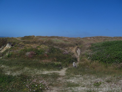
Near the beginning, and an example of the multiple trails that all end up in mostly the same place, eventually
I should probably say here that this trail is not for the faint of heart. The trail is eroded in places, and while people have made new trails around the danger zones, you still need to pick and choose your trail so as to have the best views of the ocean, cliffs, bluffs, and coves, but still are not dangerously close to the edge. If it’s just too much, a trail does go further inland, quite safe. The funny thing is that if you follow the signs, this would be the “Easy” trail, while the paved trail to the south is the “Hard” trail!
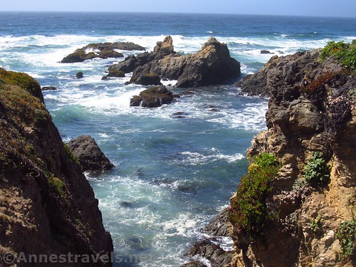
Looking through a rift in the cliff to sea stacks
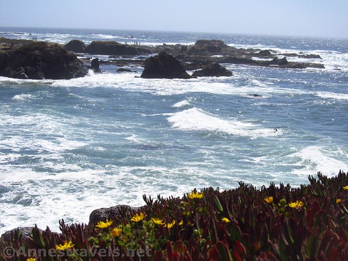
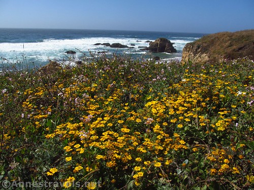
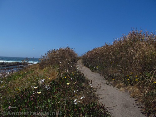
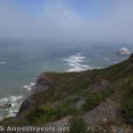
Make your way along the tops of cliffs. I couldn’t stop taking pictures. The swaths of greenery atop the headlands, the wildflowers, the yellow cliffs, the blue-green water, it was all so incredible, so outside of my experience!

Swathed in greenery and wildflowers
Below, a number of coves are picturesque, especially since they are hard to get to without a boat, perhaps impossible. In the midafternoon, with a summer sun angling down, heading north is just so beautiful!
Looking back toward Glass Beach
At last the trail, which has been twisting and turning to go around one headland after another, turns east, inland, along the top of a high cliff. Below, I could see swimmers on the beach. It must have been warmer down there; they didn’t look too cold, and I was very thankful for both my jackets on the clifftop!
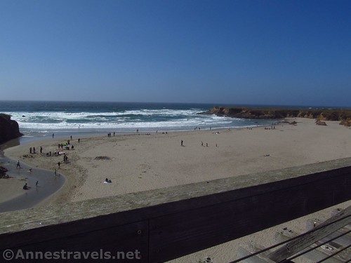
Visitors enjoying the beach below the Pudding Creek Trestle
A short distance later, the trail ended at a parking area. To the left is the Pudding Creek Trestle, first constructed for trains to carry logs to market. Later, it was converted for truck travel (logging trucks in those days were too big and heavy for normal roads). It was restored more recently with wood from another trestle, further inland.
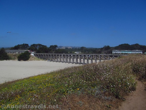
Approaching the trestle along the coastal trail
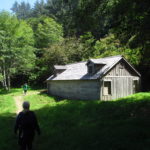
Crossing the Pudding Creek Trestle, you can access MacKerricher State Park and its hiking trails. But since more than half our (sleep deprived) group had stayed behind to make supper, the two remaining intrepid hikers decided we had gone far enough. So we went back along the more inland trails, through the waving grasses with what looked like summer homes just away across the headland.
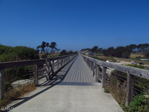
About to cross the trestle
Overall? So beautiful! If the glass on the beach wasn’t enough, this made the park outstanding in my mind!
Corn daisies and seaside daisies along the trail
Round Trip Trail Length: About 2.5 miles, depending on what trail you take. You can also do it as a 1.25 mile shuttle.
Net Elevation Change: About 30ft. The Pudding Creek Trestle is about 43ft. above sea level, the trail dips to nearly the beach near Glass Beach, proper.
Facilities: Restrooms in the Glass Beach parking area; picnic tables on the opposite end of the parking area from the restrooms; other facilities available in Fort Bragg
Fees: None
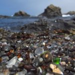
Trail Notes: Because of size constraints, no RVs are allowed in the parking area for Glass Beach. Do not collect or remove glass (obvious, but I have to say it). Overall one of the nicest coastal trails I’ve done in California (other than Point Arena-Stornetta!)
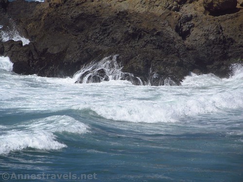
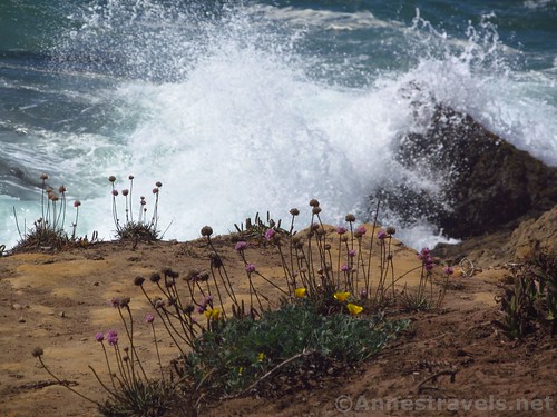
Waves crash on the cliffs
Key GPS Coordinates for the Coastal Trail South of Glass Beach
Trailhead: 39.4519306°N, -123.8109583°W (39°27’6.95″N, -123°48’39.45″W (39°27.11583’N, -123°48.65750’W) (22ft.) (0.0; ended 4.2 overall)
Trail Junction #1: 39.4519639°N, -123.8112611°W (39°27’7.07″N, -123°48’40.54″W / 39°27.11783’N, -123°48.67567’W) (30ft.) (109ft.)
Viewpoint #1: 39.4526917°N, -123.8133639°W (39°27’9.69″N, -123°48’48.11″W / 39°27.16150’N, -123°48.80183’W) (17ft.) (0.16)
Trestle Beginning: 39.4580083°N, -123.8078528°W (39°27’28.83″N, -123°48’28.27″W / 39°27.48050’N, -123°48.47117’W) (43ft.) (3.1)
Trestle End: 39.4594694°N, -123.8072333°W (39°27’34.09″N, -123°48’26.04″W / 39°27.56817’N, -123°48.43400’W) (42ft.) (3.3)
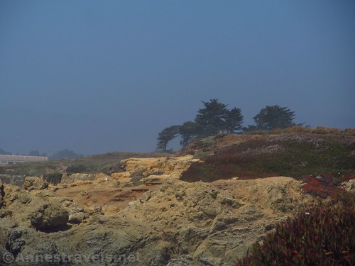
Misty views from the trail
The gpx file for Glass Beach and surrounding trails can be downloaded – please note that this and the GPS Coordinates are for reference only and should not be used as a sole resource when hiking this trail.
Download GPX File size: 79.0 KB Downloaded 68 times
(Note: I do my best to ensure that all downloads, the webpage, etc. are virus-free and accurate; however, I cannot be held responsible for any damage that might result, including but not limited to loss of data, damages to hardware, harm to users, from use of files, information, etc. from this website. Thanks!)
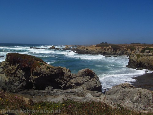
Cliffs and waves
Getting to the Coastal Trail South of Glass Beach
From the town of Fort Bragg, drive toward the north end of town on CA-1. Turn left on W Elm Street for 0.2 miles. Here the road will turn sharply to the right; turn left into the good-sized parking area for Glass Beach.
The trail along the clifftops
If you’re coming from the north, cross over Pudding Creek (the trestle will be very visible to the right as you approach the car bridge), then turn right on W Elm Street and follow the directions (above) to the trailhead.
Zoom map out to browse nearby hikes & places of interest
Wildflowers and waves
If you want to go to the Pudding Creek Trestle end of the trail, turn right with the road instead of turning into the Glass Beach Parking Area and drive to the road’s end at a parking area next to the trestle.
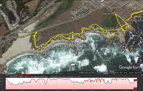
Visual trail map of the trail north of Glass Beach and across the Pudding Creek Trestle
This Week’s Featured Product!
Check out this book with 100 hiking choices in Northern California – both along the coast and in the mountains.
[forecast location=”Fort Bragg, CA” caption=”Weather for Glass Beach” measurement=’F’ todaylabel=”Today” datelabel=”date(‘D M d’)” highlow=’%%high%%°/%%low%%°’ numdays=”5″ iconset=”Default”]

Pingback: Sneak Peak: A California Trip through Desert and Snow - Anne's Travels
Pingback: Adventures… or, Perspective is the Difference - Anne's Travels