
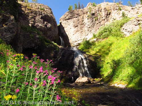
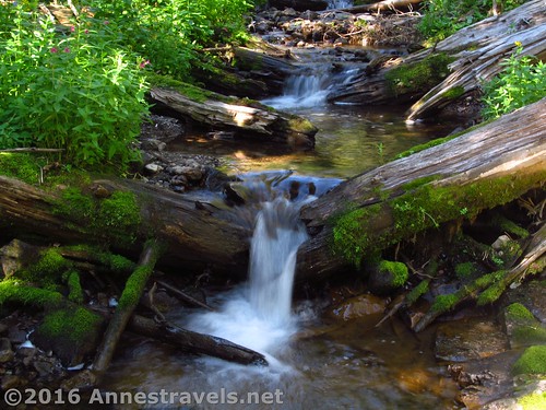
Dundee Falls. Not the best time of day to view the falls, but still very nice.
I guess we’re not very good at doing short hikes. We get to the end, and it’s like, “What? We’re here already? Let’s explore a bit further…” and so off we go on an adventure. Such was what happened while hiking to Bonneville Pass last summer. We got to the end of the pass at 2.7 miles, but the path kept going, so we did, too.
Quick Stats
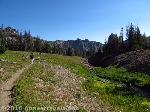
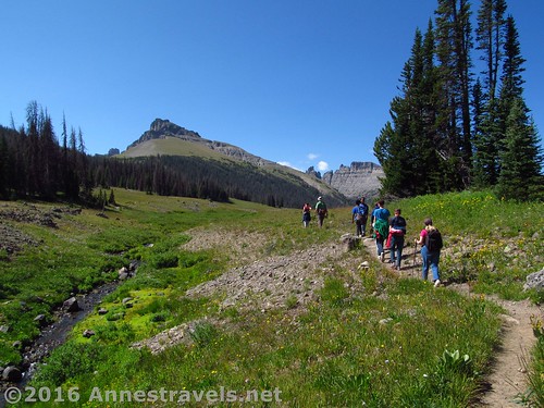
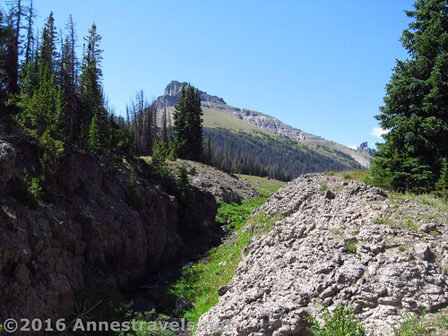
Exiting Bonneville Pass. That’s Dundee Creek to our right.
We started regretting our decision to keep going beyond the pass quite quickly, as the path began to descend at an alarming rate. And it just kept going down… and down… and down…
The trail after a bit of going downhill
We’d hoped for a few views, but those weren’t materializing quickly, and so half the group decided to explore up Dundee Creek (which the path more or less follows). We could hear a waterfall, so why not try to discover it?
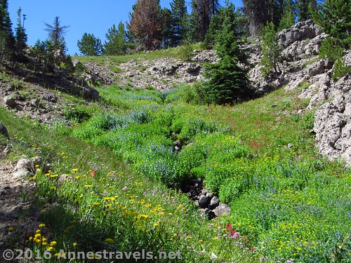
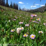
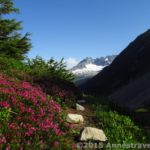
Wildflowers along the trail
Well, discover it we did – Dundee Falls really is lovely. But you’ll have to scramble off-trail, on scree, crawl over logs, etc. to get to it. So if you’re up to the chase, here’s three ways to go.
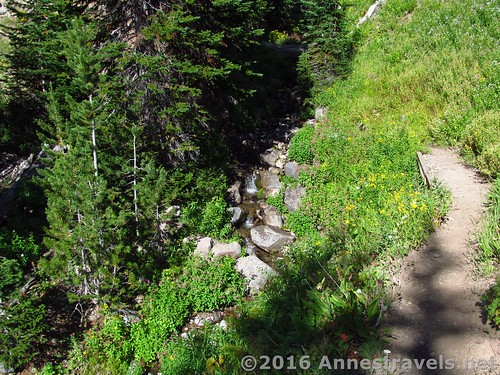
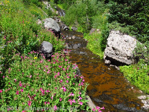
Little waterfalls along the Creek Route
Dundee Falls Route #1 (Creek Route)
This was the way I got to the falls. From the end of Bonneville Pass, continue on the trail downhill through the forest for 0.3 miles. Turn right down toward Dundee Creek (the turn is at 43.78441N / -109.94554W (43° 47′ 3.876″ / -109° 56′ 43.9434″ and is at a point where the trail turns sharply to the left, but since the trail twists and turns a lot, that’s not saying much – it might be better to say that it’s at a point where the creek is easily accessible from the trail). From here, scramble upward along the creek (over logs, etc. – you don’t have to get your feet wet, at least in August) to the waterfall, 0.25 miles upstream.
Scrambling on the Forest Route
Dundee Falls Route #2 (Forest Route)
This was the way I returned. From the end of Bonneville Pass, continue down the trail for 0.1 miles. Turn right off-trail toward what looks like an overlook that doesn’t have a view anymore because of the trees. The rock / sandy stuff is white. Continue downhill through the forest as best you can. You’ll probably have to cross downed logs, dodge boulders and thickets, and generally bushwack a bit. It’s about 0.1 miles to the waterfall. (Note: you’ll have to scramble down a fairly steep, rocky slope to get to the waterfall from this angle.)
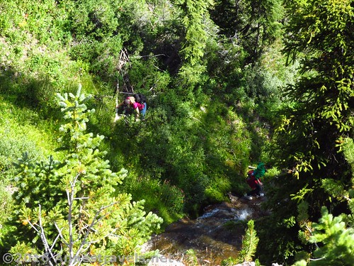
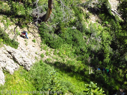
Those who took the scree route got there first (they had a head start, after all) and started taking pictures of all the falls around Dundee Falls!
Dundee Falls Route #3 (Scree Route)
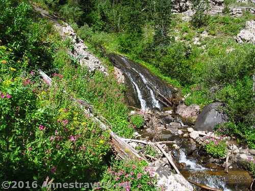
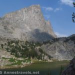
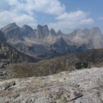
There is a third way to get to Dundee Falls from Bonneville Falls. I didn’t take that route, and those in my group who did it didn’t exactly recommend it, but I thought I’d share it anyway. From just before the stream crossing at the end of Bonneville Pass, turn right, off-trail, to follow Dundee Creek (stay well above Dundee Creek – it tumbles down into a canyon before hitting the waterfall). Scramble down the scree / boulder slope to the right of the creek until you’re below the waterfall. (Note: this route has a lot of loose scree, bad footing, etc., so don’t try it unless you like and are experienced with that kind of thing). One good point about this route is that there are some decent views just before going down the scree slope.
Views from near the Scree Route
Would I visit Dundee Falls again? Maybe in another several years. But that’s because I’m not a huge waterfall person. I suppose living within day-trip distance of Niagara Falls has its downsides…
Reentering Bonneville Pass
Round Trip Trail Length: About 6 miles (depending on your route)
Highest Elevation: 9,964 ft. (Continental Divide)
Lowest Elevation: 9,277 ft. (parking area)
Net Elevation Change: 687 ft.
Facilities: Hitch rails near the trailhead
Fees: None
Notes: This is a great way to extend your hike beyond Bonneville Pass, especially if the pass is a bit crowded in the later part of the day. Another way to extend your hike / find some solitude is to hike up either side of the pass. You can read about my experience doing that here.
Dundee Creek below Dundee Falls
Trail 
Road
Signs
Scenery
Would I go 100 miles out of my way for this?
Overall Rating:
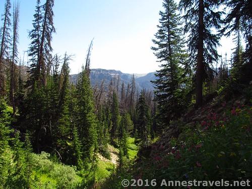
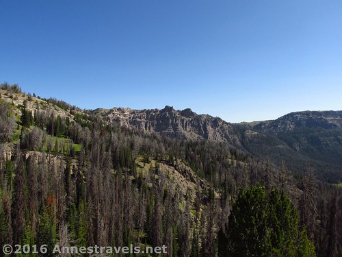
Non-views from near the trail
Key GPS Coordinates for Dundee Falls
Exit Bonneville Pass: 43.78256N / -109.94910W (43° 46′ 57.2154″ / -109° 56′ 56.76″) (9,913ft.) (2.7)
Turned Around (no views!): 43.78476N / -109.94511W (43° 47′ 5.1354″ / -109° 56′ 42.3954″) (9,673ft.) (3.1)
Turn to Waterfall: 43.78441N / -109.94554W (43° 47′ 3.876″ / -109° 56′ 43.9434″) (9,669ft.) (3.2)
Waterfall: 43.78381N / -109.94743W (43° 47′ 1.716″ / -109° 56′ 50.7474″) (9,750ft.) (3.4)
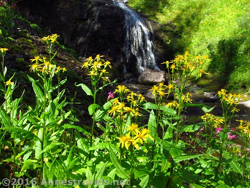
Wildflowers near the falls
The gpx file for Bonneville Pass and Dundee Falls can be downloaded – please note that this and the GPS Coordinates are for reference only and should not be used as a sole resource when hiking this trail.
Download GPX File size: 128.6 KB Downloaded 128 times
(Note: I do my best to ensure that all downloads, the webpage, etc. are virus-free and accurate; however, I cannot be held responsible for any damage that might result, including but not limited to loss of data, damages to hardware, harm to users, from use of files, information, etc. from this website. Thanks!)
Scrambling up the Forest Route
Getting to Dundee Falls Trailhead
From Moran Junction, head east on US-26E / US-287S. Pass the Togwotee Mountain Lodge and drive through Togwotee Pass. At 37.4 miles, a well-signed road will appear on the left (this is 4 miles beyond Togwotee Pass). Turn left and follow the road (FR-515) 4 miles, turn right onto FR-516 (a sign should point you toward Bonneville Pass). The road ends 1.7 miles later in a fair sized parking lot.
Dundee Creek descends into a small canyon below Bonneville Pass
Alternatively, from Dubois, head west on US-26W for 19.7 miles. Turn right onto the gravel road and follow the directions above.
The road to Bonneville Pass Trailhead is gravel / dirt, but should be passable by low-clearance vehicles.
Zoom map out to browse nearby hikes & places of interest
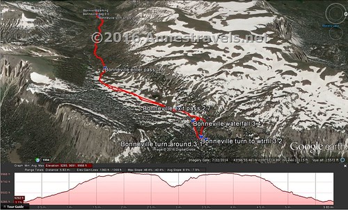
Visual trail map of walking from the parking area (top) into Bonneville Pass (middle) and then down to Dundee Falls (bottom). North is to the right.
This Week’s Featured Product!
Looking for more day hikes in the area? This book covers many within nearby Grand Teton National Park (and I can attest to that park being absolutely beautiful!)


Pingback: Return to Beautiful Bonneville Pass - Anne's Travels
Pingback: Blog Sneak Peak: The Wyoming You Never Knew
Pingback: 15 Must Do Waterfall Hikes Across the US - Anne's Travels
Pingback: 12 Epic Hikes in the Western US, Pt. 2 - Anne's Travels
Pingback: The Top 15 Pages on Anne's Travels in 2016 - Anne's Travels
Pingback: God Saw that it was Good - Anne's Travels