
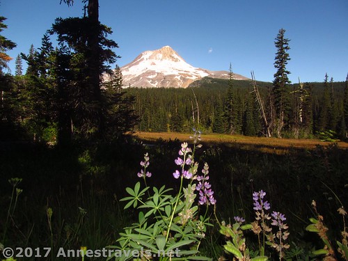
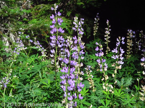
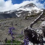
Lupines on the edge of Elk Meadows
If you like hiking through woods and views across meadows, Elk Meadows on the side of Mt. Hood, Oregon may well be a hike built for you. It’s really a backpacker’s destination, a place for a short overnight hike and plenty of places to set up a tent (likely even with a view!) But I visited as part of a day hike, and it does make a pretty good day hike at only 6.8 miles RT. In season, the wildflowers are also lovely, along with views of the big mountain.
Quick Stats
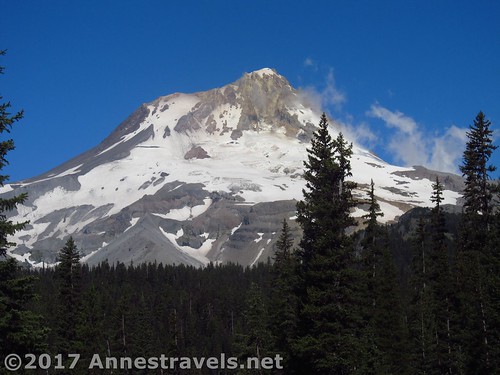
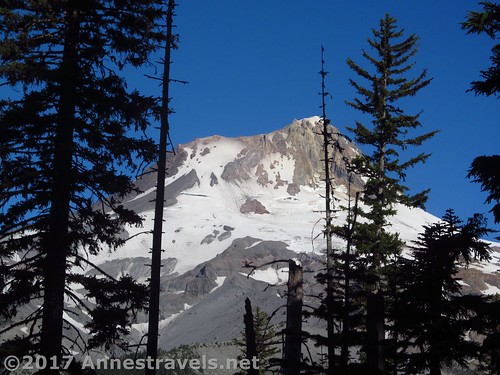
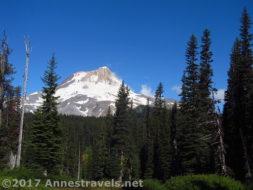
Close up of Mt. Hood from Elk Meadows
I was actually en route to Gnarl Ridge, but detoured through Elk Meadows because I’d seen some nice photos on the Oregon Hiker’s website. In some ways I was disappointed; the pictures made it seem more open, while the trail actually doesn’t even go through the meadow, just around the perimeter through the trees at the edge of the grassy expanse. Still, it’s not too hard to find trails out into the meadow proper, so the views can be pretty good!
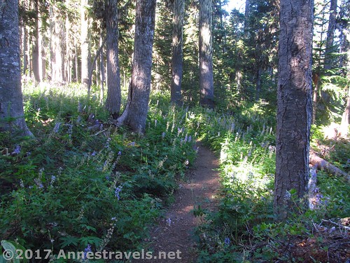
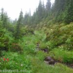
This is what the trail looks like around Elk Meadows
The trailhead was deserted when we began, very early on an August Sunday morning – by the time we got back in the late afternoon, the place was just about overrun with backpackers and short-trail day hikers checking out the Umbrella Falls Trail. But in the welcome quiet we packed up our gear and started hiking up the well-worn trail.
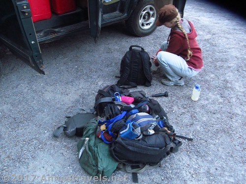
Prepping for the hike apparently includes dumping all the packs in a pile, as well as filling water bottles
At 0.4 miles from the trailhead, arrive at the first of many trail junctions; continue straight rather than turning left toward Umbrella Falls. A tenth of a mile later, continue straight again when the trail to the sno-park goes right (aka the Elk Meadows Ski Trail). You’re good on trail junctions for another half mile to the Newton Trail Junction, on left. Stay straight to arrive at Newton Creek.
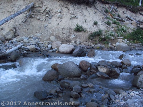
Newton Creek. Doesn’t look too hard, does it?
Newton Creek is no joke, even in August. The water is fast and fierce, the ground rocky and unstable. We scrambled up the streambed a short distance (maybe a quarter mile, maybe not quite that much) to a tree trunk and crossed via that, then scrambled back down the streambed to pick up the trail at mile 1.4 from the trailhead.
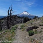
Peek-a-boo views of Mt. Hood from the trail above Newton Creek
From here, the trail begins rising in earnest, switchbacking upward relentlessly for the next mile to the junction with the Gnarl Ridge Trail. The good news? There begin to be peek-a-boo views of Mt. Hood through the trees, and know that if you’re only going to Elk Meadows, this is the most climbing you’ll have to do! Continue straight toward Elk Meadows at the junction with the Gnarl Ridge Trail. A quarter mile later, turn right at the Elk Meadows Trail (it’s the loop trail junction, not that there’s a sign that says so).
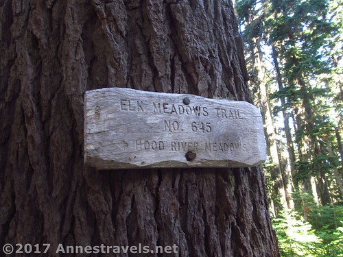
Sign marking the Elk Meadows Loop Junction
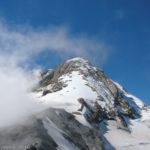
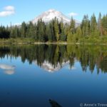
The trail immediately begins skirting the meadow. Short side trails lead to campsites and at times to excellent views of Mt. Hood over the meadow (I’m glad we saw Mt. Hood then, as the mountain was pretty socked in by the time we actually made it up to the ridgeline). The forest was also filled with wildflowers, which was fun.
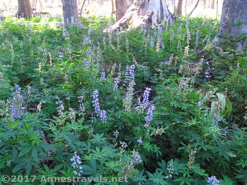
Lupines in the woods around Elk Meadows
Pass by the Blue Grass Ridge Tie and keep skirting the meadow. If you want views, you’ll have to walk down a side trail to enter the meadow, since there aren’t very many good views from the trail.
A pretty realistic view of Mt. Hood across Elk Meadows
About mile 3.4, keep left to follow the sign on the pine pointing toward the Gnarl Ridge Trail. Very shortly afterward, follow the sign for Gnarl Ridge – this junction may be easy to miss. Continue on the less-used trail through the pines 0.3 miles.
Lupines
Here you’ll come to the decision-making point. If you want to ascend to Gnarl Ridge – and it’s a very real ascent – turn right. If your destination was just Elk Meadow, continue left following the signs back to the loop trail junction (this isn’t shown on the map below, FYI), and then back up to the Gnarl Ridge Trail Junction and down to Newton Creek and so back to your vehicle for a 6.8 mile round trip hike.
But I wanted to explore Gnarl Ridge, and I’m so glad I did… but that’s the story for next week’s post!
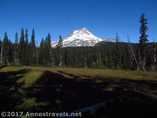
Mt. Hood from Elk Meadows
Round Trip Trail Length: About 6.8 miles
Net Elevation Change: 833ft. (4,434ft. at the parking area to 5,267ft. at the Elk Meadows / Gnarl Ridge Trail Junction)
Facilities: Primitive restroom at the parking area & a couple picnic tables. There are free-range camping opportunities slightly further up the road.
Fees: $5/day, waived with Northwest Forest Pass & Interagency (America the Beautiful) passes
Trail Notes: I’m not sure I’d do this one again unless I was going up (or coming down from) Gnarl Ridge, but then again, I’m also not as big into meadows as some. But if you’re looking for a camping spot or a detour while hiking up Gnarl Ridge (or if it’s crazy wildflower season), it’s a great place to go!
Trail 
Road
Signs
Scenery
Would I go 100 miles out of my way for this?
Overall Rating:
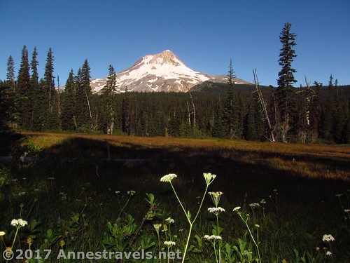
Wildflowers and Mt. Hood in Elk Meadows
Key GPS Coordinates
Gnarl Ridge / Elk Meadows Parking: 45.32223N / -121.63344W (45° 19′ 20.0274″ / -121° 38′ 0.3834″) (4,434ft.)
Trail beginning: 45.32237N / -121.63361W (45° 19′ 20.5314″ / -121° 38′ 0.9960″) (4,437ft.) (0.0; ended 12.5)
Elk Meadows / Umbrella Falls Junction: 45.32740N / -121.63182W (45° 19′ 38.6394″ / -121° 37′ 54.5520″) (4,548ft.) (0.4)
Ski Trail Junction: 45.32875N / -121.63098W (45° 19′ 43.4994″ / -121° 37′ 51.5274″) (4,549ft.) (0.5)
Newton Trail Junction: 45.33496N / -121.62614W (45° 20′ 5.8560″ / -121° 37′ 34.1040″) (4,596ft.) (1.08)
Newton Creek crossing: 45.33666N / -121.62712W (45° 20′ 11.9760″ / -121° 37′ 37.6320″) (4,626ft.) (1.2)
Pick up trail after crossing: 45.33620N / -121.62597W (45° 20′ 10.3194″ / -121° 37′ 33.4914″) (4,609ft.) (1.4)
Elk Meadows / Gnarl Ridge Trail Junction: 45.34086N / -121.62318W (45° 20′ 27.0954″ / -121° 37′ 23.4480″) (5,267ft.) (2.4; return 10.32)
Elk Meadows Trail Junction: 45.34202N / -121.61996W (45° 20′ 31.2714″ / -121° 37′ 11.8560″) (5,174ft.) (2.6)
Elk Meadows / Gnarl Ridge / Polallie Campground Junction: 45.34579N / -121.614267W (45°20’44.8500″ / -121°36’51.3600″) (5,039ft.) (3.4)
Elk Meadows / Gnarl Ridge Tie (???): 45.34554N / -121.61453W (45° 20′ 43.9434″ / -121° 36′ 52.3080″) (5,046ft.) (3.4)
Elk Meadows / Gnarl Ridge Trail Junction: 45.34610N / -121.62026W (45° 20′ 45.9594″ / -121° 37′ 12.9360″) (5,149ft.) (3.79)
The gpx file for Elk Meadows and Gnarl Ridge can be downloaded – please note that this and the GPS Coordinates are for reference only and should not be used as a sole resource when hiking this trail.
Download GPX File size: 295.3 KB Downloaded 122 times
(Note: I do my best to ensure that all downloads, the webpage, etc. are virus-free and accurate; however, I cannot be held responsible for any damage that might result, including but not limited to loss of data, damages to hardware, harm to users, from use of files, information, etc. from this website. Thanks!)
Zoom map out to browse nearby hikes & places of interest
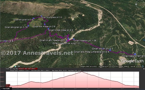
Visual trail map for the Elk Meadows Trail on Mt. Hood. Note that the elevation profile is for the entire hike up to Gnarl Ridge via Elk Meadows.
Getting to the Elk Meadows Trailhead
From Hood River, head south on OR-35S for about 30 miles. Turn right; there should be a sign pointing toward the Elk Meadows Trailhead just before the road. You’ll want to make a quick left after turning, as veering right will quickly end you up in the parking area of a ski lodge (or something like that). Keep driving 0.3 miles to the trailhead, on right.
Alternatively, from Government Camp, head east on US-26E for about 2 miles, then take the exit for OR-35N toward Hood River. Continue on OR-35N 7.5 miles. Turn left; there should be a sign pointing toward the Elk Meadows Trailhead just before the road. You’ll want to make a quick left after turning, as veering right will quickly end you up in the parking area of a ski lodge (or something like that). Keep driving 0.3 miles to the trailhead, on right.
This Week’s Featured Product!
If you’re looking for more hikes on Mt. Hood or in the region, this detailed book is a great find.

Pingback: Sneak Peak: A Land of Volcanos and Oceans - Anne's Travels
Pingback: Spectacular Gnarl Ridge below Mt. Hood - Anne's Travels