
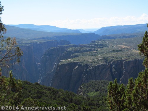
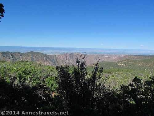
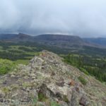
The aerial view of Black Canyon from Green Mountain
Ok, so Green Mountain in Black Canyon of the Gunnison National Park may not be the most spectacular trail in the state – or even in the park – but it does have some good points. First, it’s one of the longer trails on the North Rim (the only other long trail is the Deadhorse Trail, which I haven’t checked out yet). Second, you can see Exclamation Point along the way, and if there’s a view that’s worth seeing of Black Canyon, it’s at Exclamation Point. Third, you do get a unique view of the canyon, almost like a view from an airplane flying low. So I suppose it is worth climbing at almost 8 miles (12.8 km) RT, even if it’s not as spectacular as other vistas in the park (that are right next to the road).
Quick Stats
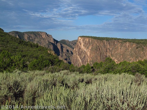
Early morning light on the cliffs from the North Vista Trail
We started out from the North Rim Ranger Station one very early morning in August. In case you’re curious, it gets very hot at Black Canyon in the middle of the summer, so we definitely wanted to be off the trail as early as possible. The only reason we were visiting was because it was raining everywhere else in the state, so we hadn’t exactly planned on hiking in a place as hot as this. Anyway, the early morning light on the canyon walls across the desert foliage was stunning. The Painted Wall is very visible from the North Vista Trail (the trail that leads to the top of Green Mountain). Take your photos now, though, because there won’t be another good view until you get to Exclamation Point.
Early morning at Black Canyon
We kept walking along the amazingly quiet trail for many minutes in silence. After the rushing streams and mountain wildlife I’d been seeing in the more mountainous areas of Colorado, this was a nice change of pace. I don’t even think there were any insects buzzing in the bushes that come right up to the edge of the trail.
The trail fairly quickly enters a juniper forest. It remains sandy and seems to wander along without much interesting to look at. You could almost be going in circles, except that you know very well that you’re not. There are two side-trails to overlooks before you reach the trail to Exclamation Point, one at 0.6 miles (0.9 km), and one at 0.8 miles (1.3 km). Beyond this, there are also multiple social trails that more or less take you over to the canyon edge. My opinion: None of these trails before Exclamation Point are worth wasting your time on. Seriously. If you’re just dying for a longer trail, have at it, otherwise, press on to mile 1.3 (2.1 km) for the Exclamation Point Trail Junction.
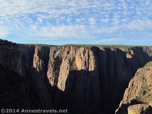
Exclamation Point View (this was actually taken after we’d climbed Green Mountain; early in the morning, there are too many shadows for good pictures)
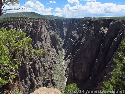
The Exclamation Point Trail Junction is well-marked, on the left side of the North Vista Trail. Take the time to walk the 0.2 miles (0.3 km) (one way) to the point; this is the best view you’ll get of the entire canyon (period). If you go in the early morning, you can get the benefit of the deep shadows, but the canyon bottom will be in shadow, too. On the other hand, if you do it in the middle of the day, the bottom will be in sun, but the stark light doesn’t make for very good photos. If you want the best of both worlds, you might try it on your way out and way back from Green Mountain. (BTW, the Exclamation Point Trail splits a few times, and there are several viewpoints at the end. All trail lead to Rome, so to speak, and all the viewpoints are good, so it really doesn’t matter which you take.)

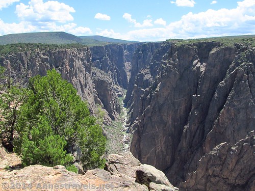
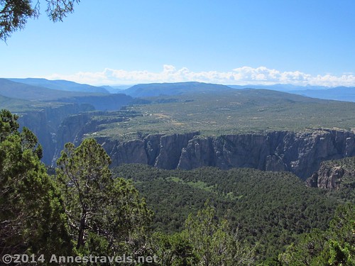
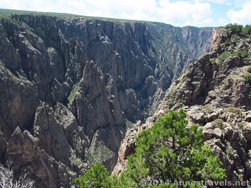
Black Canyon from Green Mountain
Retrace your steps to the North Vista Trail and turn left to go up to Green Mountain. The trail continues to roll along sandy terrain through the juniper forest. This is very hot in the summer, and quite stifling, as well…I think we all shed our jeans for our shorts for the first time since entering Colorado! (We hike in layers…so when it gets hot, we can just shed a layer instead of having to change outfits entirely.)
Finally, the trail does begin to rise, steeply enough. Then, about 3.5 miles (5.6 km) from the trailhead (if you take the trail to Exclamation Point, as well) you suddenly finish switchbacking and find yourself facing a trail split. The trail simply circles the summit, so go either direction you want. On the other hand, the top is pretty forested and there really isn’t much of a view, so you might just want to turn around. Spread out below you – almost like you’re in an airplane – is the Black Canyon of the Gunnison Gorge, snaking its way through the otherwise fairly flat mesa. It’s quite impressive, even if it doesn’t have the close-up splendor of Exclamation Point.
View from Green Mountain
Return via the way you came. Although it’s certainly not the most spectacular hike in Colorado, Green Mountain does have some nice points…and is probably worth doing if you have a day in Black Canyon of the Gunnison National Park (North Rim).
Round Trip Trail Length: About 8 miles (12.8 km)
Lowest Elevation: 7,618 ft. (2,322 m)
Highest Elevation: 8,502 ft. (2,591 m)
Net Elevation Gain: 884 ft. (269 m)
Facilities: Primitive restrooms at the trailhead across the parking area from the ranger station
Fees: $15 to enter Black Canyon of the Gunnison National Park; America the Beautiful (Interagency), Senior (Golden Age), Access (Golden Access), Volunteer, Military, and Black Canyon Annual Passes also accepted
Trail 
Road
Signs
Scenery
Would I go 100 miles out of my way for this?
Overall Rating:
Key GPS Coordiantes
Another view of Black Canyon from Green Mountain
Parking Area: 38.58673N / -107.70495W (38° 35′ 12.228″ / -107° 42′ 17.8194″) (7,571ft.; 2,307 m)
Trailhead: 38.58678N / -107.70515W (38° 35′ 12.4074″ / -107° 42′ 18.54″) (7,711ft.; 2,350 m)
Overlook 1 Junction: 38.59156N / -107.71276W (38° 35′ 29.616″ / -107° 42′ 45.936″) (7,634ft.; 2,326 m)
Overlook 2 Junction: 38.59111N / -107.71416W (38° 35′ 27.996″ / -107° 42′ 50.976″) (7,618ft.; 2,321 m)
Overlook 2: 38.59092N / -107.71412W (38° 35′ 27.3114″ / -107° 42′ 50.8314″) (7,588ft.; 2,313 m)
View from Exclamation Point near midday
Exclamation Point Trail Junction: 38.58899N / -107.72141W (38° 35′ 20.364″ / -107° 43′ 17.076″) (7,673ft.; 2,338 m)
Exclamation Point: 38.58704N / -107.72107W (38° 35′ 13.344″ / -107° 43′ 15.8514″) (7,686ft.; 2,342 m)
Exclamation Point view 2: 38.58702N / -107.72077W (38° 35′ 13.272″ / -107° 43′ 14.772″) (7,701ft.; 2,347 m)
Exclamation Point view 3: 38.58714N / -107.72054W (38° 35′ 13.272″ / -107° 43′ 14.772″) (7,700ft.; 2,346 m)
Top of Green Mountain (I turned right): 38.59474N / -107.73505W (38° 35′ 41.064″ / -107° 44′ 6.18″) (XXX!!!)
Nice View: 38.59446N / -107.73514W (38° 35′ 40.0554″ / -107° 44′ 6.504″) (8,502ft.; 2,591 m)
The gpx file for the North Vista Trail up Green Mountain can be downloaded – please note that this and the GPS Coordinates are for reference only and should not be used as a sole resource when hiking this trail.
Download File size: 156.0 KB Downloaded 109 times
(Note: I do my best to ensure that all downloads, the webpage, etc. are virus-free and accurate; however, I cannot be held responsible for any damage that might result, including but not limited to loss of data, damages to hardware, harm to users, from use of files, information, etc. from this website. Thanks!)
Getting to the North Vista Trailhead (Green Mountain)
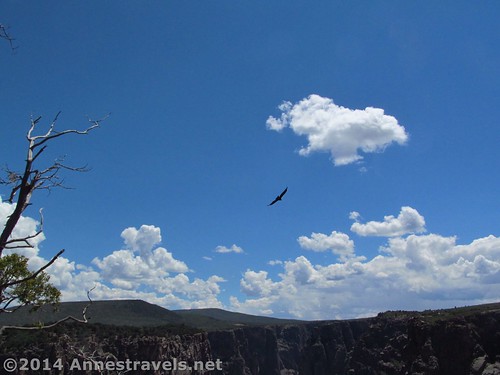
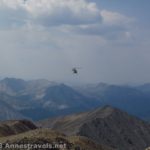
A raptor circling the canyon
In the town of Delta, turn onto CO-92 E / Hwy 92 and drive 20.7 miles. Take a slight right to continue on CO-92 and drive 10.6 miles. In the town of Crawford, instead of continuing on CO-92, turn right on Dogwood Ave, then left on 1st Street / Badger Ave, which will change names to Fruitland Mesa Road. Drive 3.3 miles. (Are you lost yet?) When Fruitland Mesa Road turns right, continue straight on 7745 Road and drive another 1.2 miles. Turn right onto A Road / Black Canyon Road; take the first right to stay on A Road / Black Canyon Road. After 0.8 miles, take the first left onto Black Canyon Road. Almost 7 miles later, the road will change names to G74 Road (you won’t know it; you’ll simply continue driving). Continue another 0.4 miles to the visitor center, on right. Park here, near the primitive restroom; the trail begins from this parking area.
Looking up the canyon from Exclamation Point
From Gunnison, CO, take US-50 W for 26 miles. Turn right onto CO-92 W to cross the Blue Mesa Dam; drive 38.5 miles. This is a very pretty, but white-knuckle, drive; I wouldn’t personally do it at night! Turn left off of CO-92 W onto Black Canyon Road for 4 miles, then turn right onto A Road / Black Canyon Road. After 0.8 miles, take the first left onto Black Canyon Road. Almost 7 miles later, the road will change names to G74 Road (you won’t know it; you’ll simply continue driving). Continue another 0.4 miles to the visitor center, on right. Park here, near the primitive restroom; the trail begins from this parking area.
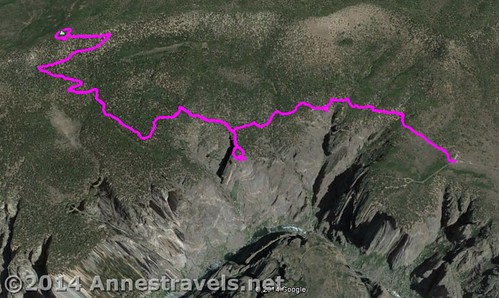
Visual map of the North Vista Trail to Exclamation Point (center) and Green Mountain (left)
Zoom map out to browse nearby hikes & places of interest
This Week’s Featured Product!
For an all-inclusive guide to Black Canyon of the Gunnison, this book is pretty good. From geology and history to hiking and boating, this book seems to have it all.
[forecast location=”Montrose, CO” caption=”Weather for the North Vista Trail” measurement=’F’ todaylabel=”Today” datelabel=”date(‘D M d’)” highlow=’%%high%%°/%%low%%°’ numdays=”5″ iconset=”Default”]
More Related Posts:
 Highest Peak in Colorado: The South Mount Elbert Trail
 Amphitheatre Peak: Beautiful Flat Tops!
 Electric Pass: The Highest Named Pass in Colorado
 Off-Trail Hiking to a Flat Tops Mountain: Pyramid Peak
 The Chapin / Chiquita / Ypsilon Loop: 3 Summits, 8 Miles!
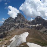 Table Mountain – Up and Down the Face Trail
Pingback: Out of the Creativity of God's Heart - Anne's Travels
Pingback: Isaiah 40 - Anne's Travels
Pingback: Terrifying Trails of the Western US - Anne's Travels