
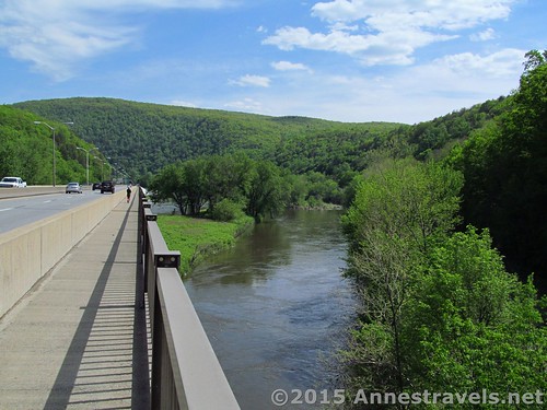
The Appalachian Trail crossing the I-80 Bridge across the Delaware River as the trail heads toward the NJ/PA state line
I don’t hike the AT much, but it seems like when I do, it’s either in North Carolina or New Jersey/Pennsylvania. I don’t know why; maybe it’s just because the AT is a convenient trail in those areas. At any rate, a real highlight of AT hiking for me last summer was walking to the New Jersey/Pennsylvania State Line in the Delaware Water Gap. It was especially special since the state line is in the middle of the river, so we had to cross a huge bridge, right beside I-80, to get to it!
Quick Stats
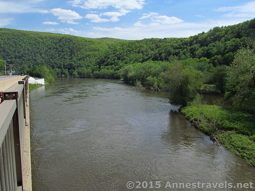
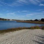
The Delaware River
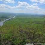
We decided to hike to the state line after trekking to the top of Mount Minsi, the high peak on the Pennsylvania side of the Delaware Water Gap. Having a few extra minutes to spare, we followed the white blazes down to road to the I-80 bridge and the state line.
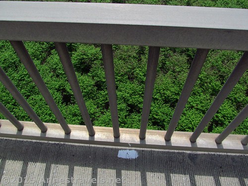
A white mark on the bridge
First off, let me say that I wouldn’t recommend walking, like we did, from the Mount Minsi parking area down to the bridge (unless you’re real keen on walking on roads). There is a secondary parking area close to the bridge, so you can easily park there instead and have a much shorter hike.
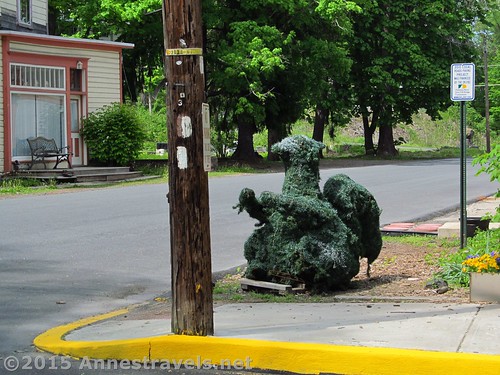
White Appalachian Trail markers and a bush that looks like a Squirrel in town
We followed the road downward and into town, always following the splotches of white paint – much of it weather-worn , faded, and all-together difficult to see on the road surface, sidewalk, or telephone poles. We crossed the large road, then turned right on the next street, heading generally toward the highway maintenance facilities next to the highway. It’s next to these buildings that there is a parking area for hikers. Fearing that we wouldn’t be able to find a place to park, we’d left the van at the Mount Minsi trailhead – no big deal, but it was a bit longer hike that we’d anticipated, so we didn’t quite get back in time (not that anyone minded).
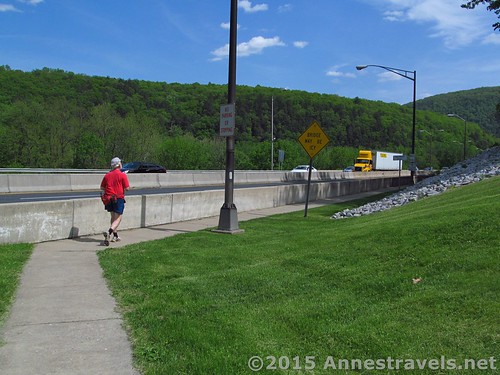
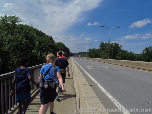
Approaching the bridge
Just after the maintenance buildings, the trail takes a sharp right toward the bridge. It’s now on a sidewalk, with only a barrier between you and the highway. I found this quite nerve-wracking, but, hey, it’s almost a once-in-a-lifetime experience (unless you live nearby, lol)!
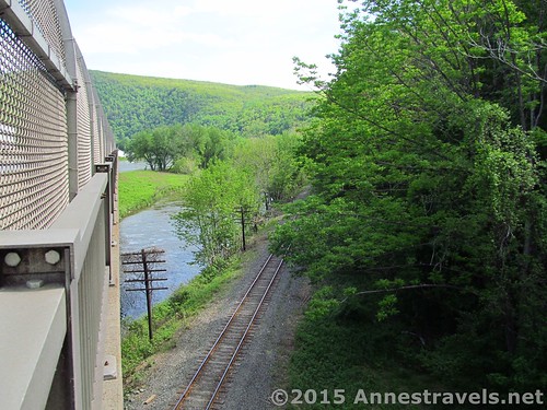
The railroad tracks
Not far onto the bridge, a chain-link fence has been installed on the right (river) side of the bridge. A railroad goes beneath the bridge at this point, so I’m guessing the fence is to keep stones, etc., from falling onto the tracks.
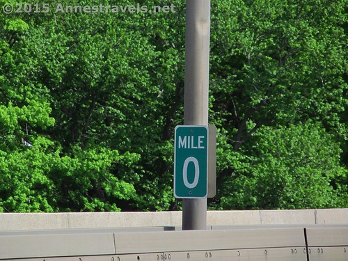
Mile 0!
Walking the bridge, it went on and on – driving across it 100s of times, I never knew how long it really was! And we only hiked half way across – to the Mile 0 sign and the NJ boarder! Ya-hoo! We did it!
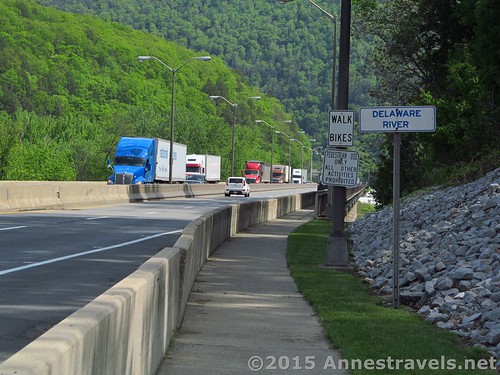
The trucks zoom past – on the other side of the highway, for now
Meanwhile, the cars and trucks kept zooming past us. Some were very considerate and, whenever possible, moved into the inner lane rather than get too close to the barrier. But sometimes those huge tracker trailers couldn’t move – or didn’t – and they’d send a wave of air rushing past our faces. Yikes!
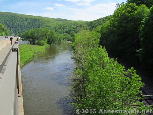
The Delaware River under the bridge
My favorite truck drivers, though, saw us all coming and gave us a friendly toot on their horn. One driver even blew the horn, then held up a bottle of his product as if to say, “Hey! Our cheese is best!”
Heading back
By then, we were really running out of time, so we hoofed it back to the PA side of the bridge, back up the street, then back up the very steep hill to the Mount Minsi trailhead parking. But was it worth it? Oh, yes!
Round Trip Trail Length: About 1.5 miles, beginning at the Mt. Minsi Parking Area
Starting Elevation: 520 ft.
Ending Elevation (state line): 372 ft.
Net Elevation Gain/Loss: 148 ft.
Facilities: None
Fees: None
Trail 
Road
Signs
Scenery
Would I go 100 miles out of my way for this?
Overall Rating:
Key GPS Coordinates for the NJ / PA State Line on the AT
Parking: 40.97982N / 075.14203W (ended 1.6 miles) (520 ft.)
State Line: 40.97779N / 075.13585W (???) (372 ft.)
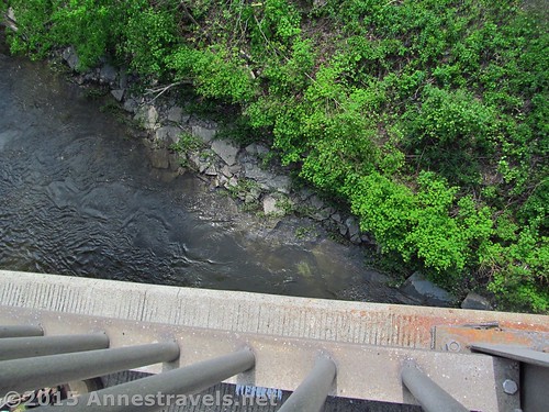
Looking down….
Getting to the Parking Area for the NJ / PA State Line on the AT
From I-80, take Exit 310 onto Broad Street. Drive 0.4 miles to a T intersection; turn left onto Main Street / PA-611 S. After 0.3 miles, turn left onto Mountain Road. Take the first right onto Delaware Ave; park in the parking area near the end of this road.
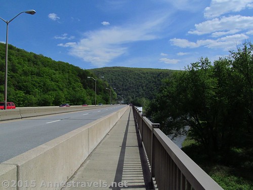
The AT crossing the bridge
Alternatively, from Portland, PA, drive 5.5 miles north on PA-611 N. Turn right onto Mountain Road. Take the first right onto Delaware Ave; park in the parking area near the end of this road.
Note: to follow the map, turn uphill on Mountain Road, then take a left onto Lake Road and drive to the parking area for the Mount Minsi Trail / AT.
Zoom map out to browse nearby hikes & places of interest
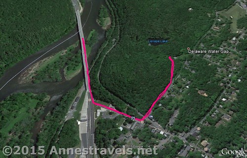
Visual map of my route along the Appalachian Trail from the Mount Minsi Parking Area to the New Jersey / Pennsylvania State Line and back.
This Week’s Featured Product!
With lots of maps and helpful information (including mileages between points of interest), this book details the AT as it traverses the mid-Atlantic states; namely, New York, New Jersey, Pennsylvania, and Maryland.
Wow. Not exactly the “alone in nature” experience, but I guess it beats swimming across the river with a backpack! I never understood the attraction to walking across the Golden Gate bridge (the bridge closest to where I live.) It’s noisy, windy, scary and those big truck side mirrors? Yikes!
Yes, much better than swimming! I did the Golden Gate a few years ago; I really enjoyed it (seeing Alcatraz, boats, planes, wildlife, etc.) but it wasn’t anything close to a wilderness experience. The traffic so close by gave me a headache, it was so loud, lol!
Hi Anne,
just found your site and boy did this bring back memories! Did this the day of our “big” earthquake -which is also what it felt like each time a tractor trailer passed on the bridge! Liked it so much the next time I went did the hike from Minsi parking, accross the bridge, up Mt Tammany, back accross the bridge and tried to make it up Mt Minsi but my dog and I both got too tired to complete the loop. Its surprising how far itvis between the trailheads. Like you say, you dont realize that while driving accross! Happy trails! e
Cool little hike, isn’t it? I love the idea of parking in PA and walking across the bridge… or maybe parking in NJ and just walking the bridge for fun!