
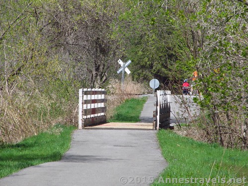
A little bridge over a stream and the railroad track crossing on the Auburn Trail
A few weeks ago, I celebrated a birthday. It was a bit of a milestone, I suppose. Anyway, I decided that I’d like to really celebrate – like, something that lasted more than an hour or so. So it was with great excitement that we planned a bike trip on a nearby Rails-to-Trails; about 20 miles on the Lehigh Valley Trail!
Quick Stats
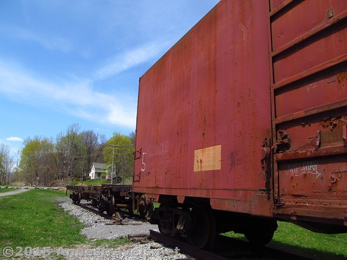
Real train cars in Rochester Junction Park, along the Lehigh Valley Trail
Actually, we started out at the Victor end of the Auburn Trail, then picked up the Lehigh Valley Trail when the two intersected near Lehigh Crossing Park (and a large iron trestle/train bridge, no less!) Both tails were fabulously maintained; some of the best maintained rails-to-trails I’ve ever traveled on. They were both also well-signed, especially the Auburn Trail, which turned out to be a very good thing at one point. One other point to note is that the only decent trail parking on the section of the Auburn Trail that I traveled was along Break of Day Road in Victor (the east end of the trail where I started), while there was space for at least 2 or 3 cars to park at every single road crossing on the Lehigh Valley Trail – so plan accordingly.
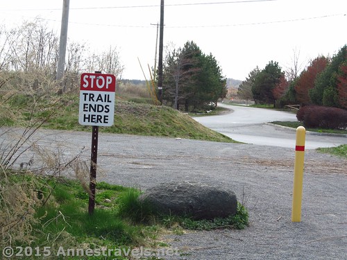
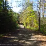
The beginning of the Auburn Trail
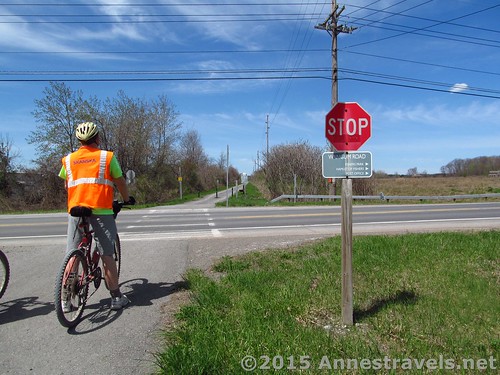
We started out just after 10am. We quickly made our way through Victor, crossing several roads. At 1.5 miles, the trail ends and you’ll have to take some roads. The first is fairly busy, but the trail picks up again pretty quickly. After crossing the railroad tracks there is a second section of roads, but these are not particularly busy. All of the road sections are very well-signed, so just keep an eye out for turns and you’ll be fine.
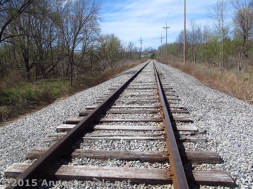
The railroad tracks we crossed along the Auburn Trail
One really nice thing is that I wouldn’t have been able to do these road sections last summer – some of the younger members of my group have matured a bit this year, and so I really wasn’t worried about them riding on the shoulder of the road. Yes!!!
One of the abundant signs marking the Auburn Trail
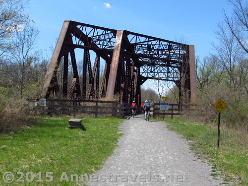
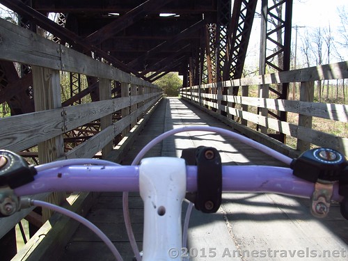
There is no more excitement until 4.6 miles, when the trail passes under a large iron train bridge (small trestle, I suppose). This is where the Lehigh Valley Rail Line passed over the Auburn Rail Line. It is so cool to ride under the bridge!
The Lehigh Valley Trail Bridge over the Auburn Trail
Just after the bridge, turn left up the gravel path marked for the Lehigh Valley Trail. From the top of the incline, you can turn left back to the bridge (which of course we did!) or you can turn right to continue on the Lehigh Valley Trail.
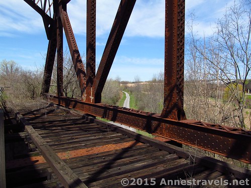
Looking down on the Auburn Trail from the Lehigh Valley Trail Trestle
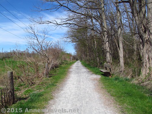
The Lehigh Valley Trail is about as well-maintained as the Auburn Trail, which means it’s in very good condition with some small gravel-type stones.
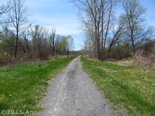
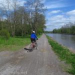
Along the Lehigh Valley Trail
The next place we stopped was at Mendon Station Park (7.8 miles from our starting point). Actually, we stopped before the park, at the signboard near the picnic table. Here we ate lunch with our drivers, who had the cooler and most of the food. It was so peaceful there; a few people biked or strolled past on the trail, but in general we had the whole place to ourselves, even if we couldn’t get too far off the trail.
The unused half of a bridge on the Lehigh Valley Trail
We then crossed the road and – what a madhouse! The park has several baseball diamonds, and I think every team in the county (ok, town) was out practicing that day! Yikes!
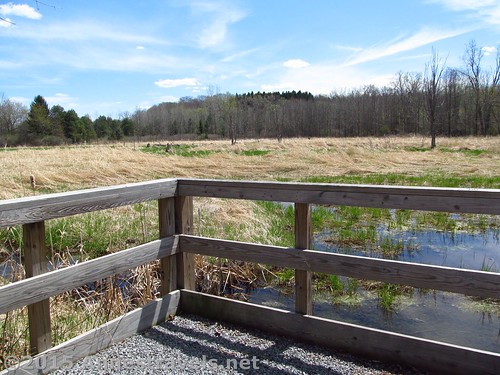
A little viewpoint out over the swamps, west of Mendon Park
Continuing down the trail, the crowds thinned out significantly. In fact, we barely saw another person on the trail after this. Before, we’d been passed by a fair number of other cyclists, hikers, dog-walkers, etc., but the further west we went, the fewer people we saw.
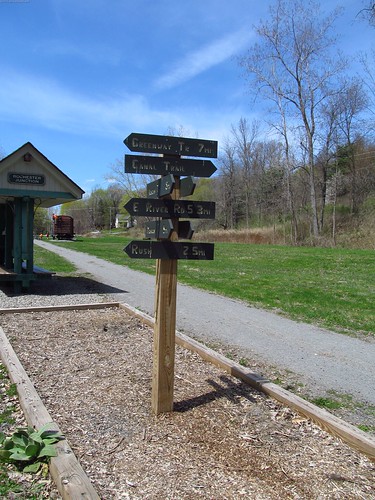
The sign marking Rochester Junction – make sure to veer left here
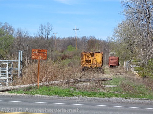
The next real attraction (besides swamps on both sides of the trail) is Rochester Junction, at mile 13.0 from our starting point. This was a very cool little place. Besides the ruins of several features (including the Pump House and Interlocking Tower), there is an old boxcar and an old flatcar, as well as a nicely restored luggage wagon. So totally cool, especially as there really isn’t that much graffiti – someone must take care of it. There are also restrooms here.
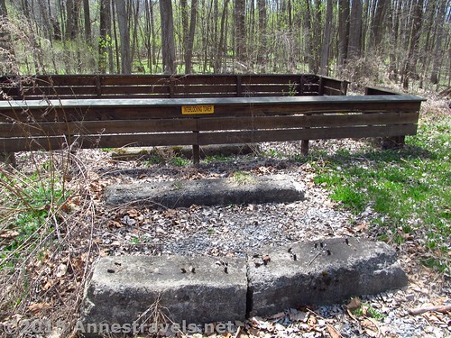
Foundation of the Interlocking Tower
We all had a wonderful time inspecting and experiencing the old equipment.
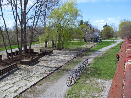
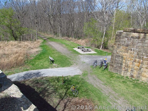
Aerial view over Rochester Junction Park – you’ll actually want to be on the path on the other side of the trees; we took the detour to see the train cars 🙂
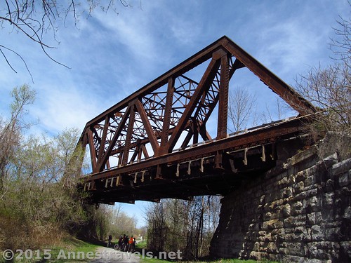
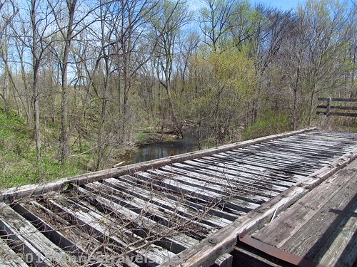
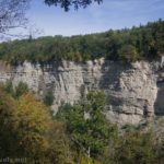
Just after the park, the trail crosses the road (be sure to take the left fork of the Lehigh Valley Trail towards the Greenway, not the right fork toward the Canal Path). Just beyond this road crossing is probably the most impressive trestle on the path. At one time it apparently had three tracks crossing the little creek, though now only one “track” is open to cyclists and other trail users. The rest of the bridge is pretty overgrown, but you can still see how impressive it once was.
The train bridge right after Rochester Junction Park
As the trail continues along through swamps and forests; there are several other bridges over streams, and one over an active railroad track. The only really tricky junction is on Fishell Road; you’ll need to turn right along the road to pass under I-390, then pick up the trail on the other side. No big deal, and it’s well-signed, but it could take you by surprise if you’re not ready for it. Oh, and when you pass through Rush Station there is a small park with a little waterfall over a dam.
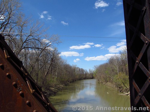
The Genesee River from the trestle that crosses the river
The last major feature on the trail is at 20.5 miles, when the trail crosses its last trestle, this time across the Genesee River. Does the picture look familiar? I was on this bridge last summer when I biked the Genesee Valley Greenway! The Lehigh Valley Trail crosses the Greenway just ahead, next to the stone pillars. We found a way to scramble up behind one of the pillars; it’s really a long way up!
Atop one of the stone pillars that once held up the Lehigh Valley Line bridge over the Genesee Valley (Greenway) Line
From here, it’s a short stint up a very steep hill, then the trail comes to its end at W River Road, 21.2 miles from the beginning of the trail in Victor (note that the bike odometers were reading closer to 20 miles).
End of the trail!
The Lehigh Valley Trail may not be the most exciting trail in Rochester, but it’s worth checking out…especially if you appreciate trails that have been well-maintained or love old train bridges!
Crossing the Genesee River Bridge
One-way Trail Length: 21.2 miles (I did this as a shuttle ride)
Net elevation gain / loss: 75ft. (618ft. (Victor end of the trail) to 543ft. (Genesee Valley Greenway Junction))
Facilities: Restrooms at Mendon Station Park (port-a-potties) and real restrooms at Rochester Junction Park.
Fees: None
Crossing a road on the Lehigh Valley Trail
Trail 
Road
Signs
Scenery
Would I go 100 miles out of my way for this?
Overall Rating:
Old train cars along an undeveloped section of track on the Auburn Trail
Key GPS Coordinates
Auburn Trail Beginning (Victor, NY): 42.96865N / -077.38439W (618ft.) 0.0
Begin road section #1: 42.97457N / -077.41154W (598ft.) (1.5)
Regain trail: 42.98004N / -077.41035W (560ft.) (1.9)
Turn left on sidewalk 42.98130N / -077.41507W (567ft.) (2.3)
Regain Trail: 42.98106N / -077.42144W (581ft.) (2.5)
Lehigh Valley Trail Junction with access trail from Auburn Trail: 43.00054N / -077.45042W (537ft.) (4.6)
Mendon Station Park: 42.99860N / -077.50651W (570ft.) (7.8)
Rochester Junction: 42.98479N / -077.59707W (574ft.) (13.0)
Lehigh Valley Trail / Genesee Valley Greenway Junction: 42.98452N / -077.73283W (543ft.) (20.6)
Trail end at W River Road: 42.98313N / -077.74311W (583ft.) (21.2)
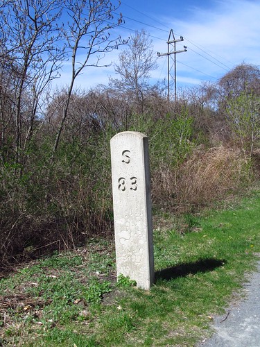
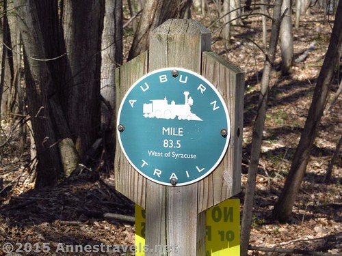
Mile marker along the Auburn Trail
The gpx file for the Auburn Trail / Lehigh Valley Trail can be downloaded – please note that this and the GPS Coordinates are for reference only and should not be used as a sole resource when hiking this trail.
Download GPX File size: 171.3 KB Downloaded 105 times
(Note: I do my best to ensure that all downloads, the webpage, etc. are virus-free and accurate; however, I cannot be held responsible for any damage that might result, including but not limited to loss of data, damages to hardware, harm to users, from use of files, information, etc. from this website. Thanks!)
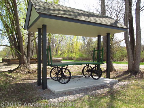
Restored baggage cart in Rochester Junction Park
Getting to the Victor end of the Auburn Trail:
From I-90 (New York State Thruway), take Exit 44 to Rt. 332 (Rochester Road). After 1.4 miles, turn right onto NY-96S for an additional 1.4. Turn left onto E Victor Road and drive 0.4 miles. Turn right onto Break of Day Road for 0.1 miles to the trailhead, on left.
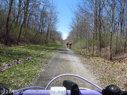
Riding along the Lehigh Valley Trail
From Victor, NY, drive Victor-Manchester Rd to E Victor Road; turn right and drive 0.4 miles. Turn right onto Break of Day Road for 0.1 miles to the trailhead, on left.
Zoom map out to browse nearby hikes & places of interest
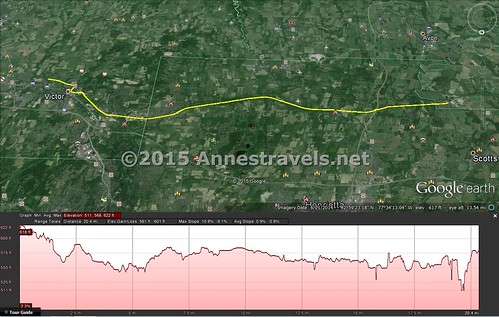
Visual map of the Auburn and Lehigh Valley Trail. North is down, so the map and the elevation profile both work left to right!
This Week’s Featured Product!
Interested in other Rails to Trails in New York State? This book, published by the Rails to Trails Conservancy, covers nearly 40 such trails, and includes black and white photos and maps.
More Related Posts:
 Genesee Riverway and Erie Canal Path: History via Bikes
 Beautiful Keuka Outlet Trail!
 Genesee Riverway – Ontario Beach Park, Turning Point Park, & Maplewood Park
 Genesee Valley Greenway – Oakland to Letchworth
 Erie Canal: Meridian Center (Rochester) to San Souci Park (Brockport)
 The Big Bend Road in Letchworth
Very nice writeup. From Victor Hiking Trails, Thank You.
You would like the Auburn Trail as it goes NW from the Lehigh Trail probably even better.
Maps and descriptions of the Victor trails are at the VHT web site.
The town of Victor now has over 55-miles of trails. From the railbed multi-use, to a mountain biking park, to single track over hills and through swamps hiking trails.
Hi Jeff, thank you so much for letting us know! I’ll have to check it out 🙂