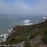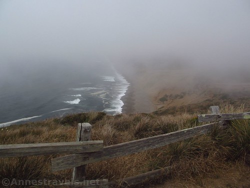
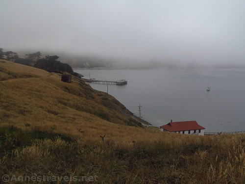
Foggy views from the viewpoint near the Point Reyes Lighthouse parking area
It’s been said that Point Reyes is the second foggiest place in North America – the foggiest being somewhere in Newfoundland – so it shouldn’t have surprised me that it was foggy when we visited late one afternoon in July. In fact, it was so foggy it was hard to see much more than five feet ahead at times. Still, we did visit, and maybe I can go back some day when it’s nicer – I hear winter is a good time for clear weather (and whale watching).
Quick Stats
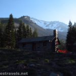
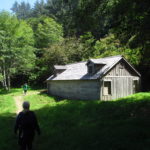
Old building (used for something!) along the road up to the lighthouse
I’ll also go back when the lighthouse is open. I hadn’t done my research right, and it happened to be closed the day I was there. It was just as well; due to vehicle issues, we would have arrived 3 minutes after the lighthouse closed if it had been open. So all in all, we didn’t see what we came to see, and couldn’t see much else, but I’ll let you know what you can see if you go on a foggy day when the lighthouse is closed – because despite what some of my group members say, it wasn’t a complete waste, because I, at least, enjoyed myself!
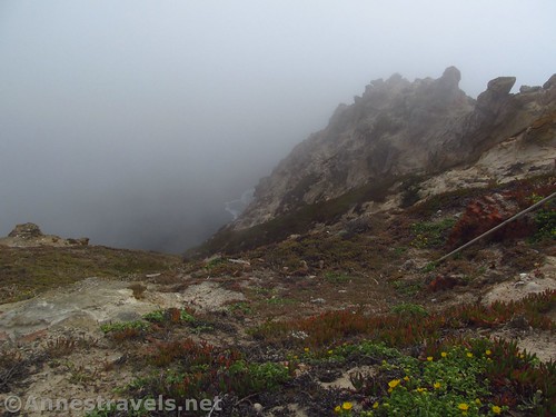
It was pretty foggy the day I visited
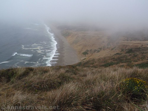
We started out at the parking area for the lighthouse. Before walking up the road to the lighthouse area, we took the almost social-looking trail across the headland to a viewpoint. It’s only 0.25 miles RT to the viewpoint, so I do recommend it. Even in the fog, we saw some deer grazing, and the beach showed itself a number of times if we were patient enough to wait.
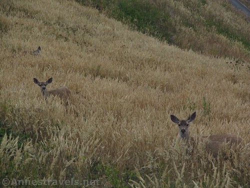
Deer – these were along the trail to Chimney Rock, so there must be quite the population on Point Reyes
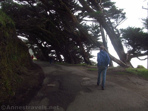
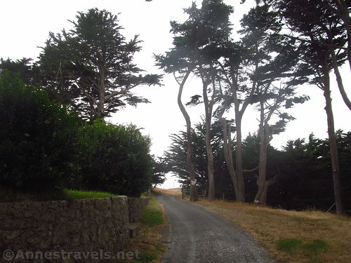
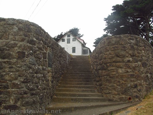
Our next venture was up the road toward the lighthouse (you can’t drive this road; you must walk it – and it’s uphill the whole way). Pass a few historic buildings along the way, and finally arrive at the visitor center 0.5 miles from the parking area. You can get information here and see a few historical displays; it was closed during my visit (but that makes sense, right?)
Walking the road to the lighthouse
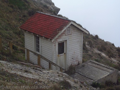
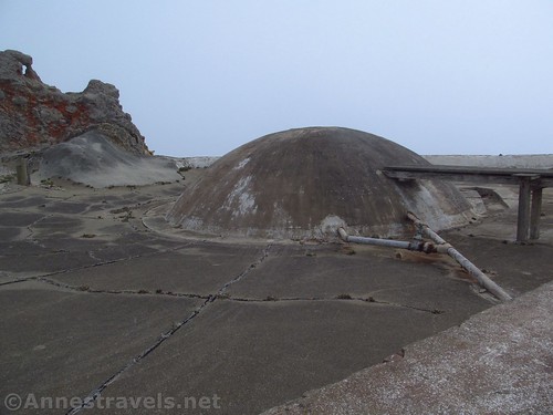
Continue beyond the visitor center via some narrow concrete sidewalks, and you’ll eventually pass some concrete domes that were part of the lighthouse workers’ water catchment system, and then come to an overlook of the lighthouse almost a tenth of a mile beyond the visitor center.
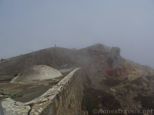
Water catchment system for the lighthouse crew (back in the day)
From here, you can look down on the lighthouse (barely visible through the fog on my visit), or, if the lighthouse is open (usually 10am-4:30pm Thursday-Monday), you can take the 308 very steep stairs down to the lighthouse itself. I won’t detail that, because I visited on a Wednesday.
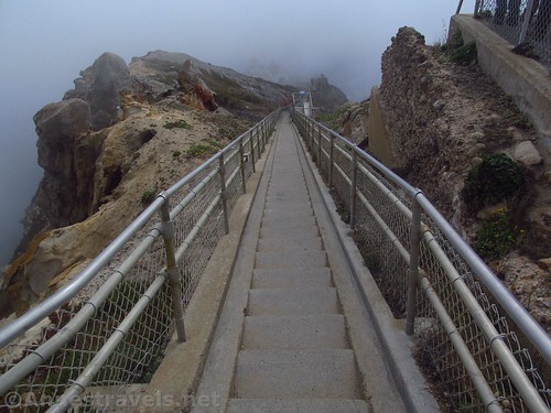
Stairway down to the lighthouse
At the overlook, the bark of the seals below, even in the summer, was totally eerie in the misty fog, sometime hollow, sometimes almost overpoweringly loud – I can’t imagine what the noise must be like in the winter, when the seal population increases!
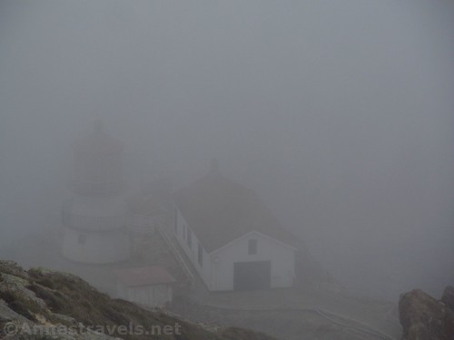
About the best view we got of the lighthouse – the fog was thick!
We took some pictures, then retraced our steps and drove over to the parking area for Chimney Rock and the Elephant Seals Overlook.
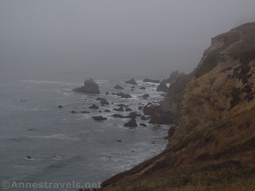
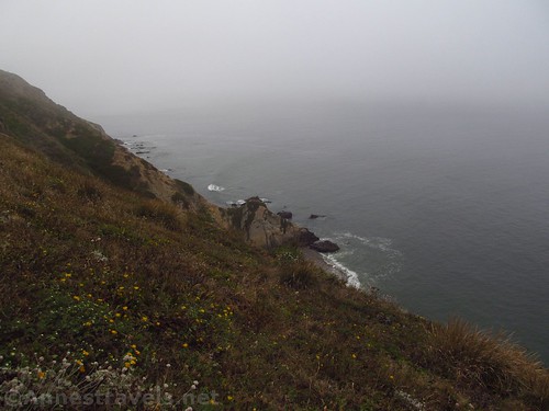
Sea stacks below Chimney Rock Overlook
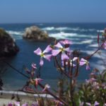
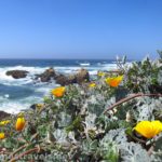
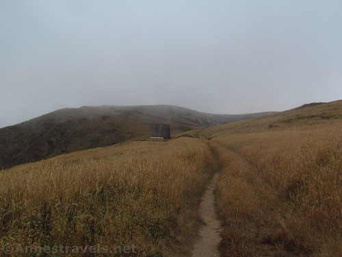
At this point, most of the group decided they really did not want to hike another trail, so three of us set off up the Chimney Rock Trail. It basically passes through headland-top meadows for 0.9 miles; when the wildflowers are out, it is quite spectacular. There are plenty of social trails, but it’s not hard to stay on the main path.
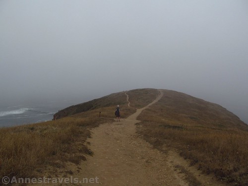
Trail to Chimney Rock Overlook
In 2015, a study discovered that there were fishers forming in a number of the cliffs along the trail. However, instead of abandoning the trail, the park service simply requests that you stay on the official path. I’m not sure if this is comforting or makes me think twice about hiking in the area.
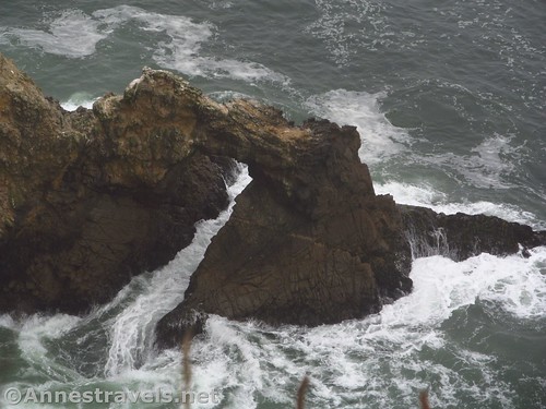
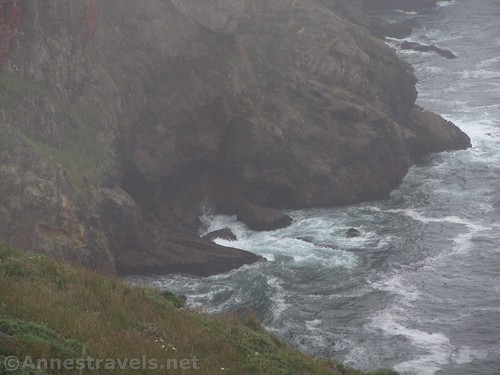
What you can see from the overlook: a sea arch
Of course, the problem with the official trail is that they did change the viewpoint after the study. And that means that you can’t see Chimney Rock, at all, from the Chimney Rock Trail. No joke. We were standing next to the fence at the end of the trail, climbing on the fence, holding the camera over our heads and shooting blindly, hoping to maybe catch a glimpse of the sea stack at the end of the headland known as Chimney Rock. Visitors before us were so impressed that there is a very worn path to the end of the headland, and the fence was even knocked down in the center to allow people through. While I didn’t go beyond the end of the fence, I sensed their pain: if you promise me Chimney Rock, than I want to see Chimney Rock!
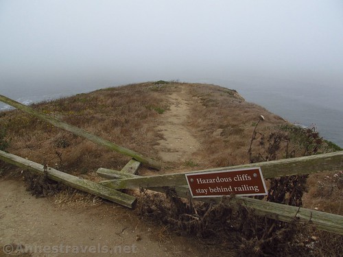
Fence at the Chimney Rock Overlook. I didn’t go beyond the fence, but you also can’t see Chimney Rock from the Overlook.
We retraced our steps about 0.6 miles to where another trail / old road (?) diverges to the right. It’s a little vague, but still very much there. The trail descends gently off the headland, passing a couple old water catchment cisterns (made of wood) to the road about 0.2 miles later. From here, you could turn right toward a dock, but I turned left up the road.
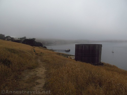
Water catchment tank along the “trail” over to the lifesaving station
The road winds back up to the top of the headland past a historic lifesaving station (don’t explore too much; people still live here, so respect their privacy). A group of men would hang out at the station, then when a call came out, they would leave in boats from the dock to help save the victims. As the sign says, “You have to go out, but you don’t have to come back.” Still, I gather there were fewer fatalities than might be expected in this type of business, and innumerable lives were saved by these brave men.
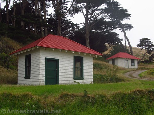
Two of the buildings that were part of the lifesaving station
The road ends right back at the parking area, 0.1 miles beyond the turnoff (on right) to the Elephant Seal Overlook. We were very pressed for time at this point, so we didn’t go out to the overlook even though it’s only 0.3 miles RT.
Road by the lifesaving station that takes you back to the parking area
But someday, I want to go back, visit the lighthouse and all… and also visit Sculptured Beach, which I hear is amazing!
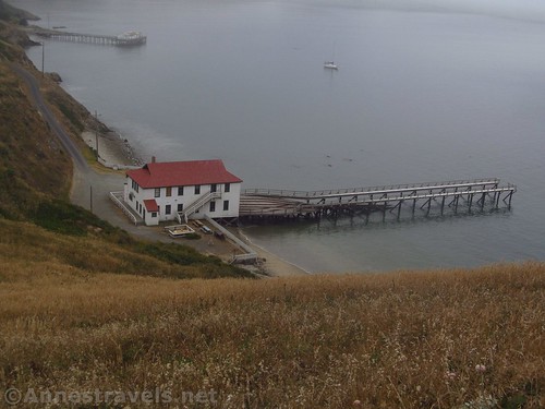
Docks for the old lifesaving station
Round Trip Trail Length: 1.4 miles to the viewpoint / lighthouse viewpoint; 1.9 miles to Chimney Rock Overlook and the lifesaving station. Total is 3.3 miles RT.
Net Elevation Change: 34ft. to the lighthouse overlook; 97ft. to Chimney Rock Overlook and the lifesaving station
Facilities: Restrooms and visitor information near the lighthouse (which, amazingly, were open!)
Fees: None (see below about the shuttle bus fees, required on winter weekends and federal holidays)
Trail Notes: Do this on a day when it’s nice. And make sure the lighthouse will actually be open, lol. Note that Point Reyes is extremely isolated; make sure you have food and gas and any other necessities before driving out onto the island. Also note that some days you are not allowed to drive out to the park, but instead must pay to take the shuttle (see below).
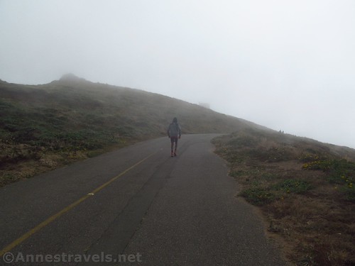
Walking up the misty road to the lighthouse
Trail 
Road
Signs
Scenery
Would I go 100 miles out of my way for this?
Overall Rating:
Views from the overlook near the lighthouse parking area. I would guess they’d be quite good on a clear day.
GPS Coordinates for the Point Reyes Lighthouse
Trailhead: 37.9980472°N, -123.0123917°W (37°59’52.97″N, -123° 0’44.61″W / 37°59.88283’N, -123°00.74350’W) (477ft.) (0.0; ended 1.39)
Viewpoint: 37.9990472°N, -123.0136583°W (37°59’56.57″N, -123° 0’49.17″W / 37°59.94283’N, -123°00.81950’W) (417ft.) (0.13)
Visitor Center: 37.9965167°N, -123.0204389°W (37°59’47.46″N, -123° 1’13.58″W / 37°59.79100’N, -123°01.22633’W) (508ft.) (0.75)
Lighthouse View: 37.9964500°N, -123.0210028°W (37°59’47.22″N, -123° 1’15.61″W / 37°59.78700’N, -123°01.26017’W) (511ft.) (0.82)
Another view of the water catchment system near the lighthouse
GPS Coordinates for Chimney Rock Overlook
Trailhead: 37.9950278°N, -122.9794778°W (37°59’42.10″N, -122°58’46.12″W / 37°59.70167’N, -122°58.76867’W) (126ft.) (0.0; ended 1.99)
Chimney Rock Overlook: 37.9902861°N, -122.9654917°W (37°59’25.03″N, -122°57’55.77″W / 37°59.41717’N, -122°57.92950’W) (167ft.) (0.91)
Trail Junction: 37.9929639°, -122.9731222°W (37°59’34.67″N, -122°58’23.24″W / 37°59.57783’N, -122°58.38733’W) (116ft.) (1.49)
Meet Road: 37.9946333°, -122.9761806°W (37°59’40.68″N, -122°58’34.25″W / 37°59.67800’N, -122°58.57083’W) (70ft.) (1.70)
Lifesaving Station (near house): 37.9954083°N, -122.9778417°W (37°59’43.47″N, -122°58’40.23″W / 37°59.72450’N, -122°58.67050’W) (74ft.) (1.82)
Elephant Seal Overlook Junction: 37.9955778°N, -122.9793250°W (37°59’44.08″N, -122°58’45.57″W / 37°59.73467’N, -122°58.75950’W) (101ft.) (1.92)
Up the stairway to the house used by the lifesaving personnel. Allow the current people who live in it their privacy. We stayed on the road.
The gpx file for the trail to the Point Reyes Lighthouse and for the Chimney Rock Overlook Trail can be downloaded – please note that this and the GPS Coordinates are for reference only and should not be used as a sole resource when hiking this trail.

Wildflowers along the trail to the lighthouse
Lighthouse:
Download GPX File size: 24.6 KB Downloaded 81 times
Chimney Rock Trail:
Download GPX File size: 22.7 KB Downloaded 84 times
Looking back up the “trail” to the lifesaving station toward the Chimney Rock Overlook
(Note: I do my best to ensure that all downloads, the webpage, etc. are virus-free and accurate; however, I cannot be held responsible for any damage that might result, including but not limited to loss of data, damages to hardware, harm to users, from use of files, information, etc. from this website. Thanks!)
Waves swirl around the bottom of the cliffs
Getting to Point Reyes
From San Francisco, head north on US-101N; take Exit 445B for CA-1 toward Mill Valley / Stinson Beach. Stay on CA-1N for 27.2 miles. Turn left on Sir Francis Drake Blvd for 18.3 miles. At this point, you can turn left 0.9 miles to Chimney Rock, or you can continue straight 1.0 miles to the parking area for the lighthouse.
Hiking from Chimney Rock Overlook to the lifesaving station
From Santa Rosa, head south on US-101S. Take Exit 474 toward E Washington Street; turn right on E Washington Street for 0.7 miles, left on Copeland Street for 0.1 miles, right on E D Street (as in, East D Street) for 15.5 miles. Turn right on Point Reyes-Petaluma Road for 3.1 miles, then left on CA-1S for 0.8 miles. Turn left on Sir Francis Drake Blvd for 18.3 miles. At this point, you can turn left 0.9 miles to Chimney Rock, or you can continue straight 1.0 miles to the parking area for the lighthouse.
Cliffs along the trail to Chimney Rock Overlook
Note that once you turn onto Sir Francis Drake Blvd, civilization diminishes rapidly to a fairly desolate farmland with a few military facilities. The road diminishes, too, and you won’t be traveling more than about 35mph on the disintegrating blacktop road (low clearance is fine). Driving through the mist made it all the more eerie and desolate-looking. Do pay attention as farm animals may wander out into the road.
The parking areas are fairly small; they have significant parking issues on weekends. During the winter, when whales are migrating and there are a significantly higher population of elephant seals, the road closes to private vehicles, and anyone wanting to visit must take the shuttle bus ($7/person 16+; not covered by park passes). The regulation system, and when each attraction is open, is pretty confusing, so take some time to understand it for the specific timeframe you will be visiting.
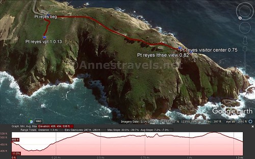
Visual trail map of my walk to a viewpoint and then up to the Point Reyes Lighthouse (but not down to the lighthouse)
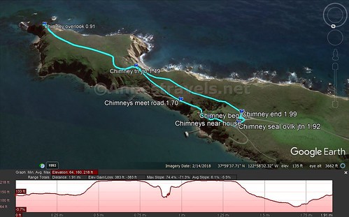
Visual trail map of my walk out to Chimney Rock Overlook, then down to the lifesaving station, and back up to the parking area
Zoom map out to browse nearby hikes & places of interest
This Week’s Featured Product!
If you’re looking for more info on hiking and walking on Point Reyes, check out this little pocket guide!
[forecast location=”Bodega Bay, CA” caption=”Weather for Point Reyes” measurement=’F’ todaylabel=”Today” datelabel=”date(‘D M d’)” highlow=’%%high%%°/%%low%%°’ numdays=”5″ iconset=”Default”]