
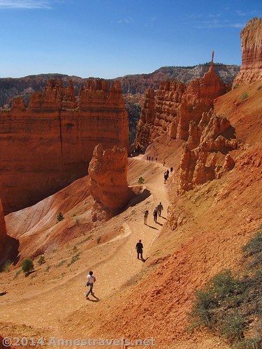
Walking up the Navajo Trail through the spires
There are many short trails in Bryce Canyon, and so many with wonderful views. Even if you’ve hiked the trails before, they’re worth doing again. I can’t count the number of times we’ve hiked the Queen’s Garden Trail, but it simply doesn’t get tiring. Part of the reason for this is the wonderful views that change per the time of day and the current conditions (we once visited Bryce just so we could see snow on the canyon along this trail), and part of the reason is because there are several options for loop hikes that begin or end around the Queen’s Garden.
Quick Stats
Many bloggers have already talked about the ins and outs of this trail, so I’ll just share some of the pictures I took on my last visit.
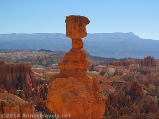
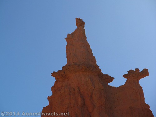
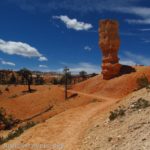
A balancing rock hoodoo
The important facts: The Queen’s Garden Loop begins at Sunrise Point. It is considered a “difficult” trail, descending into Bryce Canyon for 1.8 miles (2.9 km). Queen Victoria is located 0.8 miles (1.3 km) down the trail; the extra mile (1.6 km) takes you through the canyon bottom to the Navajo Trail, allowing you to make it a loop hike by ascending the Navajo Trail to Sunset Point and then hiking the Rim Trail back to Sunrise Point. This loop is a total of 3.6 miles (5.8 km) (give or take a bit depending on which part of the Navajo Trail (it’s a loop) you take up to Sunset Point). Alternatively, during the summer months, it is possible to take the free park shuttle back to Sunrise Point, cutting 0.5 miles (0.8 km) from the hike.
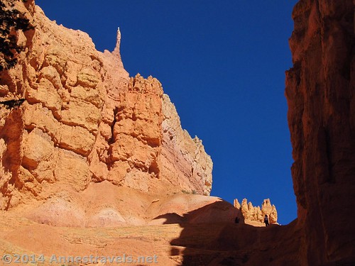
Starting from Sunrise Point very early on morning in May (a lovely time to visit – between the snow and the summer heat), the trail almost immediately begins to descend steeply. Not far down the trail, a break in the rock formations on your right allows us to see through to the hoodoos in the bottom of the canyon.
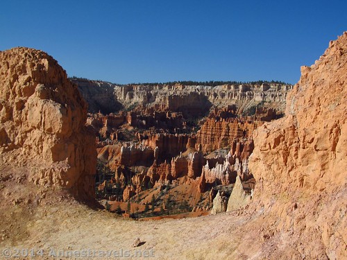
First view of some some of the canyon
Rock formations in the early morning light

Beautiful!
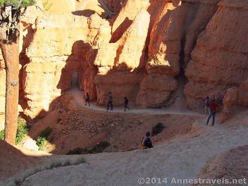
The trail switchbacks down to an archway through a hoodoo
And turning around…wow!
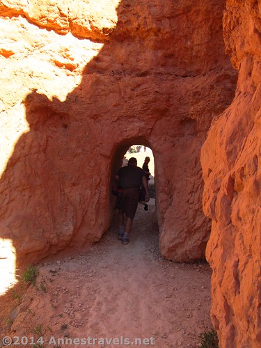
Well, that archway is none to large
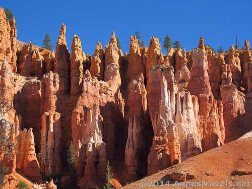
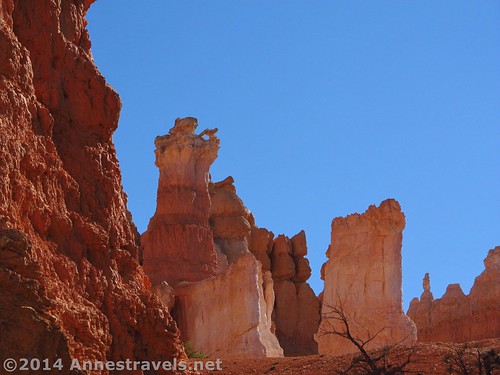
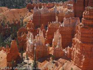
Beautiful hoodoos near the Queens Garden
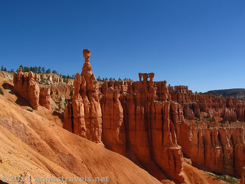
Queen Victoria (the Queens Garden is a few hundred feet (a few dozen meters) off the main trail – it’s well worth going to!)
Another interesting formation near Queen Victoria…a man with a slingshot?

And not too far away…a castle?
After another mile (1.6 km), the trail comes to an end at the Navajo Loop Trail. You can either travel through Wall Street (very cool!) or you can go past the Two Bridges. I love Wall Street (you can read about that here) but the trail was closed, so we opted to hike up past the Two Bridges.
Are the trees sticking out of the hoodoos…or just behind them?
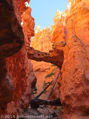
The Twin Bridges
Switchbacking back up to Sunset Point – it’s actually much worse than this 🙂
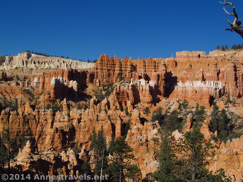
Hoodoos from Sunset Point
From here, it’s a pretty walk along the rim back to Sunrise Point (or you can take the free shuttle if it’s running). Along the trail, the sign designers decided to add a little humor:
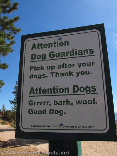
Attention, Dogs…
Round Trip Trail Length: About 3.6 miles (5.8 km) (see important information)
Highest Point: 8,042 ft. (2,451 m)
Lowest Point: 7,423 ft. (2,262 m)
Net Elevation Gain / Loss: 619 ft. (188 m)
Facilities: Restrooms at both Sunrise and Sunset Points; also a snack shop, showers, and who-knows-what-all at Sunrise Point.
Fees: $25 to enter Bryce National Park, valid 7 days. America the Beautiful (Interagency), Senior (Golden Age), Access (Golden Access), Volunteer, Military, and Bryce Annual Passes also accepted.
Trail 
Road
Signs
Scenery
Would I go 100 miles out of my way for this?
Overall Rating:
Key GPS Coordinates for the Queens Garden Trail
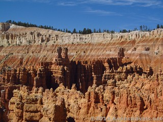
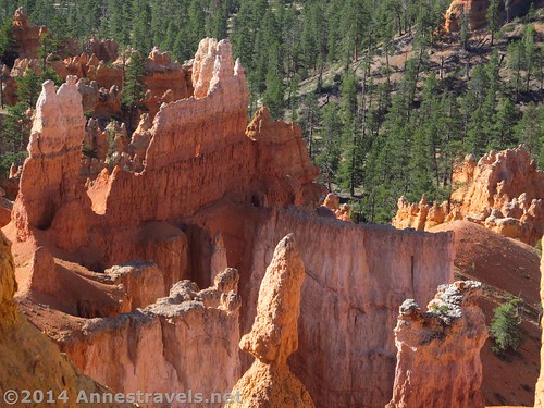
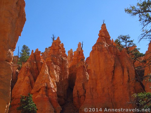
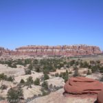
So many hoodoos…near Sunset Point at the top of the Navajo Trail
Sunrise Point: 37.63097N / 112.16438W (7,999ft.; 2,438 m)
Horse Trail Junction: 37.62559N / 112.15885W (7,698ft.; 2,346 m)
Queens Garden / Victoria Trail Junction: 37.62546N / 112.16111W (7,607ft.; 2,318 m)
Queen Victoria Formation: 37.62496N / 112.16172W (7,637ft.; 2,327 m)
Queens Garden / Navajo Trail Junction: 37.61823N / 112.16199W (7,482ft.; 2,280 m)
Key GPS Coordinates for the Navajo Trail
Queens Garden / Navajo Trail Junction: 37.61823N / 112.16199W (7,482ft.; 2,280 m)
Navajo Trail Junction: 37.62244N / 112.16578W (7,935ft.; 2,418 m)
Top of the Navajo Trail: 37.62271N / 112.16609W (8,017ft.; 2,443 m)
The gpx file for the Queens Garden Navajo Loop can be downloaded – please note that this and the GPS Coordinates are for reference only and should not be used as a sole resource when hiking this trail.
Download File size: 67.9 KB Downloaded 255 times
(Note: I do my best to ensure that all downloads, the webpage, etc. are virus-free and accurate; however, I cannot be held responsible for any damage that might result, including but not limited to loss of data, damages to hardware, harm to users, from use of files, information, etc. from this website. Thanks!)
Getting to the Queens Garden Trailhead (Sunrise Point)
Looking down on the hoodoos from the rim
From Kanab, UT, drive about 60 miles (95 km) north on US-89N. Turn right onto UT-12 E for 13.6 miles (21.8 km), then turn right again onto UT-63 for 4.2 miles (6.2 km). Follow the signs for Bryce Canyon National Park; it is well-marked. Turn left, following the signs for Sunrise Point. After 0.5 miles (0.8 km), turn left again; parking should be about 0.25 miles (0.4 km) further on the right (more parking is available slightly further along the road).
Alternatively, from I-70, take Exit 23 onto US-89S. Drive about 67 miles (107 km), turning left to stay on US-89S after 60 miles (96 km). Turn left onto UT-12 E for 13.6 miles (21.8 km), then turn right again onto UT-63 for 4.2 miles (6.2 km). Follow the signs for Bryce Canyon National Park; it is well-marked. Turn left, following the signs for Sunrise Point. After 0.5 miles (0.8 km), turn left again; parking should be about 0.25 miles (0.4 km) further on the right (more parking is available slightly further along the road).
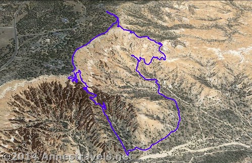
Visual map of the Queens Garden Trail / Navajo Trail Loop
Zoom map out to browse nearby hikes & places of interest
This Week’s Featured Product!
If you’re looking for non-backpacking hikes in Utah, this is an excellent guide, showcasing some of the state’s best scenery and trails. My favorites are Chesler Park, Devil’s Garden, and the Peek-a-Boo Loop, but there really is a trail for every dayhiker in this guide.
[forecast location=”Tropic, UT” caption=”Weather for the Queens Garden and Navajo Trails” measurement=’F’ todaylabel=”Today” datelabel=”date(‘D M d’)” highlow=’%%high%%°/%%low%%°’ numdays=”5″ iconset=”Default”]

I have never seen Bryce Canyon “live”, but I first discovered it about 15 years ago. When you Google images of Bryce Canyon cliff dwellers, what an incredible collection of photography. That was how I happened to find your website. Stunning photos. When I study cliff dwellers in other parts of the world and then look at Bryce I instinctively believe that the hoodoos, Queen’s garden …what look exactly like statues of various people dressed in flowing gowns like royalty including crown the amphitheatre, I can’t help but believe this really was man-made. I also sense much of the canyon was partially full of water you might say with people living much like those in Venice.
Who knows, but thanks for the fabulous photography.
Pingback: 15 of the Best Day Hikes in Southern Utah - Anne's Travels
Pingback: Joining in God’s Pleasure - Anne's Travels