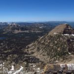
Views of Naturalist Basin and the High Uintas from Mt. Agassiz
On visiting the Uinta Mountains last June, we decided on our last day to take a bit of a risk. The risk wasn’t in scenery – it’s hard not to have a good view from the top of a rocky mountain in the Uintas – but in trail and trail length. While I had quite a few trail descriptions of how to climb Mt. Agassiz, all but one of them began the ascent from Naturalist Basin. The problem with that was that the basin itself is a 14 mile out & back hike – already a longer dayhike than I wanted to tackle. But one solitary blog article told (in succinct and exact terms) how to climb Mt. Agassiz the short way – up the southern slopes of the mountain and bypassing Naturalist Basin altogether.
Quick Stats
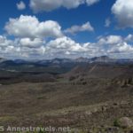
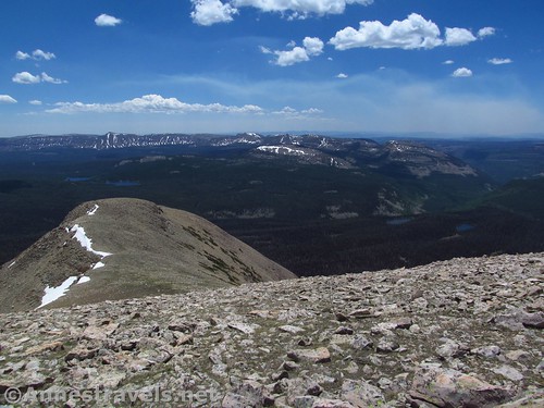
Views from the lower part of the southern slopes of Mt. Agassiz
The blogger said it should only be about 11 miles round trip. I’m afraid I didn’t believe him, but I figured it couldn’t more than 12 or 13 miles, and we would get a good view whether or not we actually made it to the summit.
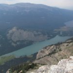
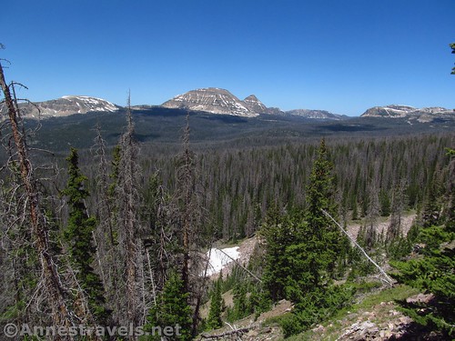
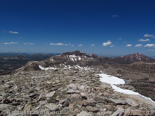
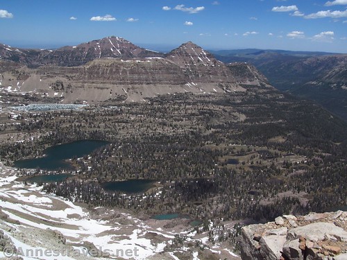
Views of cliffs, Mirror Lake, Bald Mountain, and more just before the final saddle
As it turned out, the blogger was almost exactly right on his trail mileages (my apologies to you, sir!) And the views – oh, the views – over Naturalist Basin, Kings Peak, the Mirror Lake Recreation Area, and more lakes and peaks than I could name was absolutely stunning!
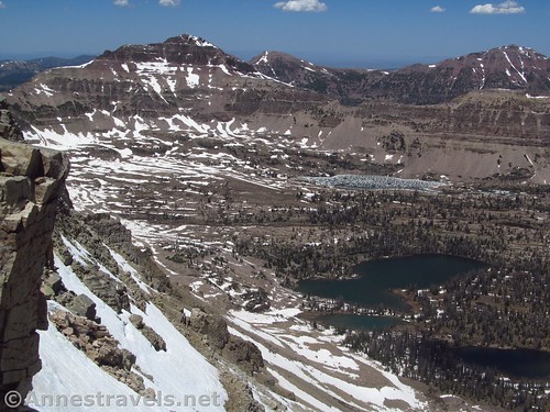
Looking down on Naturalist Basin from the saddle below Mt. Agassiz
Start at the Highline Trailhead just north of the Mirror Lake Recreation Area. Walk up to the restrooms and the trailhead is just to the right of the small building (near the signboard – don’t go down to the lake). The trail descends to a junction with a trail to Mirror Lake at mile 0.8; turn left (on the Highline Trail) and keep walking as the trail descends into a creek basin about the same time the trail enters the High Uinta Wilderness at mile 1.3.
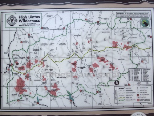
Trail map at the trailhead. The Highline Trailhead and Naturalist Basin are both in the center, far left
Keep walking past the signboards (which, when I visited, told equestrians that they could tether a horse to a tree for 1 hour, for 2 hours, and might tether horses to trees under no circumstances whatsoever – all on one signboard!) Ascend with the trail, then descend again (!). At mile 3.0, continue straight (left) when the trail to Packard Lake goes off to the right. You’ll be following the sign toward Rocky Sea Pass.
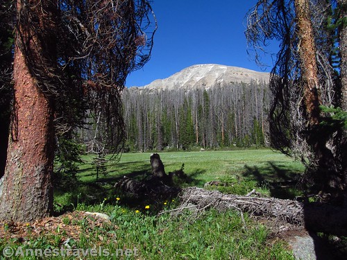
Mt. Agassiz from along the trail. Notice that long, sloping side on the right? That’s where we’re headed.
It’s surprising, but even though Naturalist Basin seems to be the premier destination in this part of the Uintas, there certainly aren’t many signs pointing in its direction. Perhaps the Forest Service is trying to keep it a not-very-well-hidden secret?
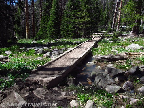
A bridge, stream, and wildflowers along the trail
From here the trail climbs for the next 0.8 miles. At the place where the trail begins its next descent, 3.8 miles from the trailhead, strike left, off-trail, through the forest. You’re heading for the slopes of Mt. Agassiz. You’ve seen the peak through the trees a few times and it’s not too hard to figure out where it is – if you start heading down, you’re heading in the wrong direction.
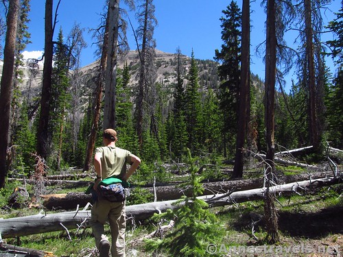
Off-trail, heading for those steep slopes ahead. If you start heading down, you’re going the wrong way 🙂
I hit the slopes of Mt. Agassiz about 0.4 miles later. You know when you’ve hit the slopes – the mild grade suddenly turns nearly straight up! You can still hike it, but it’s a Class 2 scramble at times bordering on Class 3 (to me the difference is that for Class 3 you need to use all four limbs – no ropes required).
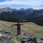
As soon as your head is above the trees, the views to Bald Mountain are outstanding!
Scramble straight as you can up the slope and before long the scramble will change from grass and small rocks to larger rocks and a true scree slope. Keep heading up, but stay left around the peak – it’s actually a false summit. But take time out to turn around and look at the view. As soon as you’re above the trees, the view is phenomenal, and as you climb, the view gets even better!
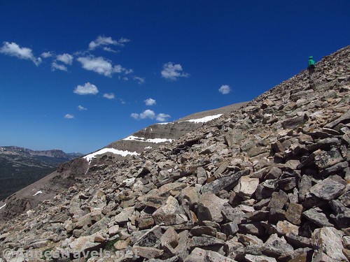
One of the steep scree slopes – you are going up, but you’re also moving laterally north
Keep going up, keeping left to skirt a second false summit. This section is a little steeper (you’re more or less maintaining elevation, but the slope down is steeper), but with decent balance, you should be fine. Keep walking to enter a saddle between the second false summit and the true bulk of Mt. Agassiz.
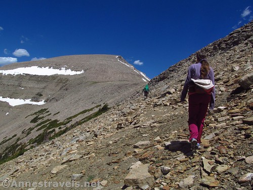
Walking the last scree slope into the saddle below Mt. Agassiz (straight ahead)
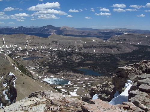
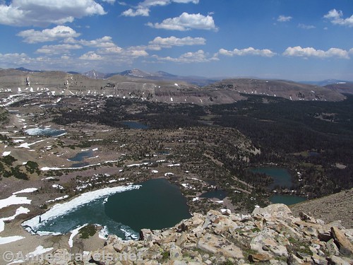
Stroll across the grassy saddle to look down on the other side. It was one of those “Oh wowowowow!!!!!” moments when I saw the view; below is Naturalist Basin, which is apparently the premier destination in the Uinta Mountains (or at least this part of the Uintas). I can’t testify what it is like to visit, but from above it’s beyond stunning to truly remarkable, especially when the lakes are still half-frozen and the peaks beyond are still streaked with snow. Incredible! I could turn around right here and not feel I had missed out (though of course you would; there’s more views to come!)
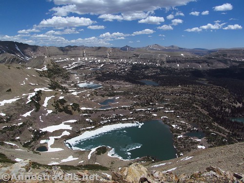
My first view down into Naturalist Basin – it took my breath away!
Scramble up the final stretch to the peak of Mt. Agassiz. I think the right-hand end is higher; we ended up there first (it’s almost exactly a mile from where I started up the steep slope) and enjoyed the incredible views down on Naturalist Basin and to the High Uintas – even all the way to Kings Peak, the highest point in Utah – and then wandered toward the right-hand end.
The peak of Mt. Agassiz
This has stunningly beautiful views across Mirror Lake Recreation Area all the way to Bald Mountain and Ibantik Lake; we could also see the smoke from a fire over near Strawberry Reservoir, even though mountains blocked the view of the lake.
Bald Mountain, Ibantik Lake area, and surrounding lakes & peaks (Mirror Lake is in the foreground)
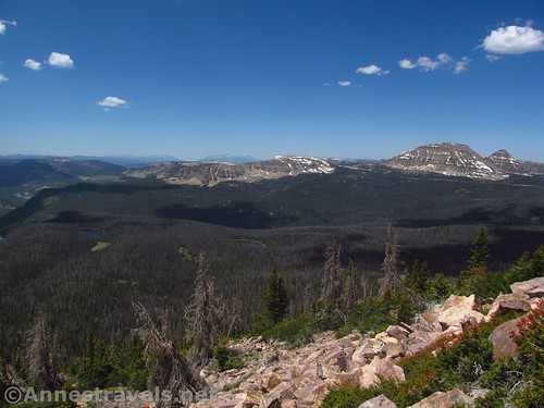
There are also fantastic views down into Middle Basin and to Hayden Peak. It was all so beautiful; so spectacular. It was hard to tear my eyes away enough to eat a snack (which I needed – climbing mountains is hard work!)
Looking the direction of Middle Basin from Mount Agassiz
All too soon it was time to go back – we had left half the group at the base of the seep section, and while I was fairly sure they would go back to the parking area by this time, I still wanted to get back to them. So we started the descent. The only sticky part was finding the trail again once in the woods; I highly recommend a GPS coordinate for that. Otherwise, it was a terrific hike – even if almost half of it was without a trail!
Heading back down Mt. Agassiz
Round Trip Trail Length: I finished at 11.8 miles
Net Elevation Change: About 2,453ft. (9,929ft. to 12,382ft.)
Facilities: Primitive restrooms and a few picnic tables at the trailhead
Fees: Per vehicle: $6/1-3 days; $12/7 days; $45/annual pass – purchase at the Forest Services offices in Kamas, Evanston, or Bear River; passes may also be purchased at the Samak Smokehouse, Mirror Lake Service (Chevron), High Mountain Restaurant, or the Kamas Foodtown. Non-annual passes may be purchased at various self-service fee tubes along the Mirror Lake Highway. National Parks & Federal Recreational Lands Passes are honored.
Trail Notes: Make sure the trail / road are open before you go – the trail was still technically snowy when I hiked in mid-June, though I didn’t see any snow at all except on the very top of the peak / surrounding peaks. Also, use care with your footing – the scree is stable until a rock decides to tip on you!
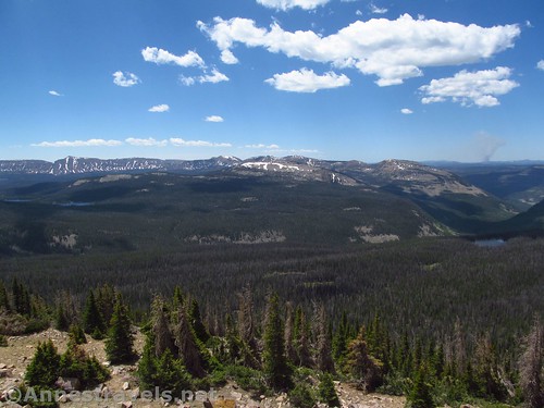
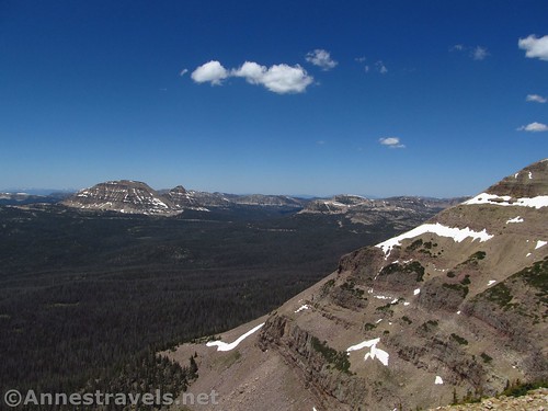
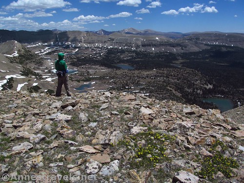
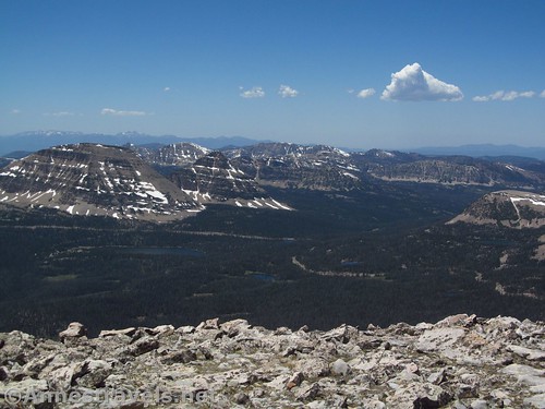
Peaks and lakes to the south – you can see the smoke from the Strawberry Reservoir Fire on the right side of the photo
Trail 
Road
Signs
Scenery
Would I go 100 miles out of my way for this?
Overall Rating:
Lower Naturalist Basin
Key GPS Coordinates for Mt. Agassiz
Trailhead: 40.7219333°, -110.8639333° (40° 43.316′, -110° 51.836′ / 40°43’18.9600″, -110°51’50.1600″) (10,388ft.) (0.0) (end 11.83)
Mirror Lake Junction: 40.7151833°, -110.8624500° (40° 42.911′, -110° 51.747′ / 40°42’54.6600″, -110°51’44.8200″) (10,134ft.) (0.79)
Enter High Uintas Wilderness: 40.7102667°, -110.8564833° (40° 42.616′, -110° 51.389′ / 40°42’36.9600″, -110°51’23.3400″) (9,945ft.) (1.32)
Packard Lake Junction: 40.6949667°, -110.8412333° (40° 41.698′, -110° 50.474′ / 40°41’41.8800″, -110°50’28.4400″) (10,091ft.) (3.03)
Leave the Trail: 40.6922167°, -110.8280833° (40° 41.533′, -110° 49.685′ / 40°41’31.9800″, -110°49’41.1000″) (10,264ft.) (3.8)
Begin ascent: 40.6948833°, -110.8245333° (40° 41.693′, -110° 49.472′ / 40°41’41.5800″, -110°49’28.3200″) (10,407ft.) (4.22)
Mount Agassiz: 40.7111500°, -110.8243833° (40° 42.669′, -110° 49.463′ / 40°42’40.1400″, -110°49’27.7800″) (12,382ft.) (5.85)
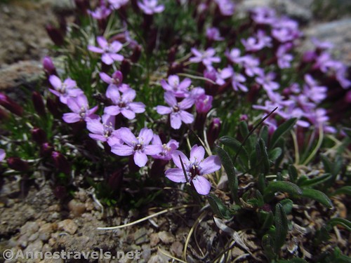
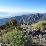
Purple phlox on the slopes of Mt. Agassiz
The gpx file for my route up and down Mt. Agassiz can be downloaded – please note that this and the GPS Coordinates are for reference only and should not be used as a sole resource when hiking this trail.
File size: Download 265.3 KB Downloaded 90 times
(Note: I do my best to ensure that all downloads, the webpage, etc. are virus-free and accurate; however, I cannot be held responsible for any damage that might result, including but not limited to loss of data, damages to hardware, harm to users, from use of files, information, etc. from this website. Thanks!)
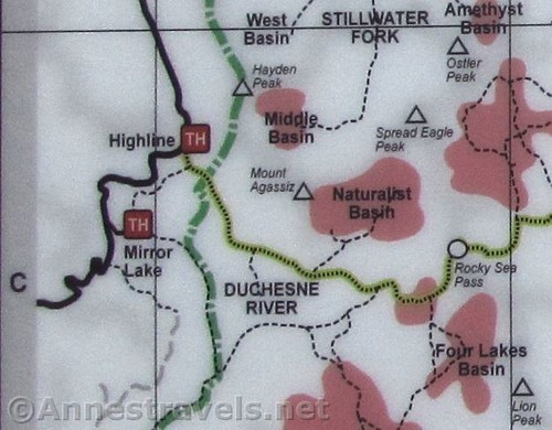
Close up of the map at the Highline Trailhead detailing the Mt. Agassiz / Naturalist Basin area
Getting to Mt. Agassiz Trailhead
From Evanston, WY (Exit 5 on I-80), drive south on UT-150 (toward Wasatch National Forest). After about 43 miles (note that you’ll cross into Utah and be on UT-150 now), turn left for the Highline Trailhead (if you get to the county line, you’ve gone too far). Take an almost immediate right to drive uphill, away from the lake and toward the higher restrooms and the trailhead.
One last view over Naturalist Basin from the saddle below Mt. Agassiz
From Kamas, UT, turn onto UT-150, driving East. Cross Bald Mountain Pass (you can climb up Bald Mountain from there!); just after crossing the county line, turn right onto the road for the Highline Trailhead (34 miles from Kamas). Take an almost immediate right to drive uphill, away from the lake and toward the higher restrooms and the trailhead.
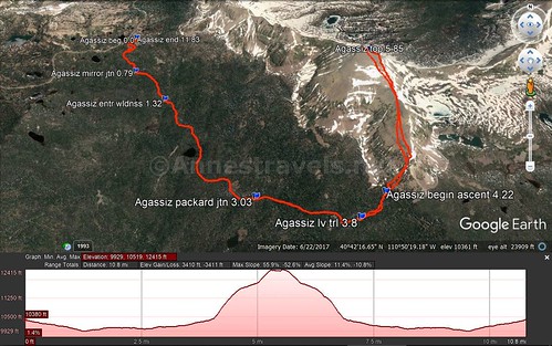
Vistual trail map and elevation profile for my hike / route up the southern slopes of Mt. Agassiz
Zoom map out to browse nearby hikes & places of interest
This Week’s Featured Product!
Looking for more hikes in the Uinta Mountains? Check out this book with 99 trail options, as well as information on fishing and other recreational activities.