
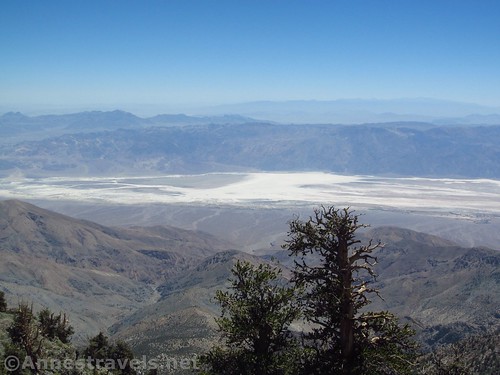
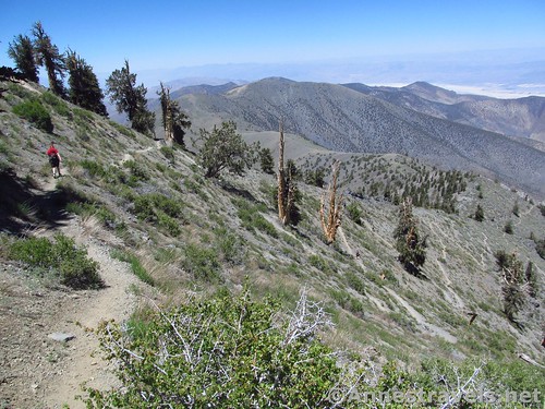
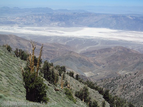
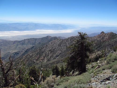
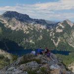
Bristlecone pines and Badwater Basin from the trail up Telescope Peak
It’s not gorgeous, it’s not all that tall, and it’s not all that easy. So why climb Telescope Peak in Death Valley National Park? One reason is bragging rights: It’s quite something to say you’ve been to both the lowest place in the Western Hemisphere and the tallest peak in Death Valley; you can easily do it within 24 hours of each other. Another reason is the interesting view: on one side, you’re looking down on Badwater Flats from above, as well as most of Death Valley National Park; on the other side, you’re looking down on China Lake (no, we didn’t see any fancy planes below us, though it’s altogether possible). Add to this that there are a significant number of ancient bristlecone pines along the way – as well as wildflowers (in season) and some very interesting geology – and you might have a reason to hike Telescope Peak!
Quick Stats
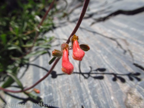
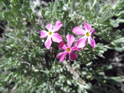
Wildflowers (beaked beardtongue, I believe) along with striped rock along the trail
Start out by hiking to Arcane Meadows at mile 2.3; I described that in more detail in my post about hiking Rogers Peak and Bennett Peak. The short of that story is to start hiking the trail, enjoy the view, and turn with the trail in the first saddle (between Rogers Peak (on right / north, with the radio towers) and Bennett Peak (on left)) to walk along the western flank of Bennett Peak. This is the same route you would take to ascend Bennett Peak.
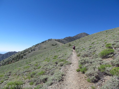
The trail as it ascends gently from the Bennett Saddle
After clearing Bennett Peak, the trail rises slightly to cross the saddle between Bennett Peak / UN9695 and the slopes of Telescope Peak at about mile 2.8. The trail works its way along the eastern slopes of Telescope Peak for a short distance.
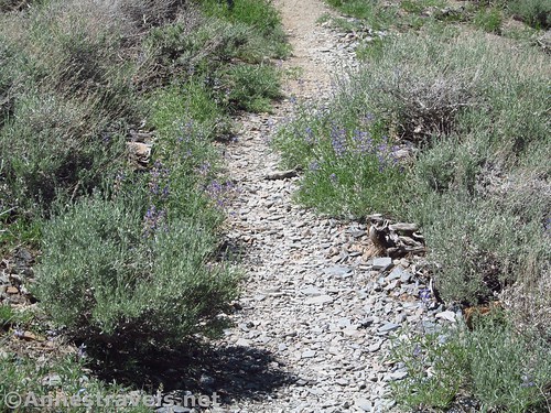
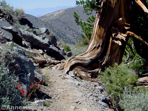
The trail before the switchbacks, along with some lovely lupines
Since entering Arcane Meadows (aka, the Rogers / Bennett saddle), the trail has been fairly flat, often rocky, and quite well-maintained, with some interesting rocks along the trail. After traversing the slopes of Telescope Peak for a short distance, the trail begins to climb – steeply – in multiple switchbacks. This is where many people turn around; the elevation is too much, the climb is too much. It is not an easy section of trail.
The switchbacks. I’m descending here, but it gives you an idea of what you have to climb up.
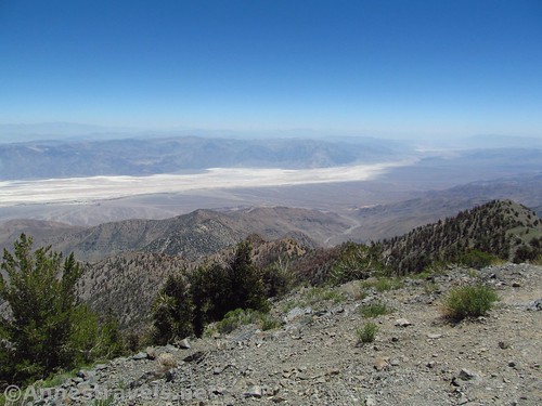
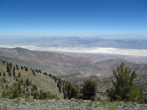
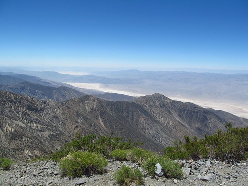
Still, the view is good. It’s mostly of bristlecone pines and over Death Valley National Park, but it gives you something to look at while you’re taking breathing breaks on the switchbacks.
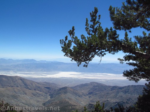
A bristlecone pine branch as a frame for Badwater Flats
With patience, endurance, resting frequently, and gratefulness that the elevation wasn’t hitting us too hard (-200ft. to 11,000ft. in one day is no joke), we finally made it to the saddle below Telescope Peak, proper, at about mile 6.4.
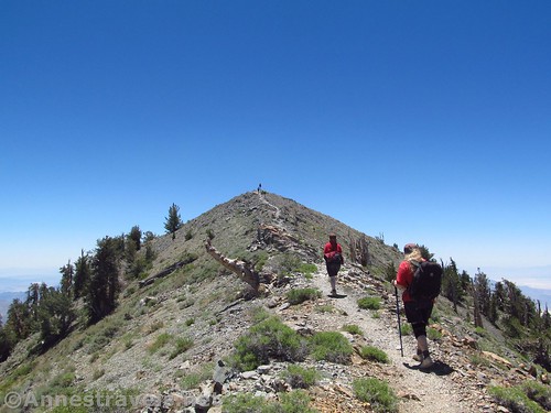
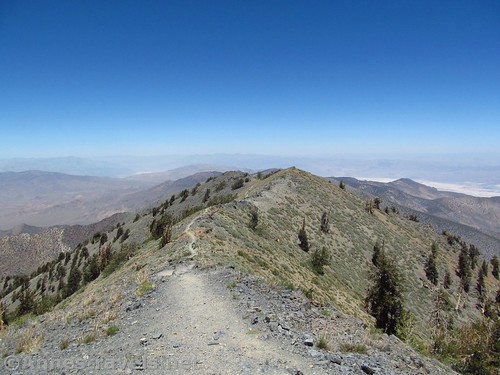
Final push up the peak
If you make it that far, don’t give up. The trail to the peak itself isn’t anywhere near as hard as what you’ve just done. You can do it from here!
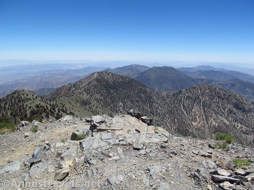
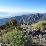
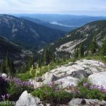
Views south from the peak
Take the rocky, ascending trail 0.25 miles up to the top of Telescope Peak and have a look around!
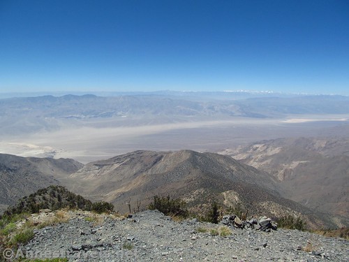
Views southeast from the peak toward the southern end of Death Valley
To the east is Death Valley; you can spot Badwater if you really look hard (binoculars help). To the west is the famed China Lake. I’ve read that China Lake is the US Navy’s largest single landholding, about 85% of the Navy’s land for research, development, acquisition, testing, and evaluation, and about 38% of the Navy’s land worldwide. I’ve also read that it’s about 12% of all of California’s air space.
Northeast from the peak toward the northern end of Death Valley
You can also see the High Sierras to the west; I’ve read that you can see Mt. Whitney, the highest peak in the continental US, but between haze and not having my favorite peak identification app with me, I wasn’t able to identify it. (Favorite peak identification app = PeakFinder Earth.)
Views to the north from the peak – Wildrose Peak is out there somewhere
Enjoy the view and the summit register before heading back down to your vehicle.
Views to the west from the peak over China Lake and the Sierras
Overall? A nice hike. I wouldn’t go across the country just for this, but really enjoyed the hike, the views were good (if not as spectacular as some in the High Sierras), and it’s a trail that’s been on my bucket list for some time that is now quite nicely checked off!
Views to the southwest from the peak over China Lake
Round Trip Trail Distance: 13.2 miles; adding Rogers Peak would be 13.8; adding Bennett would be 14.0; adding both Rogers and Bennet would be about 14.6.
Net Elevation Change: 3,339ft. (7,668ft. at the trailhead to 11,007ft. atop Telescope Peak)
Facilities: Campground with primitive restroom and picnic tables at the trailhead.
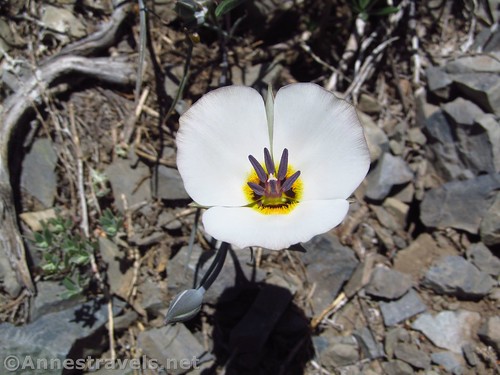
A sego lily along the trail
Fees: $25 per vehicle to enter Death Valley National Park, valid 7 days. Death Valley Annual Pass and National Parks & Federal Recreational Lands Passes are also accepted.
Trail Notes: Don’t try this trail when thundershowers are in the forecast; the trail is very exposed and you’ll be the tallest thing around (save for a few bristlecone pines on the slopes of Telescope Peak). Elevation can be an issue for some people, as this is much higher than the surrounding area / where a lot of people travel from. The peak is often still snow-covered in May; when snow-covered, crampons are necessary to reach the peak. The views toward the Sierras / China Lake are better in the morning, while the views into Death Valley are better in the afternoon.
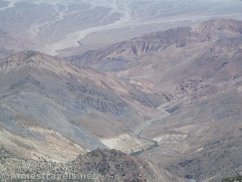
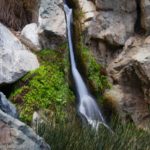
Wild canyons below Telescope Peak
Trail 
Road
Signs
Scenery
Would I go 100 miles out of my way for this?
Overall Rating:
Bristlecone pine tree and wildflowers along the trail
GPS Coordinates for the Telescope Peak Trail
Note: I’m including all the GPS coordinates from this hike, including my side treks to Rogers Peak (on the way out) and Bennett Peak (on the way back). So the mileages don’t necessarily reflect the post because I did Rogers Peak before Telescope Peak.
Trailhead: 36.2296806°N, -117.0683833°W (36°13’46.85″N, -117° 4’6.18″W / 36°13.78083’N, -117°04.10300’W) (7,668ft.) (0.0; ended 13.7)
Rogers / Bennet Pass: 36.2140528°N, -117.0890639°W (36°12’50.59″N, -117° 5’20.63″W / 36°12.84317’N, -117°05.34383’W) (9,611ft.) (Arrived 2.3; Returned 2.9; Returned 11.5)
Rogers Peak: 36.2170167°N, -117.0870389°W (36°13’1.26″N, -117° 5’13.34″W / 36°13.02100’N, -117°05.22233’W) (9,876ft.) (2.6)
Bennet Saddle: 36.1984000°N, -117.0902028°W (36°11’54.24″N, -117° 5’24.73″W / 36°11.90400’N, -117°05.41217’W) (9,499ft.) (3.4)
Badwater Basin and Bristlecone Pines
Telescope Saddle: 36.1726361°N, -117.0890333°W (36°10’21.49″N, -117° 5’20.52″W / 36°10.35817’N, -117°05.34200’W) (10,914ft.) (7.0)
Telescope Peak: 36.1698583°N, -117.0892222°W (36°10’11.49″N, -117° 5’21.20″W / 36°10.19150’N, -117°05.35333’W) (11,007ft.) (7.25)
Leave Trail for Bennet: 36.2020278°N, -117.0924806°W (36°12’7.30″N, -117° 5’32.93″W / 36°12.12167’N, -117°05.54883’W) (9,571ft.) (10.4)
Bennet Peak: 36.2065694°N, -117.0928139°W (36°12’23.65″N, -117° 5’34.13″W / 36°12.39417’N, -117°05.56883’W) (9,964ft.) (10.8)
Regain Trail after Bennet: 36.2125417°N, -117.0910972°W (36°12’45.15″N, -117° 5’27.95″W / 36°12.75250’N, -117°05.46583’W) (9,603ft.) (11.3)
Cold-desert Plox along the trail
The gpx file for Telescope Peak (with side treks to Rogers Peak and across Bennett Peak) can be downloaded – please note that this and the GPS Coordinates are for reference only and should not be used as a sole resource when hiking this trail.
Download GPX File size: 258.9 KB Downloaded 157 times
(Note: I do my best to ensure that all downloads, the webpage, etc. are virus-free and accurate; however, I cannot be held responsible for any damage that might result, including but not limited to loss of data, damages to hardware, harm to users, from use of files, information, etc. from this website. Thanks!)
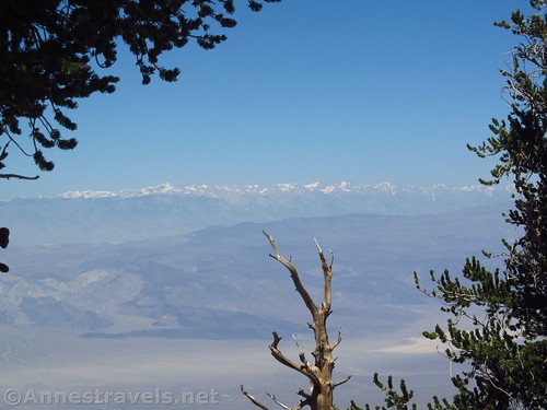
The High Sierras through a break in the Bristlecones
Getting to Telescope Peak
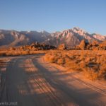
From Furnace Creek, drive north on CA-190W, the main north-south road through Death Valley (toward Beatty, though you’re not actually going to Beatty). After 33 miles, turn left onto Emigrant Canyon Road (follow sign for Wildrose). Continue about 30 miles to the trailhead.
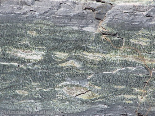
Striped rock along the trail
From Panamint Springs, head northeast on CA-190E for 21.4 miles. Turn right onto Emigrant Canyon Road; continue about 30 miles to the trailhead.
Looking across unique ridgelines to the south of Death Valley
Note: Emigrant Canyon Road is dirt and quite rough. You should be able to access the Charcoal Kilns; beyond this, high clearance may be required, although almost all the cars I’ve seen at the trailhead were low-clearance.
Zoom map out to browse nearby hikes & places of interest
Visual trail map and elevation profile of my hike up Rogers Peak, Telescope Peak, and across Bennett Peak
This Week’s Featured Product!
If you’ve ever wondered about the great amount of mining activity in Death Valley National Park prior to the park’s conception, this book will show you how to look at it – in person, in detail.
[forecast location=”Furnace Creek, CA” caption=”Weather for Death Valley National Park” measurement=’F’ todaylabel=”Today” datelabel=”date(‘D M d’)” highlow=’%%high%%°/%%low%%°’ numdays=”5″ iconset=”Default”]

Pingback: Sneak Peak: A California Trip through Desert and Snow - Anne's Travels