
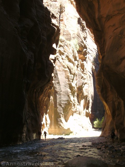
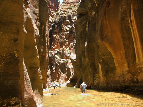
A hiker enters the shadows of the Zion Narrows
I first did the Zion Narrows in 1997. Or, should I say, I first set foot in the Virgin River in 1997, and we went around the first bend and turned around. The kids were too young; one of the four of us could swim (it wasn’t me), and two were so small that their dad was carrying both of them (or at least trying to carry both of them).
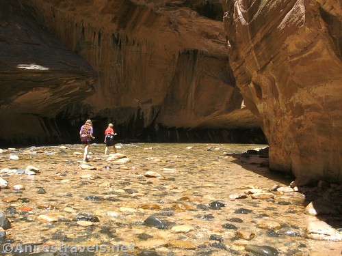
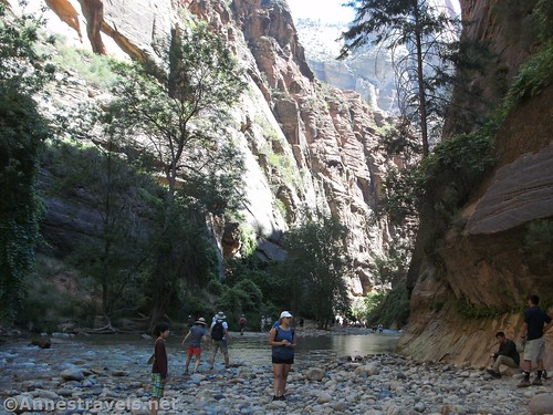
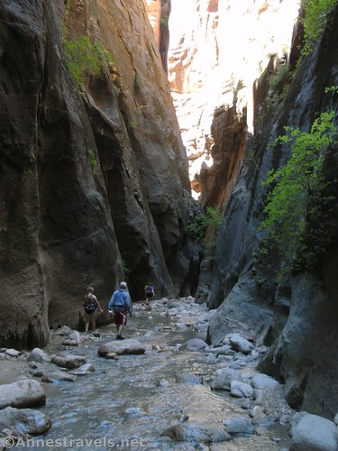
They’re a little bit more able to hike (and swim) now: Walking up a shallow section of the Zion Narrows
But ever since then, it’s been a dream in the back of my mind someday, to go back and actually walk the Zion Narrows.
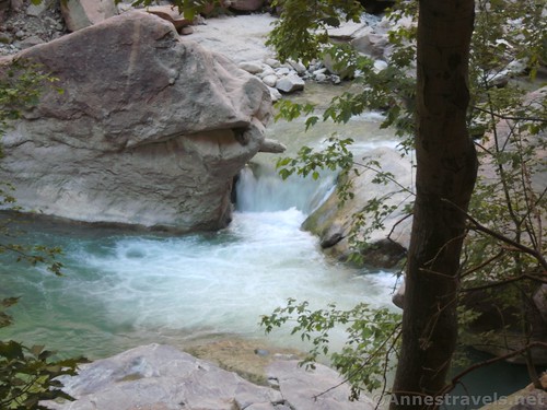
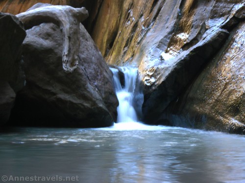
A little waterfall before the trail ends
The opportunity finally presented itself last summer, en route between Kansas City and Yosemite. It was hot, it was crowded, it was adventuresome, but we did it, and we had fun doing it!
Quick Stats
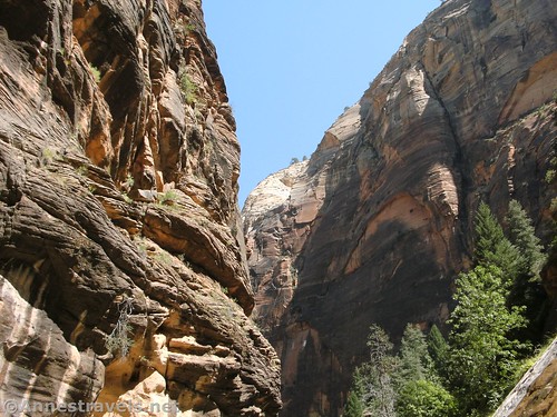
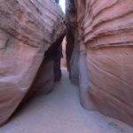
Looking up into the sky from the lower part of the Narrows
We arrived in Zion very early in the morning, but since we were driving in, we didn’t get to the visitor center until after 8am (Utah time). We packaged up our food, GPS, and camera in ziplocks and headed for the line for the shuttle bus.
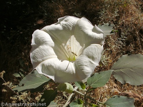
A wildflower we found along the trail above the Virgin River
The line was very long, all the way around the visitor center, and was much, much longer before we got on the bus about 30 minutes later. A sign near the bus depot gave us pertinent information, like the fact that the high for the day was 105F, the Virgin River was a cozy 64F, and flash floods were not expected today.
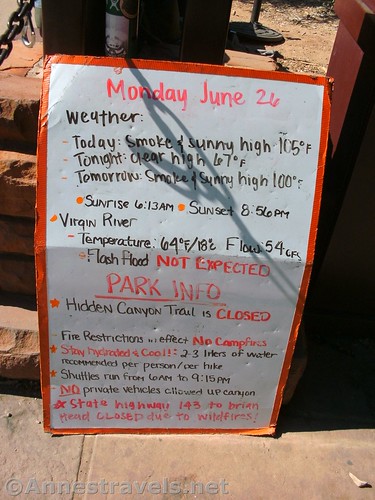
Vital stats for Zion National Park on the day we visited
The shuttle is required for just about everyone who wants to reach the Virgin River Trailhead (aka the Temple of Sinawava, the furthest stop from the visitor center on the route). If you can, get a seat on the bus on the lefthand side; the views are much better on that side than the right side of the bus.
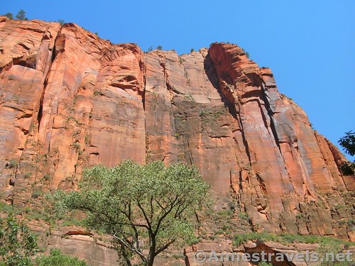
Cliffs near the trailhead
The trail (the “Riverside Walk”) up the Virgin River is technically 1 mile; I found it to be 1.5 miles. The trail is very well-maintained and goes up the shadowed canyon with views of the river, cliffs, occasional seeps, and the trees along the river.
Hiking up the Virgin River via the trail
At the end of the trail, you’ll have to enter the river. We had come prepared with close-toed water shoes, and we picked up a discarded stick for the one member of our party who usually hikes with trekking poles.
End of the trail – from here, you’ll have to walk in the Virgin River!
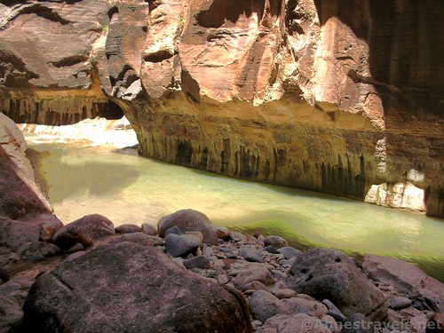
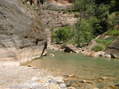
From here, the trail is mostly in the river. At times of lower flow, there are places when you can cut across sand bars and gravel bars. We took these in part because it was easier walking and in part because, as hot as it was, we weren’t trying to get soaked (well, most of us weren’t), so we didn’t want to wade through waist-deep water if we didn’t have to (often, if there is a gravel or sand bar, the water beside the bar is deeper than when the water is spread across the entire canyon). On a late June day with the flow at 54cfs (cubic feet per second), we rarely got too much above our knees in most places, and none of us got up to our waist until we wanted to.
Wading a knee-deep section
The section just at the end of the trail is extremely crowded. Around every bend of the river, the crowds decreased, at least marginally.
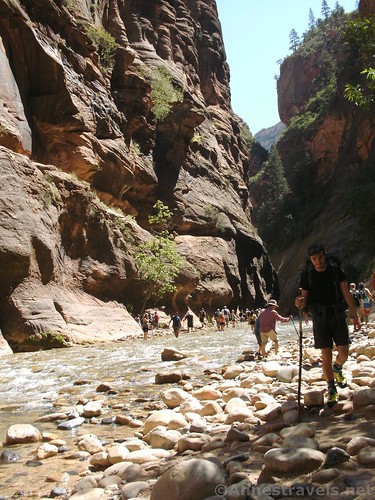
Trying to avoid the crowds in the lower part of the canyon
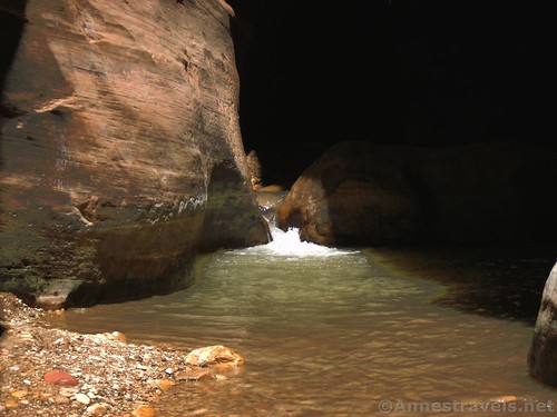
About 1.25 miles from the end of the trail, Mystery Canyon Falls cascades down the right side of the canyon walls. It’s quite beautiful, and many people come this far to take pictures and then leave (note: the falls is only in sun in the morning).
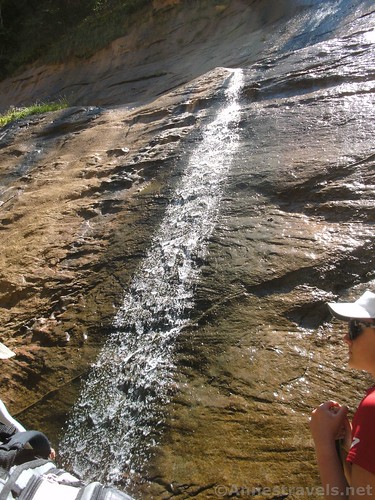
Mystery Canyon Falls
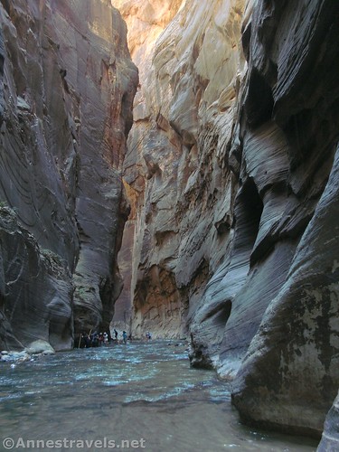
The crowds began to decrease precipitously after this, though there were still plenty of people up to Orderville Canyon at about mile 3. One place to be aware of is just before mile 2.5 – House Rock forces the river to about 10ft. wide. The river is extremely deep here and the currents uneven; on the way back, one of my group members decided to swim it and ended up losing a shoe and a sock (!!!) (she was able to retrieve the shoe, thankfully). There is a scramble of a trail to get around this section; I highly recommend it, even if crossing the river just above the rock was well over my knees!
Along the river
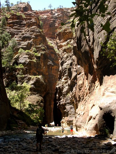
Keep walking up the canyon with overhanging walls to Orderville Canyon about mile 3 (I don’t have GPS coordinate for it because the unit wouldn’t work in the narrow canyon). We passed this by for the moment, and continued up into Wall Street, where the canyon is very narrow and the walls, very tall. It’s what people hike the Narrows to see.
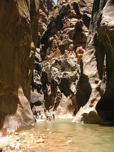
Near the entrance to Orderville Canyon
I had hoped to hike to Boulder Pair after mile 4.5 or even all the way to Big Springs just before mile 5.5. But when we got to the Floating Rock about mile 3.5, the group had about had it (it was the first hike on our trip, after all, and we weren’t sleeping well because of the heat). So we enjoyed the canyon walls for a bit and then turned around.
In the shadows of the Narrows
On the way back, we took a short side-trek up Orderville Canyon. Shortly after the entrance (it’s very cool, because the walls are so narrow) a waterfall must be scrambled to go further. It’s also quite pretty; if you get as far as Orderville Canyon, take the side trek at least this far.
The first waterfall in Orderville Canyon. I expect this would be under water at times of high water flow
A few of us scrambled the falls and went up a short distance. But it was late in the day and people down below were waiting for us. So we turned around. Orderville will have to wait for another day.
Walking back down Orderville Canyon
Overall? The Zion Narrows is crowded, but awesome! It reminded me just a little of Coyote Gulch in Grand Staircase-Escalante, but with more people and narrower walls. If you have a chance, do it!
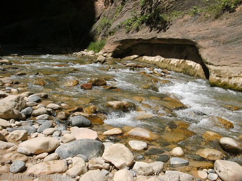
The Virgin River tumbles over rocks about the middle of the hike
Round Trip Length: I went about 8 miles – 7 in the Zion Narrows and about a half mile each direction up Orderville Canyon
Net Elevation Change: 349ft. (4,408ft. at the trailhead to 4,757ft. near the Floating Rock)
Facilities: Water and restrooms available at the trailhead
Fees: $30/vehicle, valid 7 days. Waived with Federal Lands & Recreation Passes as well as Zion Annual Pass.
Trail Notes: River flow varies by the time of year and weather conditions. When conditions are deemed unsafe, the park will close the Narrows to hikers. However, just because the Narrows are open does not mean this is an easy hike – the water might be waist deep and flowing quickly and it will still be open. Hike at your own risk. Also, close-toed shoes are a must. Some people just wear sneakers or rent canyoning gear. We used traditional water shoes and some more modern hiking/water shoes with closed toes and found them to be about the minimum of what you want to wear – the rocks on the bottom of the river aren’t sharp, but they are very much there and your toes fall down between them! (Did I mention you want strong ankles and a good sense of balance for this hike?) Also, photography is difficult because of the shadows vs. the blinding sun. Be wary of flash floods, and don’t go when there is rain in the forecast anywhere near Zion. Still, for all its challenges, this is a great (and very fun) hike!
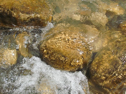
Water rushes over rocks in the Virgin River
Trail 
Road
Signs
Scenery
Would I go 100 miles out of my way for this?
Overall Rating:
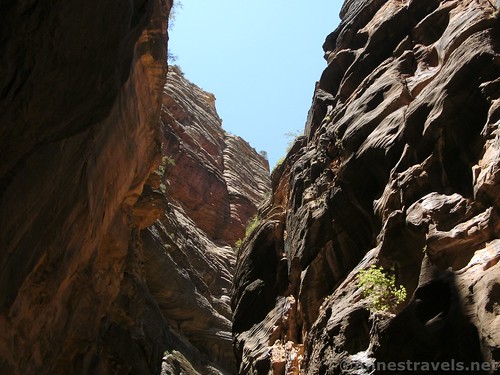
The sky above the Narrows
Key GPS Coordinates for the Zion Narrows
Trailhead: 37.2852278°N, -112.9477000°W (37°17.11367’N, -112°56.86200’W / 37°17’6.82″N, -112°56’51.72″W) (4,408ft.) (0.0; return 16.28, which is wrong)
Trail ends, river begins: 37.2967139°N, -112.9485194°W (37°17.80283’N, -112°56.91117’W / 37°17’48.17″N, -112°56’54.67″W (4,537ft.) (1.48)
Waterfall (Mystery Canyon Falls): 37.2994639°N, -112.9447750°W (37°17.96783’N, -112°56.68650’W / 37°17’58.07″N, -112°56’41.19″W) (4,566ft.) (2.18)
Return to trail: 37.2963722°N, -112.9470667°W (37°17.78233’N, -112°56.82400’W / 37°17’46.94″N, -112°56’49.44″W) (4,566ft.) (14.6, which is wrong)
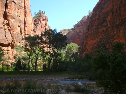
Wide spot in the Virgin River
Getting to the Zion Narrows
From I-15, take Exit 27 to turn south on UT-17 (you can’t go north, so it’s not as complicated as it sounds). After almost 6 miles, turn left on UT-9, signed as S.R. – 9. Drive for 20 miles, passing through the Zion entrance station when required, and then turn right almost immediately. Follow the road to the large parking areas behind the visitor center. The shuttle stop is located between the lot and the main park road. Make sure to get on the Zion Canyon Route and not the Springdale Route.
Another little waterfall in Orderville Canyon
From Kanab, UT, follow US-89N about 16 miles. Turn left onto UT-9W in Mt. Caramel Junction, next to the Shell station (note that gas stations do change ownership from time to time). After almost 25 miles (passing through the Zion entrance station when required), turn left, following the sign for the Visitor Center (if you get to the entrance station, and you’re leaving the park, you’ve gone too far). Follow the road to the large parking areas behind the visitor center. The shuttle stop is located between the lot and the main park road. Make sure to get on the Zion Canyon Route and not the Springdale Route. One of the cool things about this route is you get to go through the famous Zion tunnels; and the views are outstanding!
Zoom map out to browse nearby hikes & places of interest
Into the Narrows
This Week’s Featured Product!
If you’re flying into Las Vegas – or just happen to be in the area – this book will help you decide which of the many hiking opportunities are best for you (including the Zion Narrows!)
[forecast location=”Springdale, UT” caption=”Weather for the Zion Narrows” measurement=’F’ todaylabel=”Today” datelabel=”date(‘D M d’)” highlow=’%%high%%°/%%low%%°’ numdays=”5″ iconset=”Default”]


Pingback: Sneak Peak: A California Trip through Desert and Snow - Anne's Travels