
Zone 9
Appalachians (Pennsylvania, Maryland, West Virginia, Virginia, North Carolina, South Carolina, Georgia)
Pennsylvania
Mt. Gretna Loop
6.0 mile loop; 783ft. elevation gain; Moderate
Forest; views; historical interest; Mount Gretna
Maryland

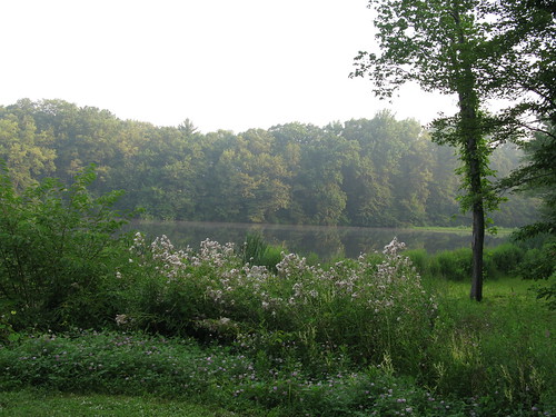
Merryman Trail
8.8 mile loop; 918ft. elevation gain; Moderate
Forest; lake; views; Baltimore
West Virginia

Blackbird/Ridge Loop
10.4 mile loop; 888ft. elevation gain; Moderately Strenuous
Forest; meadows; views; rocks; Dolly Sods Wilderness
Blackbird/Ridge Loop Trail Guide
Virginia

Fridley Gap
6.2 mile loop; 1,860ft. elevation gain; Strenuous
Forest; stream; views; George Washington National Forest
North Carolina

Campbell Creek and Lanier Falls
5.3 mile lollipop loop; 260ft. elevation gain; Moderate
Forest; waterfall; streams; Rock Raven State Park
Campbell Creek and Lanier Falls Trail Guide
South Carolina

Harbison Long Loop
8.0 mile loop; 538ft. elevation gain; Moderate
Forest; river; Harbison State Forest
Harbison Long Loop Trail Guide
Georgia

Brasstown Bald Peak
1.4 miles out & back; 430ft. elevation gain; Moderate
Views; high point; observation tower; forest; Blairsville
Brasstown Bald Peak Trail Guide
Zone 10
New England & Atlantic Coast (Maine, New Hampshire, Vermont, Massachusetts, Rhode Island, Connecticut, New Jersey, Delaware)
Maine
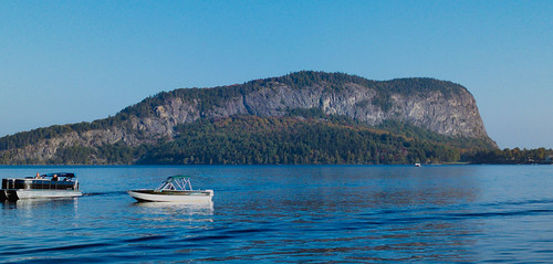
Mount Kineo
3.4 miles out & back with loop; 905ft. elevation gain; Moderately Strenuous
Views; waterfall; fire tower; forest; Mount Kineo State Park (Rockwood)
New Hampshire

Bedford Heritage Trail
1.8 miles out & back; 47ft. elevation gain; Easy to Moderate
River; forest; trail extension possible; Merrimack Valley
Vermont

Grand Lookout
1.9 miles out & back; 131ft. elevation gain; Easy
Views; observation tower; forest; pond; Barre
Massachusetts

Mount Norwottuck
3.4 mile lollipop loop; 748ft. elevation gain; Moderately Strenuous
Views; forest; rocks; Mount Holyoke Range State Park
Connecticut

Sleeping Giant Tower Trail
3.1 miles out & back; 597ft. elevation gain; Easy
Views; forest; observation tower; Sleeping Giant State Park
Sleeping Giant Tower Trail Guide
New Jersey

East Creek and Sunset Road Loop
4.7 mile loop; ~100ft. elevation gain; Moderate
Forest; lake; Belleplain State Forest
East Creek and Sunset Road Loop Trail Guide
Delaware

Ben Cardin C&D Canal Trail to Michael Castle Trail
15.4 miles out & back; 262ft. elevation gain
River; forest; historical interest; Chesapeake City