

Zone 3
Southwest (Texas, New Mexico, Arizona)
Arizona

Aravaipa Creek
11.0 mile shuttle; 585ft. ascent, 197ft. descent, Moderate
Creek, canyon, forest; Aravaipa Canyon Wilderness
New Mexico

Fourth of July Trail
4.3 mile loop; 918ft. elevation gain; Moderate
Forest, views, mountains; Cibola National Forest
Texas

Crockett Gardens and Falls
5.8 miles out & back; 498ft. elevation gain; Easy
Waterfall, forest, historic interest; Georgetown
Crockett Gardens Falls Trail Guide
Zone 4
Rocky Mountain States (Montana, Idaho, Wyoming, Colorado)
Idaho

Boulder City
12.4 miles out & back; 2,523ft. elevation gain; Strenuous
Mountains, views, ghost town, waterfalls, lake, mine; Bonners Ferry

Blue Lake
1.6 miles out & back; 373ft. elevation gain; Moderate
Lake, mountains, forest, views; Boise National Forest
Montana

Heart and Perl Lakes
7.2 miles out & back; 1,627ft. elevation gain; Moderate
Meadows, forest, lake, mountains; Lolo National Forest
Heart and Perl Lakes Trail Guide

Lava Lake
5.5 miles out & back; 1,620ft. elevation gain; Moderate
Views, lake, forest, mountains; Custer-Gallatin National Forest
Lava Lake Trail Guide, Continue up to Table Mountain for 16 mile hike that tops out at nearly 11,000ft.
Wyoming
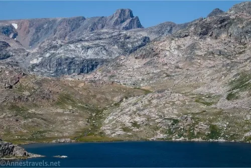
Island Lake to Becker Lake, Albino Lake, and Jasper Lake
Up to 16.5 miles, up to 2,122ft. elevation gain; Strenuous to Extremely Strenuous
Island Lake to Becker Lake, Albino Lake, and Jasper Lake Trail Guide

Sheep Lake
9.5 miles out & back; 862ft. elevation gain; Moderate
Meadows, mountains, views, lake; Medicine Bow-Routt National Forest
Colorado

Chasm Lake
8.5 miles out & back; 2,398ft. elevation gain; Strenuous
Mountains, lake, forest; Rocky Mountain National Park

Grays & Torreys Peaks
8.3 mile lollipop loop; 3,479ft. elevation gain; Very Strenuous
Views, meadows, mountains; Georgetown