There are many hidden waterfalls in the eastern US. Many are protected by state or local parks, but there are so many that many are on private or not-quite-private property.
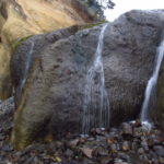
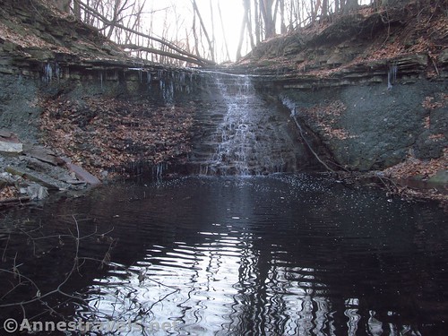
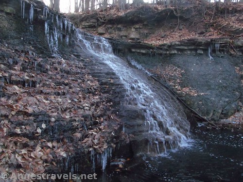
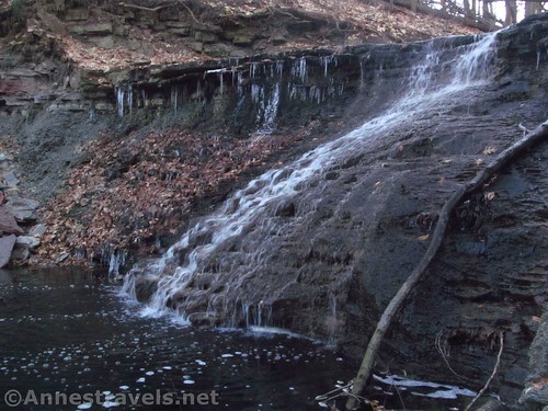
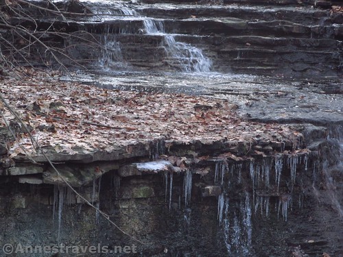
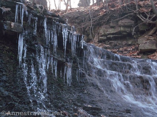
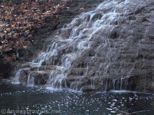
In search of one of these waterfalls on not-quite-private property, I took a little jaunt a few weeks ago to Densmore Falls in Irondequoit, New York (suburb of Rochester). It was a little adventure; short enough to be done quickly, but hidden enough to search for. It turned out to be a lovely falls, and while it was a little late in the day (and the wrong time of year) to get terrific pictures, the ones I took show just how beautiful it is.
Quick Stats
Parking is the biggest headache. Some sites suggest parking at one of the schools, but that’s been forbidden in recent years. You could park at one of the convenience shops about a half mile to the west along Norton Street or at Norton Village Park, but that will add about a mile (each way) of walking on sidewalks. I parked at the Legacy at Cranberry Landing – there are about a half dozen or less parking spaces on the east side that don’t have signs about not parking.
Realize also that I’m very, very conscientious about property rights. So if I thought this was a problem, I wouldn’t have done it. That all being said, obey all signs and rules, and don’t make a nuisance of yourself.
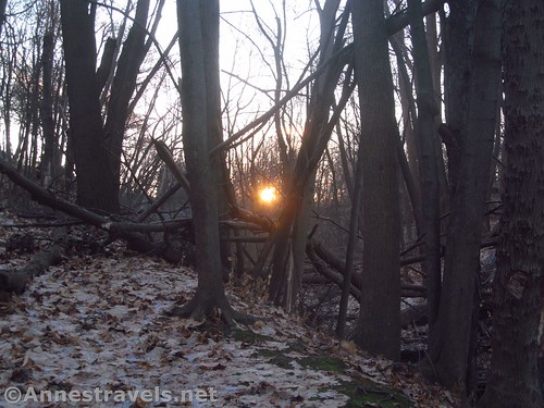
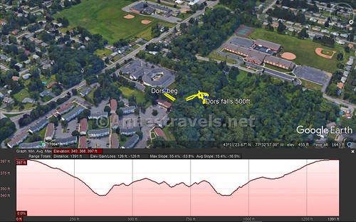
From the back right (northeast) side of the Legacy at Cranberry Landing parking area, walk behind and to the left (north) of the toolshed and follow the old road into the forest. Keep walking downhill and you’ll reach Densmore Creek (there are a few steep places to scramble down). Turn upstream a short distance to the waterfall. The entire hike is about 500ft.
How easy was that?
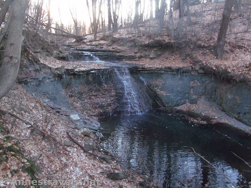
Enjoy the falls, then return the way you came. This isn’t the kind of place you’d want to chill down for a picnic and a swim on a warm summer afternoon; it’s more the place where you scramble down, see it, take a few photos, and then leave. There was some garbage around the pool below the falls, but less than I’d expect along an urban gully.
Round Trip Trail Length: Not quite 0.2 miles
Net Elevation Change: 75ft.
Facilities: None; there are convenience stores to the west along Norton Street
Fees: None
Trail Notes: The falls are best viewed in the morning, and probably summer is better than winter so the sun is further south. Use respect here – you’re a visitor, for sure!
Trail 
![]()
![]()
![]()
Road
Signs ![]()
![]()
![]()
![]()
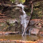
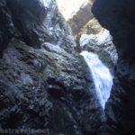
Scenery ![]()
![]()
![]()
Would I go 100 miles out of my way for this? ![]()
![]()
![]()
Overall Rating: 
![]()
![]()
GPS Coordinates for Densmore Falls
Parking: 43.189708, -77.548312 (43°11.38248′, -077°32.89872′ / 43°11’22.9488″, -077°32’53.9232″)
Trailhead: 43.1899667°, -077.5485167° (N43° 11.398′ W77° 32.911′ / 43°11’23.8800″, -077°32’54.6600″) (410ft.) (0.0) (end 0.25)
Densmore Falls: 43.1905833°, -077.5490833° (N43° 11.435′ W77° 32.945′ / 43°11’26.1000″, -077°32’56.7000″) (335ft.) (500ft. from trailhead)
The gpx file for Densmore Falls can be downloaded – please note that this and the GPS Coordinates are for reference only and should not be used as a sole resource when hiking this trail.
Download GPX File size: 9.6 KB Downloaded 413 times
(Note: I do my best to ensure that all downloads, the webpage, etc. are virus-free and accurate; however, I cannot be held responsible for any damage that might result, including but not limited to loss of data, damages to hardware, harm to users, from use of files, information, etc. from this website. Thanks!)
Getting to Densmore Falls
From Rochester or Victor or Henrietta, get to the “can of worms” I-490/I-590 split. Take Route 590 North. After 3.2 miles, take Exit 9 to Norton Street. At the top of the ramp, turn right (west) on Norton Street 0.3 miles to the driveway to Legacy at Cranberry Landing. Drive to the northeast corner and find a legal space to park.
From Webster, take Route 104 West to Culver Road. Take the exit and turn south (left). After 0.6 miles, turn left on Norton Street. After about 0.6 miles, take a left into the Legacy at Cranberry Landing driveway. Drive to the northeast corner and find a legal space to park.
Zoom map out to browse nearby hikes & places of interest
This Week’s Featured Product!
Highly recommended guide if searching out waterfalls in western and central New York. There are quite a few in here even locals haven’t seen.