
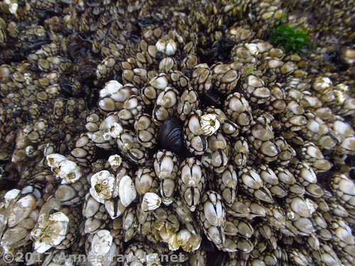
I really like the Oregon Hiker’s website. Because although most the driving directions are from Portland (and it’s rare I’m coming from that direction), the trail descriptions tend to be complete, there are pictures and sometimes maps, and it’s great to have so many trails detailed in one place! One trail I took only because I saw it on the Oregon Hiker’s site was Hug Point, just south of Cannon Beach, OR. The beach itself isn’t worth driving a long way out of your way for, but if you happen to be traveling along US-101, it is a unique little beach, complete with interesting rocks / sea life, a sea cave, and… a waterfall!
Quick Stats
(Affiliate links are present on this page.)

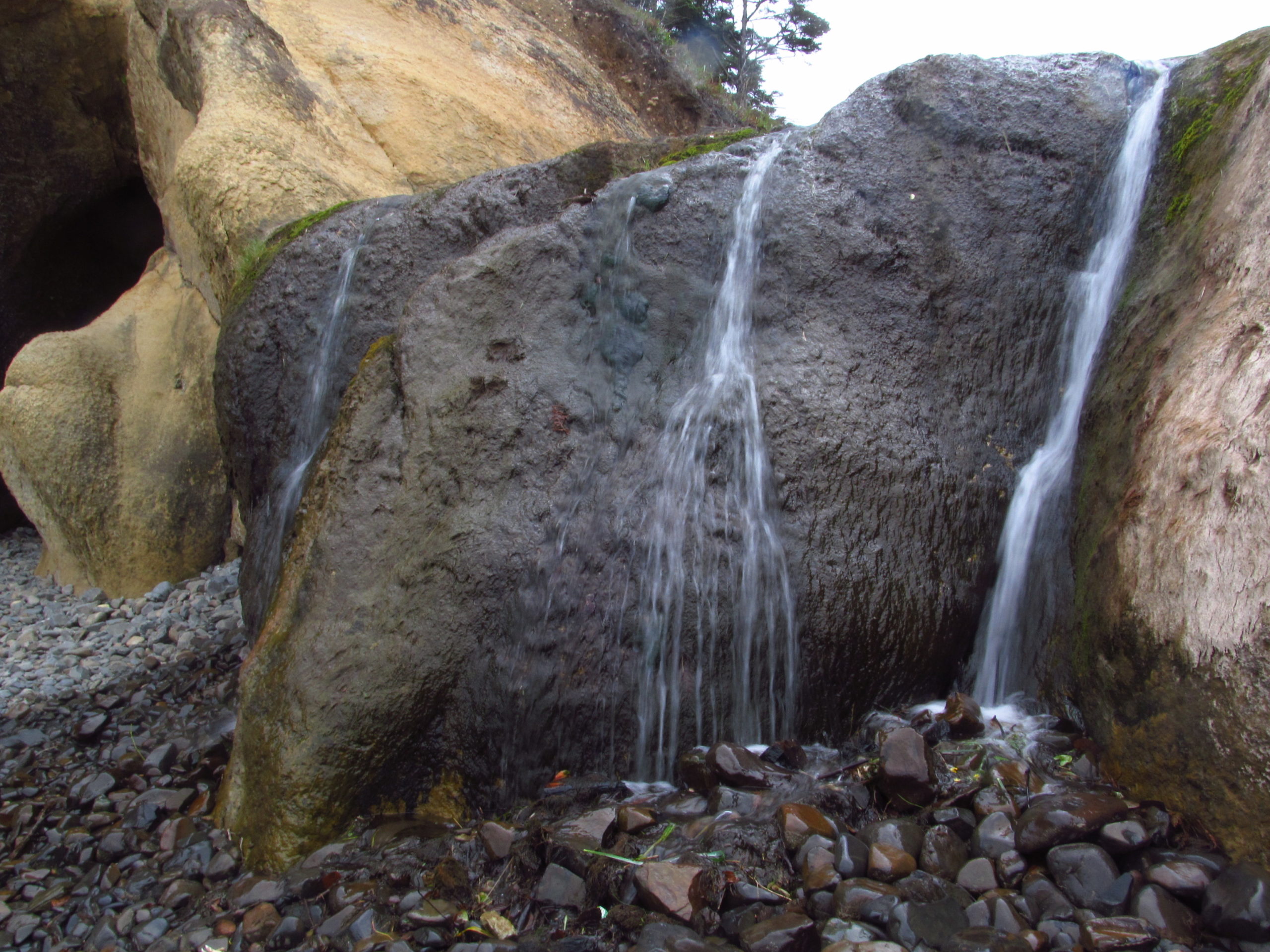
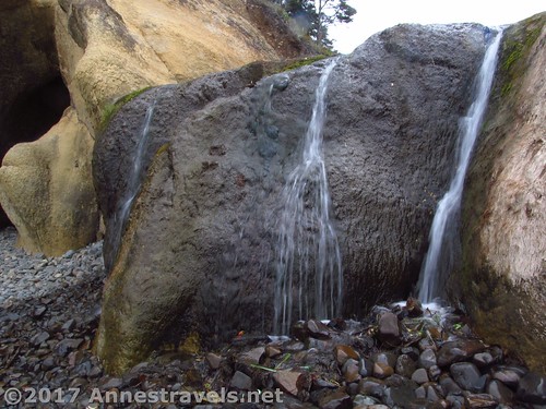
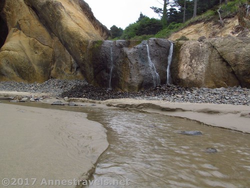
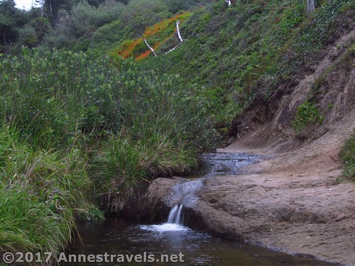
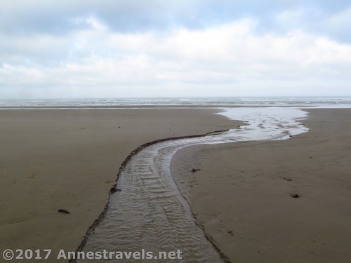
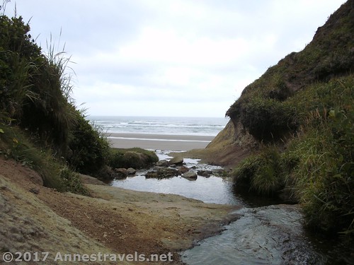
From the parking area, walk downhill to the beach. Turn right. Cross the stream (aka Fall Creek) and enjoy the nearby waterfall (I’ve heard that the stream is seasonal, but it was flowing pretty well in August) – I’ll call it Fall Creek Falls, just for fun. Nearby is a sea cave (don’t explore too much during high tide!)
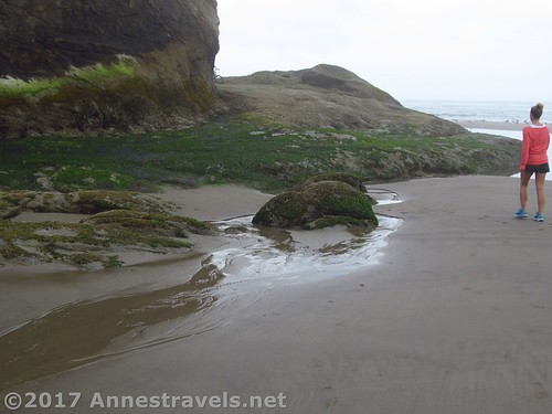
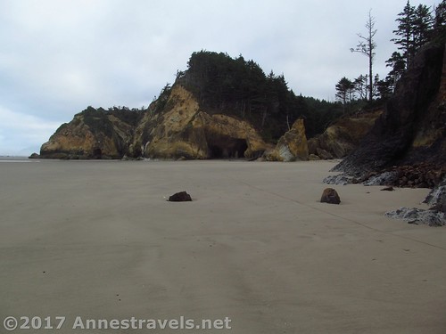
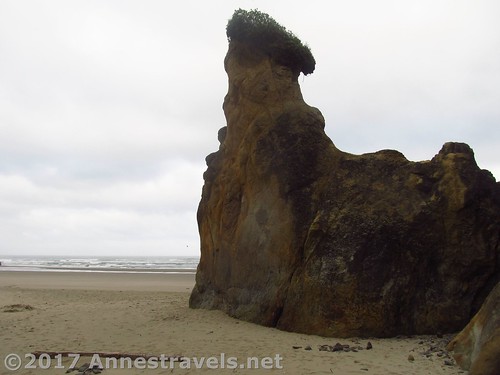
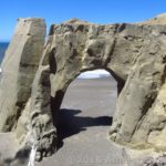
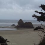
Continue walking along the beach to see some interesting rock formations at low tide. Actually, at low tide we were able to walk all the way around the point – I gather it was an especially low tide, but even so, I hear that you’d be able to do it most days. If you can walk around the point, there are more rocks and sea life en route and on the other side.
So I read, the beach used to be the highway of the region. Pioneers and stagecoach drivers had to “hug” the coastline as they rounded this point at low tide. You can still see some of the ruts in the rocks from so many wheels driving over the same place due to width of the beach here.
From the other side of the headland you can technically walk all the way up to Cannon Beach (so sayeth the internet!) We really weren’t looking for a long hike, so we turned around and went back to explore the sea cave.
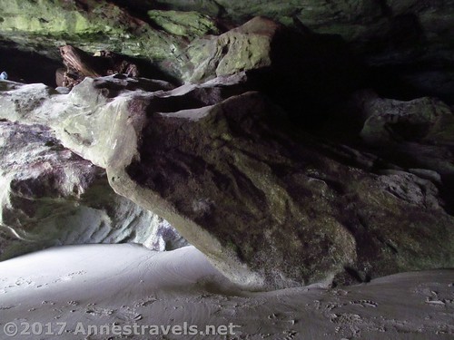
Since I hadn’t brought a light, I pretty quickly gave that up and went back to the waterfall. There are some steps cut into the rock nearby, so it’s not hard to scramble to the top. Atop the waterfall it’s also easy to pick up a trail that wanders along beside the stream. I didn’t go very far (so I have no idea where the trail ends up), but there were some very nice wildflowers along the way.
Overall? A great little stop! We spent maybe 45 minutes exploring before heading further north to Arcadia Beach!
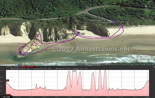
Round Trip Trail Length: 1 mile or less
Elevation change: About 59ft. (54ft. at the parking area to -5ft. while going around Hug Point)
Facilities: Restroom at the trailhead
Fees: None
Trail Notes: Make sure you visit at low tide, as high tide can be deadly or leave you stranded where you don’t necessarily want to be!
Trail 
![]()
![]()
![]()
Road
Signs ![]()
![]()
Scenery ![]()
![]()
Would I go 100 miles out of my way for this? ![]()
![]()
![]()
Overall Rating: ![]()
![]()
Key GPS Coordinates for Hug Point
Hug Point Parking: 45.82860N / -123.96109W (45° 49′ 42.9600″ / -123° 57′ 39.9234″) (54ft.)
Trail Beginning: 45.82833N / -123.96130W (45° 49′ 41.9880″ / -123° 57′ 40.6794″) (35ft.) (0.0; ended 1.06)
Waterfall: 45.82996N / -123.96200W (45° 49′ 47.8554″ / -123° 57′ 43.2000″) (0ft.) (0.22)
Hug Point: 45.83170N / -123.96313W (45° 49′ 54.1194″ / -123° 57′ 47.2680″) (-5ft.) (0.44)
The gpx file for Hug Point can be downloaded – please note that this and the GPS Coordinates are for reference only and should not be used as a sole resource when hiking this trail. Also note that I did not climb the headland, as the gpx would indicate.
Download GPX File size: 23.2 KB Downloaded 480 times
(Note: I do my best to ensure that all downloads, the webpage, etc. are virus-free and accurate; however, I cannot be held responsible for any damage that might result, including but not limited to loss of data, damages to hardware, harm to users, from use of files, information, etc. from this website. Thanks!)
Getting to Hug Point
From Cannon Beach, head south on US-101S. About 5 mile later, turn right into the long, narrow dirt parking area signed for Hug Point.
From Nehalem, drive north on US-101N. About 11 miles later, turn left into the long, narrow dirt parking area signed for Hug Point.
Zoom map out to browse nearby hikes & places of interest
This Week’s Featured Product!
A great little guide to hikes on the Oregon coastline.


3 responses to “Hug Point: Wayside Beach with a Waterfall & Sea Cave”
[…] I think my group was tiring a bit of beach walks, but I pleaded to do one more – Cannon Beach. So we visited Hug Point… […]
[…] stream above Hug Point, […]
[…] waterfall near Hug Point, […]