Searching for hikes to take near Ricketts Glen State Park last fall, I ran across a trail report for Coyote Rocks. But instead of just doing the out and back up to the views over the valleys and hills of Ricketts Glen, the hiker wandered along a peaceful creek, forged up a valley (complete with a cataract stream), and then hopped over to the trail to the rocks to make a very nice loop. I’ll detail the trail I took (very similar to his or her report) for a single 6.6 mile trek with great views and tons to explore along the way!
Quick Stats
The roads to the parking area are all dirt, but I had no trouble in a Honda Fit (probably the lowest-clearance car I’ve ever driven regularly). The route, itself, is on State Game Lands 57, so you’ll be starting in a hunters’ parking area.
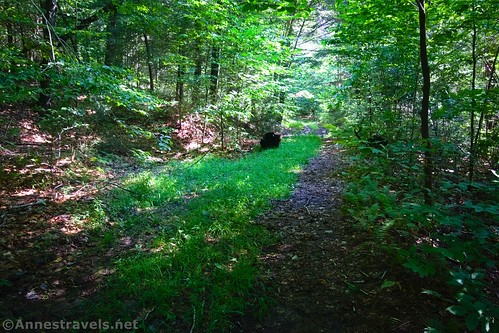
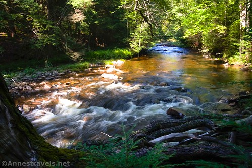
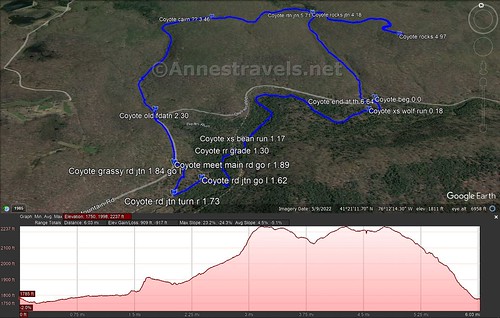
Walk back down to the road from the parking area, cross the road, and locate a vague path that leads south into the thicket-ish forest and down toward Bowman Creek. The trail – worn down enough to be called a path, but not really a trail – goes nearly to the creek and then turns west (right) to travel upstream. I’d guess this is a fisherman’s trail.
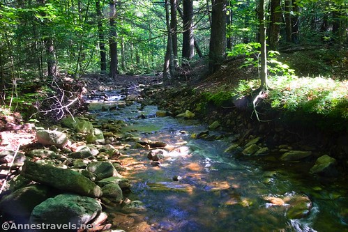
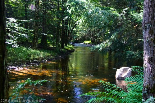
You’ll need to cross Wolf Run (a small, north-south side-stream) after almost 0.2 miles, then cross Bean Run a mile later. In the meantime, enjoy views of Bowman Creek. A couple of days after three days of rain, the area was damp but usually not too soggy, and puddles could mostly be avoided.
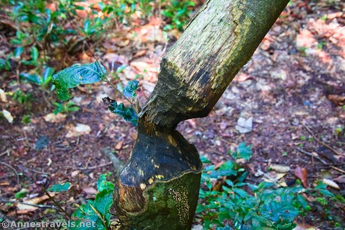
About a tenth of a mile after crossing Bean Run, you’ll come to an embankment that is obviously an old railroad grade (1.3 miles from the trailhead). You could follow this for quite a way in either direction, but I didn’t want to get off track (no pun intended), so I continued following the vague trail upstream. A little further along, I found several old railroad rails stretching across Bowman Creek.

About this point, the route turns west and a bit north to go up to a junction with two old roads about mile 1.6. Turn left on the old road (if you just come out of the trees and onto a single old road, turn left). After a tenth of a mile, turn right on another old road. A tenth of a mile beyond that, turn left onto a grassy road that will take you down a hill and out onto the road you drove in on. You’ve now completed the most difficult section of the hike in terms of finding your way; there’s only one more tricky part to go!
Turn right on the main road and hike for 0.3 miles to where the road turns sharply left to cross a bridge. Instead of turning with the road, continue straight in what appears to have once been a road. It will take you down to Bean Run; you’ll need to cross this and then turn left to walk upstream. There is no trail in this section – or if there is, I didn’t find it.

As I walked upstream, I found an old foundation and associated junk about mile 2.3 (about a tenth of a mile from the road).

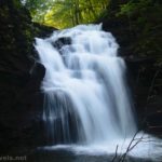
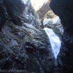
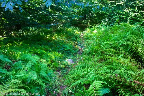
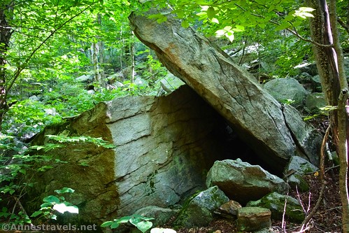
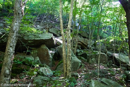
Keep walking upstream; you’ll need to cross to the north (west) side of Bean Run and then cross back to the east side (be sure not to head west (left) up a branch of Bean Run about mile 2.6). After this, the route finding becomes much easier. There is a trail heading up beside Bean Run (which is lovely – so many little waterfalls). As you hike higher, you’ll pass through a really neat area of giant rocks, including a sort of rock cave.
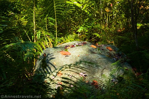
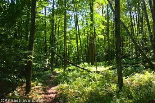
About mile 3.1, the trail leaves the stream to strike east up into the woods. There is a trail to follow, including a cairn about mile 3.4 (assuming it’s still there!) It’s a peaceful, quiet, and not terribly difficult hike through the woods, including ferns, a few big rocks, and some tiny meadows.
About mile 4.2, you’ll come to a cairn at a trail junction. The right trail looks like an old road and travels downhill. The left fork descends to quickly cross Wolf Run. To get to Coyote Rocks, you’ll want to turn left to cross Wolf Run.

The trail rises away from the stream but otherwise is fairly flat as it winds through the forest for 0.8. As you approach Coyote Rocks, the trail goes left while a few small side-trails lead to the rim of Coyote Rocks.
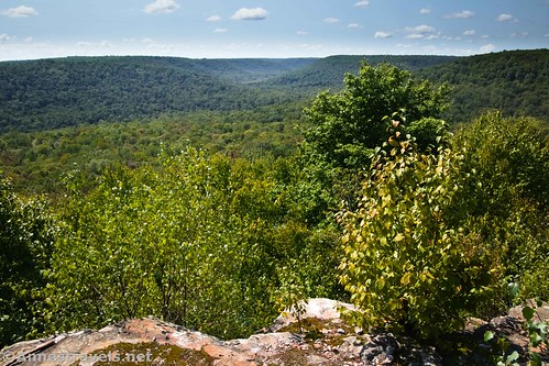
Arrive at Coyote Rocks about mile 5. Enjoy lovely views across the green hills and valleys with no signs of development or other human beings.
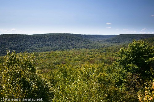
I scrambled up on the rocks to get a better view. The easy-to-access part of the rocks has too many trees for someone only slightly over five feet tall!

The trail continues beyond Coyote Rocks, but I’m not aware of where it ends up. About the time I left, I met a guy out on his bicycle. He and his friends keep up the trails in this area and he was out assessing trail conditions. I thanked him – the trails are amazingly reasonable considering how little traffic they seem to get!

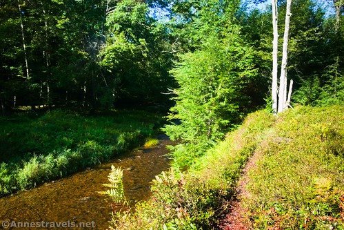
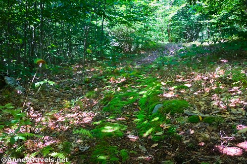
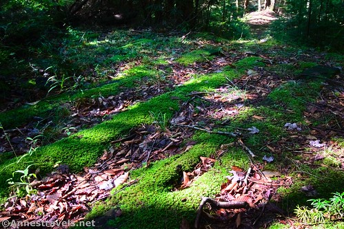
We retraced our steps back to Wolf Run, then turned left down the trail that looks like an old road. I felt it wasn’t quite as scenic as the other parts of the hike due to the fact that you’re high above Wolf Run and therefore can’t enjoy the waterfalls, etc. But we did find a little frog and some nice moss and ferns.

About mile 6.5, the old road drops you out beside the bridge on the main road that crosses Wolf Run. Turn left for 0.1 miles and you’ll find yourself back at the parking area/trailhead!
And that’s the loop! There are a lot of unmarked paths, social trails, and wayfinding on this hike, but I did it with only written instructions, so it’s doable if you have a high tolerance for adventure and are used to finding your way in the forest!

Round Trip Trail Length: 6.6 mile loop (just up to Coyote Rocks and back (via the last part of the loop) would be 3.3 miles out & back)
Elevation Gain: 917ft. (1,750ft. to 2,237ft.)
Facilities: None. There aren’t even bridges except on the road.
Fees: None

Trail Notes: You’ll want a good sense of adventure and time to find the trickier trail junctions for this hike. Be sure to take a good map and know how to get back to your vehicle if you miss something and get lost (very possible on these trails!) I don’t recommend trying this hike during hunting season – if you do, be sure to wear blaze orange. Wolf Run and Bean Run don’t pose threats in the way of stream crossings, though they could be sketchier after very heavy rains and during spring snowmelt. (It had rained three of the four days before I hiked it.) I barely got my feet wet with some creative rock-hopping and a convenient tree across Bean Run.
Trail 
![]()
![]()
![]()
Road ![]()
Signs ![]()
![]()
![]()
![]()
Scenery ![]()
Would I go 100 miles out of my way for this? ![]()
![]()
Overall Rating: ![]()
![]()
GPS Coordinates for Coyote Rocks
Trailhead: 41.3530790°, -076.1943200° (41°21.18474′, -076°11.65920′ / 41°21’11.0844″, -076°11’39.5520″) (1,788ft.) (0.0)
Cross Wolf Run: 41.3521270°, -076.1952710° (41°21.12762′, -076°11.71626′ / 41°21’07.6572″, -076°11’42.9756″) (1,761ft.) (0.18)
Cross Bean Run: 41.3503540°, -076.2049290° (41°21.02124′, -076°12.29574′ / 41°21’01.2744″, -076°12’17.7444″) (1,801ft.) (1.17)
Railroad Grade: 41.3495160°, -076.2057710° (41°20.97096′, -076°12.34626′ / 41°20’58.2576″, -076°12’20.7756″) (1,801ft.) (1.30)
Road Junction (Go Left): 41.3478400°, -076.2079300° (41°20.87040′, -076°12.47580′ / 41°20’52.2240″, -076°12’28.5480″) (1,836ft.) (1.62)
Road Junction (Go Right): 41.3470930°, -076.2095870° (41°20.82558′, -076°12.57522′ / 41°20’49.5348″, -076°12’34.5132″) (1,831ft.) (1.73)
Grassy Road Junction (Go Left): 41.3483880°, -076.2089170° (41°20.90328′, -076°12.53502′ / 41°20’54.1968″, -076°12’32.1012″) (1,910ft.) (1.84)
Meet Main Road (Go Right): 41.3488030°, -076.2095410° (41°20.92818′, -076°12.57246′ / 41°20’55.6908″, -076°12’34.3476″) (1,907ft.) (1.89)
Old Foundation: 41.3533150°, -076.2109020° (41°21.19890′, -076°12.65412′ / 41°21’11.9340″, -076°12’39.2472″) (1,878ft.) (2.30)
Cairn???: 41.3629140°, -076.2058460° (41°21.77484′, -076°12.35076′ / 41°21’46.4904″, -076°12’21.0456″) (2,232ft.) (3.46)
Coyote Rocks Junction: 41.3632800°, -076.1958160° (41°21.79680′, -076°11.74896′ / 41°21’47.8080″, -076°11’44.9376″) (2,135ft.) (4.18)
Coyote Rocks: 41.3586040°, -076.1894260° (41°21.51624′, -076°11.36556′ / 41°21’30.9744″, -076°11’21.9336″) (2,200ft.) (4.97)
Return to Coyote Rocks Trail Junction: 41.3631690°, -076.1957720° (41°21.79014′, -076°11.74632′ / 41°21’47.4084″, -076°11’44.7792″) (2,132ft.) (5.71)
Meet Road: 41.3528610°, -076.1952840° (41°21.17166′, -076°11.71704′ / 41°21’10.2996″, -076°11’43.0224″) (1,781ft.) (6.57)
End (real TH): 41.3528660°, -076.1942950° (41°21.17196′, -076°11.65770′ / 41°21’10.3176″, -076°11’39.4620″) (1,782ft.) (6.64)

The gpx file for the Coyote Rocks Loop can be downloaded – please note that this and the GPS Coordinates are for reference only and should not be used as a sole resource when hiking this trail.
Download GPX File size: 103.5 KB Downloaded 371 times
(Note: I do my best to ensure that all downloads, the webpage, etc. are virus-free and accurate; however, I cannot be held responsible for any damage that might result, including but not limited to loss of data, damages to hardware, harm to users, from use of files, information, etc. from this website. Thanks!)
Getting to Coyote Rocks Parking Area
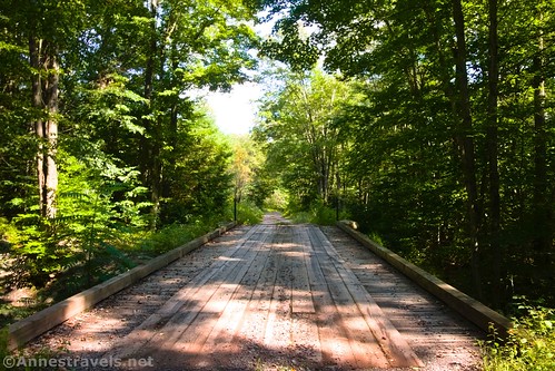
From Ricketts Glen State Park, drive north on CA-487. About 4.1 miles from the main entrance to the park, turn right onto an unmarked dirt road with a sign welcoming you to the State Game Lands. Continue straight (right at every junction or at least stay on the main road) for 6.7 miles to a short gravel drive up to the parking area, on the left just after crossing Wolf Run via a wooden bridge.

The unmarked dirt road can also be accessed from the north via PA-487, 13.3 miles south of Dushore on US-220.
The unmarked dirt road is at 41.3886986°, -076.2789684°; however, realize that cell service is sketchy out here in the Pennsylvania wilderness.
This Week’s Featured Product
Discover 50 hikes in eastern Pennsylvania with this guide! It provides options from popular trails to lesser-known paths, from short strolls to backpackable backcountry trails. Buy your copy here!