How would you like to visit four large waterfalls in the wilds of Pennsylvania – and likely have them all to yourself? Sure, the side trails to the falls are typically not marked, and it’s on State Game Land (so you might want to wait until after hunting season is over). There is also some confusing signage along the road before you get to the trailhead. But the waterfalls are spectacular. I’ve heard that they are still flowing even in dry weather, though I visited about three days after heavy rain, so they were full and gorgeous!
Quick Stats
Note: Some of the links in this post are affiliate links. If you click one and purchase something, I may earn a small commission without an extra cost to you.
The hardest part of the hike (other than the scrambles to the falls themselves) was getting to the trailhead. My GPS correctly got me through the town of Jamison and to the beginning of the Game Commission Road. However, at this point, there were two signs: One with hunting regulations and another saying, “Private Property.” I have no idea why the second sign was there; maybe the next quarter mile or so is private, but the road leads to State Game Lands 13 – which is altogether public property. Besides that, there’s a Game Commission Maintenance Facility along the way. The road itself just can’t possibly be private property. We wasted a lot of time trying to get across the river from the public road on the other side of the creek, etc., etc., before finally going back and driving through to the State Game Lands parking area. So all that to say… the trailhead was still open as of fall 2022 despite the private property signs!
The trailhead itself is near the gate (which is marked “13 – 20C”) and may be signed as the Grassy Hollow Road. There’s space for quite a few cars here – just don’t block the gate. I hear that the gate is open during some hunting seasons, but then you’re dealing with the possibility of hunters. I decided walking was preferable to risking it, even wearing Blaze Orange. Besides, the road can be an icy or muddy mess. You’ll probably just want to hike it, even if the gate is open.
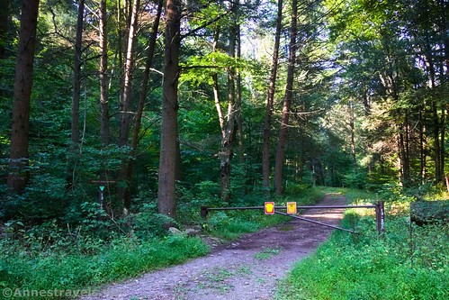
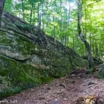
Walk up the road beyond the gate. The road travels mostly uphill through the forest. It’s an easy (if unrelenting) trek except for a few logs across the road. I expect they have been or will be cleared by the game commission sooner or later. You can’t get a vehicle over or around them, that’s for sure!
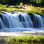
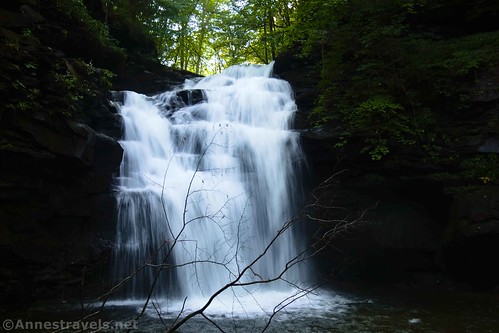
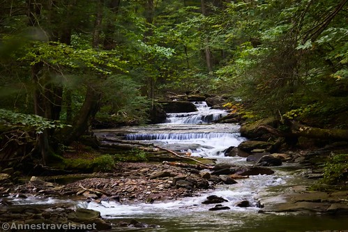
The first excitement comes 0.8 miles from the trailhead. An unmarked path descends on the right very steeply down to Big Falls. The quarter-mile path is sketchy – very steep, very slippery, and very much a social trail.
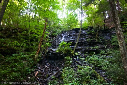
However, I’d say that Big Falls is the most scenic of the waterfalls in this area. After a rain, it was simply beautiful. I’ve heard that it’s beautiful as an ice falls in the winter, too. Looking over on the left, there were a couple of other lovely little falls that I hear only flow after it rains.
I scrambled down fairly close to the waterfall. Gorgeous!
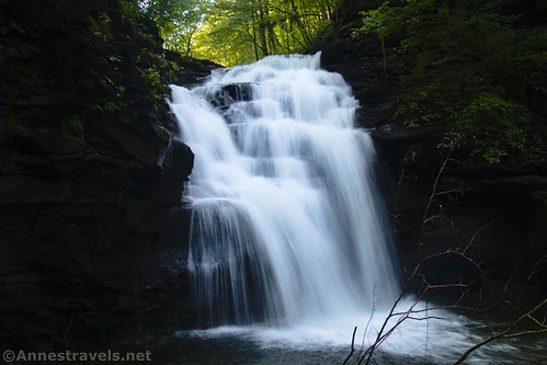
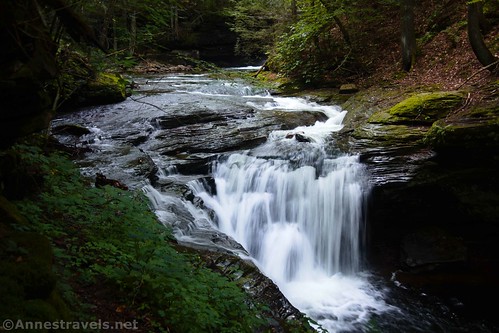
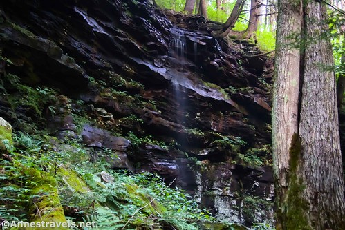
Then it was the scramble back up to the road! (Easier said than done, though going down wasn’t much fun either.) It’s about another 0.6 miles up the road to the unmarked but very real path to Twin Falls. However, unlike Big Falls, there is a parking area just beyond where the trail strikes down on the right into the woods. Also note that you may see or hear the falls from the road while you’re walking; be patient, there is a fairly good trail down to Twin Falls, and the early trails are social at best and steep and slippery beyond reason at worst.

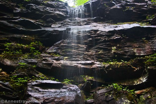
Like the name suggests, there are two waterfalls to be found at Twin Falls. The trail only goes as far as the upper falls, but a social trail continues along the rim of the gorge to a decent view of the Lower Falls. Use care, as there aren’t any guardrails.
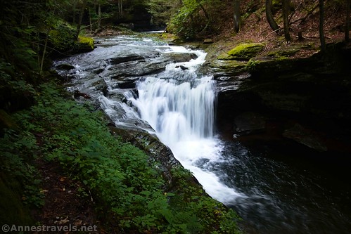
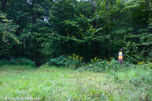
Walk back up to the road and continue uphill past the parking area (just a grassy wide place along the road). The parking area for Lewis Falls is almost 0.4 miles beyond the trail to Twin Falls. At about that point, the road splits with the left fork heading steeply uphill and the right fork continuing somewhat level (at least as far as you can see).

The Lewis Falls parking area had the only sign I saw along the trail. (Other than a few hunting regulation signs). “Lewis Falls,” says a non-auspicious brown sign on a brown post beyond some tall grass (the parking area is just a grassy open space).
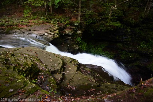
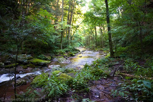
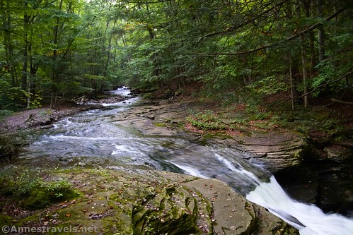
The trail down to Lewis Falls is the widest you’ve seen along the road, and it’s also in fairly good repair. It’s a pretty easy tenth of a mile down to the stream right above the falls. Sadly, it’s hard to get a good view of Lewis Falls. I walked along the rim, but the gorge is such that it’s almost impossible to see the river below the falls, let alone the falls themselves. The best view is fairly near where you come down to the river.
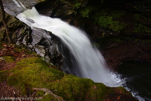
The views up the stream are nice, too.
Retrace your steps back down the road to the parking area beyond the gate. Despite being mostly along a dirt road, the hike is a fun and interesting one with great waterfalls, and I highly recommend it if you’re in the area (and not totally waterfalled-out by Ricketts Glen!)

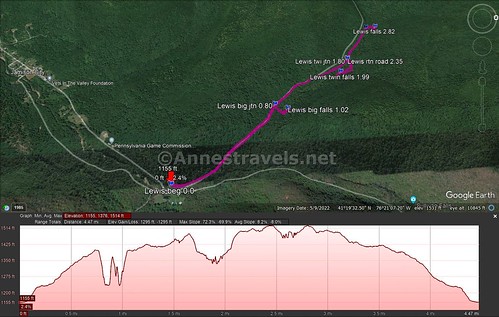
Round Trip Trail Length: I went 4.8 miles total. Exploring a bit less along the rim of the gorge would make it a little bit shorter.
Elevation Gain: 1,295ft. (1,155ft. to 1,514ft)
Facilities: None. There is one restaurant in Jamison but I didn’t see any public restrooms.
Fees: None
Trail Notes: Some of the trails are marked some of the time. There are plenty of pictures of signs on the internet. I found the Twin Falls sign; it had fallen off the post. But I didn’t see a sign for Big Falls. I hear that the road is icy in winter and soggy in spring, so it’s probably best to just walk it, even if the gate is open. Don’t try the social trail down to Big Falls if you’re not proficient in social trails and bouldering. My hiking companion decided it was better to let me do that one; she’s not much on crazy scrambling!

Trail 
![]()
![]()
Road ![]()
Signs ![]()
![]()
![]()
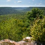
Scenery ![]()
Would I go 100 miles out of my way for this? ![]()
Overall Rating: 
![]()

GPS Coordinates for the Lewis Falls Hike
Trailhead: 41.3196730°, -076.3438780° (41°19.18038′, -076°20.63268′ / 41°19’10.8228″, -076°20’37.9608″) (1,158ft.) (0.0)
Big Falls Junction: 41.3277590°, -076.3523060° (41°19.66554′, -076°21.13836′ / 41°19’39.9324″, -076°21’08.3016″) (1,378ft.) (0.80)
Big Falls: 41.3287490°, -076.3518720° (41°19.72494′, -076°21.11232′ / 41°19’43.4964″, -076°21’06.7392″) (1,353ft.) (1.02)
Twin Falls Junction: 41.3346180°, -076.3584750° (41°20.07708′, -076°21.50850′ / 41°20’04.6248″, -076°21’30.5100″) (1,473ft.) (1.80)
Twin Falls: 41.3338160°, -076.3567700° (41°20.02896′, -076°21.40620′ / 41°20’01.7376″, -076°21’24.3720″) (1,375ft.) (1.99)
Return to the road after Twin Falls: 41.3346340°, -076.3584620° (41°20.07804′, -076°21.50772′ / 41°20’04.6824″, -076°21’30.4632″) (1,473ft.) (2.35)
Lewis Falls Junction: 41.3372600°, -076.3637670° (41°20.23560′, -076°21.82602′ / 41°20’14.1360″, -076°21’49.5612″) (1,511ft.) (2.70)
Lewis Falls: 41.3382350°, -076.3640310° (41°20.29410′, -076°21.84186′ / 41°20’17.6460″, -076°21’50.5116″) (1,474ft.) (2.82)
Return to the road after Lewis Falls: 41.3372270°, -076.3636900° (41°20.23362′, -076°21.82140′ / 41°20’14.0172″, -076°21’49.2840″) (1,510ft.) (3.07)
End: 41.3197410°, -076.3438340° (41°19.18446′, -076°20.63004′ / 41°19’11.0676″, -076°20’37.8024″) (1,159ft.) (4.80)

The gpx file for my hike to Lewis Falls can be downloaded – please note that this and the GPS Coordinates are for reference only and should not be used as a sole resource when hiking this trail.
Download GPX File size: 86.7 KB Downloaded 452 times
(Note: I do my best to ensure that all downloads, the webpage, etc. are virus-free and accurate; however, I cannot be held responsible for any damage that might result, including but not limited to loss of data, damages to hardware, harm to users, from use of files, information, etc. from this website. Thanks!)
Getting to the Lewis Falls Trailhead (Grassy Hollow Road)
It’s hard to describe exactly how to get to the Lewis Falls Trailhead because it’s pretty much in the middle of nowhere. Chances are, you’ll be on one or more dirt roads just getting to Jamison, and cell service is spotty at best (I had virtually none with both Sprint/T-Mobile and Version). If you have a dedicated GPS, it should get you there, so here are the GPS coordinates of the trailhead: 41.3196730°, -076.3438780°
From I-80, take Exit 236 and turn north on PA-47N. After 22.8 miles, take a sharp left turn onto PA-118W. Drive another 3.3 miles and turn right onto School House Drive; a short distance later, turn right onto Central Road. After 1.3 miles, turn right onto Jamison City Road. Take this road straight for about 2.2 miles to the closed gate that marks the trailhead. Along the way, you’ll pass by a PA Game Commission Maintenance Facility on the left.
From I-180, take Exit 15 for US-220N. Turn onto US-220N for 4.8 miles. Turn left onto N. Main Street (PA-405) for 0.3 miles, then take a left onto PA-118E (E Water Street). After 19.9 miles, take a slight left onto Central Road (if there’s no sign, continue a short distance to School House Drive and follow the directions above). Drive 1.8 miles; turn right onto Jamison City Road. Take this road straight for about 2.2 miles to the closed gate that marks the trailhead. Along the way, you’ll pass by a PA Game Commission Maintenance Facility on the left.
From I-81, take Exit 170 to merge onto PA-309N toward Wilkes Barre. Drive 6.8 miles and then turn left onto Hillside Road, which is signed for Penn State WB, for 3.2 miles. Take a slight right onto Old Rte 115 for 0.9 miles, then turn left to stay on Old Rte 115 for another mile. Keep left to continue on Old Rte 115 for another 1.5 miles so you can turn left onto PA-118W. After 18.6 miles, turn right onto School House Drive; a short distance later, turn right onto Central Road. After 1.3 miles, turn right onto Jamison City Road. Take this road straight for about 2.2 miles to the closed gate that marks the trailhead. Along the way, you’ll pass by a PA Game Commission Maintenance Facility on the left.
This Week’s Featured Product!
Discover dozens upon dozens of waterfalls in Pennsylvania with this book. It’s a fantastic way to enjoy the outdoors. Buy it here!