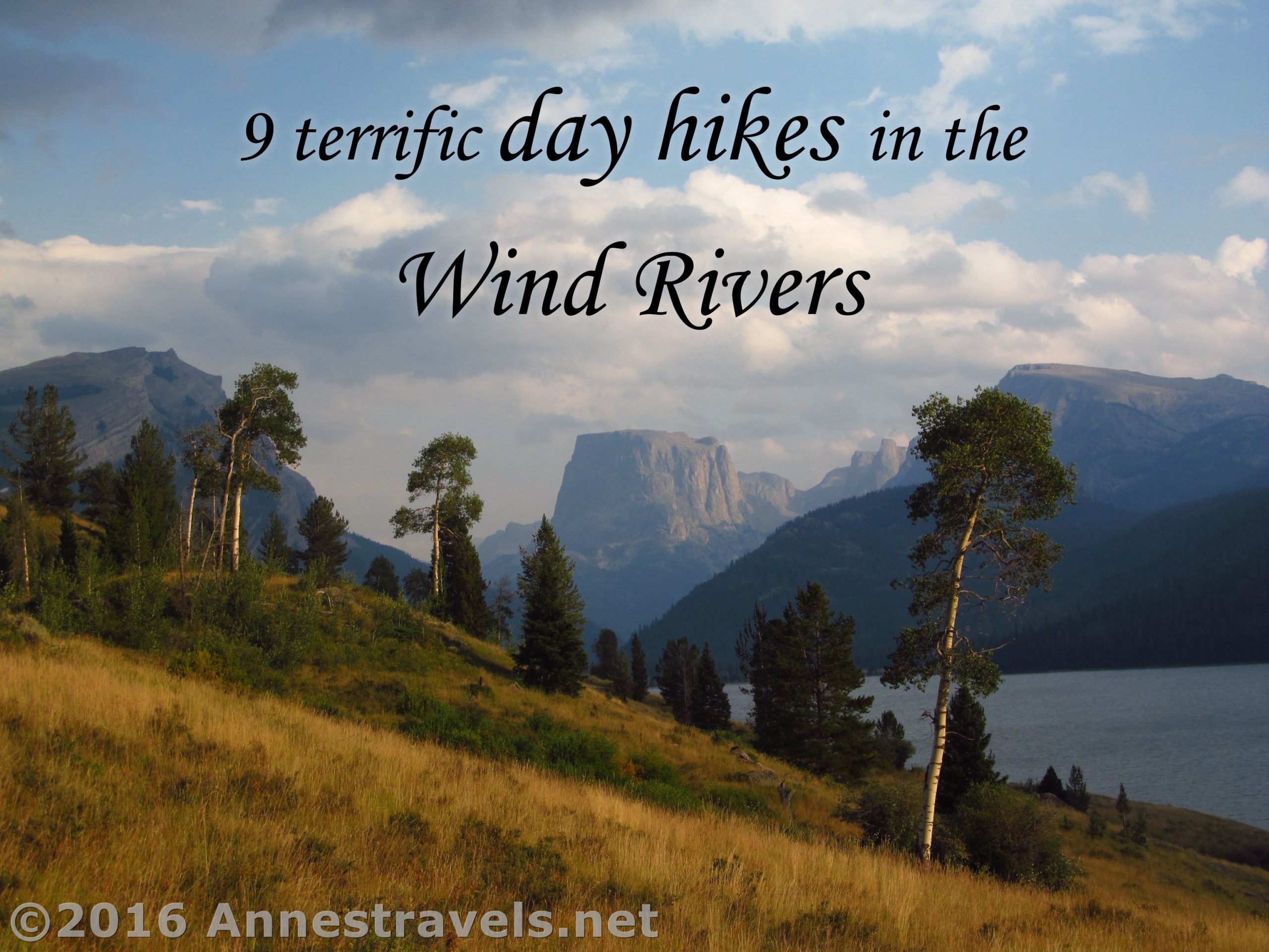
The Wind River Range of Wyoming is truly spectacular. Snow-capped peaks, jagged cirques, lovely meadows, alpine lakes, it’s a view junkie’s paradise. But day hikes of any reasonable length are hard to come by; the area is known as a backpacker’s paradise because few destinations are less than 8 miles from a trailhead.
(Affiliate links are present on this page.)
So here I’ve collected 9 incredibly scenic
, day hikeable trails in the Wind Rivers, known as one of the most remote wilderness areas in the lower 48 states (which is why there’s often water and restrooms at most trailheads, I suppose). Anyway, enjoy!
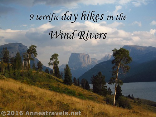
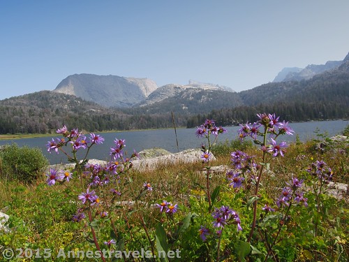
9 Incredibly Scenic Day Hikes in the Wind Rivers
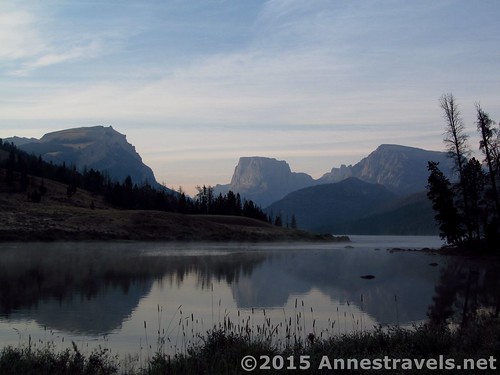
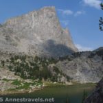
Lower Green River Lake Circuit. If you can only do one hike in the Wind Rivers, this might very well be your best bet. Only a 6.5 mile loop, the Highline Trail section of the hike displays one of the Winds’ most iconic vistas: Squaretop Mountain over Lower Green River Lake. Return via the Lakeside Trail for a loop option.
Big Sandy Lake. This is probably one of the most popular areas of the Wind River Range due to its vicinity to many other more popular destinations, but Big Sandy Lake is also a great destination unto itself. And even though the hike is 11.5 miles RT, the trail is so flat, climbing only 600ft., it feels like much less.
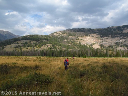
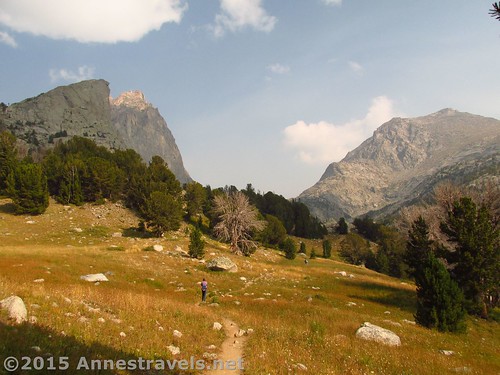
Stough Creek Pass. In all actuality, Stough Creek Pass is just a saddle en route to the backpacker-haven Stough Creek Basin, but the views from the pass are so epic it’s hard not to stop and gawk. And at 9.2 miles RT and only moderate elevation gain, well, why not?
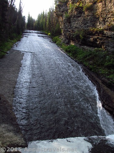
Slide Creek Falls. The falls isn’t a known destination, in fact, you might not even know it exists unless you saw it on a topo map. But since it runs right next to the Slide Lake Trail, and it’s only 4.5 miles from the parking area, it’s quite easy to visit (and you get to see some truly epic Wind River scenery en route!).
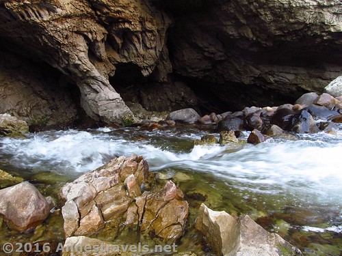
Sinks Canyon. Really, this is a state park, but since it’s within the Wind Rivers, and it’s pretty cool (and free), I thought I’d mention it. Here, along as little as a 0.5 mile trail, the Popo Agie River disappears into a cave to reappear some quarter mile and 2 hours later…
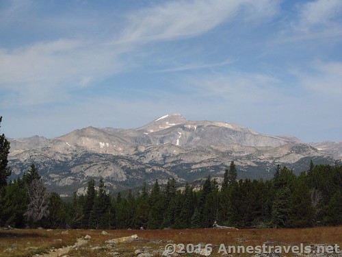
Roaring Fork Mountain. Get to Stough Creek Pass, then strike off-trail up the mountainside to ever more epic views… and maybe every more epic wind speeds, if bloggers’ experiences are anything to go on. At any rate, the view makes it more than worth the 10.6 miles RT.
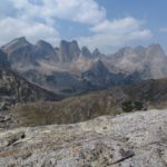
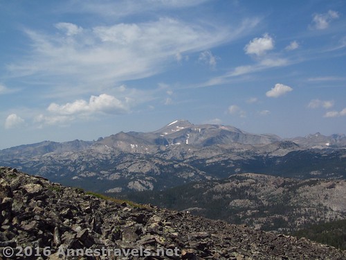
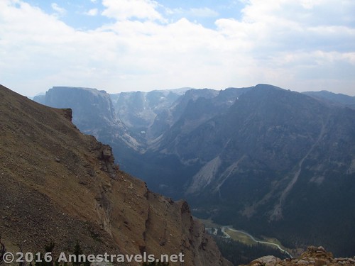
North Lake. Not that I’m that into alpine lakes, but here the views in the pass and of nearby cliffs and pinnacles truly make this 14.6 mile hike both scenic and worthwhile. Stop at the lake, or continue up to the Cirque of Towers Overlook.
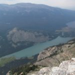
White Rock via the Northwest or Northeast Slopes. Now here’s a hike that is incredibly scenic, but just might be too long and hard as a dayhike. At 15 miles RT – about half of it without a trail – White Rock isn’t for the faint of heart. But if you do it, you’ll be rewarded with alpine meadows, views of Wind River peaks and cirques galore, and over-the-top jaw-dropping views of the Green River Lakes far, far below.
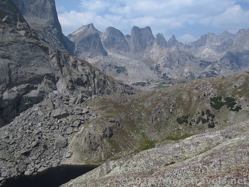
Cirque of Towers Overlook. Ok, so this really isn’t a dayhikeable trail by distance: at 16.6 miles RT, that’s just too long for my kind of dayhiking. But 10+ of those miles are extremely easy, and I did it, and there is a trail… which shows it can be done. (And I’ll be the first to say it’s worth every step!)
Bonus #1: Doubletop Mountain. I wanted to do this 12+ mile hike, but between hazy skies and lack of time, I’ll just have to do it next time I visit. (Unfortunately, the write up about the peak I originally looked at seems to have become infested with internet nastiness, so I’ll just say to start at the New Fork Lakes Trailhead, take the Doubletop Mountain Trail about 6 miles, then scramble up the peak.)
Bonus #2: Photographers Point. Actually, when I first saw the pictures, I thought, no, not my kind of view. But now that I’ve visited the Winds, I can say I know why people hike the 9 miles RT to get here.
Anything I missed here? Let me know in the comments!
Zoom map in to browse individual hikes around the Wind Rivers