
The hikes that begin from the Mt. Baker Highway in northwest Washington State have got to be some of the most spectacular in the Continental US. There’s something about Mt. Baker’s cone, Mt. Shuksan’s rugged profile, and all the other nearby snowcapped peaks are simply awe-inspiring. Oh, and did I mention the wildflowers in season?
(Affiliate links are present on this page.)
I finally got to explore the highway a bit last summer, so here are my personal favorites – aka, the
6 Best Hikes on the Mt. Baker Highway!
Note that the Mt. Baker Highway is late to thaw out – it’s unlikely that you’ll be able to drive to Artist Point until late July at the very earliest; most years the point isn’t open until August, and even then snowfields will cover trails, year round or at least into the fall months.
The 6 Best Hikes on the Mt. Baker Highway
- Table Mountain. A short hike with an awesome view, the Table Mountain Trail switchbacks steeply upward, then rolls along the flat top of the mountain to awe-inspiring views of Mt. Baker, Mt. Shuksan, and lakes far below. 3.0 miles RT.
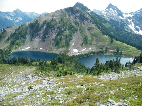
- Winchester Mountain. Besides the excellent views over the Twin Lakes, Winchester Mountain boasts an old fire lookout, open on a first-come, first-serve basis. Combined with views over the Canadian Cascades (and the northerly Washington Cascades), the moderately difficult trail is one to remember. 3.5 miles RT.

- Artist Ridge to Huntoon Point. Now, if you’re looking to get a real bang for your hiking buck, Artist Ridge delivers it. Only a mile or so RT, and with social trails galore to go further, views of Mt. Shuksan (best in the afternoon) open up from the first and continue to get better as the trail meanders along the ridgeline. The trail comes highly recommended! Less than 1.5 miles RT, even with some social trail exploring.
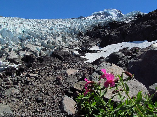
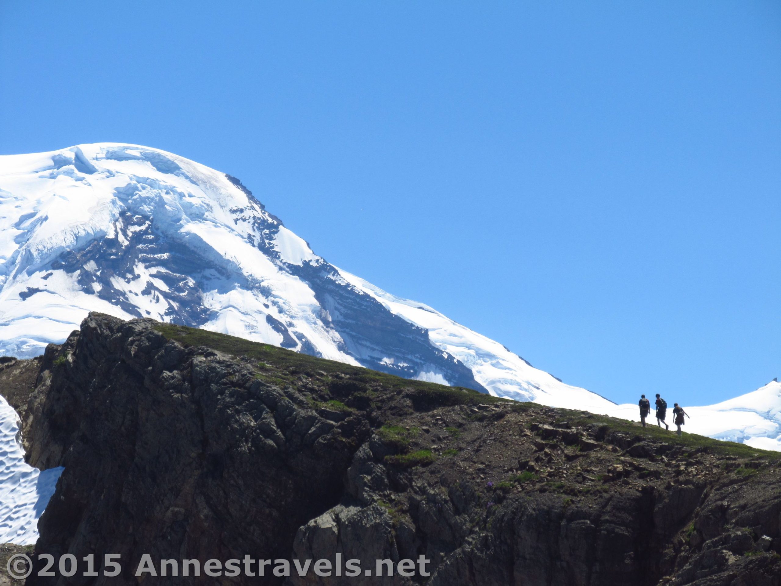
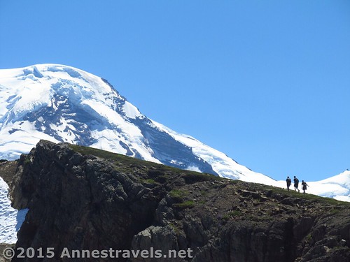
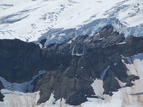
- Heliotrope Divide. Gaping crevasses, idyllic waterfalls, and Mt. Baker’s cone, seemingly directly above you, make this hike unlike any other along the Mt. Baker Highway. Although you likely will never get a glimpse of a glacier quite like the spectacular view at the end of this trail (at least in Washington), the four stream crossings can be a deterrent to those who don’t like getting their feet wet. 6.5 miles RT.
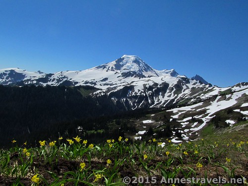
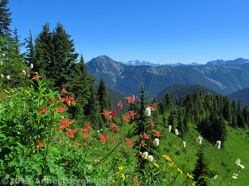
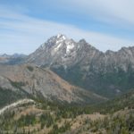
- Skyline Divide. A true favorite on my last visit, this trail promised a lot and delivered so much more. Walking for miles along the ridgeline with Mt. Baker ever present, and Mt. Shuksan close by – not to mention the lovely wildflowers and peaceful valleys not so far away – this is a one-in-a-million hike. 4.2 to 10+ miles RT.
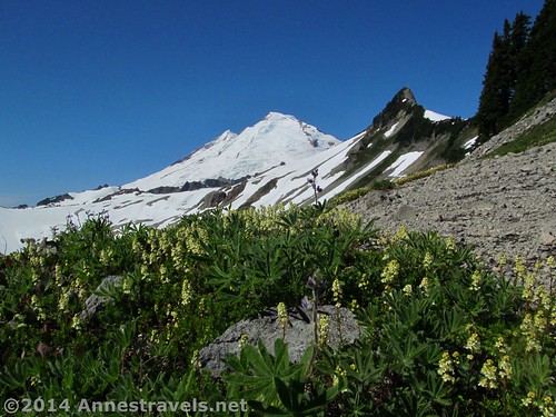
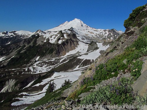
- Ptarmigan Ridge. And then there’s Ptarmigan Ridge. Snowfields give way to rocky scree, which in turn give way to Mt. Baker’s cone, only a valley away. Meanwhile, Mt. Shuksan rears up across another several valleys, making this a hike a front-row view to all the Mt. Baker Highway has to offer. Some snowfields cover the trail permanently, but often it is hikable without an ice ax by the middle of August. About 10 miles RT.
Do you have a favorite hike in the Mt. Baker area?
If you want more of the “best of the best” from the Mt. Baker Highway, click here
Getting to the Mt. Baker Highway
From Bellingham, WA, take WA-542 (Mt. Baker Highway) about 35 miles east to the tiny town of Glacier. The one major feature here is a ranger station, with visitor information, fee station ($5/day fee charged throughout the highway; all Interagency/America the Beautiful and Northwest Forest Passes accepted if displayed in vehicle windshield), weather information, trail conditions, etc.
Zoom map in to browse individual hikes around Mt. Baker

This Week’s Featured Product!
Looking for even more hiking possibilities in Mt. Baker? Check out this travel book, covering the area around Mt. Baker, North Cascades National Park, the San Juan Islands, and much more. (affiliate link; there is no extra cost for you)


2 responses to “6 Best Hikes on the Mt. Baker Highway”
[…] The 6 Best Hikes on the Mt. Baker Highway, Washington. If I had to pick the best of the best of my posts about the best, I’d pick this one. Mt. Baker is just spectacular. Amazing. Awe-inspiring. When can I go back? […]
[…] Winchester Fire Lookout. Very reminiscent of the views from North Cascades National Park proper, this slightly shorter trail switchbacks up a near-sheer mountainside meadow to views over the Canadian Cascades, two blue-green lakes, and the cone of Mount Baker. Pretty cool! 5 miles RT. […]