
I don’t go to New England much. I’m not exactly sure why; maybe I’m spoiled by the mountains west of the Mississippi, or maybe it’s just so hard to find free (or even cheap) places to camp that trips to New England become a nightmare. But at times, whether to relive an event or to see something new, New England becomes a destination.
Quick Stats
(Affiliate links are present on this page.)
The second-to-last time I was in New Hampshire, there was a significant part of the group who wanted to revisit Grafton Notch, specifically to hike to the top of Table Rock (which is in Maine). I didn’t recall the hike, which we’d taken nearly 15 years earlier, but I’m up for a hike almost any time…especially when it means scrambling up rocks to a view, and then hiking the AT back to the parking area! And it was only about 2 miles RT!
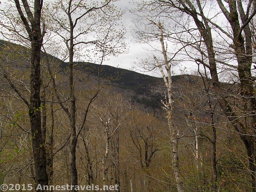
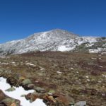
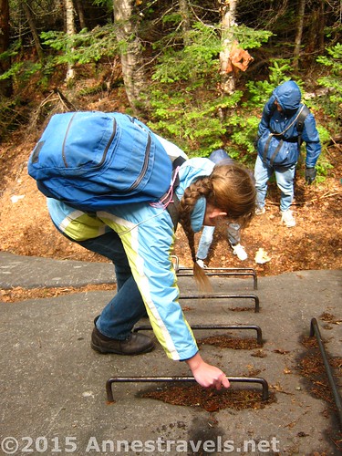
The trail begins across the road from the parking area, and enters a slightly marshy area. Turn right on the Table Rock Trail; this is a shorter, but steeper approach – we went this way, then looped back on the AT (the longer, less demanding route). It begins to climb in earnest up the side of the valley, er, mountain by Northeast standards. The trail winds upward through the trees, occasionally with peek-a-boo views and plenty of large boulders along the way. At times the boulders must be scrambled, but it’s not a difficult hike compared to some of the scree slopes I’ve done out west!
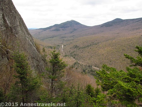
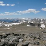
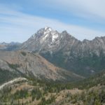
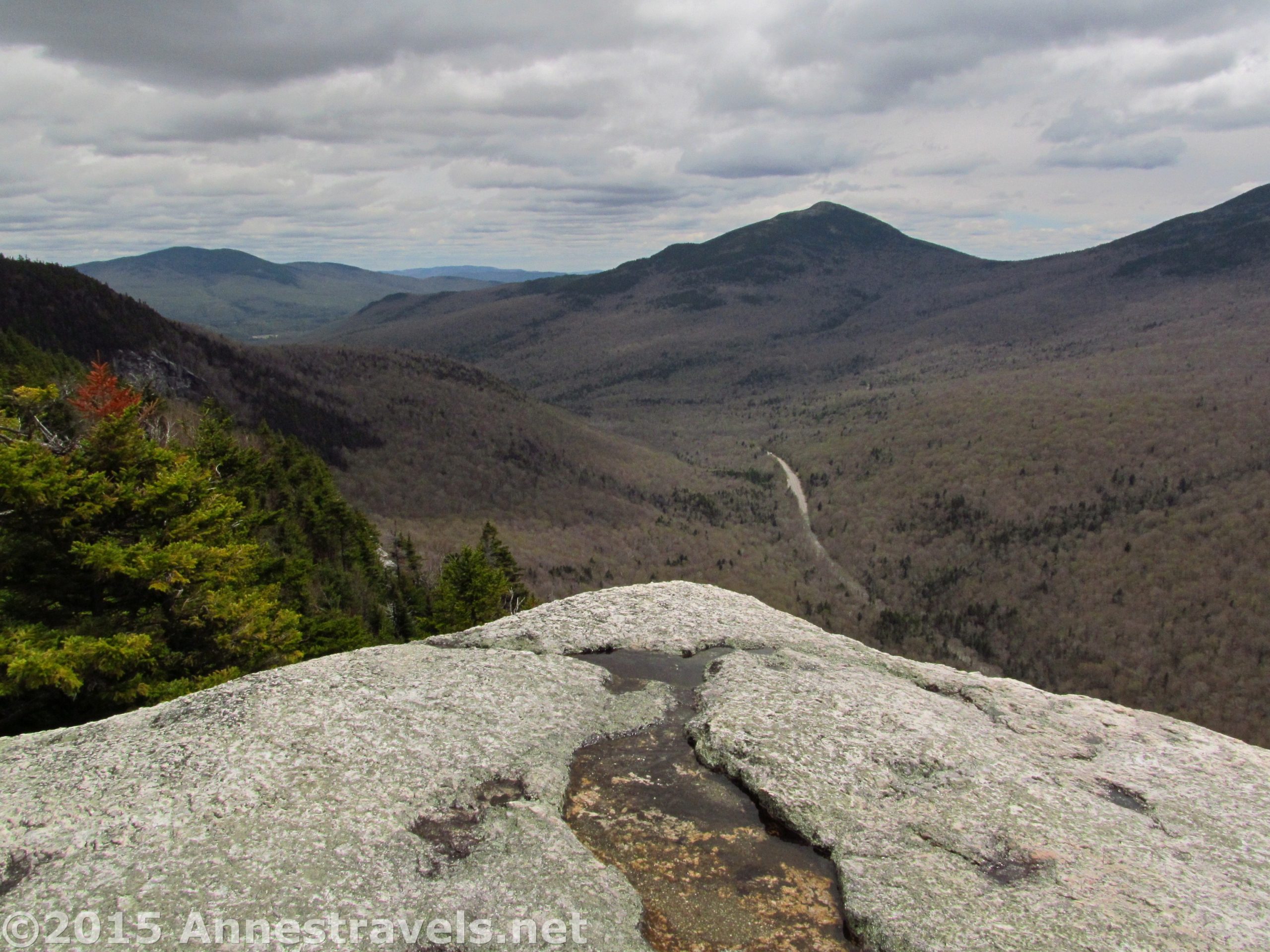
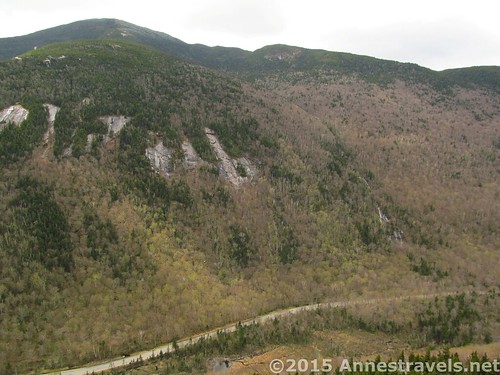
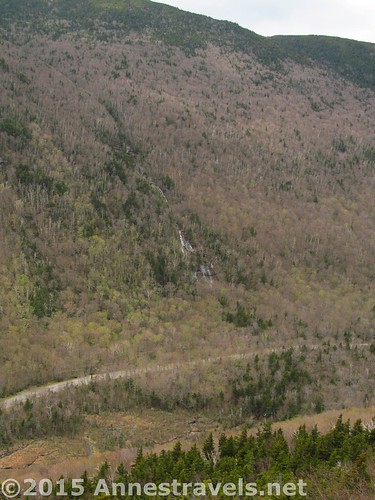
After passing the WP caves – which really make you feel like you’re ascending through a cleft in the rock – the trail loops around, away from the cliffs and boulder fields but into the slickrock (does the Northeast have slickrock? Or is that a Utah thing?) At any rate, the trail winds around, then, about 0.8 miles from the trailhead, a likely unmarked side-trail leads through the pines, up a small ravine to the top of Table Rock – and views of Old Speck and Rt. 26, some 900 ft. below!
Note that there are no guard rails here – its you, the rock, and thin air.
After admiring the view (and the people during the summer; this is a quite popular hike), return to the main trail, turn left, and continue as the trails slopes downward. Along the way, enjoy the ladders that take you down over boulders – sooo much fun!
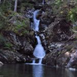
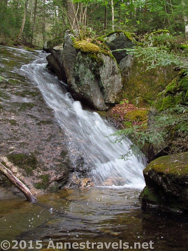
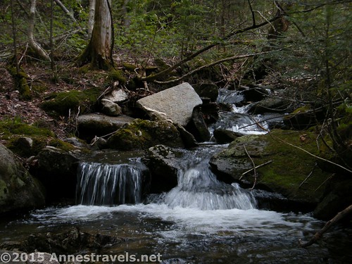
About 0.5 miles beyond Table Rock, connect with the AT (white blazes). Turn left to descend to the parking area. Not long after this junction, a series of small waterfalls are a pleasant diversion. A long diversion, that was, for someone just dying to use the manual shutter speeds on her camera!
Descend about 0.6 miles, then turn right to cross the road again back to the parking area.
It’s a pity our day wasn’t nicer, but, hey, we enjoyed ourselves and I suppose you don’t need sunshine to have fun scrambling up, over, and around boulders in the forest!
Round Trip Length: About 2.0 miles
Net elevation gain / loss: About 900 ft.
Facilities: A couple picnic tables and a primitive restroom at the parking area
Fees: $3/per person per day for adult non-residents; $2 for adult residents, and $1 for children and non-resident seniors (resident seniors are admitted free). Be prepared to pay cash at the self-service fee station in the parking area.
Trail 
![]()
![]()
Road
Signs ![]()
Scenery ![]()
Would I go 100 miles out of my way for this? ![]()
![]()
Overall Rating: ![]()
Getting to Grafton Notch and the Table Rock Parking Area
From Newry, ME, turn off of US-2 / ME-5 onto ME-26N. Drive 12.1 miles to the parking area, on left.
Alternatively, from Errol, NH, take NH-26E (then ME-26S) 18.4 miles to the parking area, on right.
Zoom map out to browse nearby hikes & places of interest
This Week’s Featured Product!
Love waterfalls? Love New England? This book is for you! With more than 400 waterfalls covered, it’s a waterfall lover’s paradise, as well as for those who enjoy the thrill of searching out each new cascade. Also included are numerous options for swimming holes throughout the region.