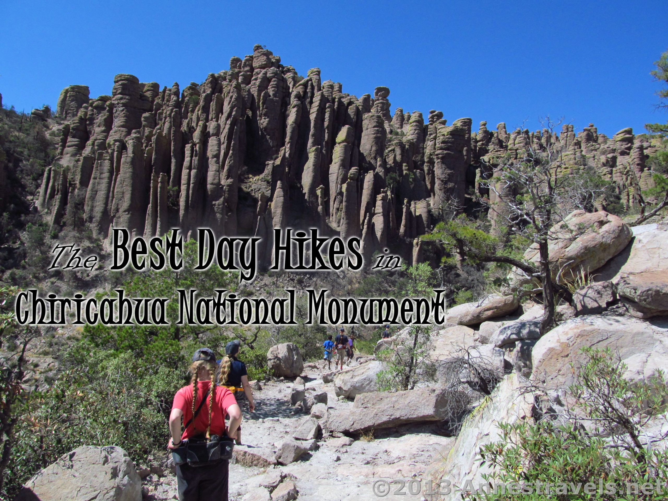

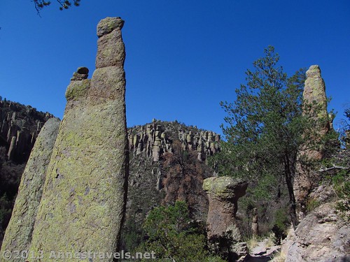
The first time we visited Chiricahua National Monument, we thought we must have entered a rock-formation-wonderland. We were used to the red rocks of Utah (Bryce and Arches have long been favorite national parks), but this was a totally different experience: These rock formations looked like people, animals, and objects, and these rock formations were gray and covered with green and brown lichen.
(Affiliate links are present on this page.)
So to say the least, we were very impressed. We’ve been back multiple times since, and it never ceases to amaze me!
Best Day Hikes in Chiricahua National Monument
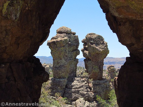
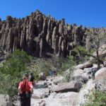
- Heart of Rocks Loop. The absolute best place in Chiricahua to see the formations is on the Heart of Rocks Loop. You’ll pay for that privilege in the way of hiking – it’s at least 2.9 miles just to get to the beginning of the 1-mile loop – but if you’re up to it, it’s a fantastic place, filled with rock formations that look like people, animals, and all kinds of other things to an active imagination! 6.9 miles lollipop loop out and back from the Echo Canyon TH; 7.1 mile shuttle between the Echo Canyon TH and the Visitor Center; or 8.3 mile loop from Echo Canyon TH via the Ed Riggs, Mushroom Rock, Big Balanced Rock, Heart of Rocks, Sarah Deming, Upper Rhyolite, and Echo Canyon Trails.

- Echo Canyon Loop. Not up to the Heart of Rocks trek but still want to see the formations? Check out the Echo Canyon Loop, which wanders down the Ed Riggs Trail, across on the Hailstone Trail, and then up the Echo Canyon Trail for some of the best views of the spires near a trailhead. 3.1 mile loop

- Inspiration Point. To look down on the canyon full of spires, Inspiration Point lives up to its name. It can be added onto the Heart of Rocks hike (see above) for extra fun. 4.8 miles out & back from the Echo Canyon TH (Ed Riggs Trail to Mushroom Rock Trail to Inspiration Point Trail) or can be a spur off the Heart of Rocks hike (add 1 mile to the hike)

- Big Balanced Rock. The Big Balanced Rock is a worthy destination unto itself. To me, it’s always resembled a giant water cooler, but it’s fascinating… and always shrinks in my imagination. In reality, it’s huge! 4.8 miles out & back from the Echo Canyon TH (add a mile if you want to also visit Inspiration Point), 6.2 miles out & back from the visitor center; can be added without any additional mileage to the Heart of Rocks hike.

- Sugarloaf Mountain. It’s sort of like being in an airplane. But looking down on much of Chiricahua National Monument is a treat, especially if you love desert mountains. 1.8 miles out & back
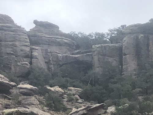
- Natural Bridge. The bridge itself is pretty neat – who doesn’t like a good arch? – but getting to it is a little trickier. The trail takes hikers to a viewpoint; beyond this, it’s up to the hiker how close they want to get. Beyond the bridge, views of more rock formations make the hike a bit more interesting. 4.8 miles out & back to the viewpoint

- Faraway Ranch. It’s not really an official day hike, but I love walking to the old dude ranch, wandering around the old buildings, and exploring the scenery around the ranch. There’s quite a bit of history as well as guided tours at certain times (check with the visitor center). 0.5 mile lollipop loop to the ranch, around the buildings, and back to the picnic area
Share your favorite trail in Chiricahua National Monument in the comments below!
Zoom map to browse individual hikes around Chiricahua National Monument
This Week’s Featured Product!
Hike some of Arizona’s best wilderness areas with this book, which includes Chiricahua National Monument and vicinity. (affiliate link; there is no extra cost to you)