

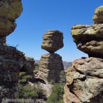
In my last post I talked about hiking to the Big Balanced Rock in Chiricahua National Monument. If you like the Big Balanced Rock, you’ll absolutely love a trail that starts only yards from that rock formation: the Heart of Rocks Loop Trail. Only 1.1 miles long (which will up your mileage to at least 9.3 miles), there are more amazing formations, awesome views, and incredible rocks in that single mile than in the rest of what you’ll see in the rest of Chiricahua’s trails. Because it’s not very long (but so fascinating), I thought I’d make this more of a picture-post than normal…so…enjoy the pictures!
Quick Stats
(Affiliate links are present on this page.)
The Heart of Rocks trail junction is just beyond the Big Balanced Rock. Turn down this; after about 0.1 miles the trail comes to a Y junction. Since the trail is a loop, you can go either right or left. I’ve always gone left; I think this offers some of the best views of the formations, so I’ll describe the loop as though you’re walking it clockwise.
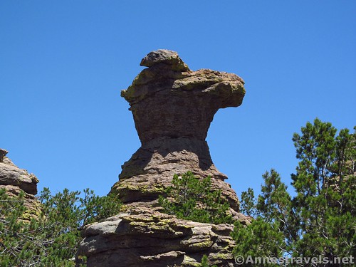
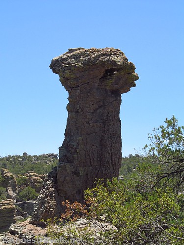
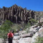
The Heart of Rocks Trail quickly descends into a wooded section. The first formation you’ll come to is Pinnacle Rock, a slightly taller version of the Big Balancing Rock:
It’s not exciting compared to others on the loop, but it’s a nice introduction to say, “You’ve arrived!!”
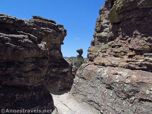
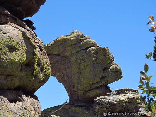
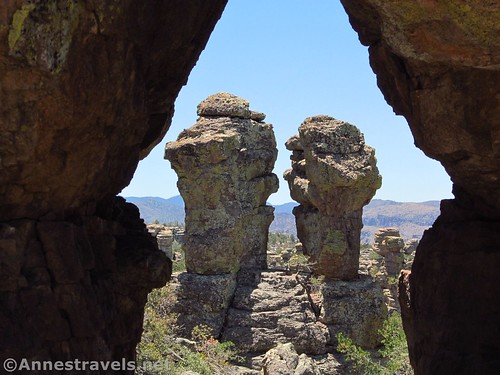
The trail then squeezes through a narrow set of rocks, which requires a little scrambling. It’s not difficult; just an obstacle to be overcome. Coming through this narrow place, The Old Maid appears:
And soon afterward, The Camel’s Head:
Looking back at The Old Maid:
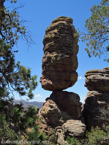
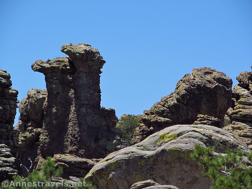
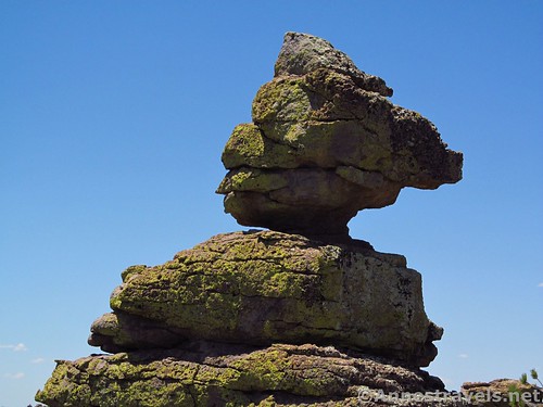
Then Thor’s Hammer:
All of these have been marked with very nice signs. However, some rocks looked to us like physical objects. Like, after passing through a second passageway in the rocks (no scrambling required this time), we discovered a formation that looks a lot like an Egyptian Pharaoh:
Or some very realistic looking Camels:
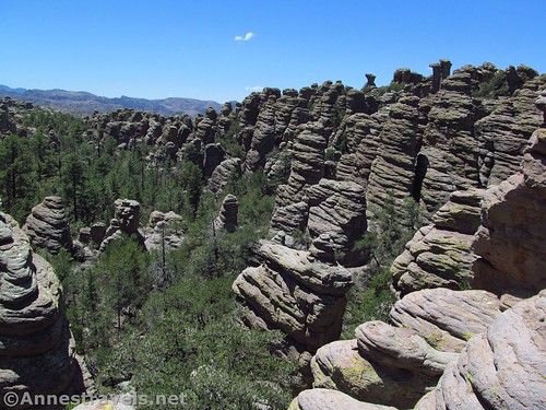
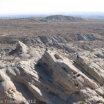
Continuing around the loop, you can look out over the Heart of the Rocks area…I call it a “Fun View” because there are so many interesting rock formations that look like everything from a space alien to a turtle:
The next named rock formation is Punch and Judy, so titled because it looks like two people looking at each other:
As the trail rises to top a hill, there are some nice views across the valley full of rock formations, such as this one:

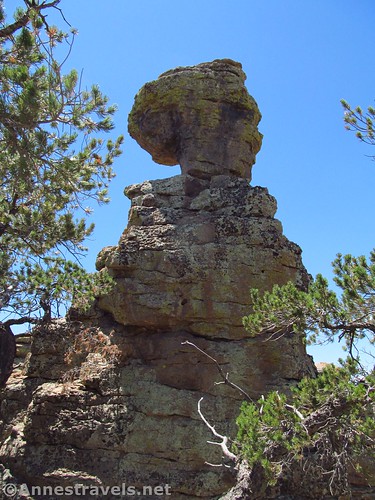
The next formation is a really cool one…Duck on a Rock:
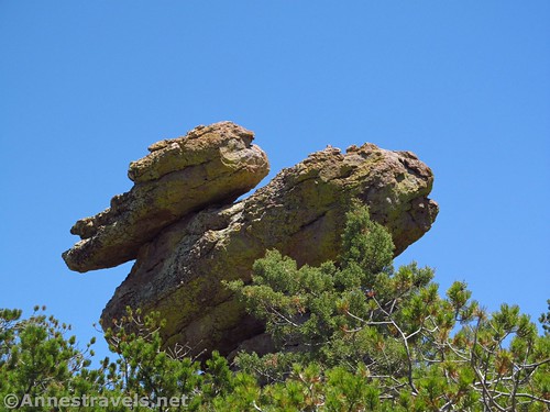
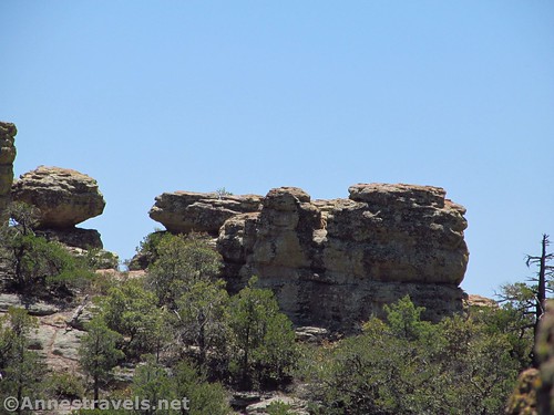
Another unnamed formation, as you round a corner, is the Fire Chief:
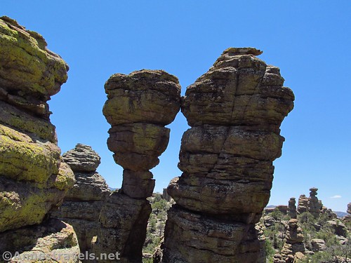
The last of the named formations are the Kissing Rocks. I guess this one got its name because the two rocks are leaning against each other:
But one more view awaits those with good imaginations. Looking across the Heart of Rocks area, there are many rocks with lichen on them. One of these has lichen in the general pattern of the Mona Lisa…really!
The trail dips into the woods, then, quite suddenly, you’re back at the Y junction. Turn left to return to the Big Balancing Rock Trail Junction…and be on the lookout for next week’s post about the Sarah Deming Trail and Upper Rhyolite Trails (which will begin to take you back up to your vehicle)!
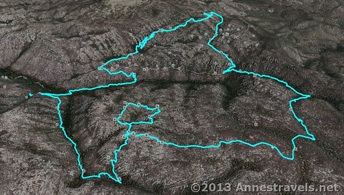
Round Trip Trail Length: The shortest RT trail is 9.3 miles (15 km). RT loop (including the Heart of Rocks Trail) is 9.5 miles (15.3 km) (though my GPS came out saying 8.7 miles (14 km))
Highest Elevation: 7,480 ft. (2,280 m) (Echo Canyon Parking Area)
Lowest Elevation (on loop): 5,900 ft. (1,798 m) (Sarah Deming Trail / Rhyolite Trail Junction)
Net Elevation Gain/Loss: 1,680 ft. (512 m)
Facilities: Primitive restrooms at the Echo Canyon Trailhead – otherwise, none.
Fees: $5 per person fee (age 16 and older) to enter Chiricahua National Monument, valid 7 days. America the Beautiful (Interagency), Senior (Golden Age), Access (Golden Access), Volunteer, Military, and Chiricahua Annual Passes also accepted – however, note that these only cover the pass holder and three other individuals (we ended up having to pay for one extra person; unlike some parks, these staff members seem serious about enforcing this (but they were very nice, all the same!)). Update: The entrance fees to Chiricahua have been eliminated, so you can now visit for free!
Trail 
![]()
![]()
Road ![]()
Signs
Scenery
Would I go 100 miles out of my way for this?
Overall Rating: 
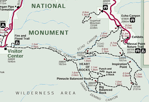
Key GPS Coordinates for the trail to the Big Balanced Rock
Heart of Rocks Trail Junction: 31.99459N / -109.32260W (31° 59′ 40.5234″ / -109° 19′ 21.3594″) (6,792 ft.; 2,070 m)
Pinnacle Rock: 31.99551N / -109.32316W (31° 59′ 43.8354″ / -109° 19′ 23.376″) (6,825 ft.; 2,080 m)
Old Maid: 31.99601N / -109.32337W (31° 59′ 45.6354″ / -109° 19′ 24.1314″) (6,868 ft.; 2,093 m)
Camel’s Head: 31.99607N / -109.32327W (31° 59′ 45.8514″ / -109° 19′ 23.7714″) (6,861 ft; 2,091 m)
Thor’s Hammer: 31.99684N / -109.32301W (31° 59′ 48.6234″ / -109° 19′ 22.8354″) (6,860 ft.; 2,091 m)
Egyptian Pharaoh: 31.99739N / -109.32278W (31° 59′ 50.6034″ / -109° 19′ 22.0074″) (6,857 ft.; 2,090 m)
Camels: 31.99727N / -109.32208W (31° 59′ 50.172″ / -109° 19′ 19.4874″) (6,839 ft.; 2,084 m)
Fun View: 31.99714N / -109.32195W (31° 59′ 49.704″ / -109° 19′ 19.02″) (6,851 ft.; 2,088 m)
Punch and Judy: 31.99679N / -109.32114W (31° 59′ 48.444″ / -109° 19′ 16.1034″) (6,885 ft.; 2,098 m)
Duck on a Rock: 31.99682N / -109.32027W (31° 59′ 48.5514″ / -109° 19′ 12.9714″) (6,906 ft.; 2,105 m)
Fire Chief: 31.99627N / -109.32052W (31° 59′ 46.5714″ / -109° 19′ 13.872″) (6,883 ft.; 2,098 m)
Kissing Rocks: 31.99591N / -109.32085W (31° 59′ 45.2754″ / -109° 19′ 15.0594″) (6,857 ft.; 2,090 m)
Mona Lisa View: 31.99594N / -109.32080W (31° 59′ 45.384″ / -109° 19′ 14.88″) (6,851 ft.; 2,088 m)
The gpx file for the Chiricahua Heart of Rocks Loop can be downloaded – please note that this and the GPS Coordinates are for reference only and should not be used as a sole resource when hiking this trail.
Download GPS File File size: 208.5 KB Downloaded 822 times
(Note: I do my best to ensure that all downloads, the webpage, etc. are virus-free and accurate; however, I cannot be held responsible for any damage that might result, including but not limited to loss of data, damages to hardware, harm to users, from use of files, information, etc. from this website. Thanks!)
Getting to the Echo Canyon Parking Area
From I-10 in Arizona, take Exit 340 in Willcox. Head southeast (left if you’re coming from the east, right if you’re coming from the west) on Fort Grant Road/W Rex Allen Drive for 1.1 miles (1.7 km). Turn right onto AZ-186 E (signs will point toward Interstate 10 Business). After 0.7 miles (1.1 km), turn left to continue on AZ-186 E; drive 31.4 miles (50.5 km). Turn left onto AZ-181 for 3 miles (4.8 km), then continue on E Bonita Canyon Road for 7.3 miles (11.7 km). Turn right, following the signs for Sugarloaf and Echo Canyon; take an almost immediate left into the Echo Canyon Parking Area.
If you’re coming from the visitor center, turn left out of the parking area and drive 5.3 miles (8.5 km) to the turnoff for Sugarloaf. Turn right here, then take an almost immediately left into the Echo Canyon Parking Area.
This Week’s Featured Product!
Looking for some shorter hikes? This book covers over 60 shorter trails in the state of Arizona, from Grand Canyon and Organ Pipe to Phoenix and Tuscan.


4 responses to “Chiricahua Formations: The Heart of Rocks”
[…] ranch, with the family taking visitors on saddle rides through the formations of Chiricahua such as Heart of Rocks. Today, it’s a cluster of buildings in a sheltered valley near the road into the national […]
[…] Trail, Mushroom Rock Trail, and Big Balancing Rock Trail, taking a side-loop to hike around the Heart of Rocks Trail, and then traversing the Sarah Deming Trail and Upper Rhyolite Trail) we were ready to be back at […]
[…] Mushroom Rock Trail, and Big Balancing Rock Trail, then taking a side-loop to hike around the Heart of Rocks Trail, we decided to end our hike by making the trail a loop – this added less than a mile (2 km) to […]
[…] So…now I’ll keep you in suspense…because (now that we’ve gotten there) I’ll post next week about the very best part of Chiricahua National Monument: The Heart of Rocks!!! […]