

I’d read about climbing White Rock, high above the Green River Lakes in the Wind Rivers of Wyoming, on SummitPost.com. From the descriptions, it sounded easiest to take the Northeast Slopes approach, climbing through meadows to the summit. Well, that didn’t work out so well, the route being so steep and so tangled with avalanche debris that it took us hours to walk the 3 or so miles up the mountainside. I detailed that in another post, along with my suggested “easiest” route to the top. But because of the difficulty of our climb, no one was anxious to go back down that same way. From SummitPost, I knew there was a way to climb the northwest slopes, and from the top it looked simple…if we could just get through the trees.
Quick Stats
(Affiliate links are present on this page.)
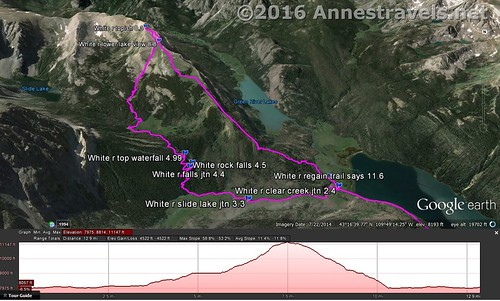
As it turned out, the northwest slopes route is quite doable; there is a way to get through the trees, and it’s slightly shorter than the northeast slopes route I took – taking the Northwest Slopes would be about 14 miles RT. I’ll describe it as though you were going up, even though I did it coming down.
Begin by hiking the Highline Trail 2.4 miles to the Clear Creek Trail; continue straight on the Highline Trail a short distance to where the trail crosses Clear Creek via a log-and-handrail bridge. Continue down the trail a very short distance to where an unmarked trail crosses the Highline Trail – to the right the creek is very visible (horse ford):
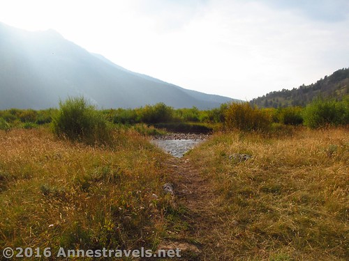
and to the left is simply a fairly well-used social trail.
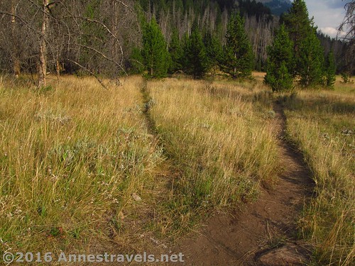
Turn left, following the trail as it parallels the side of the hill. At a couple points, trees have fallen across the trail and vague social trails have been made around the trees – do your best and always come back to the “main” social trail.
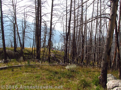
After walking for a few minutes, a social trail goes off on the left, ascending the hillside. I don’t know how else to describe it; the trail simply goes straight up the hillside. It peters out, then begins again, then becomes obliterated in the grass, then reappears. Just keep going upward as best you can, following the trail where possible. Eventually (assuming you’re following my GPS track, or somehow stumble onto it) you’ll come to a fairly decent trail that swtichbacks up the hillside. This trail is extremely steep, but at least it gets you more or less around the increasing number of dead trees. A fire swept through here a number of years ago, and trees continue to fall. Use caution, and realize that my GPS track may go through areas where trees have since fallen.

As the trail climbs, it becomes vague in places, as well as having multiple arms that might or might not lead back to the “main” trail. Basically, just keep going upwards and you’ll get there eventually.
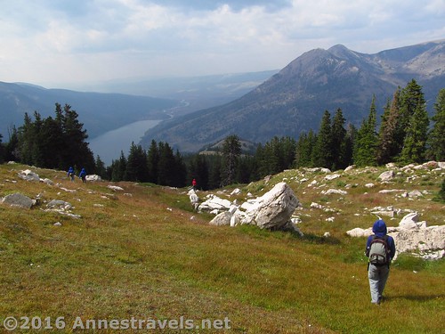
After about 2 or 3 miles of walking through the burned-out forest, come out into your first meadow. This is serious reason to cheer – the going is much easier from here!
Unfortunately, sometime during this section, my GPS turned off. So the straight line isn’t exactly accurate to my exact route.
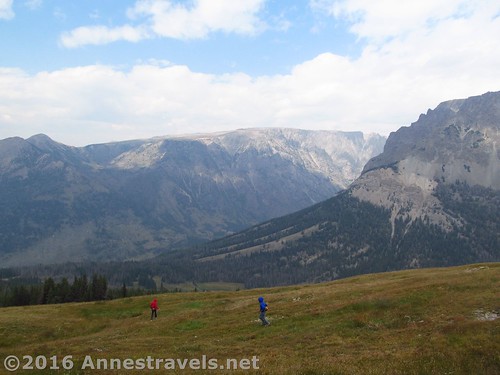
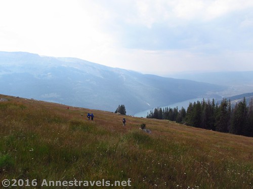
Cross the meadow and work your way through the trees to the next meadow. Keep going upward and, one or two ribs of trees later, you’ll be more or less beyond the trees and can just concentrate on heading upward through the steep meadows.
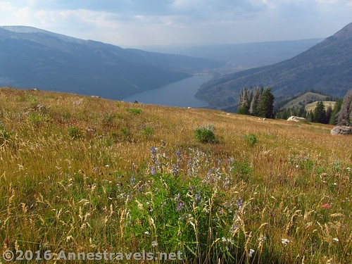
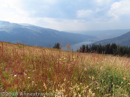
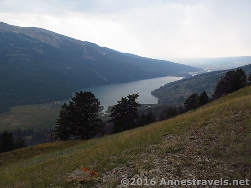
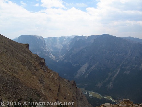
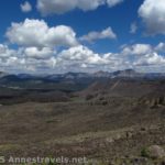
The meadows go on and one, probably around 2 miles of them. There are views closer to the western edge of the mountain, but the cliffs on that side are also pretty sheer, so I preferred staying a bit of a ways away from the edge.
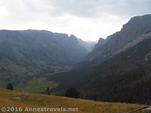
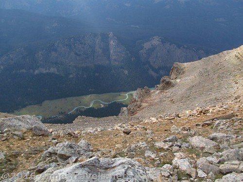
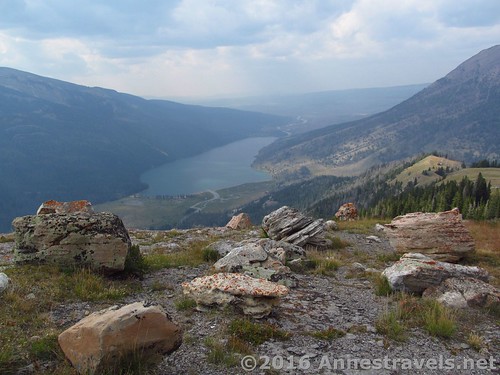
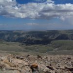
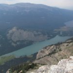
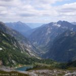
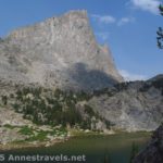
The views themselves are quite impressive – and beautiful. Down below are the Green River Lakes and the Green River (a unique shade of glacial green), and out at the end of the valley are the plains. Breathtaking!
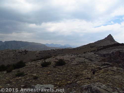
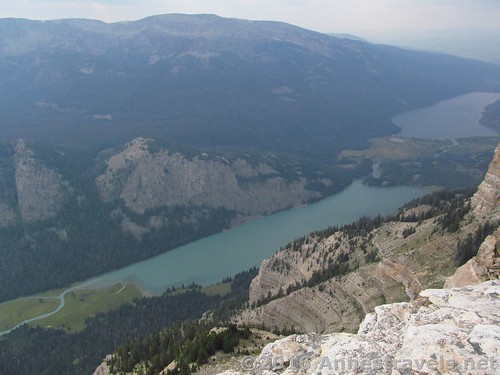
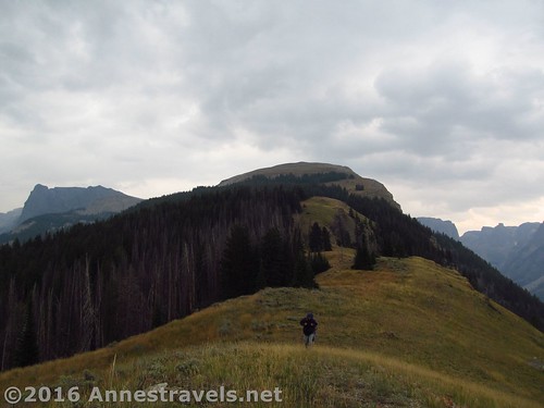
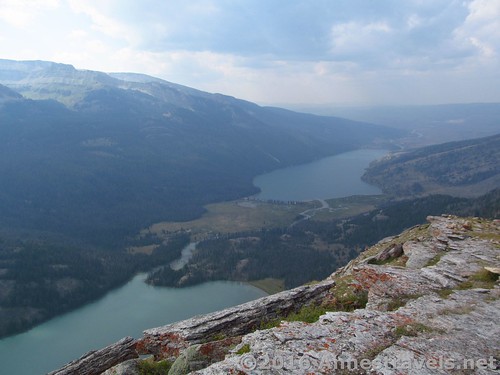
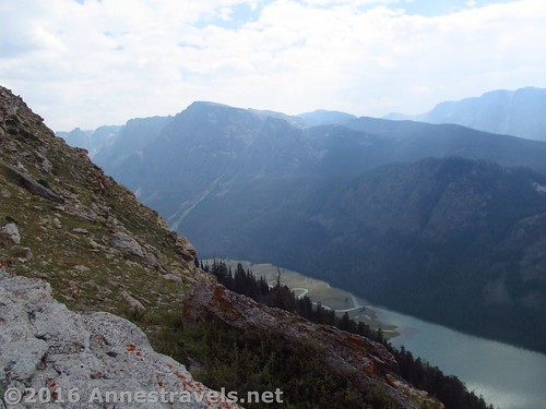
Finally, about 6.5 miles from the parking lot, arrive at the top ridge. Immediately go to the edge to look over at the green lakes, or continue over toward the summit block, very obvious because of its pyramid-like appearance.
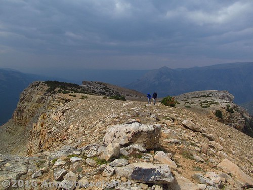
Unfortunately, the day I visited was cloudy and hazy. In the early summer or fall (or even mid-summer if it wasn’t hazy / smokey), the views would be simply spectacular! Dozens of Wind River Peaks (Squaretop may be partially visible around the summit block), the aptly named Green River and Green River Lakes (the pictures don’t do the color justice; they’re like glacial green gems – it’s hard to believe the color is real!), and the cliffs and valleys nearby and so far away. Incredible! The view makes the steepness of the trail worthwhile!
Return the way you came, or past Slide Creek Falls via the route I describe here as the #1 best route for climbing White Rock…it’s much shorter than trying to descend through an avalanche zone…
Round Trip Distance: 14-ish (probably slightly more) if you go up and down the Northeast Slopes like I’ve described here; the better route would be around 14 or 15 miles; RT for us was about 15 miles
Lowest Elevation: 7,957 ft.
Highest Elevation: 11,093 ft.
Net Elevation Gain: 3,136 ft.
Facilities: Drinking water and primitive toilets at the trailhead. Campground nearby (and opportunities for free-range camping also nearby…oops, maybe I shouldn’t have let that secret out!)
Fees: None
Trail 
![]()
![]()
![]()
Road ![]()
![]()
Signs ![]()
![]()
![]()
Scenery
Would I go 100 miles out of my way for this?
Overall Rating: 
![]()
Key GPS Coordinates for White Rock (Northwest Slopes)
Parking: 43.31404N / -109.85827W (43° 18′ 50.5434″ / -109° 51′ 29.772″) (8,029ft.)
Trail beginning: 43.31382N / -109.85838W (43° 18′ 49.7514″ / -109° 51′ 30.1674″) (8,040ft.)
Highline Trail / Lakeside Trail Junction: 43.31371N / -109.85839W (43° 18′ 49.356″ / -109° 51′ 30.2034″) (8,049ft.) (50ft.)
Corrals Junction: 43.31450N / -109.85659W (43° 18′ 52.2″ / -109° 51′ 23.7234″) (7,981ft.) (0.12)
Gunsite Pass Trail Junction: 43.31479N / -109.85379W (43° 18′ 53.244″ / -109° 51′ 13.644″) (7,957ft.) (0.3)
Enter Bridger Wilderness: 43.31009N / -109.85127W (43° 18′ 36.324″ / -109° 51′ 4.5714″) (7,982ft.) (0.75)
Cleer Creek Canyon Junction: 43.29387N / -109.83237W (43° 17′ 37.9314″ / -109° 49′ 56.5314″) (8,002ft.) (2.4)
Regain Trail: 43.29206N / -109.83167W (43° 17′ 31.4154″ / -109° 49′ 54.012″) (7,991ft.) (2.6)
Lower Green River Lake View: 43.26804N / -109.80319W (43° 16′ 4.9434″ / -109° 48′ 11.484″) (10,863ft.) (6.4)
Near summit block: 43.26333N / -109.79981W (43° 15′ 47.988″ / -109° 47′ 59.3154″) (11,093ft.) (6.9)
The gpx file for the hike to the top (and back) of White Rock (including the side trip to Slide Creek Falls) can be downloaded – please note that this and the GPS Coordinates are for reference only and should not be used as a sole resource when hiking this trail.
Download GPX File size: 313.6 KB Downloaded 664 times
(Note: I do my best to ensure that all downloads, the webpage, etc. are virus-free and accurate; however, I cannot be held responsible for any damage that might result, including but not limited to loss of data, damages to hardware, harm to users, from use of files, information, etc. from this website. Thanks!)
Getting to the Trailhead for Slide Creek Falls
In Pinedale, WY, head north on US-191. After nearly 6 miles, turn right onto WY-352 for 25.3 miles. (This turn is 5 miles south/east of where US-191 leaves US-189). The roads are entirely gravely / dirt after this, but are fairly well-maintained and should usually be accessible for low clearance vehicles. Continue straight onto the Green River Lakes Road for 18.5 miles. Take a slight left to not turn into the campground, then turn left toward the parking areas instead of the boat launch. Near the restrooms, turn right toward the hiker parking instead of the corrals. The parking area is large, but fills up during the summer months.
(By the way, there is technically a way to take a shortcut across the mountains on dirt roads via Union Pass. It’s even more or less on the AAA Wyoming map. Well, I’ve tried it, and it would probably be faster (and certainly easier on your vehicle) to take the paved roads south around the mountains (north might also be faster, but you’ll have to go through Grand Teton National Park, and while you won’t have to pay for that section of highway, the speed limit is also lower!) Scenery-wise, all three routes are really pretty, so enjoy the views of badlands, buttes, and the western side of the Wind Rivers (going around the southern end), views of meadows, trees, and mountain region (not really mountains) via Union Pass, or the Tetons and Togwotee Pass (via the northern route).)
Zoom map out to browse nearby hikes & places of interest
This Week’s Featured Product!
If you like hiking guides by people who have spent significant time in a given area, this may just be the book you’ve been looking for. The author has spent most of his life traversing the Wind Rivers, and this no-nonsense book takes current day hikers up peaks, past lakes, and generally on the well-known and unknown trails throughout the range.

6 responses to “Dayhiking White Rock – Northwest Slopes”
[…] one thing we were all agreed: we’d be taking a different route down. But that route (down the Northwest Slopes) is a post unto […]
[…] via Slide Creek Falls – way too long, with fresh avalanche damage on the Northeast Slopes and a burned out forest on the Northwest Slopes, it ended up being a grueling 15 mile hike, about half of it without a trail. The weather also […]
[…] the Northeast Slopes and how I should have reached the top, and the next week, we’ll find out how I went down via the Northwest Slopes… three distinct routes to the top of White […]
[…] trail, or down to the horse ford of Clear Creek. (Turning left here would take you to the northwest slopes of White Rock, but that’s definitely another post unto […]
[…] Rock via the Northwest or Northeast Slopes. Now here’s a hike that is incredibly scenic, but just might be too long […]
[…] via a tangled avalanche chute (really, no one was voluntarily going back down that way, even if another way was longer!), and kept walking around Horseshoe Mesa even though we were already at the 13 mile […]