
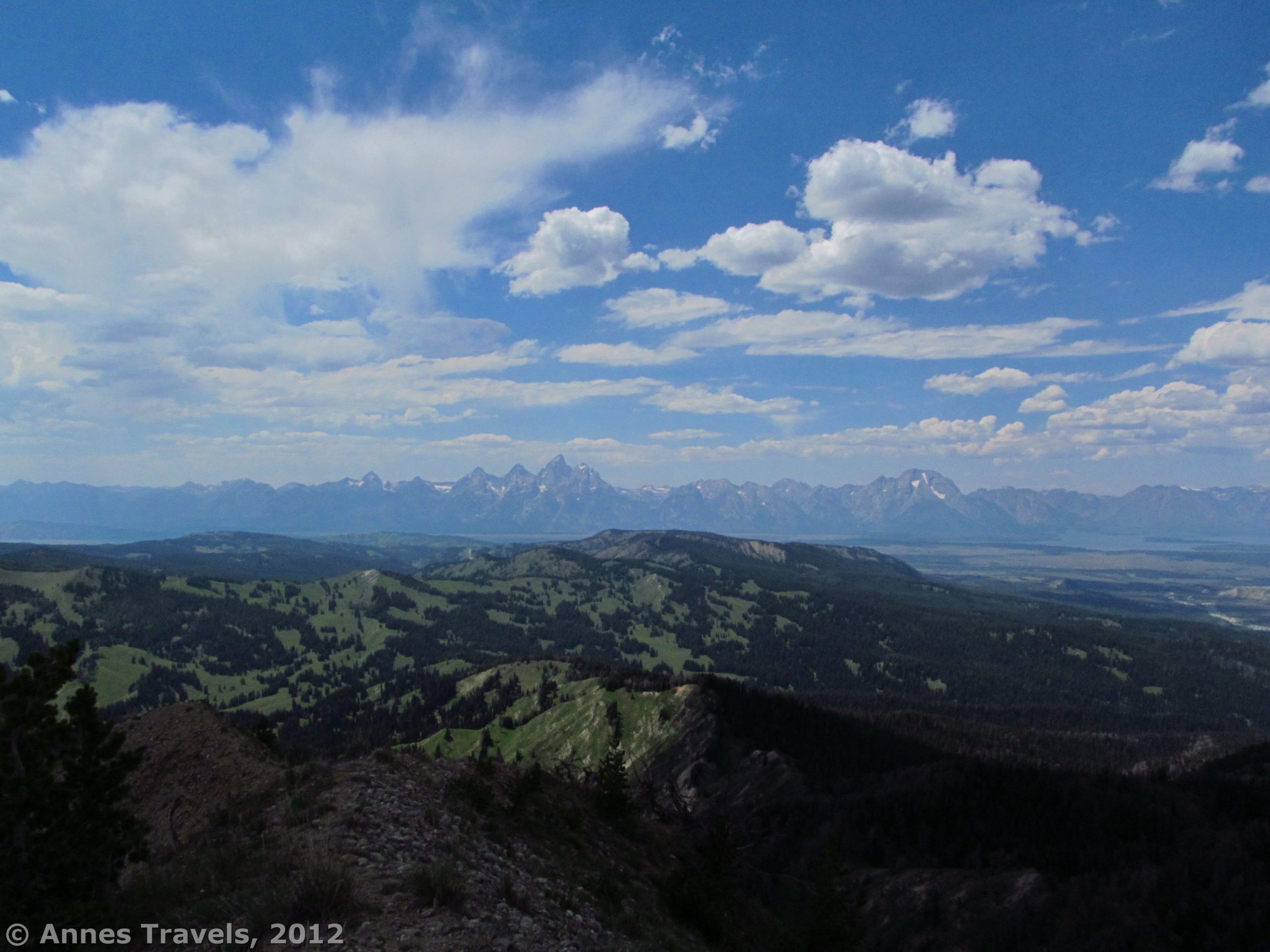

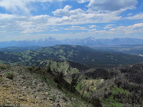
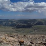
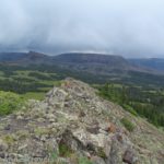
Last summer, while hiking in the Tetons, I needed a short hike with a nice view. Deciding that the description of Mount Leidy fit nicely, we set out on an adventure. The road was both worse and better than expected, the trail shorter and more vague, and the view, nicer. Even so, it wasn’t a hard hike, and I’d likely do it again in the morning. You can see a lot of the surrounding area, including the entire Teton Range, Jackson Lake, Two Ocean Lake/Emma Matilda Lake, the Absaroka Range, the Gros Ventre Range, and even some of the peaks of the greater Yellowstone area. We even got to see some fires in the area – not exactly what we were looking for, but quite exciting! At only 2 miles (3.2 km) RT, it’s worth the hike for those who don’t mind rough dirt roads and who have a little extra time in the Teton area.
(Affiliate links are present on this page.)
Key GPS Coordinates for Mount Leidy:
Leidy Lake: 43.719090 N /-110.376517 W (43N 43’ 8.724” / -110W 22’ 35.4612”)
Saddle: 43.717521 N / -110.398049 W (43N 43’ 3.075” / -110W 23’ 52.9764”)
Mount Leidy: 43.725497 N / -110.406033 W (43N 43’ 31.7886” / -110W 24’ 21.7182”)
Getting to Mount Leidy
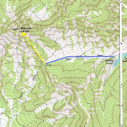
From Moran Junction, drive about 8 miles (12.8 km) east on US 26/US 287. There will be a road on the right side of the road with a sign for Hatchet Campground. You want to turn down this road (Flagstaff Road, aka FR 30160), but not go into the campground itself. If you’re coming from the east (traveling west on US 26/US 287), this road is just west of the Blackrock Ranger Station. Go straight past the campground; quite soon you will see a signboard on your right. We found this signboard fairly useless, but it’s a great way to know you’re on the right road. Follow FR 30160 for 8.5 miles (13.6 km) to a junction with FR 30140. When we drove the road, both forks were labeled with 30100 – you want to go right by the signboard. Drive another 4.3 miles (6.9 km) to a junction with FR 30250, which goes straight (the way you want to go) while 30100 goes left. After 2.8 miles (4.5 km) you should arrive at Leidy Lake. The rest of the road is slightly worse than what you’ve already driven through, but not much. We made it to the top of the pass (1 mile (1.6 km) from the lake) without issue in our high-clearance, 2-wheel-drive van. You could also park near the lake if you don’t think your vehicle can handle the road.
Head up the road to the saddle if you parked near the lake. Once you reach the saddle (or if you parked there), head north (right) up the wooded hillside. You do not want the trail that descends on the left side of the saddle, nor do you want to follow the clearing up the left hillside. Instead, go up the right hillside that has little or no trail. At times it may see like there is a trail, and then you will lose the trail again. Just keep walking upwards; after about ¼ mile (0.4 km), you will find the real trail that will take you to the top of Mount Leidy. Follow this trail as it winds upward along the increasingly narrow hillside. Be forward, this is not a stellar trail. At times, it is no more than a six-inch-wide sandy patch on the edge of a cliff. However, it will take you where you want to go.
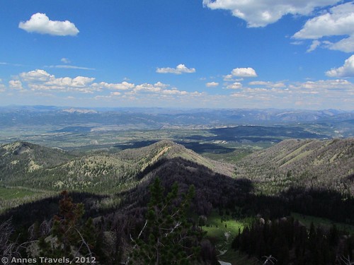
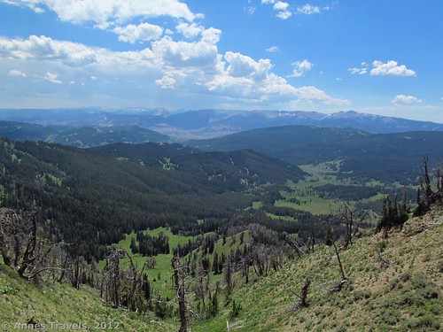
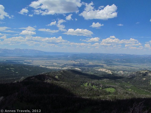
Keep following the trail as it winds upward, taking the trail-of-straight rather than the trail-of-easy. Occasionally it goes through the middle of pine forests or bushes, other times it runs along the cliff-edge. At the bottom of the hill, we were surrounded by wildflowers in early August, up here there were still lupines and a few other dusty wildflowers. Every once in a while, you’ll get a glimpse of what is to come, but keep going: the view here is nothing like what you’ll see at the top!
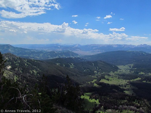
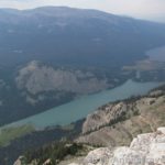
At last the trees melt away and you’ll come out into an area of low-lying bushes with no more trees in sight. Keep going, you’re almost to the top! The last part of the trail is a bit steep, but doable. About 1 mile (1.6 km) from the saddle, you will reach the summit of Mount Leidy. Congratulations! Reward yourself with a look around! And what a view! Ahead of you is the Teton Range, spread out from end to end, and Jackson Lake. To your left is the Gros Ventre Range, to your right, Two Ocean Lake, Emma Matilda Lake, and the Greater Yellowstone Peaks. Behind you is the Absaroka Range; you may even be able to see the Wind River Range from here. I think the view would be best in the morning (I did it in the early afternoon), but it’s nice any time of day.
Return by the way you came. This is a nice little day hike; you could also make a peaceful vacation of it along the road by stopping by the lakes or along the stream. I’ll admit, that water in the stream was very inviting after a hike on a warm August day!
Round Trip Trail Length: About 2 miles (3.2 km)
Facilities: None
Fees: None. (Warning: we free-range camped along a spur road, and the bugs were terrible. It gave us a great way to test out our bug screens).
Trail 
![]()
![]()
![]()
Road ![]()
![]()
![]()
Signs ![]()
![]()
![]()
![]()
Scenery ![]()
Would I go 100 miles out of my way for this? ![]()
![]()
Overall Rating: 
![]()
![]()
This Week’s Featured Product!
Hiking poles can be very helpful when walking through variable terrain, especially on trails that take the “trail most straight” or are vague at best. These poles are rated highly for their comfort, light weight, and adjustable size for all heights of hikers.


4 responses to “Deserted View of the Tetons on Mount Leidy”
fantastic post, very informative. I wonder why the other specialists of this sector don’t notice this. You should continue your writing. I am sure, you have a great readers’ base already!
Thanks for the wonderful article, I was searching for details like this, going to check out the other posts.
[…] Tetons from Mt. Leidy, […]
[…] Mount Leidy (about 2 miles RT). Really in the mood for views of the entire Teton Range? Mount Leidy is a rough road to get to, then a scramble through the forest, but the views are absolutely epic. […]