
We like to have a destination in mind when we’re hiking. It’s for sanity, mostly. We all know that if we can just “walk until we decide to turn around” we’ll never turn around until we’re way further from the trailhead than we should be. And that isn’t a good way to make your hiking companions happy. So when we started talking about hiking across the Flat Tops in Colorado, I decided to find some mountain peaks that might be worth being “destinations” so our hikes didn’t end up being crazy long. One peak that caught my attention was Pyramid Peak in the northeastern section of the Flat Tops Wilderness Area near Sheriff Reservoir. Although it was cloudy nearly all day, the hike turned out to be a nice one, filled with the adventure of off-trail travel and less-than-helpful directions. Still, it’s only about 9 miles RT, so for those looking for a bit of an adventure in the Flat Tops, as well as some nice not-quite-grassy Flat Top views, I’d highly recommend the hike!
Quick Stats
(Affiliate links are present on this page.)
We pulled into Flat Tops very early one morning in August. (Just in case you’re curious, August is one of the worst months for hiking in Colorado – every afternoon (and far too many mornings) there is a thunderstorm, often accompanied by hail, lightening, rain, snow, etc. – but more on that later). We knew we could use more information than I’d been able to download off the internet, so we waited around the Yampa Ranger Station until it opened, then went inside to see what we could find out. The people behind the desk tried to be helpful, but even more helpful was the rack full of information sheets on the left side of the room (as you walk in the door). These sheets cover many of the trails in the Flat Tops, often with maps and other helpful info. Finally, a member of the trail crew overheard us talking about what we wanted to do and went into Google Earth to show us where Pyramid Peak was and how to get to it. Cool!
Stocked with information (and ice from the nearby store – a real walk back into history), we headed up toward Sheriff Reservoir. The drive wasn’t bad most of the way; even a low-clearance car could have made it down the graded gravel road. By the time we arrived, the early morning sunshine had been replaced by grey clouds. Bother, but it was better weather than was forecasted elsewhere, where it was supposed to rain all day. We hit the trail, hoping the clouds would lift by the time we got someplace where it would matter.
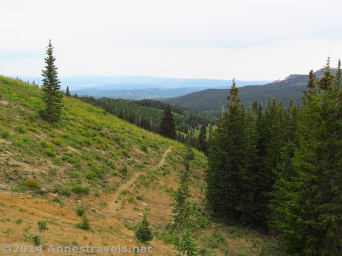
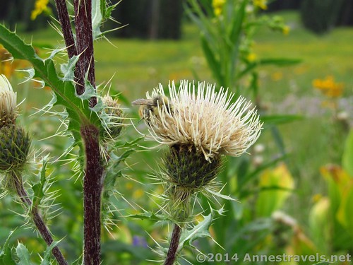
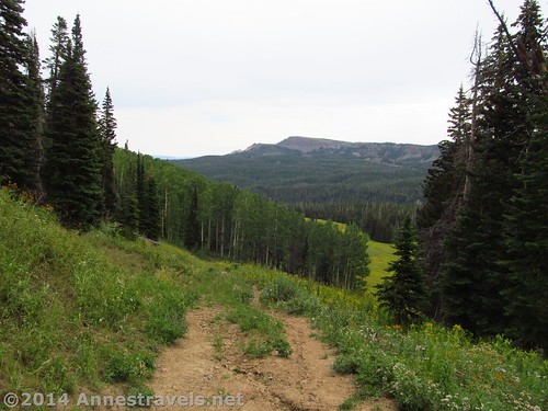
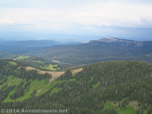
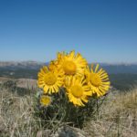
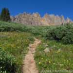
The hike begins along an old logging road, though it just looks like a narrow path through a dense meadow. At some times of year, the meadow is bursting with wildflowers; there were still enough in early August for some nice photos (if the sun had been out). From the beginning, the trail climbs, not too steeply but relentlessly. At 0.8 miles, the trail enters the Flat Tops Wilderness Area. For the next mile or so, the trail alternately passes through meadows and small stands of trees. Occasionally, looking back, there are nice views.
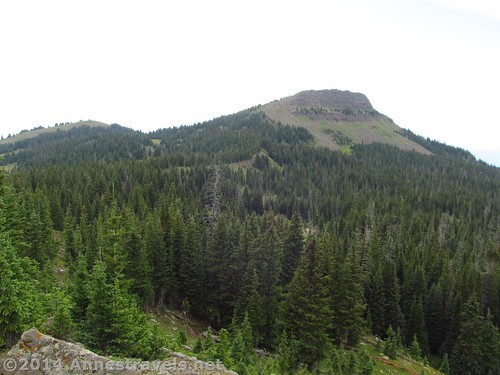
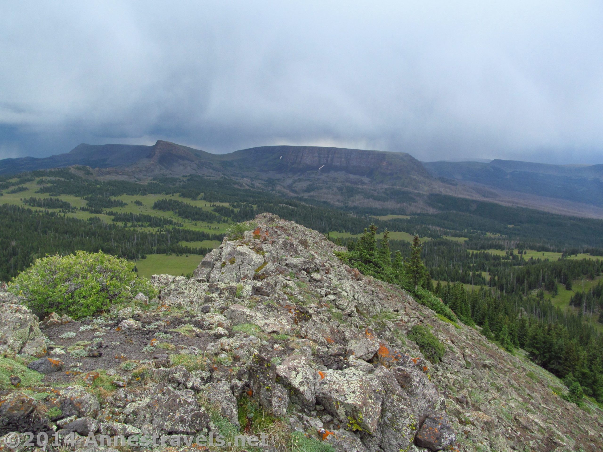
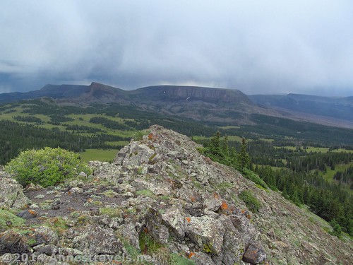
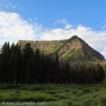
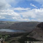
At 1.6 miles, the trail comes close (but not quite to) a cliff edge, and you can look out across the view. A social trail goes up to a rocky place where we stopped for lunch, but it’s also a very good place to stop and take a look at the surroundings. The ridge you just climbed onto goes up, turns right in a kind of saddle or pass, and then (continuing right) goes up into a mountain. This is Pyramid Peak, your destination. Take a good long look, and perhaps some pictures, to plan your general route up the ridge and the up the mountain, as there won’t be a trail to follow once you hit the saddle.
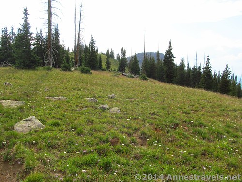
Continue climbing on the trail, which for the most part is in the trees, for another 1.4 miles to the place where the trail suddenly flattens out as it passes along and between a series of posts stuck into rock cairns. If you continued after this, the trail would begin to descend. However, you don’t want to follow the trail in this way. Instead, turn right off the trail to stay on the ridge and head toward Pyramid Peak. From here on out, there is no trail; simply stay close to the “cliff” edge and work your way along the ridge. At first, the terrain is grassy/rocky but not too hard a hike. The higher you go, however, the more bushwacking is required. Finally, you will break out of the trees into a very small meadow with scrubby trees. Directly ahead of you should be Pyramid Peak.
***Author’s Note*** This was the way I descended from Pyramid Peak, and it is far better than the way I ascended (which I don’t recommend at all unless you have a GPS to assist you in not getting lost). I continued through the pass and ended up “following” the Old Baldy Trail for a bit before turning off the trail and up through meadows and forest to Pyramid Peak.
But back to Pyramid Peak:
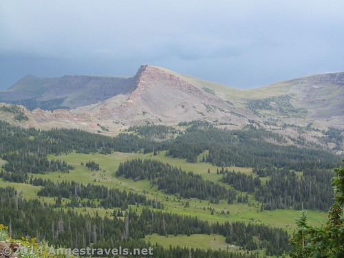
Here, near the scrubby trees, we encountered a major setback: it began to thunder. Then it began to rain. Then ice pellets began cascading out of the sky. When the thunder began, we put our lightning-safety skills to good use. But when the thunder diminished, and we realized we were all getting wet, we backed up into the scrubby pine trees for a bit of shelter. It was fascinating, standing on the lee side of a fir tree and watching the storm sweep across the valley, leaving every cliff in its path ridged with white snow and ice. I think we spend the better part of 45 minutes trying not to get wet, but at last the storm blew past, and we all came out of our respective trees for the final push up Pyramid Peak.
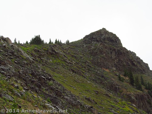
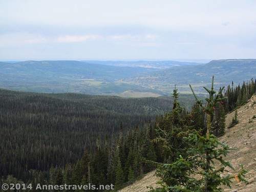
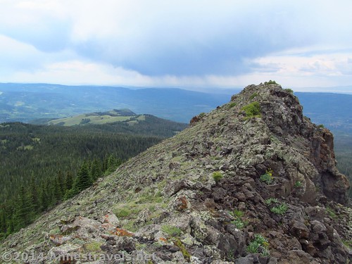
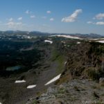
The last part of the trail is just a simple scramble up a rocky area to the more stable fin that is the summit. Actually, there are several summits, so choose the one you think is the highest to claim as the peak. The views from here are very nice, or would have been had the sun been out. Still, even cloudy views can be sweeping, and the snow on the nearby cliffs really was special!
Return by the way you came. This is not a trail for those who like the comforts of a trail, but for adventure seekers, it is an adventure with a nice reward at the end!
Round Trip Trail Length: About 9 miles, depending on your exact route
Starting Elevation: 9,547 ft.
Ending Elevation: 11,548 ft.
Net Elevation Gain: 1,964 ft.
Facilities: None – though there is a campground near Sheriff Reservoir which might have a primitive restroom.
Fees: None
Trail 
![]()
![]()
![]()
Road ![]()
![]()
Signs ![]()
![]()
![]()
![]()
Scenery
Would I go 100 miles out of my way for this? ![]()
Overall Rating: ![]()
![]()
Key GPS Coordinates
Pyramid Peak Parking Area: 40.14982N / -107.13885W (40° 8′ 59.3514″ / -107° 8′ 19.86″) (9,547ft.)
Pyramid Peak Trail Beginning: 40.14857N / -107.13913W (40° 8′ 54.8514″ / -107° 8′ 20.8674″) (9,790ft.)
Flat Tops Wilderness Boundary: 40.14029N / -107.13803W (40° 8′ 25.044″ / -107° 8′ 16.908″) (10,170ft.) (0.8 miles)
Nice view/Lunch: 40.13352N / -107.15678W (40° 8′ 0.6714″ / -107° 9′ 24.4074″) (10,621ft.) (1.6 miles)
The Pass: 40.11781N / -107.15190W (40° 7′ 4.1154″ / -107° 9′ 6.8394″) (11,123ft.) (6.05 miles)
Pyramid Peak: 40.12299N / -107.16904W (40° 7′ 22.764″ / -107° 10′ 8.5434″) (11,548ft.) (4.7 miles)
I regret to say that I don’t have a GPS track for the Pyramid Peak Trail. My GPS ate the track before I could get it onto the computer 🙁
Getting to Pyramid Peak Parking Area
From Yampa, CO, turn off of CO-131 onto County Road 17. Drive 5.5 miles, staying on County Road 17 and then County Road 19 when the road changes names when it intersects County Road 13. Turn left again on to County Road 132; drive for 8.7 miles (County Road 132 will change names to County Road 8). Take another left onto Forest Road 959. Follow the gravel road for 2.5 miles to a parking area just before reaching Sheriff Reservoir. The parking area is unmarked; however, it is the last parking area before the Forest Service campground at the end of the road. I’ll admit that we went all the way to the campground and then came back to be sure we were in the right place!
Alternatively, from the Meeker, CO Airport, drive 0.5 miles northeast on Hwy 789/Hwy 13. Turn right on County Road 8 / State Hwy 132 and drive 66.8 miles. Take a right onto Forest Road 959; follow the gravel road for 2.5 miles to a parking area just before reaching Sheriff Reservoir. The parking area is unmarked; however, it is the last parking area before the Forest Service campground at the end of the road.
Zoom map out to browse nearby hikes & places of interest
This Week’s Featured Product!
A fly fishing book dedicated to the Flat Tops Wilderness Area! The book includes access information, parking, seasons, hatches, recommended equipment, and even fly patterns.

2 responses to “Off-Trail Hiking to a Flat Tops Mountain: Pyramid Peak”
[…] to do one short thing before moving on to another location. Both were the case after hiking the Pyramid Peak Trail in the Flat Tops Wilderness Area. I’d read that the Sand Creek Trail, which left from the same […]
[…] have a few options: #1) Hike anyway (like the Owl Point or McNeil Point Trails on Mt. Hood, or Pyramid Peak in the Flat Tops of Colorado), #2) Wait it out (I never did post about hiking the Trail of the […]