

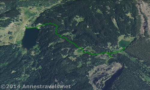
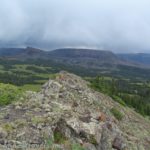
Although I like long hikes, sometimes we just need a shorter walk. My group does get tired (or just isn’t in the mood for yet another 12 mile (20 km) trek), or we want to do one short thing before moving on to another location. Both were the case after hiking the Pyramid Peak Trail in the Flat Tops Wilderness Area. I’d read that the Sand Creek Trail, which left from the same parking area, had some nice lakes within 2 miles (3.2 km) of the trailhead, so it seemed like an ace-in-the-hole before heading over to the Trappers Lake Area in the afternoon. (After all, Colorado mornings are often nicer than Colorado afternoons – at least in August – so we figured it would be best to use the morning sunshine to the full!) The trail itself is a very nice short dayhike, and the lakes are beautiful and varied in their settings. The only major obstacles are two stream crossings, but even these aren’t that difficult!
Quick Stats
(Affiliate links are present on this page.)
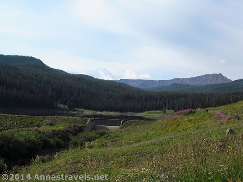
The Sand Creek Trail begins by crossing the dam at the end of Sheriff’s Reservoir. This offers some very nice views of the reservoir and the Flat Tops cliffs beyond. At the far end of the dam, the trail heads into the woods. There is an alternate trail that leads down to where Sand Creek enters Sheriff’s Reservoir; I explored this on the way back and all I can say is that it’s not terribly interesting unless you like dams, have children who enjoy throwing rocks into water, or are a fisherman. The waterfall into the lake isn’t even all that pretty. But, it’s still an option if you want to check out the reservoir.
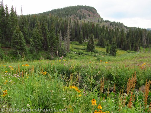
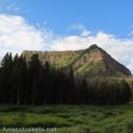
The trail from this point on climbs uphill. There are a couple short downhills, but in general the trail climbs incessantly if at times not too steep. The trail also stays in the forest most of the time. It does pass through a couple meadows, but for the most part it climbs through a pine forest. This didn’t bother me as much as it might have; I suppose I was expecting forest and a few lakes, so I wasn’t looking for stunning, far-ranging views.
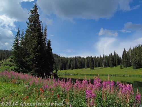
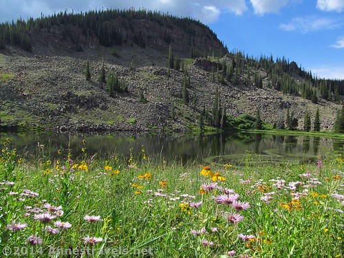
After crossing the stream once on a log “bridge”, the trail continues steeply upward to the first lake set of lakes (Spring Lake and Camel Lake) at 1.3 miles (2.1 km). Spring Lake is set in a very nice meadow setting; in August, wildflowers studded the lake. Beautiful! Camel Lake is on a side trail to the left of Spring Lake, or continue on the Sand Creek Trail around the south end of Camel Lake. Camel Lake is larger than Spring Lake; both would probably have nice fishing opportunities.
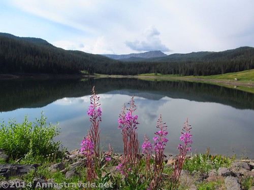
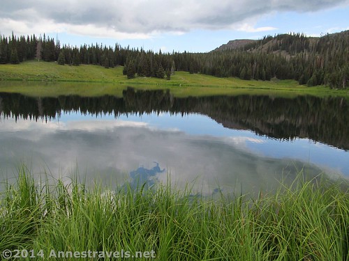
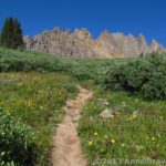
Continuing on the Sand Creek Trail, the path wonders through meadows and forests on a far less steep trail than before. Only 0.2 miles (0.3 km) beyond Camel Lake, the trail splits at a signed junction. For now, turn right toward Crater Lake. This was the nicest lake in my opinion, set below a large cliff with rocks all around. I would think this would be beautiful near sunrise or sunset, but even the early morning stillness the pond was quiet and peaceful. Again, there were some nice wildflowers, although most were past their prime.
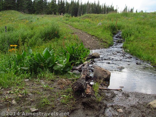
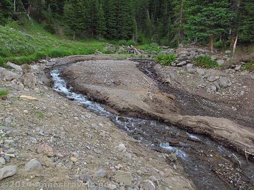
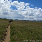
Return to the main trail and continue upward, following the sign for Sand Lake, 0.3 miles (0.5 km) further up the trail. However, before you reach this lake you must cross the stream again at 1.9 miles (3 km). This stream crossing is slightly easier because Sand Creek here is shallower, so you can rock-hop as well as crossing on logs or branches. Not long after the crossing, the trail splits; turn left to go to Sand Lake. The right fork continues for several miles further up through forest and meadows toward the Flat Tops proper. We didn’t have the interest (or time) to go that far, so we just went up to Sand Lake.
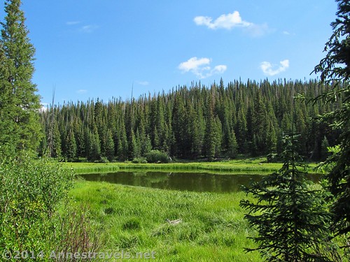
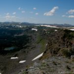
The trail to Sand Lake hugs the edge of the hillside for about 0.l miles (0.1 km) before suddenly switchbacking upward over an earthen dam to Sand Lake itself. The stream that runs out of the lake may cross the trail; just do your best to follow a social trail that goes around the stream. Several of us tried to cross the outlet on our way back down, and let’s just say some of the several walked back to the trailhead with damp feet! Sand Lake is probably the largest of the lakes; I would think there would be some pretty good fishing here. We mostly hung out on top of the dam and enjoyed the increasingly cloudy view. The meadow is a pristine setting, with one Flat Tops cliff visible beyond the grass and trees. Beautiful!
Return by the way you came, or enjoy a longer hike up beyond the lakes on the Sand Creek Trail. Either way, the trail is a quiet and peaceful place for a short dayhike…or to enjoy a little fishing!
Round Trip Trail Length: 4 miles (6.5 km)
Net Elevation Gain / Loss: 628 ft. (191 m)
Facilities: None. There may be a primitive restroom in the campground.
Fees: None
Trail 
![]()
![]()
Road ![]()
![]()
Signs ![]()
![]()
Scenery ![]()
![]()
Would I go 100 miles out of my way for this? ![]()
![]()
![]()
Overall Rating: ![]()
![]()
Key GPS Coordinates for the Sand Creek Trail:
Sand Creek Trail Parking Area: 40.14982N / -107.13885W (40° 8′ 59.3514″ / -107° 8′ 19.86″) (9,547ft.; 2,909m)
Sand Creek Trail Beginning: 40.14931N / -107.13865W (40° 8′ 57.5154″ / -107° 8′ 19.1394″) (9,780ft.; 2,981m)
Overlook (Sand Creek Outlet): 40.14843N / -107.13536W (40° 8′ 54.3474″ / -107° 8′ 7.296″) (9,756ft.; 2,973m)
First stream crossing: 40.14822N / -107.13111W (40° 8′ 53.592″ / -107° 7′ 51.996″) (9,841ft.; 2,999m)
Lake #1 (Spring Lake): 40.14277N / -107.12579W (40° 8′ 33.9714″ / -107° 7′ 32.8434″) (10,077ft.; 3,071m)
Lake #2 (Camel Lake) Trail Junction: 40.14224N / -107.12538W (40° 8′ 32.064″ / -107° 7′ 31.368″) (10,084ft.; 3,073m)
Lake #2 (Camel Lake, south end): 40.14150N / -107.12392W (40° 8′ 29.4″ / -107° 7′ 26.1114″) (10,082ft.; 10,072m)
Sand Lake/Crater Lake Junction: 40.14142N / -107.12190W (40° 8′ 29.1114″ / -107° 7′ 18.8394″) (10,160ft.; 3,096m)
Crater Lake: 40.14088N / -107.12074W (40° 8′ 27.168″ / -107° 7′ 14.6634″) (10,160ft.; 3,096m)
Stream crossing #2: 40.141832N / -107.11860W (40° 8′ 30.5952″ / -107° 7′ 6.96″) (10,158ft.; 3,096m)
Sand Lake Trail Junction: 40.14198N / -107.11827W (40° 8′ 31.1274″ / -107° 7′ 5.7714″) (10,170ft.; 3,099m)
Sand Lake: 40.14232N / -107.11801W (40° 8′ 32.3514″ / -107° 7′ 4.8354″) (10,175ft.; 3,101m)
The gpx file for the Sand Creek Trail can be downloaded – please note that this and the GPS Coordinates are for reference only and should not be used as a sole resource when hiking this trail.
Download File size: 89.1 KB Downloaded 655 times
(Note: I do my best to ensure that all downloads, the webpage, etc. are virus-free and accurate; however, I cannot be held responsible for any damage that might result, including but not limited to loss of data, damages to hardware, harm to users, from use of files, information, etc. from this website. Thanks!)
Getting to the Sand Creek Trail Parking Area
From Yampa, CO, turn off of CO-131 onto County Road 17. Drive 5.5 miles (8.8 km), staying on County Road 17 and then County Road 19 when the road changes names when it intersects County Road 13. Turn left again on to County Road 132; drive for 8.7 miles (14 km) (County Road 132 will change names to County Road 8). Take another left onto Forest Road 959. Follow the gravel road for 2.5 miles (4 km) to a parking area just before reaching Sheriff Reservoir. The parking area is unmarked; however, it is the last parking area before the Forest Service campground at the end of the road. I’ll admit that we went all the way to the campground and then came back to be sure we were in the right place!
Alternatively, from the Meeker, CO Airport, drive 0.5 miles (0.8 km) northeast on Hwy 789/Hwy 13. Turn right on County Road 8 / State Hwy 132 and drive 66.8 miles (107.5 km). Take a right onto Forest Road 959; follow the gravel road for 2.5 miles (4 km) to a parking area just before reaching Sheriff Reservoir. The parking area is unmarked; however, it is the last parking area before the Forest Service campground at the end of the road.
Zoom map out to browse nearby hikes & places of interest
This Week’s Featured Product!
A fly fishing book dedicated to the Flat Tops Wilderness Area! The book includes access information, parking, seasons, hatches, recommended equipment, and even fly patterns.
3 responses to “Pretty Little Lakes in the Flat Tops on the Sand Creek Trail”
Thanks for the blog. After hiking this yesterday I thought I made to sand lake when in fact I just figured out I only made it to the spring lake 🙂
Yeah, so hard to know with no signs! And the USFS handouts, while a whole lot better than nothing, aren’t very specific. I almost called Spring Lake “Lake 1″…
Anne
[…] around Spring Lake in the Flat Tops Wilderness of […]