

This is a story of sunsets, traffic jams, map programs, wild fires, and adventurism. Don’t worry; everyone’s fine in the end 🙂
The day began pretty normally. We woke up in a Walmart parking lot somewhere in Wyoming (or was it Nebraska?), packed up the sleeping bags, and ate breakfast on the road (homemade cinnamon rolls and coffeecake – yum!) The morning continued normally for a driving day, save for a couple traffic jams and construction on the other side of the highway that kept that side totally clear for many miles before we again saw streams of traffic! Even the scenery wasn’t exciting – let’s just say that, after I-40 across northern Texas and eastern New Mexico, I-80 through Wyoming has to be one of the least interesting sections of the US interstate system. For mile after mile there was nothing but fields – and fields – and more fields…so we all stuck our noses in books and electronic devices to pass the time.
(Affiliate links are present on this page.)
However, in the afternoon, we began noticing clouds ahead of us. At first, we weren’t sure what it was – smoke, maybe, or dust? The closer we got, though, the more we were pretty sure it was smoke. Then, just ahead of us we saw a line of police cars stretched across the road. As we slowed and came closer, we realized that the policemen were directing the traffic off of the highway. I-80 – and with it, our way of going anywhere – was closed!
It wasn’t like we could just drive south (away from the fire) on a frontage road; there weren’t even any paved roads at this exit. Just a dirt road heading off, north and south.
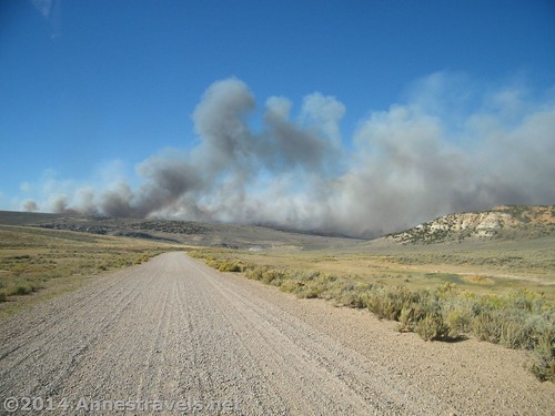
Being the adventurous type (I guess), we decided to take a chance. We’d drive south, away from the fire, then see if we could find some dirt roads that would take us around the fire area.

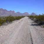
The choice wasn’t as crazy as it might have been. As soon as we were off the highway, I pulled out my laptop and began frantically searching for our location on Microsoft Streets and Trips, which works offline (this was in the years before we had a GPS). As we drove along, bouncing and jouncing on the rutted, washboarded road, I told the driver, “I think we can get to the next big town on I-80. Just turn on this dirt road…” And so we did. Down one road and up another, always generally heading west, hoping for goodness sakes’ the roads marked on the map actually existed and that none were closed – and even more, that the fire wasn’t on the south side of I-80.
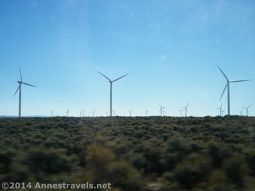
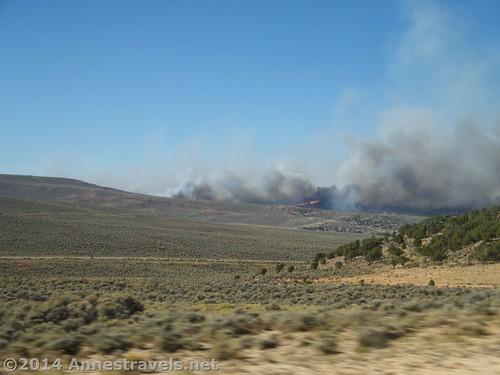
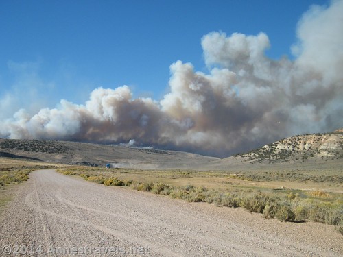
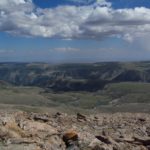
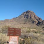
We passed wind farms, ranches, and more rugged canyons than I could count. Finally, on one of the better roads, one of us in the back seat asked the driver to stop. We were totally in the middle of nowhere, and all we could see ahead was wilderness and billows of smoke (still well far enough away to be safe). We all hopped out and began snapping pictures.
Suddenly, from the road ahead came another vehicle – a full-sized tractor trailer!
We couldn’t believe our eyes (after all, this wasn’t the world’s greatest dirt road), but it was a reassuring sign. That truck had to come from someplace real, and it was logical that it had come from I-80 on the other side of the fire. There was hope that there was a clear road between here and there!
Not far behind the tractor trailer came an SUV. The driver asked if she could get to such-and-such place, and of course we couldn’t tell her since we didn’t know the area. However, we did tell her were we came from, which made her happy. She’d been sent home from work (a convenience store) because of the fire, so she was hoping she could get home (which thankfully was on the south side of the highway). She drove on; we took some last-minute photos, and drove on, ourselves.
Within another 30 minutes, we came to a paved road – hurray! Than we came to the big town I’d seen on the map – double hurray! And I-80W, which ran through the town, was open for business – triple and quadruple hurray!!!
As if we hadn’t had enough adventure that day, the next question became: can we get to the Great Salt Lake before it gets dark? Our original plan had been to stop for a couple hours in the afternoon, then continue driving toward our first big travel destination of the trip (Great Basin National Park). We thought maybe we could make it before sunset, though we wouldn’t have too much time to enjoy it even if we did make it on time. (Thankfully, we’d visited a nice little state park on the lake several years earlier, so we knew where we were going and what to expect there.)
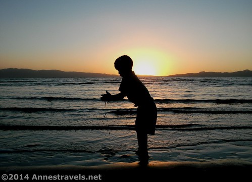
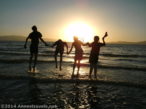
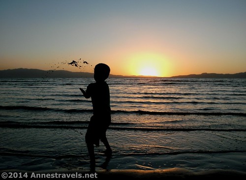
We pulled in at the state park very late in the afternoon. We all quickly collected our gear (cameras!) walked across the salt flats to the lake itself. The late afternoon sun shone low over the sparkling water, turning everything gold and red. We waded out to our knees (which is a long way in the Great Salt Lake), sticking our fingers into the water and then admiring the salt that was left on our hands when the water dried. Then, as the sun sank lower, the real treat came: silhouette pictures. I love taking silhouette shots, and I think some of the nicest I’ve ever taken were this day.
A few of my favorite shots…
As the darkness settled over the land, and the lights on the salt factory began shining across the dark water, we all took one last look and headed back to the faucets to wash off our feet and legs before climbing back into the van – we had a few more miles we wanted to cover before it was time to sleep! (When we’re driving across the country we drive a loooonnnngggg time!)
But our adventures for the day still weren’t over yet. As we drove south (now on I-15), we were a bit surprised – and sobered – to see wildfires on the hills across the valley from the highway. In the darkness, we could see the orange fire. Someone on that side of the van tried to get some pictures, but they didn’t turn out very well (moving van + through a tinted van window + darkness / bright fire = blurry pictures). We could also see what areas had been evacuated because of the fires. There would be a line of emergency vehicles across the road that ran through the bottom of the valley and then darkness – total darkness except for the fires – for miles on end. We made a mental note that we’d have to contact our relatives back home the next morning to let them know we were fine – after all, fires along I-15 and the closing of I-80 were sure to make national news, right?

You can find my account at the Great Salt Lake here.
Our trip to Great Basin National Park can be found here.
This Week’s Featured Product!
Driving through Wyoming? You just might enjoy this little book with factoids about many of the miles traveled. It’s organized by road so it’s easy to find your mile marker on the route you take…or to plan a new and exciting route!
One response to “The Day I-80 Closed – And We Were On It”
[…] planned, or the view wasn’t what we expected, or the weather had a mind of its own. Sometimes the road is closed, or the hike turned out to be 5 miles longer than the Falcon Guide said. But what to do when […]