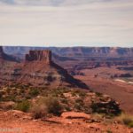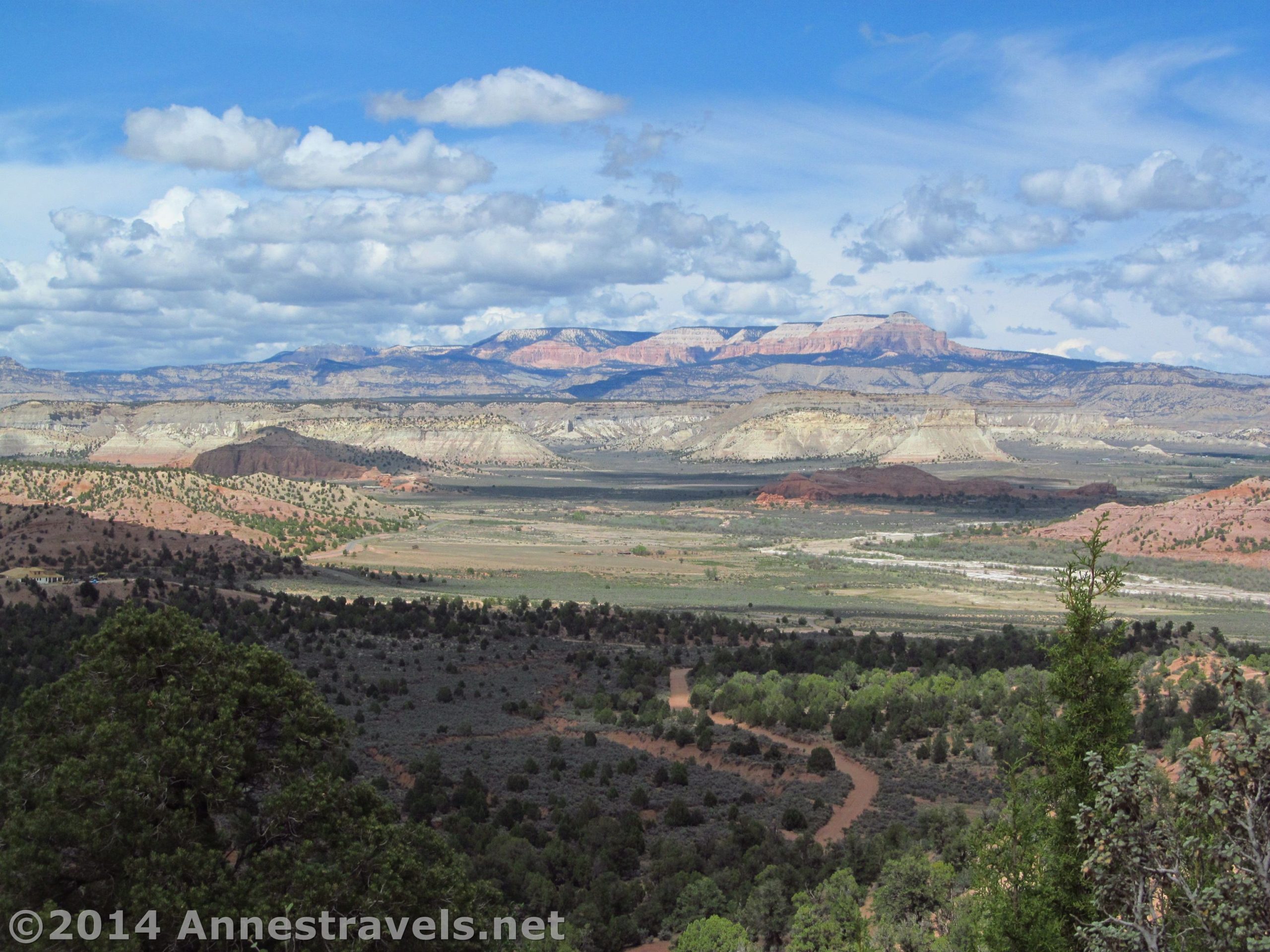

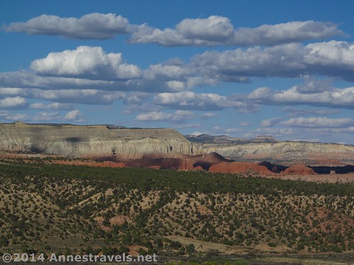
What’s better: A free campsite, or a paid campsite with a view? Or, are you like me, and would say, “Why not both?” However, free campsites with views are difficult to find, so when you find a good one, you come back to it again…and hope it’s still free. Last spring, when we were in the Bryce / Grand Staircase-Escalante area, we returned to a campsite with a view: one on the Skutumpah Road just outside of Cannonville, UT. Late in the day, the view was fabulous: red and white buttes rising across the valley, colorful rocks, and cliffs that seem to let off into the “end of the world” into a blue sky. Since we’d arrived a bit early, we had a wonderful time exploring the area before supper.
Quick Stats
(Affiliate links are present on this page.)
***Note*** Visitors are allowed to “free range” camp in Grand Staircase-Escalante National Monument, provided they camp in an already disturbed area, keep their vehicles on established roads, remove their own litter and provide their own waste disposal, use a camp stove or bring their own firewood to burn in a metal container, and generally leave an all-around clean camp when they leave. This particular site is an undeveloped area where people have camped before. Please keep the area clean and obey all rules and regulations to allow yourself and everyone else to continue free range camping. There are no picnic tables or other facilities in this camp spot (though you might find a stone fire ring or two).
We pulled into Camp Cannonville (our unofficial name) late in the afternoon. We’d hoped to spend a little time at Bryce, but the weather wasn’t good so we figured we’d find a place to camp well before dark. Everyone climbed out, the little ones grabbed the bag of trucks to play in the sand, and the rest of us set out to see if we really had the best spot, or if there was a better one down the social road that continued beyond the site. There turned out to be several other sites, but ours (the first one on the right) was the one with the best view, and one of the few that had a view worth talking about. Others of the sites were nicely shaded with pinion pines and / or junipers.
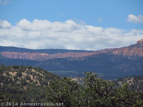
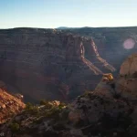
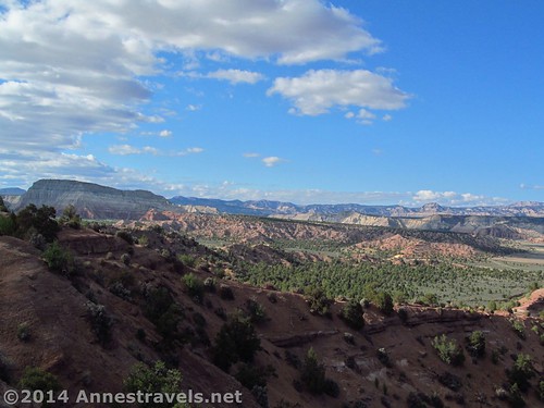
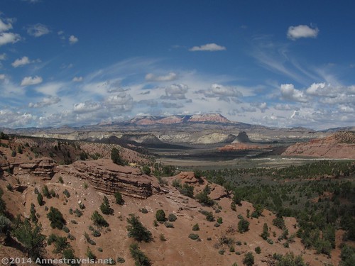
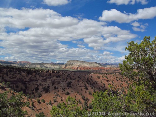
We walked down the road until it ended – at a fence with “no trespassing” signs on it. So much for finding a view that way! We retraced our steps, then set off across the Skutumpah Road to see if we could find another view. (BTW, there were several nice views along the road; at one point, we could even see some of the spires in Bryce Canyon.) There were several social trails heading off in that direction, so we figured we weren’t the first to come this way. The views were also quite rewarding – maybe not better than the campsite, but certainly a bit more expansive and more wild-looking. Along the valley, the puffy white clouds were building up, offering a very nice background to the layers of buttes across the valley and the rock formations. Turning with our backs to Camp Cannonville, there were cliffs rising in a gentle slope ahead of us. They dropped suddenly away, but since we couldn’t see where they ended, it definitely looked a bit like “the end of the world”!
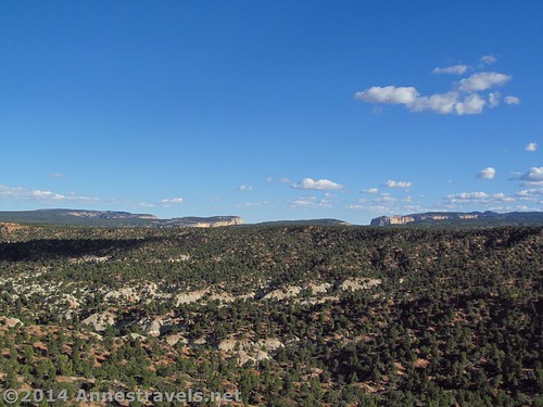
You could continue walking a long way along the cow paths and social trails if you had a good gps to get you back to the camping area, but went less than 0.5 miles, in part due to the sandy nature of the terrain and lack of real, easy-to-follow trails, and in part because we weren’t looking for a long hike – just something to do with a nice view attached to it.
We returned to the camp spot where the rest of the group was just beginning to think about supper, then watched the sun set on the buttes across the valley. It was so beautiful – I know we’ll be back to Camp Cannonville next time we’re in the area.
Facilities: None
Fees: None
Regulations: Please view the regulations via the links at http://www.blm.gov/ut/st/en/fo/grand_staircase-escalante/Recreation/camping.html
Trail 
![]()
![]()
![]()
![]()
Road ![]()
![]()
Signs ![]()
![]()
![]()
Scenery
Would I go 100 miles out of my way for this? ![]()
![]()
Overall Rating: ![]()
![]()
Key GPS Coordinates for Camp Cannonville:
Campsite: 37.51887N / -112.06003W (37° 31′ 7.9314″ / -112° 3′ 36.1074″) (5,927ft.; 1,806m)
View from the campsite road: 37.52058N / -112.06234W (37° 31′ 14.088″ / 112° 3′ 44.424″) (6,040ft.; 1,841m)
Far end of the campsite road: 37.52191N / -112.06364W (37° 31′ 18.8754″ / -112° 3′ 49.104″) (6,057ft.; 1,846m)
View 1 from across the Skutumpah Road: 37.51812N / -112.05940W (37° 31′ 5.232″ / -112° 3′ 33.8394″) (6,050ft.; 1,844m)
View 2 from across the Skutumpah Road: 37.51724N / -112.05879W (37° 31′ 2.064″ / -112° 3′ 31.644″) (6,053ft.; 1,845m)
The gpx files for our two little trecks – they can both be downloaded. Please note that this and the GPS Coordinates are for reference only and should not be used as a sole resource when hiking this trail. The first file goes through the camping area to the fence; the other goes from the Skutumpah Road on the social trails.
Download File size: 17.8 KB Downloaded 478 times
Download File size: 7.0 KB Downloaded 457 times
(Note: I do my best to ensure that all downloads, the webpage, etc. are virus-free and accurate; however, I cannot be held responsible for any damage that might result, including but not limited to loss of data, damages to hardware, harm to users, from use of files, information, etc. from this website. Thanks!)
Getting to Camp Cannonville:
In Cannonville, UT, turn off of Highway 12 onto Mains Street, following the signs for Kodachrome Basin State Park. A hotel is on the corner of this road and Highway 12. Drive 2.8 miles, then turn right onto the Skutumpah Road. After 1.1 miles, as you’re driving up a hill, the hillside on the right should give way to a sandy access to the top of the hill where Camp Cannonville sits. The Skutumpah Road is passible to this point by low-clearance vehicles; high-clearance may be required to access the camping area and 4×4 may be required in wet weather.
Zoom map out to browse nearby hikes & places of interest
This Week’s Featured Product!
If off-road or less-traveled roads are your thing, this book covers almost 50 such roads or treks in the Grand Staircase-Escalante area. Mines, ghost towns, and old railroads showcase the area’s history, while classic Utah views abound on the routes.