

So I’m trying something new in hopes of streamlining some processes here on the blog. Some of the posts (at least for the time being) will have this new way of showing the mileages, etc. They’ll also probably have fewer pictures. Hopefully, I can add more narrative and pictures in the future, but for now, at least you have the bare bones of how to enjoy some great scenery!
Quick Stats
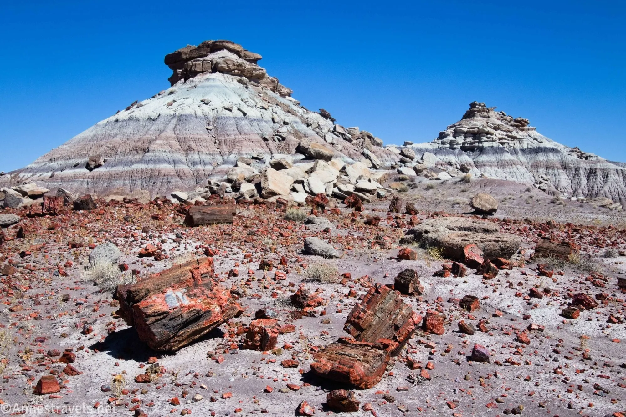
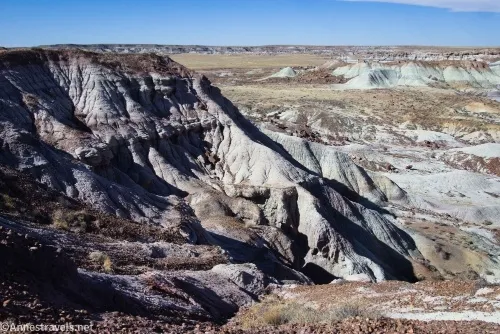
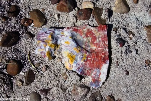
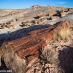
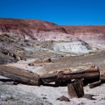
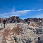
Today, we’ll talk about First Forest Point, an off-trail adventure (a little tricky, too) out to an overlook on a grassy mesa top in Petrified Forest National Park. Along the way, you’ll get some great badlands views as well as a boatload of petrified wood – it’s everywhere! This is one of the best off-trail Petrified Forest hiking trails in my opinion (though I have some others that are almost as good!)
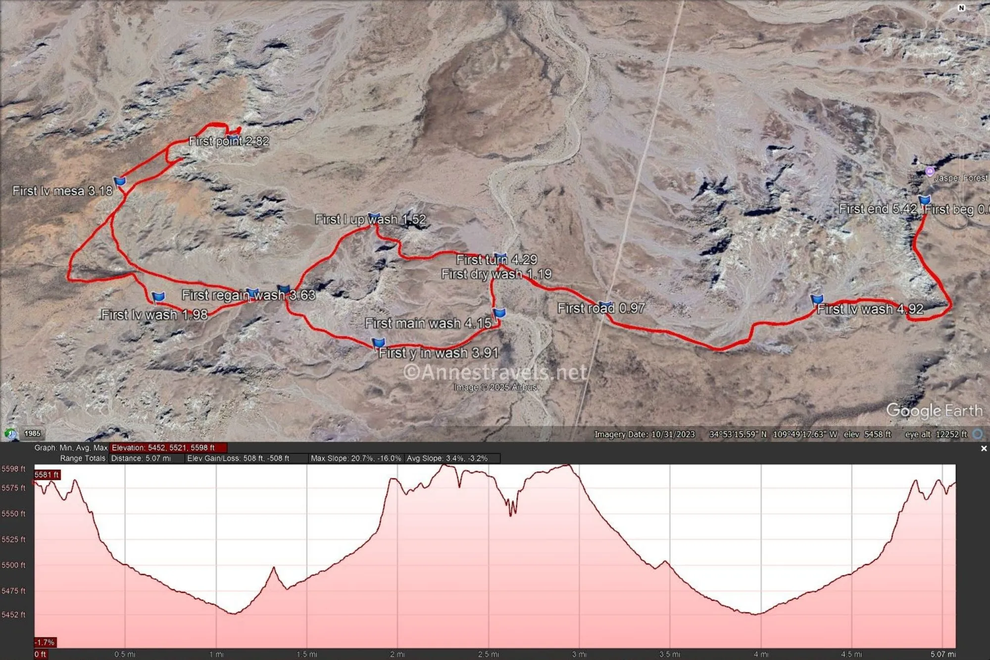
I highly recommend stopping at the visitor center or the Rainbow Forest Museum on your way in; ask for the printout for First Forest Point. They’ll hand you a full-color, 8.5×11 (A4) printout with directions and pictures about how to get to the point. Unfortunately, this is the worst of the printouts I used while exploring the park; it does great down to the “larger wash” and then was so confusing we had to pretty much made it up (and we definitely spent more time than necessary wandering in the desert looking for where we were supposed to be). Thankfully, with the provided coordinates, we did make it out to the point – I hope my directions here will help you not get quite so lost!
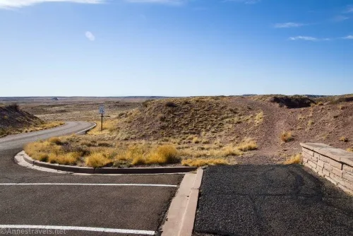
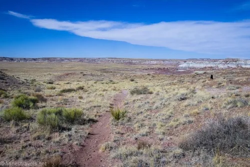
0.0 Left (south) end of the Jasper Forest Parking Area (5,576ft.). Note that there is another trail (Jasper Forest) at the right (north) end of the parking area, so be sure you get the right one! Walk south on the light but apparent path. You’ll fairly quickly pass some petrified wood. Continue southward along the top of the badlands. After 0.2 miles, the path turns right to work its way downhill and into a wash. Take note of this trail so you can find it on your way back. (34.887854, -109.807893)
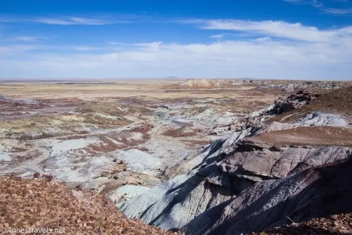
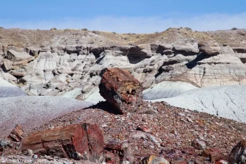
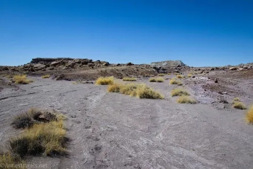
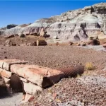
0.5 Drop into wash (5,505ft.). Turn left (downstream) and follow the wash. Petrified wood is scattered around, and views are very nice. (34.885017, -109.811991)
1.0 Cross a dirt road (5,471ft.). This is a utility road, used by the National Park Service and is not open to private vehicles. Cross the road and continue downstream. (34.884903, -109.818313)
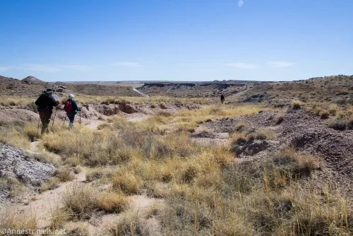
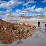
1.2 Enter larger wash (5,452ft.). Again, make a note of this junction for your return trip. If you’re following the official NPS printout, this is where I’ll deviate, as the instructions from the NPS are vague at best and misleading at worst, at least when I visited. My best guess is the NPS wants you to walk straight toward the badland wall in front of you, then turn left and walk along the badland wall. Instead, I say turn left up the wash until you come to a small wash which enters the larger wash from the right just after the first major bend in the larger wash turns to head eastward. (34.886319, -109.821395)
1.3 Turn up smaller wash (5,457ft.). The wash is easy to miss as its mouth is fairly grown in. Shortly after entering the wash, it widens and heads generally south and west. (34.884714, -109.821433)
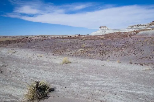
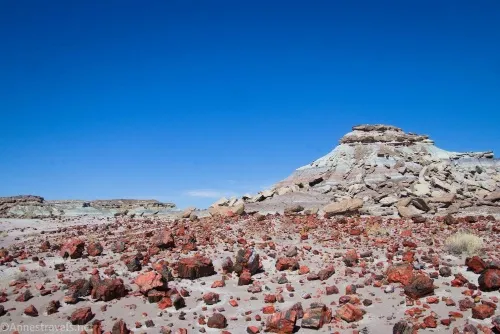
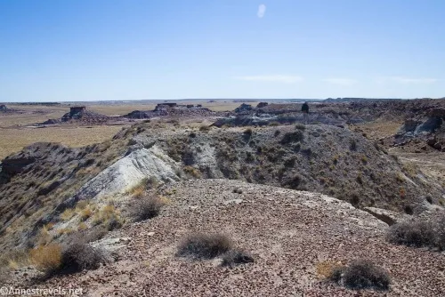
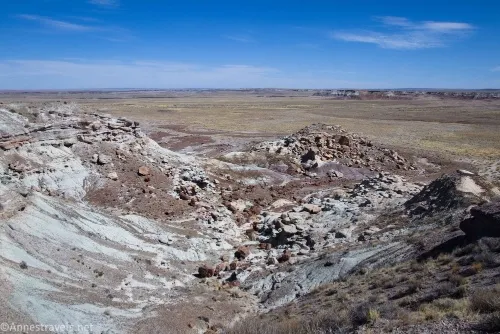
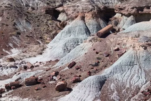
1.4 Y in wash (5,482ft.). Take the right fork. Continue following the wash upstream until it more or less disappears in a white bandland-dust area with a lot of petrified wood (this is where you would pick up the instructions from the NPS). Head north to cross over what little remains of the badland wall here (not much; this is a low saddle in the badland wall), then descend via a small drainage to the wash in the next valley. (34.883878, -109.825015)
1.6 Drop into wash (5,502ft.). Turn left to walk upstream for a short distance. (34.885296, -109.827940)
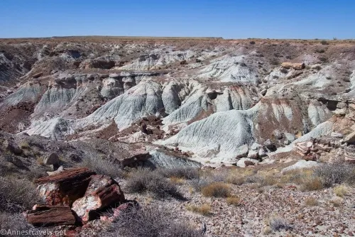
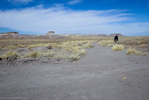
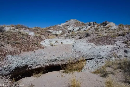
1.7 Leave wash (5,503ft.). A vague but findable social path leads from here up toward the hills, heading in a generally west and slightly northward direction. As you climb up into the hills, the trail becomes fainter until it disappears altogether in a wash. Follow the wash upward until it, too, disappears. Continue upward until you reach a white basin topped with red just before the top of the mesa. If you scramble up the left-ish side, you may find a vague trail on the mesa top. (34.885210,-109.828831)
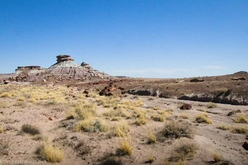
2.1 Top of Mesa (5,594ft.). Strike out across the mesa (hopefully with a light social trail) in a generally northeast direction (shying south – this is right from the coordinates) until you reach the edge of the mesa and can look down on badlands and petrified wood. Walk left (north and east) around this basin of badlands. (34.888504, -109.833721)
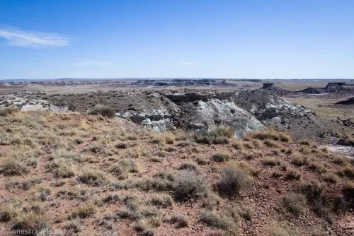
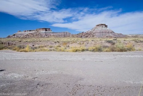
2.4 Turn south (5,582ft.). Turn south (right) here to walk out onto First Forest Point. The route is generally just fine, but there is one very narrow section of badland that may be too sketchy to attempt. Do not do anything that would put you in danger. (34.890804, -109.830561)
2.5 First Forest Point (5,569ft.). Enjoy views from wherever you feel safe. I especially liked the views down into the basin to the right (west), but the views across the grassy plains and back across the way you came are also excellent. (34.889945, -109.830437)
Round Trip Length: I went 5.4 miles with all of my wandering (which was a little crazier than the mileages above, which comes out at about 5.0 miles).
Elevation Gain: I went 508ft. (5,598ft. to 5,452ft.) – more technically, it’s probably closer to 425ft. (4,52ft. to 5,598ft.)
Facilities: None
Fees: $25/vehicle, valid 7 days. America the Beautiful National Parks & Federal Public Lands Passes are accepted, as are Petrified Forest Annual Passes.
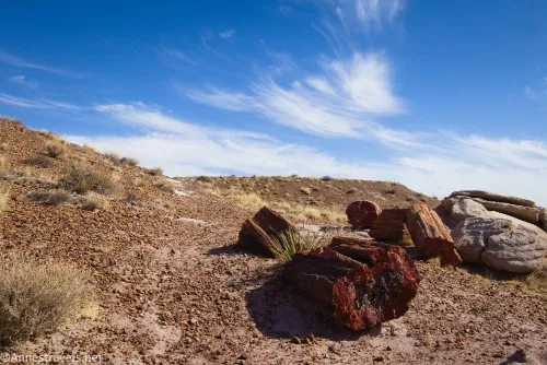
Trail Notes: This is not the most logical of routes, especially after leaving the “large wash.” It’s also the most confusing of the NPS guides I’ve used. Part of the trouble is simply that there aren’t a lot of good landmarks. Hopefully following my coordinates will make your life easier! Don’t try this in warm times of the year (May-September) due to extreme heat and no shelter from the sun. It’s also very dry – bring plenty of water, sunblock, and snacks. The “First Forest” was the first set of petrified wood early travelers would see when coming from the train station.
Trail 
![]()
![]()
![]()
Road ![]()
Signs ![]()
![]()
![]()
![]()
Scenery ![]()
Would I go 100 miles out of my way for this? ![]()
Overall Rating: ![]()
![]()
GPS coordinates from my trek to First Forest Point
TH: 34.8878720°, -109.8079140° (34°53.27232′, -109°48.47484′ / 34°53’16.3392″, -109°48’28.4904″) (5,576ft.) (0.0)
Dirt road: 34.8848960°, -109.8182880° (34°53.09376′, -109°49.09728′ / 34°53’05.6256″, -109°49’05.8368″) (5,472ft.) (0.97)
Dry wash: 34.8863470°, -109.8214120° (34°53.18082′, -109°49.28472′ / 34°53’10.8492″, -109°49’17.0832″) (5,452ft.) (1.19)

Left up wash: 34.8875190°, -109.8254230° (34°53.25114′, -109°49.52538′ / 34°53’15.0684″, -109°49’31.5228″) (5,481ft.) (1.52)
Leave wash: 34.8850700°, -109.8315900° (34°53.10420′, -109°49.89540′ / 34°53’06.2520″, -109°49’53.7240″) (5,528ft.) (1.98)
First Forest Point: 34.8899740°, -109.8303900° (34°53.39844′, -109°49.82340′ / 34°53’23.9064″, -109°49’49.4040″) (5,567ft.) (2.82)
Leave mesa: 34.8884530°, -109.8336750° (34°53.30718′, -109°50.02050′ / 34°53’18.4308″, -109°50’01.2300″) (5,594ft.) (3.18)
Regain wash: 34.8852100°, -109.8288310° (34°53.11260′, -109°49.72986′ / 34°53’06.7560″, -109°49’43.7916″) (5,503ft.) (3.63)
Leave wash: 34.8853170°, -109.8279230° (34°53.11902′, -109°49.67538′ / 34°53’07.1412″, -109°49’40.5228″) (5,501ft.) (3.69)
Y in wash: 34.8838900°, -109.8249470° (34°53.03340′, -109°49.49682′ / 34°53’02.0040″, -109°49’29.8092″) (5,482ft.) (3.91)
Main wash: 34.8847190°, -109.8214480° (34°53.08314′, -109°49.28688′ / 34°53’04.9884″, -109°49’17.2128″) (5,457ft.) (4.15)
Turn: 34.8863190°, -109.8214070° (34°53.17914′, -109°49.28442′ / 34°53’10.7484″, -109°49’17.0652″) (5,452ft.) (4.29)
Leave wash: 34.8850350°, -109.8119830° (34°53.10210′, -109°48.71898′ / 34°53’06.1260″, -109°48’43.1388″) (5,505ft.) (4.92)
End: 34.8878890°, -109.8079020° (34°53.27334′, -109°48.47412′ / 34°53’16.4004″, -109°48’28.4472″) (5,577ft.) (5.42)
The gpx file for First Forest Point (including all of my attempts to find the way!) can be downloaded – please note that this and the GPS Coordinates are for reference only and should not be used as a sole resource when hiking this trail.
Download GPX File size: 143.4 KB Downloaded 407 times
You can also download a gpx file I made after returning home that more closely follows the route described above.
Download GPX File size: 65.6 KB Downloaded 416 times
(Note: I do my best to ensure that all downloads, the webpage, etc. are virus-free and accurate; however, I cannot be held responsible for any damage that might result, including but not limited to loss of data, damages to hardware, harm to users, from use of files, information, etc. from this website. Thanks!)

Getting to the Jasper Forest Trailhead (First Forest Point Trailhead)
From the Rainbow Forest Museum, drive 7.6 miles north on the main park road. Turn left toward the Jasper Forest. Park in the lot 0.4 miles later.
From the northern entrance station (Visitor Center), continue along the main park road as it winds above the Painted Desert and then south through the park. After 18.1 miles, turn right toward the Jasper Forest. Park in the lot 0.4 miles later.
Today’s Featured Book!
Discover the unique geography and history of Petrified Forest National Park with this guide. It covers little-known historical facts as well as describing how the wood was formed and much more. Buy your copy here.


One response to “First Forest Point in Petrified Forest”
[…] and the plain below the route to First Forest Point, Petrified Forest National Park, […]