
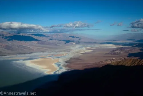
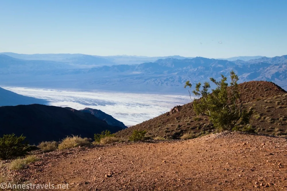
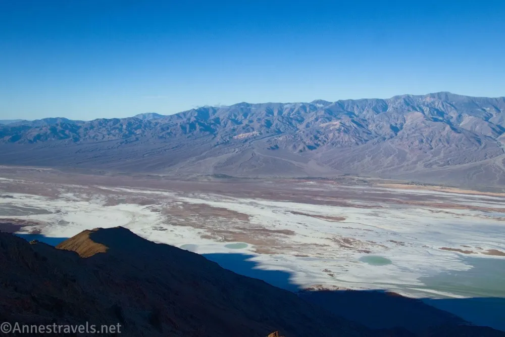
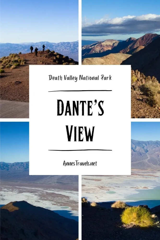
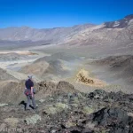
If you’re looking for a quick, gorgeous view in Death Valley – and one of the most accessible views from a mountain in the park – Dante’s View is perfect. From the parking lot, you can look down on Death Valley (you’re standing almost directly above the lowest point in North America) as well as across the valley to the Panamint Mountain Range (including Telescope Peak, the highest point in the park). It’s beautiful at any time of day, but I personally like early morning (though not too early) when the views are best to the west. If you want more than a parking lot view, a trail goes along the ridgeline to a small viewpoint – and it’s worth seeing, too!
Quick Stats
This post contains an affiliate link. If you click it and purchase something, I may receive a small commission at no extra cost to you.
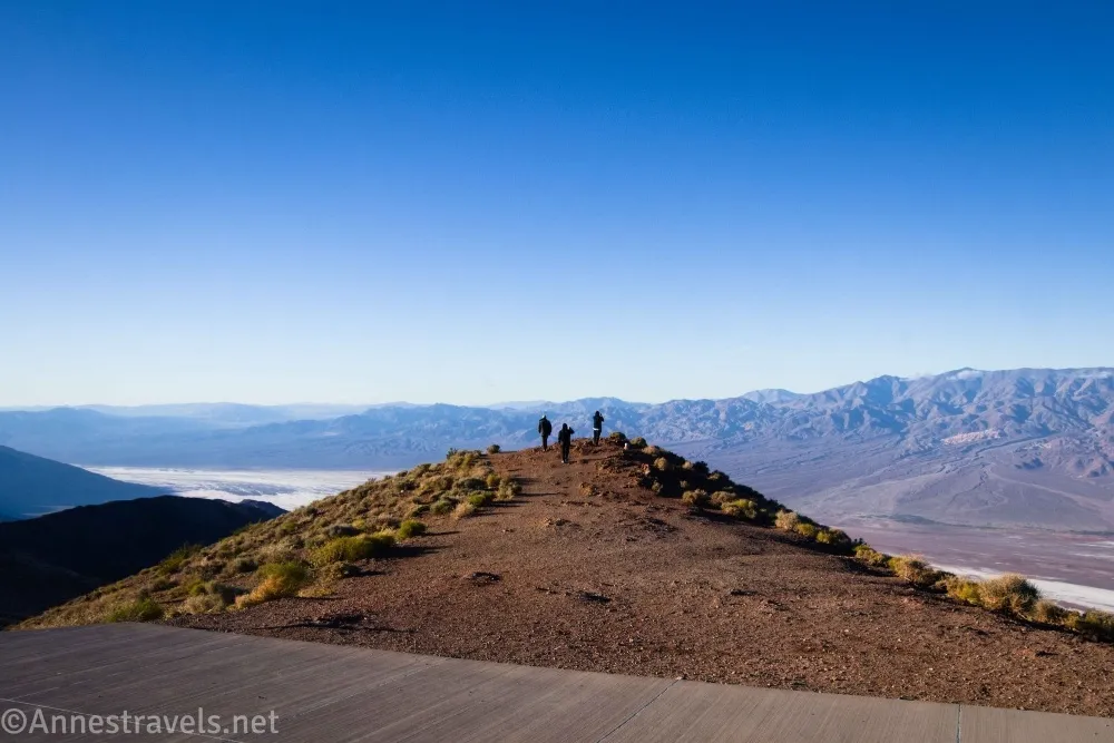
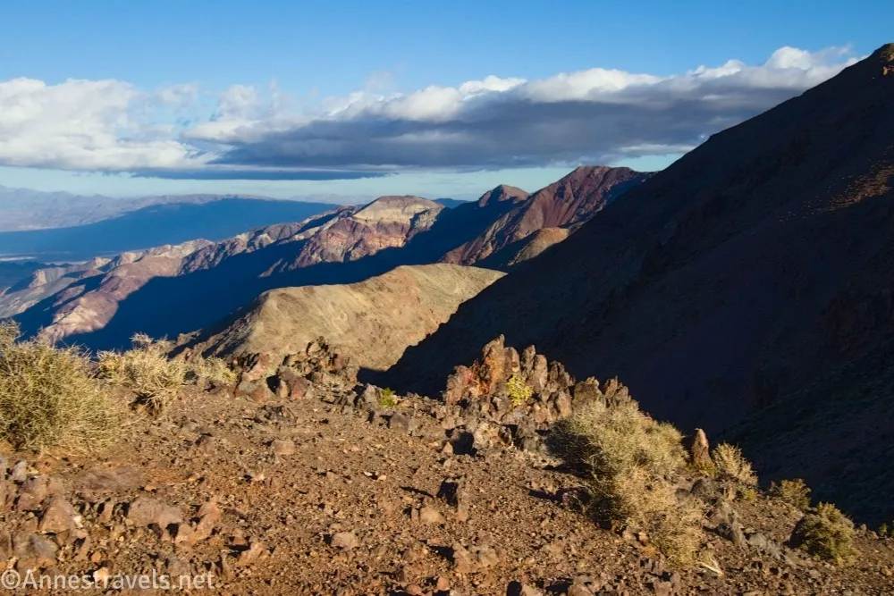
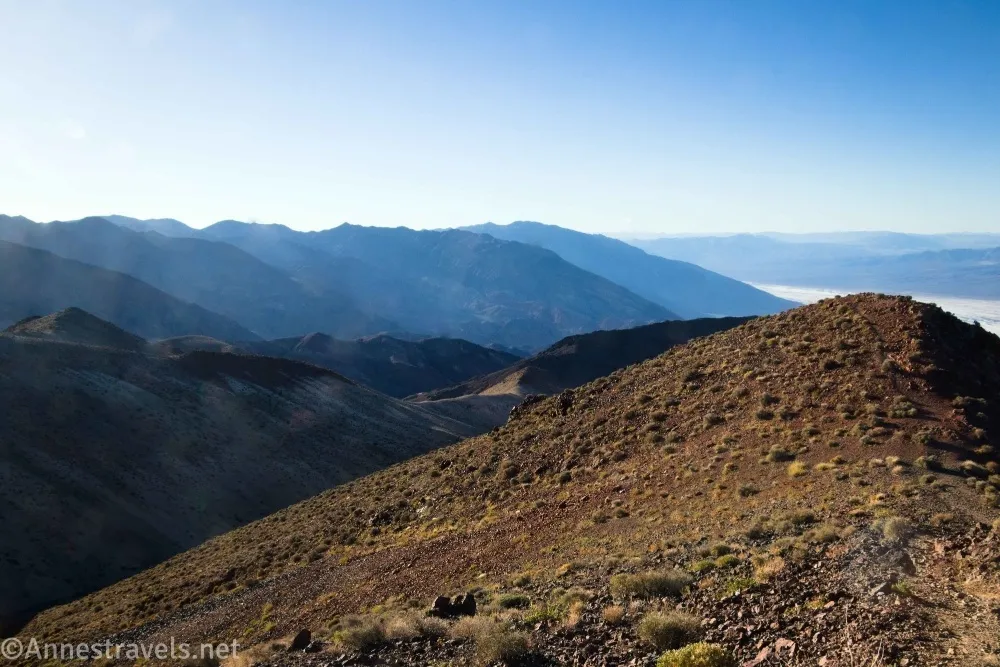
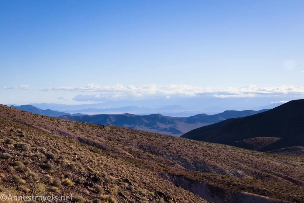
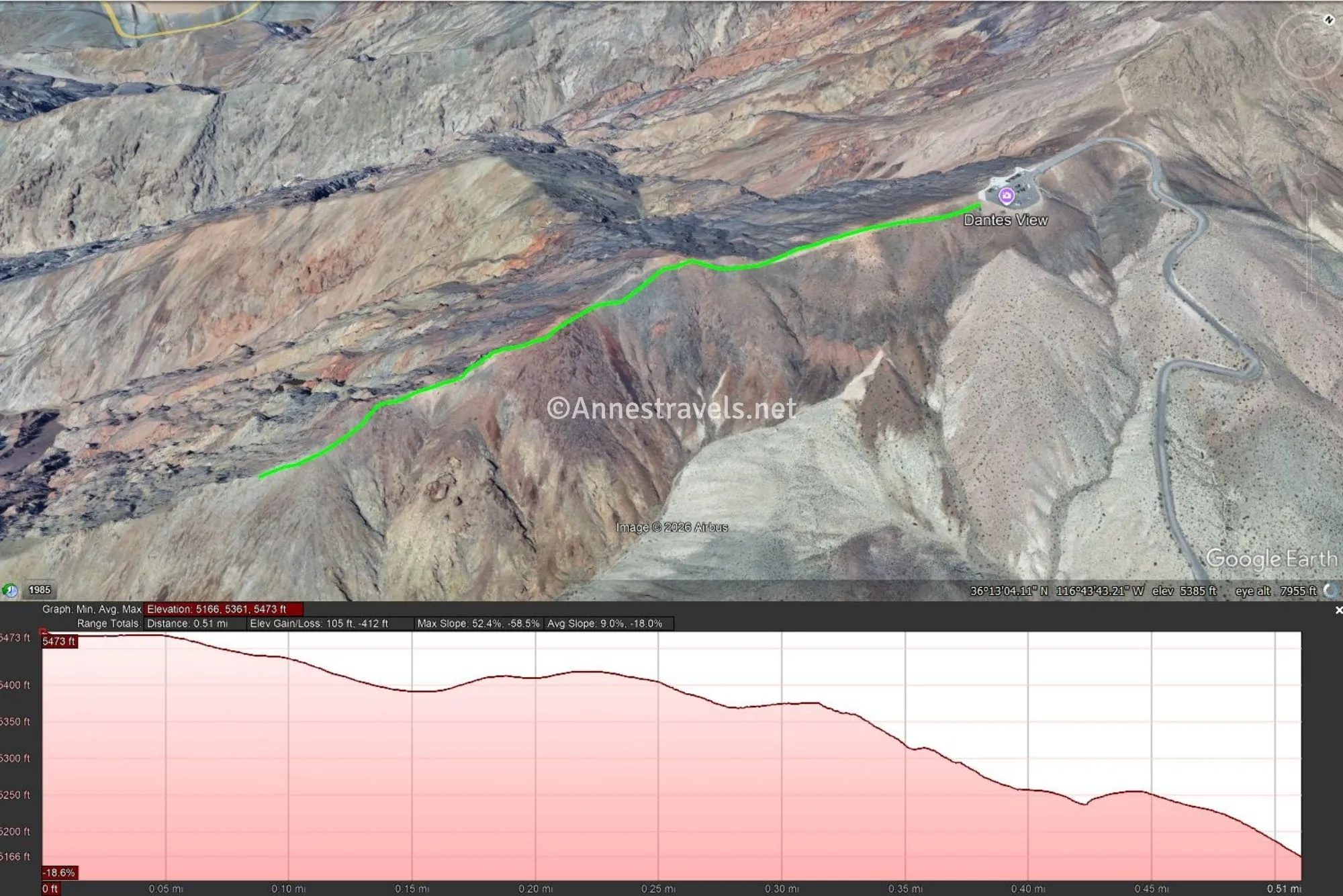
0.0 Dantes View Trailhead (5,473ft.). Walk south (left if you’re facing the view down on Badwater Flats) on the well-defined trail along the ridgeline. (Don’t go right – these are great views, too, but you’ll be on the trail to Mount Perry instead of the much, much shorter trail to Dante’s Viewpoint.) Views are excellent both down on Death Valley and into the Black Mountains on your left. (36.220576°, -116.726783°)
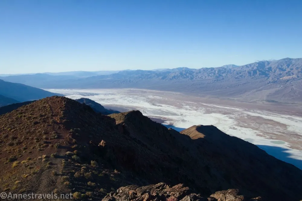
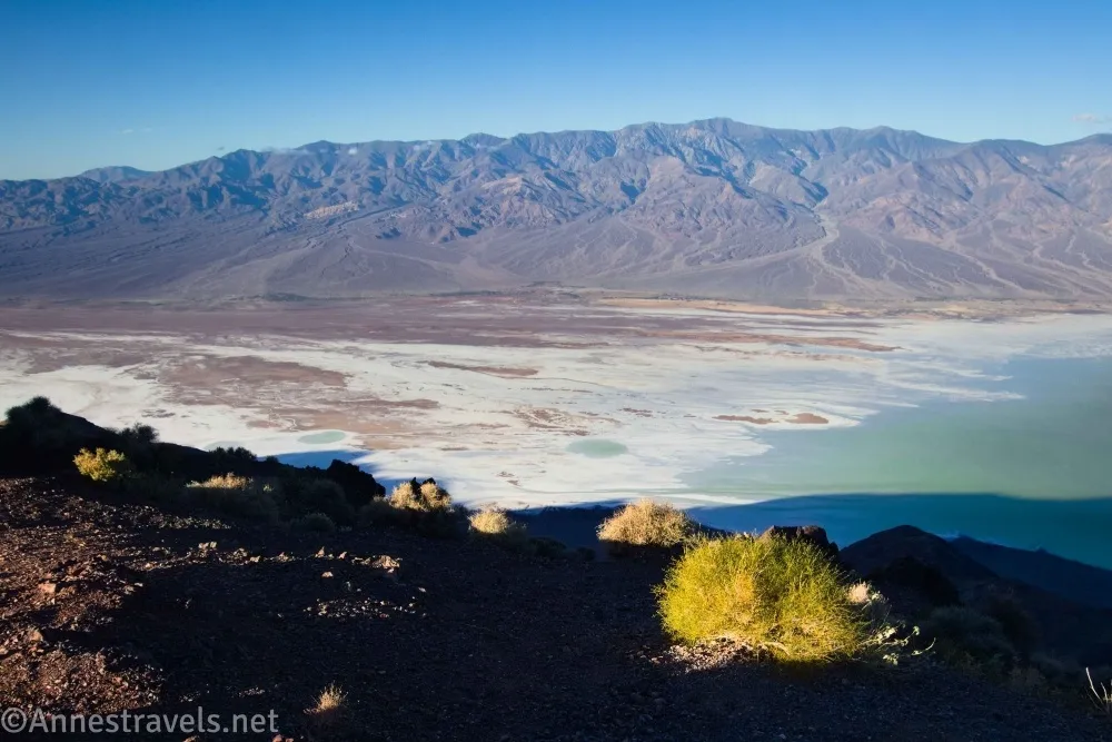
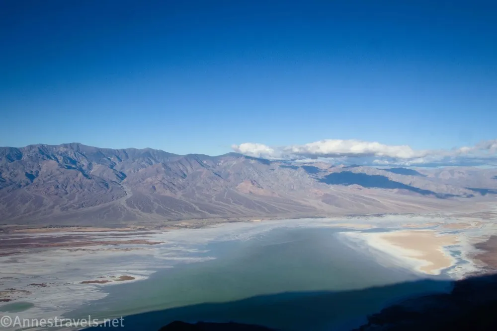
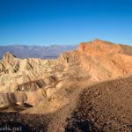
0.5 Dantes View Overlook (5,166ft.). Enjoy spectacular views of the Panamint Mountains to the west, Badwater Flats, the Black Mountains, nearby valleys, and more. I had the joy of visiting Death Valley after the storms in the late summer/fall of 2003 turned the valley into a lake (Lake Manly). So my pictures have water in Death Valley – not at all a common sight! The canyons in the Panamint Mountains are (R-L/N-S) Trail Canyon, Hanaupah Canyon, Johnson Canyon, and Galena Canyon. You can also see Telescope Peak (the highest point in the range and as well as in Death Valley National Park) and Wildrose Peak (over Trail Canyon). (36.214612°, -116.730847°)
Round Trip Trail Length: About 1 mile. You don’t have to go the entire way if you don’t want to.
Elevation Gain: 517ft. (5,473ft. to 5,166ft.)
Facilities: None. There is a restroom a short distance down the road.
Fees: $30/vehicle to visit Death Valley National Park, valid 7 days. National Parks & Federal Public Lands Passes and Death Valley Annual Passes are accepted.
Trail Notes: I often recommend this view to first-time visitors to Death Valley for three reasons: 1) It’s a great view, 2) it’s cooler than being in the valley, and 3) it’s easy. Most people recommend sunset up here, but it’s not my favorite because the mountains across the valley (the Panamint Mountain Range) are silhouetted against the setting sun. However, visit too early in the morning, and the Black Mountains will shadow Death Valley (as is evidenced in some of my pictures!) If you’re desperate to stay high elevation in this area, you can also hike the trail to Mount Perry or the trailless trek to Coffin Peak.
Trail 
![]()
Road ![]()
Signs ![]()
![]()
Scenery
Would I go 100 miles out of my way for this? ![]()
Overall Rating: ![]()
GPS Coordinates for Dante’s View
Dante’s View Trailhead: 36.220576°, -116.726783° (36°13.23456′, -116°43.60698′ / 36°13’14.0736″, -116°43’36.4188″) (5,473ft.) (0.0)
End of Trail: 36.214612°, -116.730847° (36°12.87672′, -116°43.85082′ / 36°12’52.6032″, -116°43’51.0492″) (5,166ft.) (0.5)
The gpx file for Dante’s View can be downloaded – please note that this and the GPS Coordinates are for reference only and should not be used as a sole resource when hiking this trail.
Download GPX File size: 9.0 KB Downloaded 145 times
(Note: I do my best to ensure that all downloads, the webpage, etc. are virus-free and accurate; however, I cannot be held responsible for any damage that might result, including but not limited to loss of data, damages to hardware, harm to users, from use of files, information, etc. from this website. Thanks!)
Getting to Dante’s View
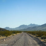
From Furnace Creek, drive east (toward Badwater Road) on CA-190. About 10.7 miles after the Badwater Road goes off on the right (stay on CA-190 at this junction), the road to Dante’s View will go off also on the right. Turn up this road for 12.6 miles to the restroom on the left. Trailers must park here. Continue another 0.6 miles up to the parking area at the top of the road – with a viewpoint right there along the railing!
From Death Valley Junction (near the Amargosa Opera House), turn onto CA-190 toward Death Valley National Park. After 18.1 miles, turn left onto the road up to Dante’s View. The parking area will be on the left after 12.6 miles (it’s beside the restroom). Trailers must park here. Continue another 0.6 miles up to the parking area at the top of the road – with a viewpoint right there along the railing!
More Easy Hikes in Death Valley
Explore the easier side of the rugged hills, valleys, and old mining claims of Death Valley National Park. Buy your copy here!

4 responses to “Short and Easy Walk at Dante’s View”
[…] drive the scenic drive, or you can explore a bit up 20 Mule Team Canyon. Then drive up to Dante’s View for great morning views down on Death Valley – hike all the way out to Coffin Peak if you […]
[…] The entrance to the 20 Mule Team Scenic Drive is 0.7 miles west of the Echo Canyon road and 6.1 miles west of the road to Dante’s View. […]
[…] The entrance to the 20 Mule Team Scenic Drive is 0.7 miles west of the Echo Canyon road and 6.1 miles west of the road to Dante’s View. […]
[…] Dante’s View is likely one of the most beautiful viewpoints in Death Valley – at least in the morning. It showcases the amazing vertical change between Badwater Flats (-282ft.) to Telescope Peak (11,049ft.). You can also continue up to Mount Perry if you want more views. […]