
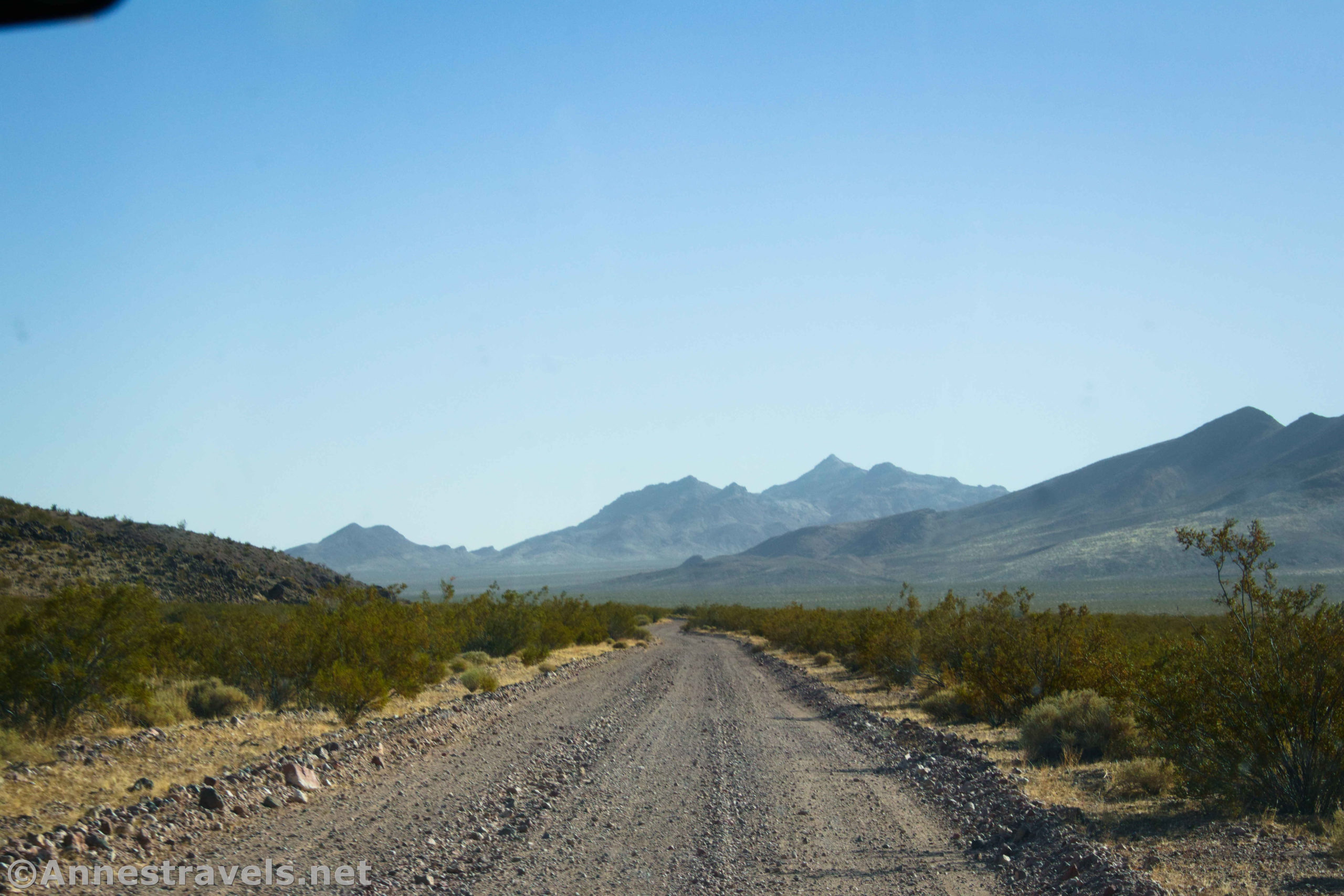

The Greenwater Valley Road is somewhere between quite busy and totally overlooked. It’s popular in that it’s near the main attractions of Death Valley National Park – Dante’s View, Zabriskie Point, Furnace Creek, Badwater, etc. However, since it goes to pretty much the same place as the paved Badwater Road, typically only adventurers take the rough gravel road through the mountains (which is probably a good thing). I drove it about noon on a November afternoon – and it’s quite scenic, even if the scenery is pretty monolithic throughout the drive.
Quick Stats
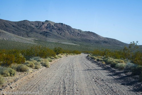
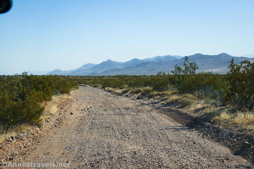
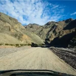
The Greenwater Valley Road is 28.3 miles long, stretching between Dante’s View Road and the Jubilee Pass Road. If you’re trying to get anywhere quickly, definitely take Badwater Road (not that the Badwater Road is all the quick a drive, but you can go more than 25mph most of the time). It tends to be fine for high clearance, 2WD vehicles, though 4×4 is recommended and the washboard is often fierce. Slow down and enjoy the scenery!

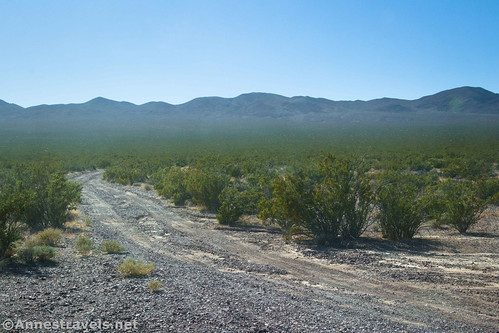
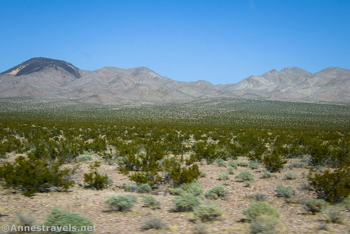
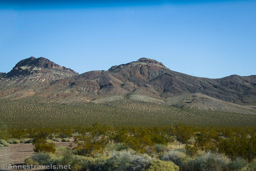
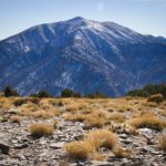
My biggest surprise while driving the road was just how green the valley appeared, likely courtesy of Hurricane Hillary. The mountains are classic examples of Death Valley scenery – the Black Mountains on the west and the Greenwater Range on the west.

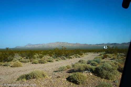
Starting at Dante’s View Road, the Greenwater Valley Road gets off to a rough, washboard start – the first couple of miles along the road are often used by visitors looking for dispersed camping opportunities (note that you’ll need a free permit to camp along the Greenwater Valley Road – more about permits here.) So those first 2 miles are enough to vibrate the bobblehead off your dashboard.
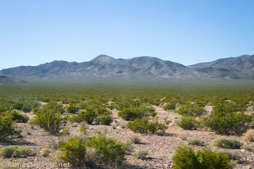
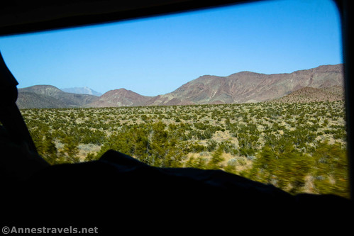
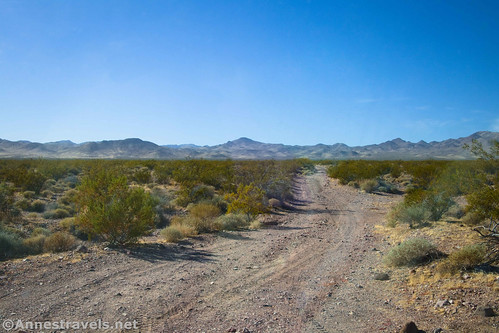
The scenery in this first section is pretty much what you’ll see for the remainder of the trip: A greasebush-covered plain with mountains on both sides (Black Mountains on the right, Greenwater Range on the left). Here, the mountains are slightly closer than in other areas, and they’re also just slightly colorful in a few places.
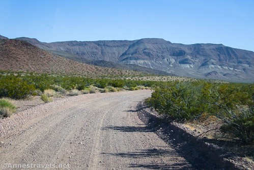
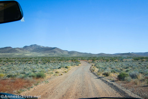
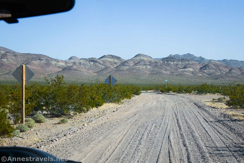
Pass by the official campsites and heave a sigh of relief as the road improves somewhat. The road itself is gravelly but has a fairly firm surface – though near the south end of the road, the gravel can be deeper, especially after storms.

After 2.8 miles, a road goes off on the right – it leads to the Furnace Townsite. While I’ve read that it’s 2WD-friendly in most places, it didn’t look like much fun without 4×4.
Continue another 3 miles (mile 5.8) to another road on the right – this is the Greenwater Townsite Road, and if you followed it, and were careful about turning in the right places, you could do a loop back to the Greenwater Valley Road, passing the Greenwater Townsite on your way. (More about that road here). Someone was letting some air out of their tires at this junction, so I couldn’t see the road very well. But apparently, they thought they needed to do it! (I’ve read that it might be 2WD or you might need 4×4.)

A third road on the right appears at mile 8.4 – this is also the Greenwater Townsite Road. (More about this road – which is slightly different from the one above – here.) Looking up the road, it seemed to be in pretty decent (if brushy) condition, but you still might want 4×4.
All of these sideroads are not very well-traveled. So they’re brushy, narrow, and don’t offer much in the way of turnaround opportunities, let alone places where you could pass another vehicle. Travel at your own risk, as they say. They all lead to the sites of tent cities when mining booms rocked the valley in the early 1900s.
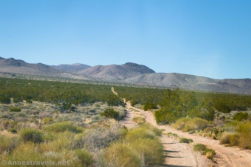
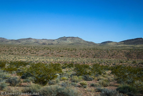
For the next 8.3 miles (to mile 17.7), the Greenwater Valley Road wanders almost straight through the valley. Greasebushes, sagebrush, somewhat distant mountains, decent views.

At mile 17.7, the Gold Valley Road goes off on the right. While you might be able to drive a few miles with a 2WD vehicle, it’s definitely 4×4 into Gold Valley. In fact, you’d better have some pretty good experience with 4×4, as there are places where you could flip your vehicle, especially after bad storms. (More about the Gold Valley Road here.)
Only half a mile later (mile 18.2), the Deadman Pass Road goes off on the left. It’s somewhat popular to turn left here up to Deadman Pass, which is usually accessible to 2WD vehicles. Beyond the pass, the road is definitely 4×4, as it crosses deep gravel fields to reach CA-127. (More about Deadman Pass Road here.)
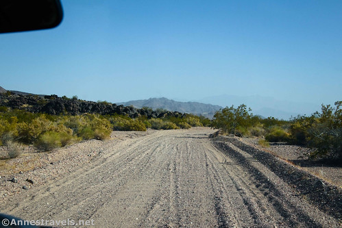
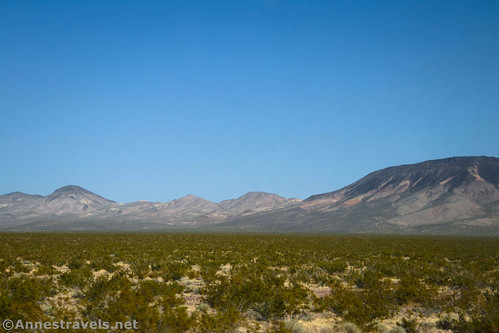
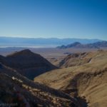
You’ve now finished passing all of the interesting sideroads, so you can lean back and enjoy the rest of the ride. The mountains also are closer to the road, which is pretty. In fact, I’d call this end of the road my favorite in terms of scenery.

Beginning about mile 21.5, the road follows a wash – I didn’t find this to be an issue, nor did I particularly notice when we were or were not in the wash. But the gravel can be deeper in this section (I didn’t have any trouble with my 2WD van, but conditions change with every storm).

About mile 28, you’ll begin to be able to see a green road sign up ahead. This means you’re getting close to the Jubilee Pass Road. In fact, at mile 28.3, you can choose if you want to turn right on the Jubilee Pass Road (19.2 miles will bring you to the south end of the Badwater Road at the junction with the Harry Wade Road) or if you want to turn left (5.8 miles to CA-127 just north of Shoshone).
Or maybe you just want to turn around and see it all over again!
Road Length: 28.3 miles point to point
Elevation Gain: 897ft. up, 2,026ft. down (north to south) (2,101ft. to 4,060ft.)
Facilities: None except a few primitive campsites (free permit required)
Fees: $30/vehicle, valid 7 days. America the Beautiful National Parks & Federal Lands Passes and Death Valley Annual Passes are honored.

Road Notes: The road is usually high clearance, 2WD friendly; however, 4×4 is recommended. Camping is now by permit only (pick up the permit at the Furnace Creek Visitor Center). Washboard is this road’s biggest issue; take it slow. In early spring, the wildflowers tend to be quite good in Greenwater Valley. On maps other than official NPS maps, the road is called the Furnace Wash Road or Furnace Creek Wash Road – this is slightly confusing, since there is another Furnace Wash Road just south of Greenwater Valley, and the two roads don’t connect (at least at this point – they may have connected at some point in the past). Even the road sign at the junction with the Jubilee Pass Road calls it the Furnace Crk Wash Road.
Road 
![]()
![]()
![]()
Signs ![]()
![]()
![]()
Scenery ![]()
![]()
Would I go 100 miles out of my way for this? ![]()
![]()
Overall Rating: 
![]()
![]()

GPS Coordinates for the Greenwater Valley Road
Greenwater Valley Road Beginning (Dante’s View Road): 36.268580°, -116.663770° (36°16.11480′, -116°39.82620′ / 36°16’06.8880″, -116°39’49.5720″) (3,231ft.) (0.0)
Furance Creek Townsite Road: 36.235353°, -116.637157° (36°14.12118′, -116°38.22942′ / 36°14’07.2708″, -116°38’13.7652″) (3,480ft.) (2.8)

Greenwater Townsite Road (North): 36.201757°, -116.603069° (36°12.10542′, -116°36.18414′ / 36°12’06.3252″, -116°36’11.0484″) (3,733ft.) (5.8)
Greenwater Townsite Road (South): 36.170867°, -116.577234° (36°10.25202′, -116°34.63404′ / 36°10’15.1212″, -116°34’38.0424″) (3,880ft.) (8.4)
Gold Valley Road: 36.055750°, -116.507392° (36°03.34500′, -116°30.44352′ / 36°03’20.7000″, -116°30’26.6112″) (3,093ft.) (17.7)
Deadman Pass Road: 36.050658°, -116.500158° (36°03.03948′, -116°30.00948′ / 36°03’02.3688″, -116°30’00.5688″) (3,001ft.) (18.2)
Jubilee Pass Road: 35.966360°, -116.363601° (35°57.98160′, -116°21.81606′ / 35°57’58.8960″, -116°21’48.9636″) (2,101ft.) (28.3)
The gpx file for Greenwater Valley Road can be downloaded – please note that this and the GPS Coordinates are for reference only and should not be used as a sole resource when hiking this trail.
Download GPX File size: 113.5 KB Downloaded 369 times
(Note: I do my best to ensure that all downloads, the webpage, etc. are virus-free and accurate; however, I cannot be held responsible for any damage that might result, including but not limited to loss of data, damages to hardware, harm to users, from use of files, information, etc. from this website. Thanks!)
Getting to the Greenwater Valley Road
From Furnace Creek, drive east on CA-190 for 12.0 miles. Turn right onto the road for Dante’s View. After 7.5 miles, there will be a gravel parking lot on the right and a gravel road on the left. Turn left onto the Greenwater Valley Road.
From Death Valley Junction (near the Amargosa Opera House), take CA-190W for 18.2 miles. Turn left onto the road for Dante’s View. After 7.5 miles, there will be a gravel parking lot on the right and a gravel road on the left. Turn left onto the Greenwater Valley Road.

Today’s Featured Product!
Learn about Death Valley while exploring some of the best (not necessarily most popular) areas of the park. With scenic drives, easy hikes, overnight trips, and everything in between, this is a great guide. Check it out here!


3 responses to “Greenwater Valley Road – Rough but Pretty”
[…] clearance is required for this scenic drive between two mountain ranges. The Greenwater Valley Road also allows access to other roads, especially those accessing the sites of tent cities set up […]
[…] The Greenwater Valley Road now also requires a permit for dispersed camping. The process is pretty much identical to the […]
[…] Greenwater Valley Road – Located in the far east of Death Valley. Usually 2WD accessible though it has heavy washboard. Free permit is required to camp; ask the rangers at the Furnace Creek Visitor Center. […]