
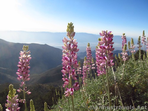
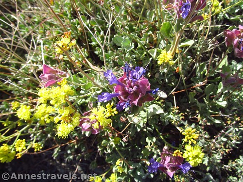
Lupines bloom along the lower reaches of the Telescope Peak Trail below Rogers Peak
If you happen to visit Death Valley in the spring, fall, or summer, you’ll probably want to get out of the valley as quickly as possible to escape the heat. The problem is that one of the few ways to escape the valley is to drive up toward Telescope Peak, and if you don’t want to hike the 6.6 miles (one way) all the way to the peak, what to do?
Quick Stats
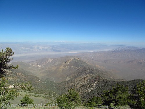
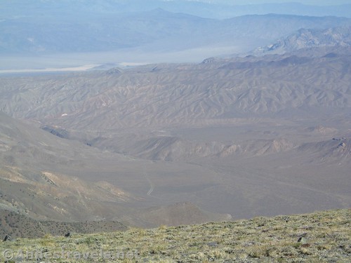
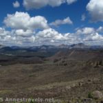
Views into China Lake from Rogers Peak
One thought is to hike only to Rogers Peak (5.2 miles round trip) and / or Bennett Peak (7.0 miles round trip) (together, 7.6 miles round trip). You get a lot of the same views as Telescope Peak without that mountain’s insane switchbacks that are enough to daunt even experienced hikers!
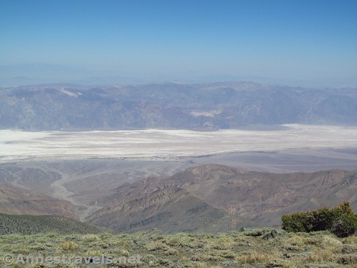
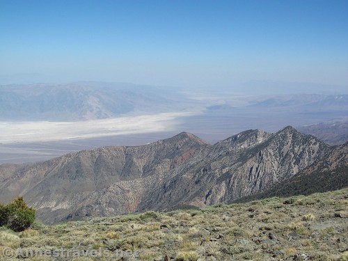
Badwater Flats from Bennett Peak
I hiked the first part of the Telescope Peak Trail back in 2001, escaping 100+ temperatures of the valley in May. We were in search of Bennett Peak, which the park service recommends in their hiking literature. Having since hiked Bennett Peak with the aid of a GPS, I can’t figure out why it’s so prominently recommended (not because of the view, but because of its non-ease of access), but I’ll also save you all the trouble of not finding Bennett Peak by telling you the easiest way to get to the top (which is not the way you might think).
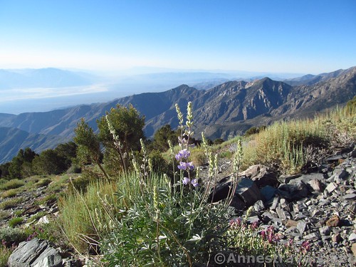
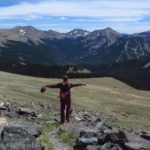
Lupines along the trail
The trail begins in the small parking area next to the campground (free; I highly recommend it; in late June, there were no more than three groups in the campground on any given night). You won’t miss the trailhead, as it’s fairly well-marked with a sign pointing toward Telescope Peak, 7 miles. Now, I didn’t hike 14 miles even with side trips to Rogers Peak and walking over Bennett Peak, so take that number with a grain of salt.
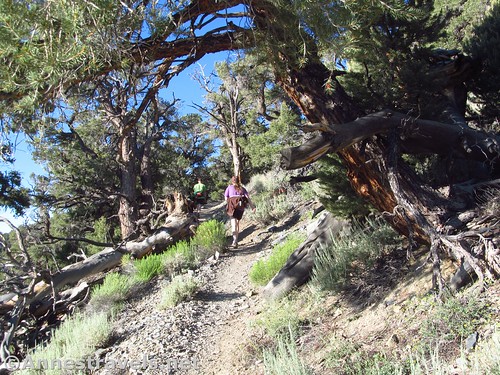
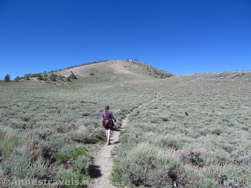
Hiking an early stretch of the trail
The trail begins by winding upward through the trees. It was very odd to me to be walking through a pine forest and discover a flowering cactus. That’s not something you see every day!
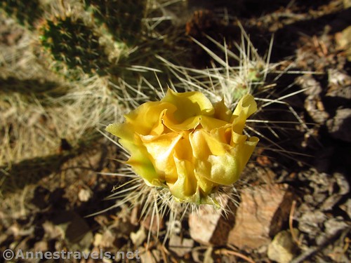
Flowering cactus in the juniper forest
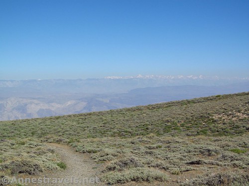
Fairly quickly the trail breaks out of the forest on the eastern slopes of Rogers Peak. Views begin to open up of Badwater and Death Valley in general. There were lupines in bloom in late June after a heavy snow year.
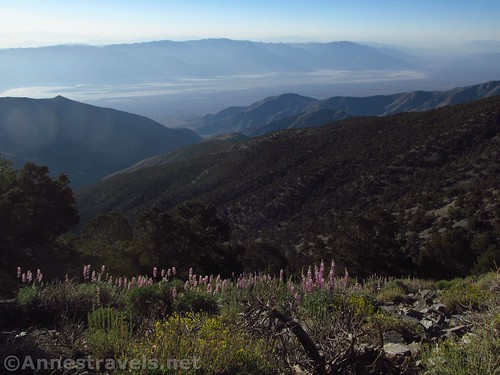
Wildflowers and views of the valley
Keep walking upward along the trail (you can’t get too lost; there is only one trail) as it turns west to ascend toward Arcane Meadows (the saddle between Rogers Peak and Bennett Peak). It was in this section in 2001 that one of our group members, then in a baby backpack, lost her favorite shoe. Another hiker so kindly picked it up and set it on a rock where we could find it on our way back down. I’ve never forgotten that hiker’s kindness, and this time, the group member walked up in her own shoes under her own locomotion!
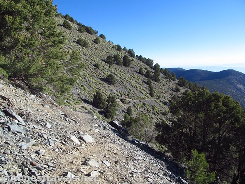
The trail along the slopes of Rogers Peak
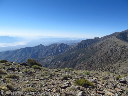
Reach the saddle (Arcane Meadows; there’s no sign indicating this) at mile 2.3 and enjoy the view of Death Valley (to the east, behind you) and China Lake and the High Sierras (to the west and across the pass). This is about as far as we got in 2001, elevation and cloudy skies taking its toll on us all.
Views of the High Sierras from Arcane Meadows
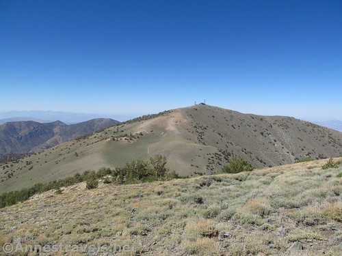
To climb Rogers Peak, turn right to ascend the slopes of the mountain 0.3 miles toward the radio towers. Take one of the social trails or choose your own path. I only ask that you stay on rocks rather than the fragile alpine vegetation.
China Lake from Rogers Peak
Reach Rogers Peak at mile 2.6. Enjoy the view of the High Sierras and the northern part of Death Valley, then retrace your steps to your vehicle, unless you want to climb Bennett Peak.
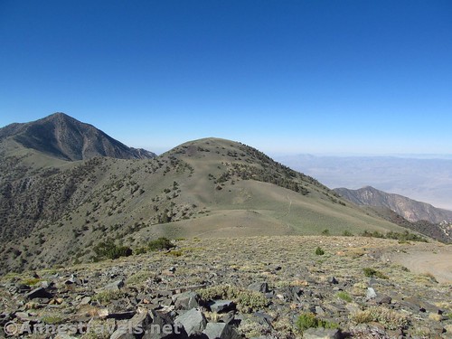
Telescope Peak (L) and Bennett Peak from Rogers Peak
To climb Bennett Peak, from the saddle / meadow, continue on the Telescope Peak Trail as it turns left to follow the western flank of Bennett Peak. Continue on the trail all the way around Bennett Peak until you come to its south side, not quite to the saddle and about 2.2 miles from the trailhead, or 3.1 if you’ve done Rogers Peak. Turn left, off-trail, to ascend the scree up 0.4 miles to the top of the peak.
Walking the trail around Bennett Peak
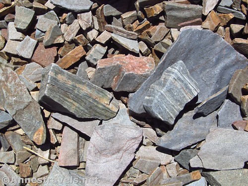
The fun part about the scree is that some of the rocks are quite interesting to look at. There are bent lines and splintered veins, and I’m not sure what to call it all (my high school science teacher wasn’t much into geology, and besides, that was a long time ago). At any rate, it’s worth seeing!
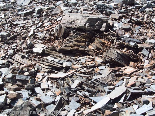
Interesting rocks on the slopes of Bennett Peak
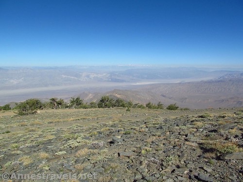
The views atop Bennett Peak are really quite good; very different than Rogers IMHO. There are pretty all-encompassing views of Death Valley, and great views down into China Lake, and views across China Lake to the High Sierras (which, after a 200% snow year, were still very snowy in late June / July!) I expect that if you knew what you were doing, and it was a clearer day, you could pick out Mt. Whitney, the highest peak in the continental US.
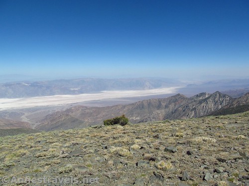
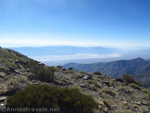
Southern Death Valley from Bennett Peak
Retrace your steps to return to your vehicle, or continue along the trail to climb Telescope Peak!
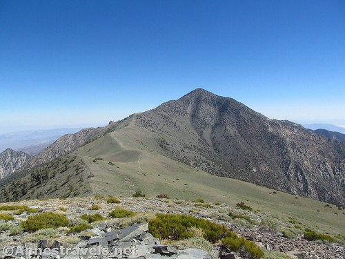
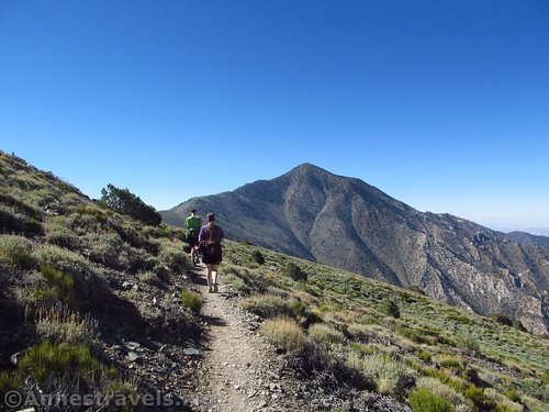
Telescope Peak from Bennett Peak. It’s another 3.6 miles from Bennett Peak to Telescope Peak, and the switchbacks make it feel like it’s closer to straight up!
Why do I take you all the way around the mountain and up its far side when you could just strike up the mountain from Arcane Meadows?
Rogers Peak from Bennett Peak
Well, the reason is actually simple: it’s a whole lot easier to hike further. I did Bennet Peak after coming down from Telescope Peak (two of us went over the top, while the others took the trail). It was easy to go up the southern flanks of the mountain, but coming down the north flank was mostly wading through waist-high scrub, and even as the two of us chatted while we hiked, my mind was racing Rattlesnakes! Rattlesnakes! At least on the southern side you can see where you’re putting your feet!
Wild landscape below Rogers Peak
So yes, it’s absolutely possible to hike up the northern side of Bennett Peak. All my maps show me coming down that way. But I don’t personally recommend it, and if you do, keep a wary eye out for desert critters hiding from the sun under bushes, or sunning themselves on rocks, etc.
Hiking the trail back toward Rogers Peak
Round Trip Trail Length: Rogers Peak: 5.2 miles round trip; Bennett Peak: 7.0 miles round trip; together, 7.6 miles round trip
Net Elevation Change: Rogers: 2,208ft.; Bennett: 2,296ft. (7,668ft. at the trailhead to 9,876ft. on Rogers Peak and 9,964ft. on Bennett Peak)
Facilities: Campground with primitive restroom and picnic tables at the trailhead.
Fees: $25 per vehicle to enter Death Valley National Park, valid 7 days. Death Valley Annual Pass and National Parks & Federal Recreational Lands Passes are also accepted.
Trail Notes: Don’t try this trail when thundershowers are in the forecast; the trail is very exposed and you’ll be the tallest thing around. Elevation can be an issue for some people, as this is much higher than the surrounding area / where a lot of people travel from. I found the views from Rogers vs. Bennett Peak to be fairly different, even though Bennett Peak is less than 100ft. taller than Rogers Peak. I think the difference may be due to the great views of the valley / Badwater from Bennett Peak, while Rogers offers views north into some very interesting country. Both offer views to the west and the High Sierras. The views toward the Sierras / China Lake are better in the morning, while the views into Death Valley are better in the afternoon.
Morning views into Death Valley
Trail 
![]()
![]()
Road ![]()
![]()
Signs ![]()
![]()
Scenery
Would I go 100 miles out of my way for this?
Overall Rating: ![]()
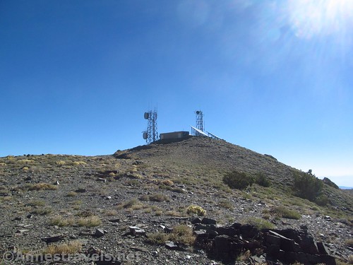
Radio towers atop Rogers Peak. The park service has done a good job at hiding the road up the peak from the Telescope Peak Trail.
GPS Coordinates for the trails to Rogers Peak & Bennett Peak
Trailhead: 36.2296806°N, -117.0683833°W (36°13’46.85″N, -117° 4’6.18″W / 36°13.78083’N, -117°04.10300’W) (7,668ft.) (0.0; ended 13.7)
Rogers / Bennet Pass: 36.2140528°N, -117.0890639°W (36°12’50.59″N, -117° 5’20.63″W / 36°12.84317’N, -117°05.34383’W) (9,611ft.) (Arrived 2.3; Returned after Rogers 2.9; Returned after Telescope & Bennett 11.5)
Rogers Peak: 36.2170167°N, -117.0870389°W (36°13’1.26″N, -117° 5’13.34″W / 36°13.02100’N, -117°05.22233’W) (9,876ft.) (2.6)
Leave Trail for Bennet: 36.2020278°N, -117.0924806°W (36°12’7.30″N, -117° 5’32.93″W / 36°12.12167’N, -117°05.54883’W) (9,571ft.) (3.1)
Bennet Peak: 36.2065694°N, -117.0928139°W (36°12’23.65″N, -117° 5’34.13″W / 36°12.39417’N, -117°05.56883’W) (9,964ft.) (3.5)
Regain Trail after Bennet: 36.2125417°N, -117.0910972°W (36°12’45.15″N, -117° 5’27.95″W / 36°12.75250’N, -117°05.46583’W) (9,603ft.) (4.0)
Southern part of Death Valley National Park, a slightly zoomed in picture from Bennett Peak
The gpx file for Telescope Peak (with side treks to Rogers Peak and across Bennett Peak) can be downloaded – please note that this and the GPS Coordinates are for reference only and should not be used as a sole resource when hiking this trail.
Download GPX File size: 258.9 KB Downloaded 528 times
(Note: I do my best to ensure that all downloads, the webpage, etc. are virus-free and accurate; however, I cannot be held responsible for any damage that might result, including but not limited to loss of data, damages to hardware, harm to users, from use of files, information, etc. from this website. Thanks!)
Wildflowers along the trail
Getting to Rogers and Bennett Peak
From Furnace Creek, drive north on CA-190W, the main north-south road through Death Valley (toward Beatty, though you’re not actually going to Beatty). After 33 miles, turn left onto Emigrant Canyon Road (follow sign for Wildrose). Continue about 30 miles to the trailhead.
Striped rocks on the slopes of Bennett Peak
From Panamint Springs, head northeast on CA-190E for 21.4 miles. Turn right onto Emigrant Canyon Road; continue about 30 miles to the trailhead.
Views across the Panamint Mountains and Death Valley from Rogers Peak
Note: Emigrant Canyon Road is dirt and quite rough. You should be able to access the Charcoal Kilns; beyond this, high clearance may be required, although I think almost all the cars I’ve seen at the trailhead were low-clearance.
Zoom map out to browse nearby hikes & places of interest
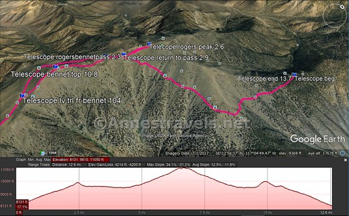
Visual trail map of the trails up Rogers Peak and Bennett Peak. Note that the elevation profile first climbs Rogers Peak, then Telescope Peak, then goes over the top of Bennett Peak.
This Week’s Featured Product!
If you want more hikes in Death Valley, check out this book.
[forecast location=”Furnace Creek, CA” caption=”Weather for Death Valley National Park” measurement=’F’ todaylabel=”Today” datelabel=”date(‘D M d’)” highlow=’%%high%%°/%%low%%°’ numdays=”5″ iconset=”Default”]

Pingback: Sneak Peak: A California Trip through Desert and Snow - Anne's Travels
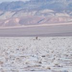
Pingback: Walk Across Death Valley on the Badwater Flats! - Anne's Travels
Pingback: Climbing Telescope Peak! - Anne's Travels