
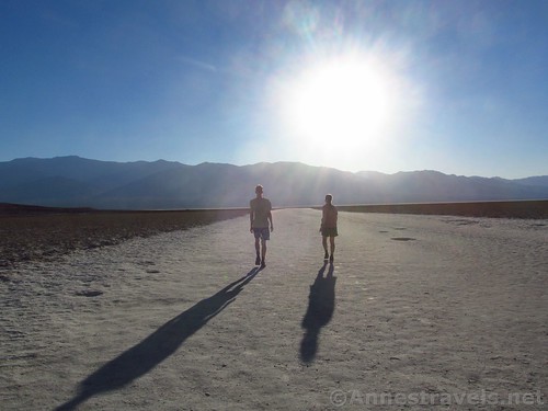
Walking out onto the Badwater Basin salt flats late on a June day
We were crazy to go to Badwater Basin in the middle of June the week after record-breaking high temperatures in California. We knew we were crazy. But we also wanted to hike Telescope Peak, and since we had to travel east to west somehow, going to Badwater made as much sense as driving right by.
Quick Stats
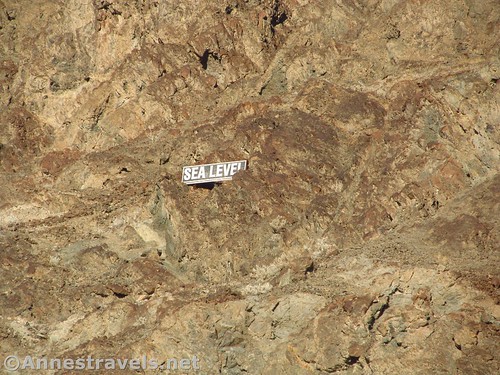
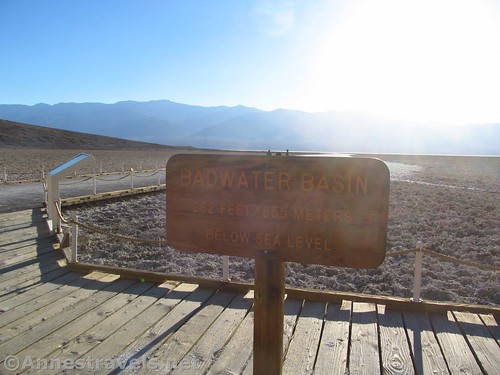
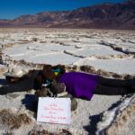
Cute little “Sea Level” sign on the cliff above Badwater Basin
Badwater Basin is known as the lowest place in the western hemisphere. That’s pretty cool. But cooler yet are the salt flats, pancakes covered in crystals, with ridges between each pancake of crystal formations.
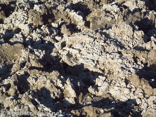
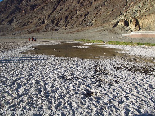
Not many crystals, but cool mud formations near the boardwalk
Most of the crystal formations aren’t visible near the boardwalk out onto the salt flats; you’re better off hiking across the flats if you want to see these. But there are still a few not too far from the boardwalk, and if you don’t want to hike far, or it’s just too crazy hot to want to hike at all, Badwater Basin makes a pretty good substitute.
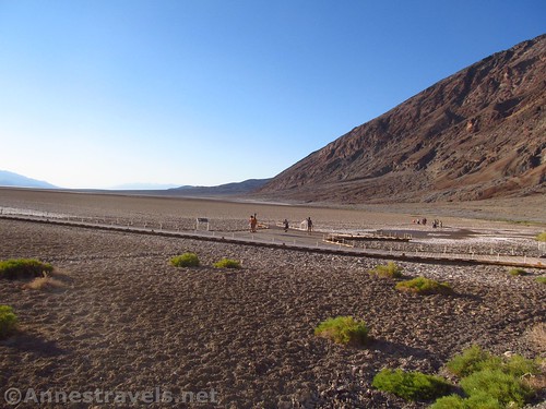
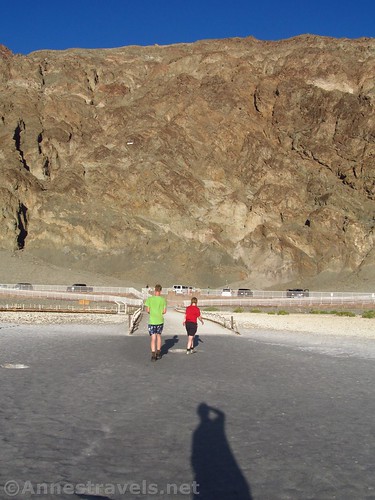
The boardwalks from the parking area
Several stairways and ramps lead down to the main boardwalk from the parking area. I would expect that at times of high visitation – say, Spring Break – the parking area would be overcrowded. It was crowded enough in the middle of June, and I’m not sure why anyone would be crazy enough to endure those temperatures (so sayeth someone without air conditioning in their vehicle!)
Water on the salt flats
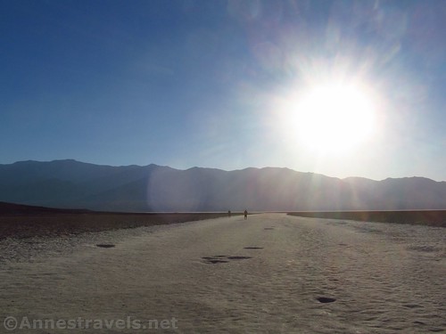
The boardwalk goes out onto the salt flats and almost immediately you can turn right to the famous Badwater Sign. No one else was wanting it, so we got lots of pictures, no problem.
Of course, the pictures aren’t very good with the sun behind them. Badwater is best visited in the later morning.
From there, the boardwalk goes out to the salt flats. For a good quarter mile beyond the end of the boardwalk, the flats are packed solid from so many feet. Stay on the trail in this section. If you want to go beyond the end of the “trail” to see some more natural formations, good, but for now, protect what is left close to the parking area.
Walking out on the salt flats
We wandered out for a short distance, just far enough to say we had really done it, and took crazy photos of crazy people jumping in the evening sunlight (um, actually, those crazy people are us!)
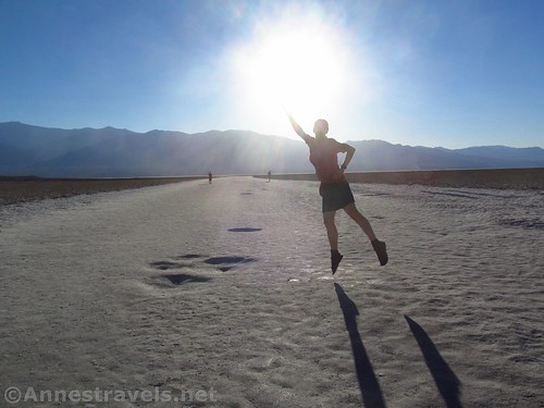
Jumping into the sunset on the Badwater Basin salt flats
We had told those who didn’t want to get out of the van to give us five minutes, and we spent probably closer to ten minutes. But it was worth it. How many other people can say they hiked Badwater Flats at 120°F?
Walking back to the boardwalk and the parking area
Round Trip Trail Length: At least 0.1 mile just to walk the boardwalks, plus however far you decide to walk out on the salt flats
Net Elevation Change: About 11ft.
Facilities: Primitive restrooms; more facilities available at the visitor center up the road
Fees: $25/vehicle/week. Death Valley Annual Passes and Federal Lands & Recreation Passes (annual, senior, access, volunteer, military, 4th grader) also accepted.
Trail Notes: Try this trail in November-April for the best results – it’s also the most beautiful because Telescope Peak has snow!
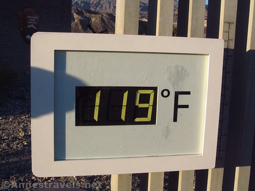
Proof that 30 minutes later it was 119F at the visitor center!
Trail 
![]()
Road
Signs
Scenery ![]()
Would I go 100 miles out of my way for this? ![]()
Overall Rating: 
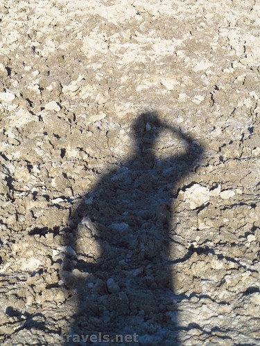
Shadow fun
Key GPS Coordinates for Badwater Basin
Parking: 36.2297611°N, -116.7673056°W (36°13’47.14″N, -116°46’2.30″W / 36°13.78567’N, -116°46.03833’W) (-281ft.)
Sign: 36.2299417°N, -116.7677167°W (36°13’47.79″N, -116°46’3.78″W / 36°13.79650’N, -116°46.06300’W) (-292ft.)
End of Boardwalk: 36.2299556°N, -116.7681139°W (36°13’47.84″N, -116°46’5.21″W / 36°13.79733’N, -116°46.08683’W) (-292ft.)
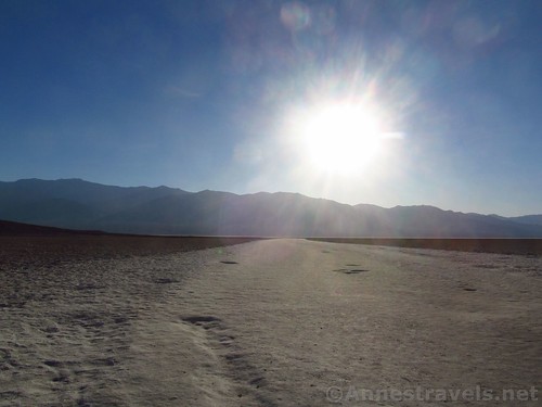
Evening on the salt flats
Getting to Badwater Basin
From the Furnace Creek Visitor Center, head south on CA-190E. After 1.3 miles, turn right onto the Badwater Road, following signs for Badwater. Drive 16.5 miles to the parking area for Badwater Basin, on right.
Badwater Basin is also on left about 30 miles north of Ashford Junction.
Zoom map out to browse nearby hikes & places of interest
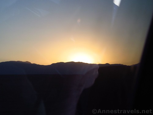
Driving at sunset through Death Valley National Park. The hand on the steering wheel is a reflection in the window.
This Week’s Featured Product!
If you’re looking for a guide on hiking in Death Valley, this one comes highly rated – and an updated version from years of hiking in the national park.
[forecast location=”Furnace Creek, CA” caption=”Weather for Badwater Basin” measurement=’F’ todaylabel=”Today” datelabel=”date(‘D M d’)” highlow=’%%high%%°/%%low%%°’ numdays=”5″ iconset=”Default”]
Pingback: Sneak Peak: A California Trip through Desert and Snow - Anne's Travels