

A few weeks ago, I talked about exploring around 20 Mule Team Scenic Drive in Death Valley National Park. Well, partially by accident, and partially intentionally, I also ended up exploring 20 Mule Team Canyon, also located along the scenic drive. It’s a pretty canyon – maybe not up to Sidewinder Canyon excitement or Fall Canyon grandeur, but worth exploring nonetheless. You can also do it as a loop with Corkscrew Canyon, but that’s a topic for another post. For now, know that 20 Mule Team Canyon is a fun little adventure with three dryfalls to scramble and a few side canyons that can be explored.
Quick Stats

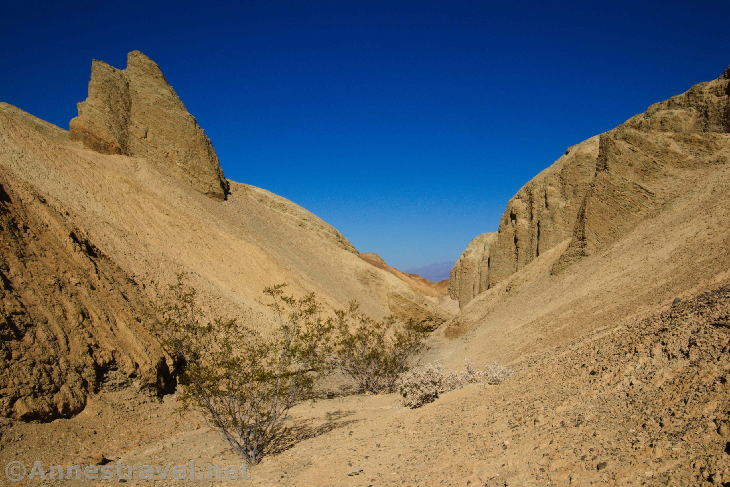
Start out from the 20 Mule Team Scenic Drive. The canyon (wash at this point) crosses the scenic drive about mile 1.8, so it’s easy enough to spot. Walk up the wash and about mile 0.25 you’ll come to an old borax mine. It’s barred off now, but it’s still pretty cool.

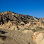
Be sure to look up to the hills on the right – some of them are very colorful. The morning light makes these views even better, but they’d be beautiful almost any time of the day.

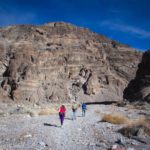
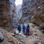
Almost immediately after the borax mine, the canyon walls shift from badlands to rocks, and the canyon narrows. It winds this way for 0.75 miles (from the trailhead) to the first dryfall. This is fairly easily scaled by scrambling up the left hand side of the dryfall on the social trail.
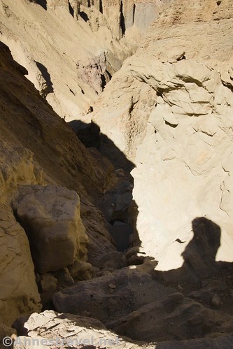
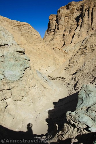
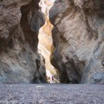
Keep walking upcanyon. Another dryfall is fairly easily climbed about mile 0.8 before you reach the only real obstacle in the canyon about mile 0.9: A very sketchy 80ft. dryfall. My best advance is to climb straight up the choke stone, then scramble up the scree on the left side of the tumble of rocks that make up the dryfall. If you can make it to the top, you’re good to go: It’s an easy hike from here to the top of the canyon (there is at least one more small dryfall about mile 1.0, but it’s not difficult to climb).

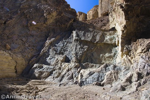
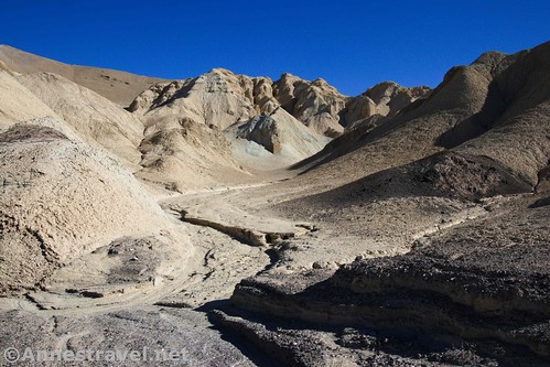
One of the enjoyable parts of the canyon is all of the rock formations. Some are just rocks up above the main canyon, others are eroded like spires in Bryce (only all yellow).

I explored two side canyons on the left on my way up. None were especially remarkable, but they were fun to see.

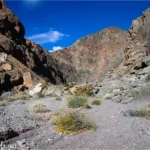
As you climb up the canyon, the walls gradually drop lower and lower until the canyon widens out into a sea of gravel and shallow channels. Keep walking a short distance further to the very end of the canyon. From here, scramble up onto the badlands so you can see the very good views down on Corkscrew Canyon (there’s nothing to keep you from scrambling down the badland washes from here and walking down Corkscrew!) and north to the Funeral Mountains. Beautiful!

From here, it’s a “simple” matter of retracing your steps back down to your vehicle! As I said, the canyon itself isn’t all that remarkable, but it is a fun little escape in the main part of Death Valley with some good views to boot!
Note: Always tell someone where you’re going, or, better yet, hike with at least one other person. Several of us had set out that morning to explore somewhat independently with the promise to keep an eye on each other. One of my group members lost her footing, slid down a slope, and limped back to the van, where everyone else’s response was, “Here’s the first aid kit, and… Where’s Anne?!?”

I was oblivious, exploring 20 Mule Team Canyon. Another group member had been keeping an eye on me (just like I’d had my eye on him until I got down in the canyon) and so he met me on my way down just below the first dryfall.

Knowing the general location of each other saved us from panic… but it would have been nice if the injured group member had had someone with her at the time of her fall. And it would have been better if I’d been in a place where I could have seen everyone instead of deep in a canyon and unable to see what was going on with the others in my group.

All that to say this: Hike with someone, or at least let someone know where you’re going and when you’ll be back. It could save your life!
Round Trip Trail Distance: About 4.25 miles out & back
Elevation Gain: Not more than 1,132ft.
Facilities: None; restrooms are available at Zabriskie Point
Fees: $30/7 days; Death Valley Annual and National Park & Federal Recreational Lands Passes accepted.

Trail Notes: Do not attempt to explore this area during the warm summer months – it’s not worth risking heat stroke and dehydration. If you get lost (hard in a canyon, but you never know), head north – you’ll run into either the 20 Mule Team Scenic Drive or CA-190 sooner or later. As always in slot canyons, be wary of possible flash floods. Much of the trail would be too muddy to be passible after a rain. If the sketchy dryfall looks like too much for you, don’t do it – I’ve had more than a few years’ worth of experience in these things.
Trail 
![]()
![]()
![]()
Road ![]()
Signs ![]()
![]()
![]()
Scenery ![]()
Would I go 100 miles out of my way for this? ![]()
![]()
Overall Rating: ![]()
![]()

GPS Coordinates for 20 Mule Team
Beginning (western end) of the 20 Mule Team Scenic Drive: 36.409644, -116.794734 (36°24.57864′, -116°47.68404’ / 36°24’34.7184″, -116°47’41.0424″)
End (eastern end) of the 20 Mule Team Scenic Drive: 36.397922, -116.770275 (36°23.87532′, -116°46.21650′ / 36°23’52.5192″, -116°46’12.9900″)
Beginning at the mouth of 20 Mule Team Canyon: 36.3911000°, -116.7782000° (N36° 23.466′ W116° 46.692′ / 36°23’27.9600″, -116°46’41.5200″) (1,202ft.) (0.0)

First dryfall approx. 36.3839417°, -116.7826083° (36°23.03650′, -116°46.95650′ / 36N 23’ 02.19”, -116W 46’ 57.39”) (0.75)
Second dryfall approx. 36.3828528°, -116.7830111° (36°22.97117′, -116°46.98067′ / 36N 22’ 58.27”, -116W 46’ 58.84”) (0.8)
Third Dryfall: 36.381869, -116.782324 (36°22.91214′, -116°46.93944′ / 36°22’54.7284″, -116°46’56.3664″) (0.9)
Fourth Dryfall: 36.380746, -116.781786 (36°22.84476′, -116°46.90716′ / 36°22’50.6856″, -116°46’54.4296″) (1.0)
Top of 20 Mule Team Canyon: 36.3739500°, -116.7744833° (N36° 22.437′ W116° 46.469′ / 36°22’26.2200″, -116°46’28.1400″) (1,917ft.) (2.3)

The gpx file for my trek around 20 Mule Team Canyon can be downloaded – please note that this and the GPS Coordinates are for reference only and should not be used as a sole resource when hiking this trail.
Download GPX File size: 43.9 KB Downloaded 450 times
(Note: I do my best to ensure that all downloads, the webpage, etc. are virus-free and accurate; however, I cannot be held responsible for any damage that might result, including but not limited to loss of data, damages to hardware, harm to users, from use of files, information, etc. from this website. Thanks!)

Getting to 20 Mule Team
From the Furnace Creek Visitor Center, turn right onto CA-190. Pass by the road to Badwater after 1.3 miles; continue another 4.7 miles (you’ll also pass Zabriskie Point). Turn right onto the 20 mule team for 1.8 miles to the mouth of 20 Mule Team Canyon or wherever you can safely find a place to pull off. Note that the canyon isn’t signed and Google has it in the wrong place, so you’ll be best off using the GPS coordinates above.
The entrance to the 20 Mule Team Scenic Drive is 0.7 miles west of the Echo Canyon road and 6.1 miles west of the road to Dante’s View.

The 20 Mule Team Scenic Drive is dirt/gravel, but it’s usually accessible to passenger cars. Don’t attempt after a heavy rain.

This Week’s Featured Product!
Looking for more on-the-beaten-path and off-the-beaten-path hikes in Death Valley? Check out this guide to the park, considered by some to be one of the best, most detailed hiking guide ever written.
One response to “Adventuring up 20 Mule Team Canyon”
[…] explored 20 Mule Team Canyon. It’s pretty cool, with only one really sketchy dryfall to […]