

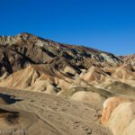
Probably the most fun canyon I explored in Death Valley last fall was Grotto Canyon. It’s a bit infamous – and for good reason – but it’s also a beautifully formed slot with a lot of fun areas. And by “fun” I mean dryfalls, choke stones, narrows, and a cool grotto at the head of the canyon. (You can technically get up beyond the grotto – but I’ll get into that later.) All that to say that Grotto Canyon is not for the casual hiker. It’s also not for small children or people who don’t enjoy scrambling. But if you can make it, you’ve got 2.8+ miles of canyon fun without the need of a rope (unless you want one). I’ve also included instructions for bypasses in italics. But if you’re looking for a beautiful and easier canyon to hike, nearby Mosaic Canyon is more family- and hiker-friendly.
Quick Stats
The first excitement is getting to the Grotto Canyon Trailhead. A rough road leads up from the main park road near Mesquite Sand Dunes. It’s ok for low-clearance vehicles (be careful; it is not maintained) for the first mile or so to a small parking area for low-clearance vehicles (if you park here, you’ll need to walk another mile up to the trailhead).

After the low-clearance parking area, the road drops into the wash that is the lower part of Grotto Canyon. In our high-clearance van, we dropped into the wash (it was sort of an accident – the driver didn’t realize we’d come to the low-clearance parking area) and got partway to the 4×4 trailhead before we started spinning out in the loose gravel (we don’t have 4×4). So we got ourselves out of the gravel, turned around for a quick exit if necessary, and pulled off of the road far enough that other vehicles could get around us. Then we walked 0.2 miles to the trailhead.

The trailhead is just the point where there is a sign indicating that vehicles are not allowed beyond this point. There’s a turnaround with space for several vehicles. From here, just continue upcanyon. It’s still gravely, but not too difficult a walk.

The first dryfall is about a quarter-mile beyond the parking area. Most people don’t go any further than the bottom of this dryfall, and I can’t blame them. It’s about 30ft. high total, in three steps. The first and second steps are the most difficult because the water has polished the rock so it’s hard to get a grip. I expect being tall would help. I made it up with some creative scrambling and a hand from above, but several of my group decided that this was a little too exciting… and went back to the van for our clothesline rope.

There are two good things about this dryfall. First, if you can’t make it up, the grotto below the dryfall is pretty cool. Second, if you can make it up the first dryfall, you can probably make it up any of the other dryfalls in the canyon.

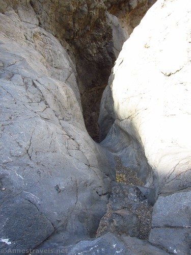
The second dryfall is just around the bend from the first one. It’s a shelf with a pile of rocks that previous hikers have piled up to give themselves a boost up. Granted, it’s easier if you’re taller (which I’m not). I did make it up by adding a couple of additional rocks to the stack.

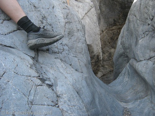
Directly after the second dryfall is a choke stone (as if things couldn’t get more exciting than two dryfalls). Head over to the right side and you’ll find a way through that isn’t too difficult – though it’s a little tight, so you might have to take off your pack.
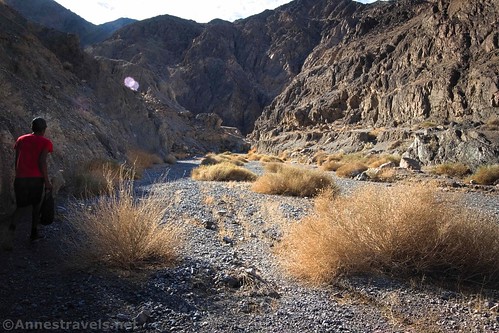
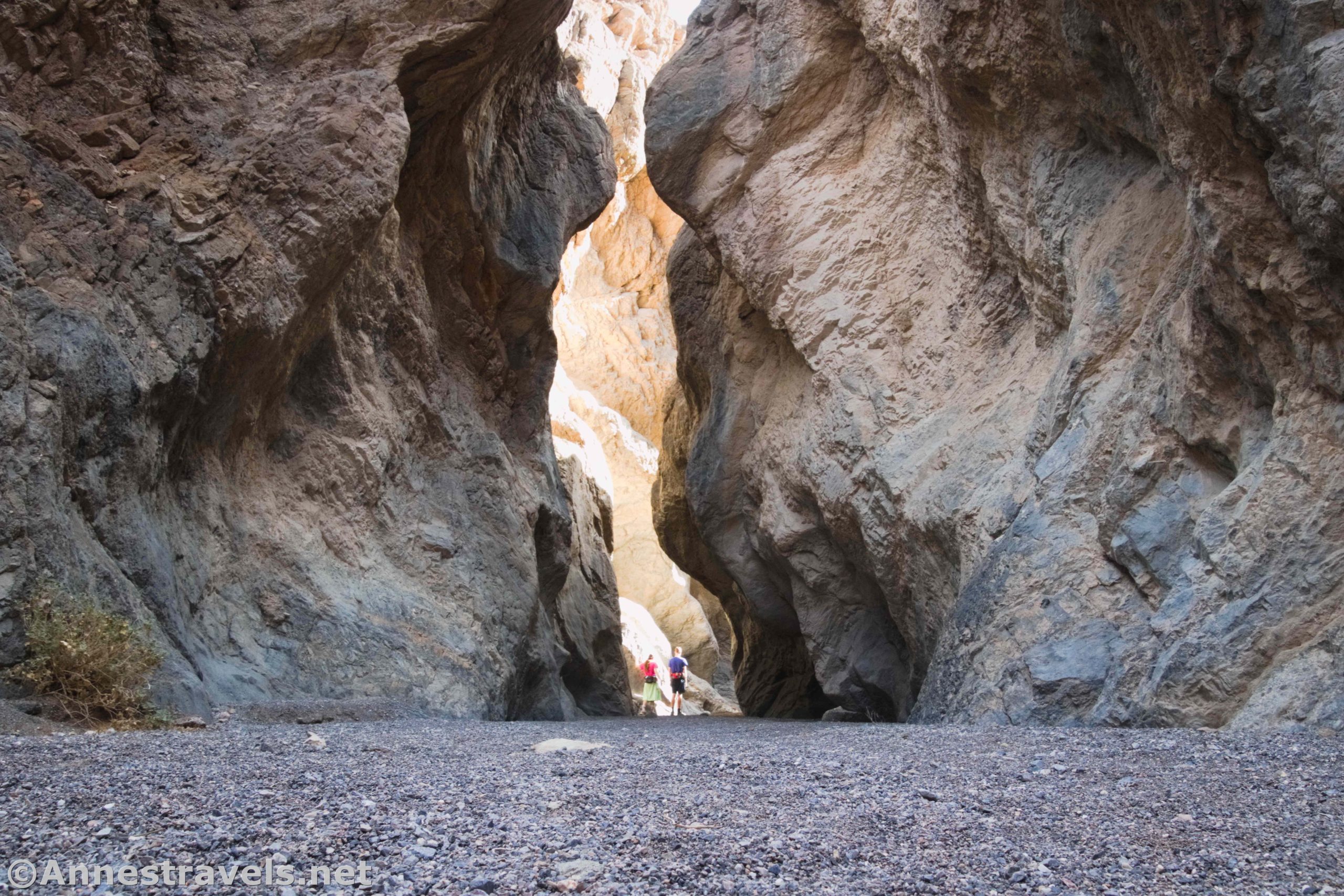
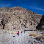
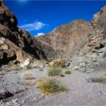
Once through the choke stone, breathe a sigh of relief. The canyon widens, and walking becomes much easier. The walls are pretty cool here, so it’s not like this section of the canyon is boring.

Now if all of that sounded just way too exciting, I found out after the fact that there are easier bypasses. After finding the first dryfall, hike back downcanyon about 0.1 miles to a cairn-marked route up a drainage on the east (right if you’re going downcanyon) side of the main canyon. The cairned route will bring you down into the canyon above the choke stone.

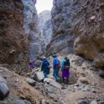
We continued upcanyon through some very nice narrows. The next excitement is at about mile 1.0 – a 10ft. dryfall in what’s called the Second Grotto. Not knowing any better, I chimneyed up it without a qualm. In fact, this chimney is pretty difficult, and even people with rock climbing experience sometimes fail here. Score one for great hiking boots and online workouts, I guess. Anyway, I find this dryfall to be the most scenic, and it signals even more beauty ahead.

But first, you’ll have to climb one last obstacle. It’s not that hard, especially considering what you’ve been through, so scramble up it and enter another short section of beautiful narrows.

If you can’t climb the dryfall – and it’s quite the obstacle, so don’t feel bad if you can’t – there may be a way to backtrack downcanyon a short distance to scramble up the left side (which left? I don’t know, but I’d guess left when you’re coming upcanyon) and drop back into the canyon above the dryfall and obstacle.

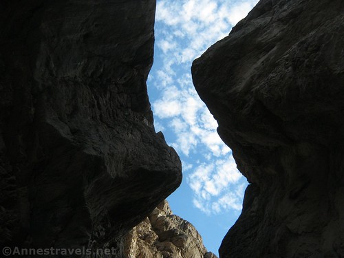
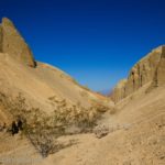
Grotto Canyon becomes wide again for a short distance, then the canyon enters what is probably the most beautiful section of narrows. The walls tower above, sometimes almost closing overhead, with rock formations high on the walls.

The final Grotto is reached about mile 1.3. It’s pretty impressive, with a towering 40ft. pouroff and darkness throughout the day from the high walls. This is the endpoint for many hikers of Grotto Canyon, and it’s a fantastic endpoint. You’ve seen much of what the canyon has to offer in terms of beauty.

But – if you’re feeling adventurous – there is more to see. Backtrack down to the last wide part of the canyon. You’ll find a sketchy but obvious social trail scrambling up the north/right (when coming downcanyon) side of the canyon. The hardest section is the first, as the hillside is very loose. In fact, a couple of my group members insisted I leave my camera behind for fear I’d fall and break it… so much for photos of the upper canyon. Once the trail gains some elevation, it heads for the canyon above the pouroff. There is one sketchy section that is a narrow shelf of rock (too narrow for my taste, given the fall to the canyon below) but it’s short. Three of us went up to the top of the pouroff, and then I continued upcanyon.
It’s not as exciting as the part below, but it’s still very nice with narrows and occasional small dryfalls or obstacles to be climbed. I didn’t go too far (only about 0.3 miles), since I knew the others were waiting down below (if I’d continued a short distance further, I believe I would have come to another nice narrows). But I’ve heard that you can go quite a distance before you hit a choke stone that blocks progress about a mile beyond the top of the pouroff. It may be passable either by scrambling or via a bypass… you’ll have to hike it yourself and let me know in the comments!

Round Trip Trail Length: 2.8 miles to the pouroff and back per my GPS. A closer inspection of the GPS track suggests it’s closer to 1.25 miles RT.
Elevation Gain: The GPS says 606ft. I expect it’s slightly less than that.
Facilities: None. The nearest restrooms are in the Mesquite Sand Dunes Parking Area.
Fees: $30/vehicle/week; National Park and Public Lands Passes and Death Valley Annual Passes also accepted.
Trail Notes: Some previous experience bouldering and/or rock climbing is recommended (I’ve bouldered and scrambled quite often but I’ve never done rock climbing). If you don’t think you can’t do it, just don’t. Mosaic Canyon is just as nice. I found the first dryfall to be much harder to come down than to climb up – so it was the only time I used the rope. It would have been just a nice slide if it hadn’t been so long and steep… As always in canyons, never hike when flash floods may be present, and be aware of your surroundings.

Trail 
![]()
![]()
![]()
Road ![]()
![]()
![]()
![]()
Signs ![]()
![]()
![]()
Scenery
Would I go 100 miles out of my way for this?
Overall Rating: ![]()
![]()

GPS Coordinates for Grotto Canyon
Low-clearance parking area: 36.591471, -117.110551 (36°35.48826′, -117°06.63306′ / 36°35’29.2956″, -117°06’37.9836″) (434ft.)
Where I parked: 36.5847000°, -117.1052000° (N36° 35.082′ W117° 06.312′ / 36°35’04.9200″, -117°06’18.7200″) (657ft.)
Grotto Canyon TH: 36.5822167°, -117.1038333° (N36° 34.933′ W117° 06.230′ / 36°34’55.9800″, -117°06’13.8000″) (738ft.) (0.0)
Top of Dryfall 1: 36.5798500°, -117.1029667° (N36° 34.791′ W117° 06.178′ / 36°34’47.4600″, -117°06’10.6800″) (812ft.) (0.37 – probably more like 0.2)
Dryfall 2: 36.5798000°, -117.1029333° (N36° 34.788′ W117° 06.176′ / 36°34’47.2800″, -117°06’10.5600″) (831ft.) (0.57 – probably more like 0.23)

Top of choke stone: 36.5797833°, -117.1027667° (N36° 34.787′ W117° 06.166′ / 6°34’47.2200″, -117°06’09.9600″) (845ft.) (0.61 – probably more like 0.25)
Chimney Dryfall: 36.5766167°, -117.1019833° (N36° 34.597′ W117° 06.119′ / 36°34’35.8200″, -117°06’07.1400″) (996ft.) (1.00 – maybe 0.5)
Ledge: 36.5766333°, -117.1016833° (N36° 34.598′ W117° 06.101′ / 36°34’35.8800″, -117°06’06.0600″) (1,013ft.) (1.07 – maybe 0.55)
Grotto: 36.5761500°, -117.1006833° (N36° 34.569′ W117° 06.041′ / 36°34’34.1400″, -117°06’02.4600″) (1,080ft.) (1.33 – maybe 0.65)
Begin up trail: 36.5761667°, -117.1014500° (N36° 34.570′ W117° 06.087′ / 36°34’34.2000″, -117°06’05.2200″) (1,065ft.) (1.63 maybe 0.7)
End: 36.5822000°, -117.1038833° (N36° 34.932′ W117° 06.233′ / 36°34’55.9200″, -117°06’13.9800″) (823ft.) (2.80 maybe 1.25)
The gpx file for Grotto Canyon can be downloaded – please note that this and the GPS Coordinates are for reference only and should not be used as a sole resource when hiking this trail.
Download GPX File size: 14.2 KB Downloaded 528 times
(Note: I do my best to ensure that all downloads, the webpage, etc. are virus-free and accurate; however, I cannot be held responsible for any damage that might result, including but not limited to loss of data, damages to hardware, harm to users, from use of files, information, etc. from this website. Thanks!)

Getting to Grotto Canyon
From Furnace Creek, drive north on CA-190W for 22.0 miles. Turn left onto a mostly-unmarked dirt road – it should have a sign that says Grotto Canyon, but it’s easy to miss. Drive 0.9 miles to the edge of the wash and park here if you have low-clearance, then follow the road to the trailhead. If you have 4×4, drive down into the wash, turn left with the road, and drive another 0.9 miles to the Grotto Canyon Trailhead.
From Stovepipe Wells, drive east on CA-190E for 2.2 miles. Shortly after passing the parking area for the Mesquite Sand Dunes, turn right on a mostly-unmarked dirt road… see above for the rest of the directions.

This Week’s Featured Product!
You’ll want to love the backcountry to enjoy this guide to Death Valley National Park. With rarely visited areas and plenty of exploration opportunities, it’s a great resource.
One response to “Grotto Canyon: Dryfalls And Other Excitement”
[…] next day, we took a gamble and tried for Grotto Canyon. We had to haul some of the group up the dryfalls via our clothesline (it doubles as a […]