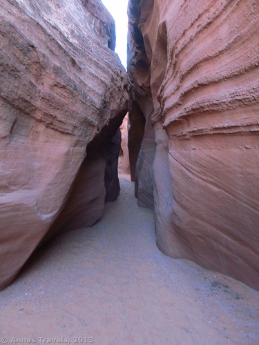
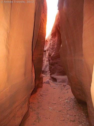
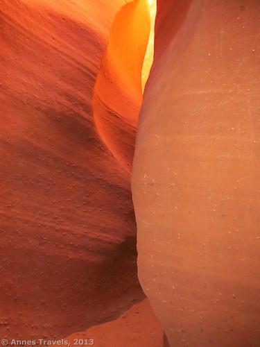
In last week’s post, I talked about Peek-a-Boo Slot (one of the Dry Fork Slots), one of the prettiest slot canyons I’ve ever seen. This week, I’d like to continue that post by talking about another really interesting slot canyon in the same vicinity: Spooky Slot. Spooky gets its name from the narrowness of the canyon which blocks most of the light that might filter down to where you’re standing. It is a very tight slot, though it’s still passible if you walk sideways (which is more than I can say for some of the slot canyons I’ve been in!) I will tell you how to navigate Spooky Slot as though you were doing the Peek-a-Boo and Spooky Slots as a loop – although you could hike back down Peek-a-Boo Slot and then hike down the Dry Fork wash to the beginning of Spooky Slot. Even though the loop is shorter, you may want to retrace your steps anyway. I’ll explain why in a minute. The Peek-a-Boo/Spooky Slots Loop is about 3.5 miles RT (5.5 km).
As soon as the walls drop away to a dry wash at the top of Peek-a-Boo slot, there should be a cairned trail leading right out of the wash. It has never been difficult to find this trail, but I believe it is easier than ever to follow. However, before you take this trail, consider carefully. If you are not good with rock scrambling/rock climbing or hate sliding down 10-ft. near-sheer drops/wiggling your way around rocks that most adults won’t fit past, you do not want to do the loop; retrace your steps and come up Spooky Slot from the Dry Fork end of the slot. You’ll be happier that way. However, if that descriptions sounds like fun (or at least doable) to you, turn right and follow the cairned trail out of the wash.
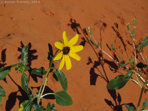
The trail is not difficult to follow as it winds its way through bushy, sandy desert. Keep your eyes open for cairns and you should be fine. About 0.5 miles later (1 km), the trail will abruptly descend a sandy trail to the bottom of another wash. Turn right to enter Spooky Slot. Spooky at this point is narrow enough, but don’t be deceived: it will get narrower soon, but not before the trail gets trickier!
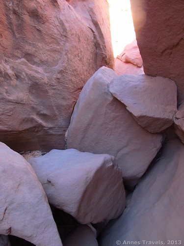
Not very long after entering Spooky Slot, there will be a small stone-jam blocking the path. Scramble over it and keep going – this is not the notorious “choke-stone” that clogs the upper end of Spooky Slot. A short while later, you will come to what looks like a huge pile of rocks. This is the choke-stone and the place that really gets tricky.
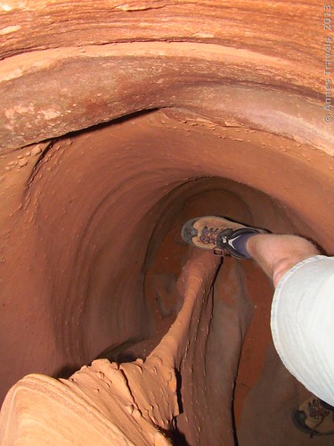
Work your way around the boulders as best you can. In the past, we were able to scramble across the top of the rocks and then down at the far end; this is no longer possible. (Yes, the choke-stone has gotten larger since we came last!) Several smaller members of my group found a place on the left-hand side where they could wiggle around several boulders and then take a 6-ft. drop to the lower part of the slot. I didn’t know if I could make it, but I was sure the not-quite-so-small members of my group wouldn’t make it that way, so I walked around to the right. A short ways before the end of the choke-stone, a hole between two boulders allowed me to drop about 10 feet to the lower canyon. I did this mostly by stretching my legs across to the other canyon wall (so that my feet were on one wall and my back was against the other wall) and then “unching” myself down to where I could drop safely. Getting the other members of my group down proved a little trickier, but we all made it. Easy? No. Fun? Definitely!
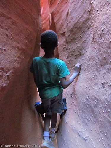
Keep walking down canyon. If there are many people (and there often are) this is where life gets exciting, because the canyon is barely wide enough for one person to walk sideways, let alone for two people to pass each other. However, with some creativity (and perhaps some backing up) you can likely get through. The canyon widens and narrows for about a half a mile (1 km). It rarely gets so wide that you can’t touch both walls with your hands, and sometimes it’s so narrow that one member of my group had a bit of trouble getting through – backpacks are fun because you can’t possibly wear them, so you have to carry them in your hands! (And if the backpack is too large, it may not fit at all!)
At last you will come to a wider place and then to an even wider place where two people can walk side-by-side. You’re basically out of the slot now. Keep walking and you will come out into a sandy wash. Keep walking for a hundred feet or so back out to the Dry Fork Wash; turn right. You may miss this junction and simply turn right by accident (I did!) because that’s the way most people come from. Follow the Dry Fork Wash back to Peek-a-Boo Canyon and then back to the trail up to the parking area. If you turn left instead of right at the bottom of Spooky Slot you will come to Brimstone Slot. I have never done this because it requires technical climbing gear (something I don’t have).
Spooky Slot is such fun, especially for children who can walk through the canyon where you have to squeeze. It’s always been my favorite of the Dry Fork Slots, even though Peek-a-Boo is prettier.
Key GPS Coordinates for Spooky Slot:
Dry Fork Slots Parking Area: 37.47649N / -111.22031W (37N 28’ 35.3634” / -111W 13’ 13.1154”)
Dry Fork Slots Trailhead: 37.47675N / -111.22008W (37N 28’ 36.3” / -111W 13’ 12.2874”)
Top of Spoofy Slot (where you turn off of the overland trail): 37.48525N / -111.20956W (37N 29’ 6.9” / -111W 12’ 34.4154”)
Bottom of Spoofy Slot: 37.48135N / -111.20932W (37N 28’ 52.8594” / -111W 12’ 33.552”)
The gpx file for the Dry Fork Slots (Peek-a-Boo/Spooky Slots Loop) can be downloaded.
Download GPS File File size: 67.9 KB – Downloaded 683 times.
(Note: I do my best to ensure that all downloads, the webpage, etc. are virus-free and accurate; however, I cannot be held responsible for any damage that might result, including but not limited to loss of data, damages to hardware, harm to users, from use of files, information, etc. from this website. Thanks!)
Getting to the Dry Fork Slots
From the town of Escalante, drive about 5 miles (8 km) east on UT-12 to Hole in the Rock Road (this junction is well-marked; if you see signs for Calf Creek, you’ve gone too far). Turn right on Hole in the Rock Road and drive 26 miles (41.8 km) to a turn-off on your left. In previous times, this road was marked for the Dry Fork Slots; I believe it is now simply marked as “Dry Fork of the Coyote Gulch”, although it may have no marker. On some maps, this road is marked as #252. Drive this road for about half a mile (0.8 km); then turn left at the obvious fork. The road used to be well-graded and quite passible for passenger cars; today it is quite rough although passenger cars can still make it to the trailhead. Most cars park just before the trailhead, as a large bump leading into the parking area may require high clearance. Note: there are several potential camping spots along the right fork in the road; no camping is allowed at the trailhead.
Also note that this area is best visited in the extreme early morning. I think we left about 7:30am on a weekday in mid-May and it wasn’t a moment too soon. The Dry Fork Slots are too small to hold many people unless everyone is moving in the same direction, which most people are not. We met at least 25 people as we were coming back around 10am, a few of which had to go backwards for a short ways to let us through…so…try to go when there are very few people in the area!
Round Trip Trail Length: The entire loop is about 3.5 miles (5.5 km) RT
Facilities: None
Cost: None
Trail 


Road 


Signs 


Scenery 


Would I go 100 miles out of my way for this? 


Overall Rating: 


This Week’s Featured Product!


Pingback: 10 Best (and worst) Day Hikes in Grand Staircase-Escalante
Pingback: Hole in the Rock: Scramble to Lake Powell! - Anne's Travels
Pingback: Dry Fork Slots, pt. 1: Peek-a-Boo Slot - Anne's Travels
Pingback: Epic Day Hiking Road Trip to Southern Utah - Anne's Travels
Pingback: The Glory of the Lord Comes from the Wilderness - Anne's Travels