
I love the Grand Canyon! And I love finding new trails into the canyon I’ve never thought about doing before! So, last winter, when my hiking colleagues and I began talking about a dayhike on the Grandview Trail this spring, I was ecstatic. I found the trail to be pretty, but more of a trail to other destinations than a beautiful hike on its own. However, there are still dayhiking opportunities using the trail that are well worth the hike it takes to get there. In the next several posts, I’ll explain our dayhike down the Grandview Trail, across Horseshoe Mesa, down to the Tonto Trail, east around Horseshoe Mesa on the Tonto Trail, then back up to the Grandview Trail via a trail past Miner’s (Page) Spring. At 17.5 miles (28.2 km) RT, it’s really too long to be a dayhike, but I’ll get more into that later. For now, I’ll start in this post by laying the groundwork and then taking you down the Grandview Trail to the trail split just before the old mine buildings at Last Chance Mine on Horseshoe Mesa.
(Affiliate links are present on this page.)
Before I get into the post, let me explain that, according to my calculations from a Falcon Guide on the Grand Canyon, the loop was supposed to be 12-13 miles (19-20 km) RT. We’ve done this length before in the Grand Canyon, so I packed well and wasn’t worried. The key here is that I packed well. Even though I was expecting a 12 mile (19 km) hike, I packed enough food and water for a 14 mile (22 km) hike – and I’m thankful I did, because the trail turned out to be closer to 17 miles (27 km) RT (and our longest dayhike ever)! So as a warning to anyone wanting to hike in the Grand Canyon, I highly recommend packing more food and water than you think you’ll need: sometimes even the best guidebooks get it wrong…
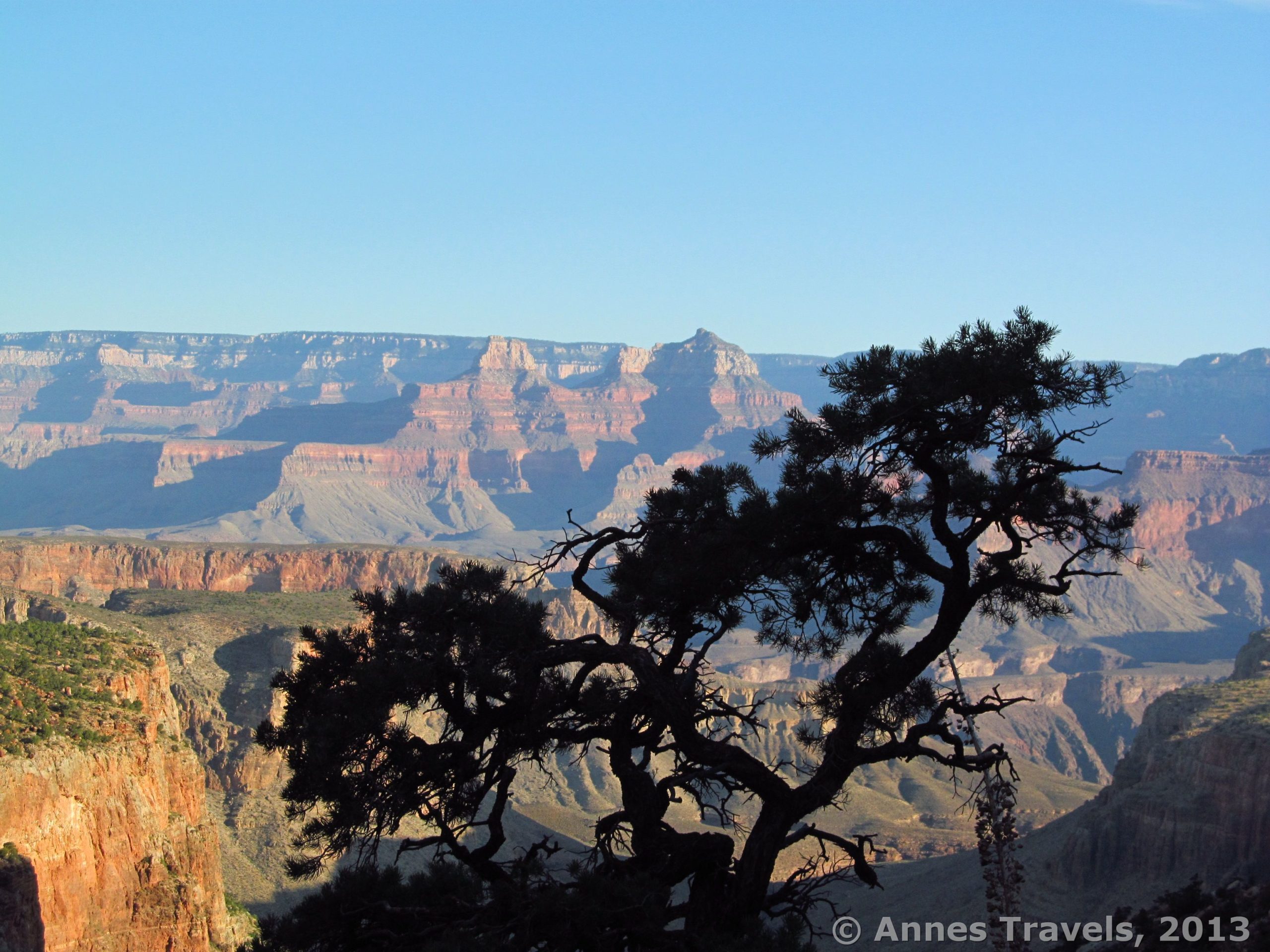
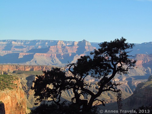
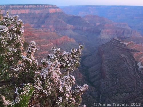
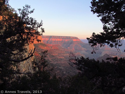
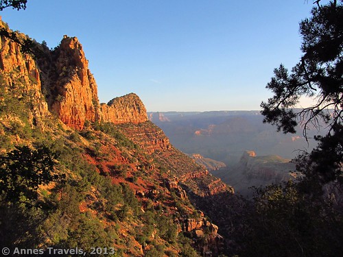
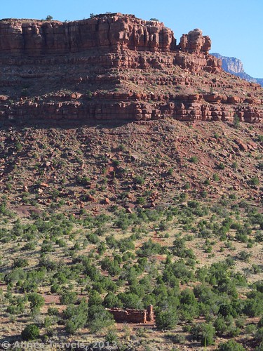
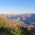
We arrived before sunrise, put up the curtains over the windows in the van (to cut the heat when we returned); then headed down the trail: 5:07am. It was light enough to see, but sunrise wasn’t scheduled for another 20 minutes yet. We descended the beginning switchbacks with a fair amount of speed, pausing as the sun rose over the canyon beyond to take pictures. By this point, we’d left the slippery rocks of the trail near the viewpoint behind and had entered a more wooded area – this would be great if it was hot and sunny, but as it was it only blocked the view.
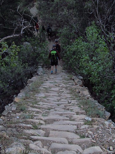
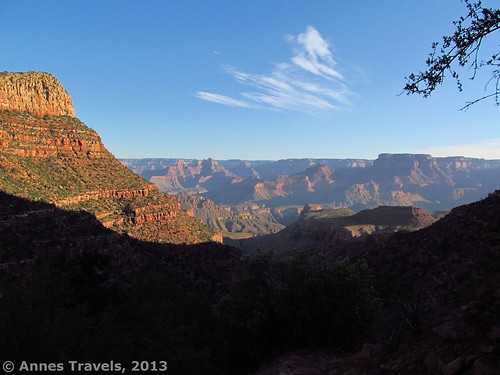
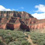
Just before Coconino Saddle (1.1 miles (1.7 km) from the trailhead), we ran across the “cobbles” I’d read so much about (and had been utterly unable to imagine). Long, thin rocks have been buried in the trail, creating a kind of large-cobbled “street” for hikers to walk down. This greatly aids with stopping erosion and keeps hikers from skidding up or down the trail. However, I also found I had to watch my feet due to the unevenness of the cobbles. That was alright, though, because there really aren’t many views during the first mile (2 km) of the Grand View Trail. At Coconino Saddle, there are some views out through a riff in a cliff, but otherwise I didn’t find the saddle very interesting. Just below the saddle, however, I found the first good view I’d seen since almost the beginning of the trail. After this, the views continue to improve, although there are no really jaw-dropping views on the Grandview Trail. Ironic, isn’t it? The cobbles continue most of the way to Horseshoe Mesa.
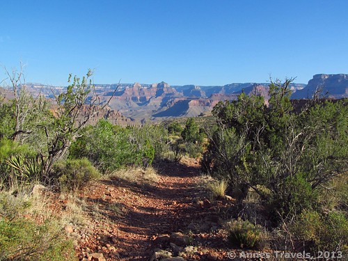
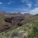
At 7am we called a halt at a nice enough view to eat a second breakfast. We spent 30 minutes or so enjoying the view, then continued the trail downward. There are more switchbacks after Coconino Saddle, but they are more irregular and often the trail is simply following the side of the ridge downwards toward Horseshoe Mesa. Eventually, the ridge will flatten out a bit and we found ourselves walking through scrubby Grand Canyon vegetation. Here we met the only two people we saw until mid-afternoon: a volunteer park ranger patrolling the trail and a very nice couple who were coming back from a week-long backpacking trip along the Tonto Trail from the South Kaibab Trail. We chatted a few minutes with each before continuing down the Grandview Trail.
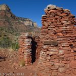
Just after 10:30am we came to a rather difficult-to-read sign and a trail leading off to the right. Whatever the sign said, I was sure we didn’t want it, so we continued straight. It turned out later that the sign pointed toward Page Spring (also known as Miner’s Spring). However, the sign looked more like “Pace Spring” or something like that. Also in this area are some old mines; signs warn visitors to stay back because of the danger of radiation. We stayed well away on our hike down the trail, but on our way back two members of the group accidently followed a social trail straight through the area…sigh.
Not much further beyond the Page Spring Junction, and 3 miles (4.8 km) from the Grandview Trailhead, we came to the Cottonwood Creek Trail Junction. Those wanting to walk all the way around Horseshoe Mesa would turn left here. However, if they want to see some old mine buildings or use a (very primitive) toilet, they can keep going straight for another few hundred feet (100 m) or so out onto Horseshoe Mesa. I’ll talk more about these mine buildings, toilet, and the awesome views beyond in my next post!
Key GPS Coordinates for Grandview Trail
Grandview Trail beginning: 35. 99846N / 111.98764W (5:07am)
Grandview/Trail to Page Spring Junction: 36.01831N / 111.97578W (7:35am)
Grandview Trail/Cottonwood Creek Trail Junction: 36.02014N / 111.97576W (7:40am)
Cabin on Horseshoe Mesa: 36.02033N / 111. 97594 (7:45am)
The gpx file for the Horseshoe Mesa Loop can be downloaded.
Download GPS File File size: 382.1 KB Downloaded 914 times
(Note: I do my best to ensure that all downloads, the webpage, etc. are virus-free and accurate; however, I cannot be held responsible for any damage that might result, including but not limited to loss of data, damages to hardware, harm to users, from use of files, information, etc. from this website. Thanks!)
Getting to the Grandview Trail
From the west end of the Rim Drive (just south of the Grand Canyon Visitor Center), drive 8.7 miles (14 km) to the Grandview Point Road, on your left. Turn down this road; drive to its end and park as best as you can. This parking lot fills up quickly during the day and you are expected to park in a legal parking space. Overnight hikers are supposed to park on the far side of the loop at the end of the road, but dayhikers and sightseers also use this parking area.
Note: If you’re into “free-range” camping in the National Forests, there is a dirt road that leads into the national forest 2 miles (3.2 km) east of the turnoff for Grandview Point. A dumpster and picnic table are located at the beginning of the road along with a “No Camping” sign. Continue down the road about 0.5 miles (0.8 km) to a signboard; any sites beyond this can be used. If you don’t understand the rules of camping in a national forest, or don’t respect them, please use a designated campground in Grand Canyon National Park.
Round Trip Trail Length: 6 miles (9.6 km) to/back from the Last Chance Mine on Horseshoe Mesa; 17.5 miles (28.2 km) if you do the entire loop
Facilities: Primitive toilets at the trailhead (no water; make sure to fill up at the visitor center or Desert View before attempting a hike); extremely primitive toilets near the Last Chance Mine
Fees: $25 fee to enter Grand Canyon National Park, valid 7 days. America the Beautiful (Interagency), Senior (Golden Age), Access (Golden Access), Volunteer, Military, and Grand Canyon Annual Passes also accepted.
Trail 
![]()
![]()
Road
Signs ![]()
Scenery
Would I go 100 miles out of my way for this? ![]()
Overall Rating: ![]()
This Week’s Featured Product!
The book that inspired me to do this hike! “Hiking Grand Canyon National Park” Falcon Guide has one of the best maps of the loop I found (it finally made all the internet descriptions make sense). The guide details many different hikes for both dayhikers and backpackers (though the book is aimed at the latter). The length of the loop around Horseshoe Mesa is longer than the authors estimate, but otherwise it’s a great resource that I’ll be using again!

8 responses to “Horseshoe Mesa Loop, pt. 1: Grandview Trail”
[…] Canyon. There’s only one last segment to go: the trail that connects the Tonto Trail to the Grandview Trail near the Last Chance Mine on Horseshoe Mesa, sometimes known as the East Horseshoe Mesa Trail. […]
[…] the Tetons, and the Grand Canyon (though once this resulted in a 17-mile dayhike on the Horseshoe Mesa Loop Trail). So, we can often see what the backpackers see, but return to our vehicle at […]
[…] spring, I was preparing to hike the Grandview Trail in Grand Canyon. During my internet searching, I ran across a Grand Canyon sight I’d never […]
[…] Horseshoe Mesa Loop, Grand Canyon National Park, Arizona […]
[…] decided to hike out to Shoshone Point the day after we’d hiked the Horseshoe Mesa Loop. Needless to say, after a 17.5 mile (28.2 km) hike the day before, we were all pretty tired and […]
[…] Grandview Trail / Horseshoe Mesa Loop, Grand Canyon National Park, AZ […]
[…] Early morning along the Grandview Trail […]
[…] along the Grandview Trail, Grand Canyon, […]