

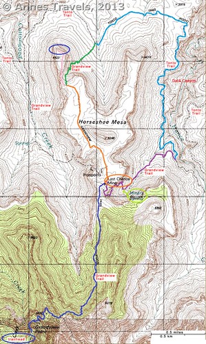
If you decide to hike the Grandview Trail in Grand Canyon National Park, the only way I can recommend it is if you go another couple miles (3+ km) out onto Horseshoe Mesa. This is where the “grand views” really take shape. The views are so spectacular, but also so different from what you’d see on the main trails down into the Grand Canyon (Kaibab, Bright Angel, etc.). In fact, taking the Grandview Trail out onto Horseshoe Mesa is a day hike I’d highly recommend to those in very good shape who can tackle a 10-mile (16 km) RT down-and-up hike, simply because the views are so good. It would also make a good shorter backpacking trip (there are several campsites on Horseshoe Mesa). In this post, I’ll take you from the junction of the Grandview Trail/Cottonwood Canyon Trail out to the end of the west arm of Horseshoe Mesa (the orange and pink sections of the trail map below).
(Affiliate links are present on this page.)
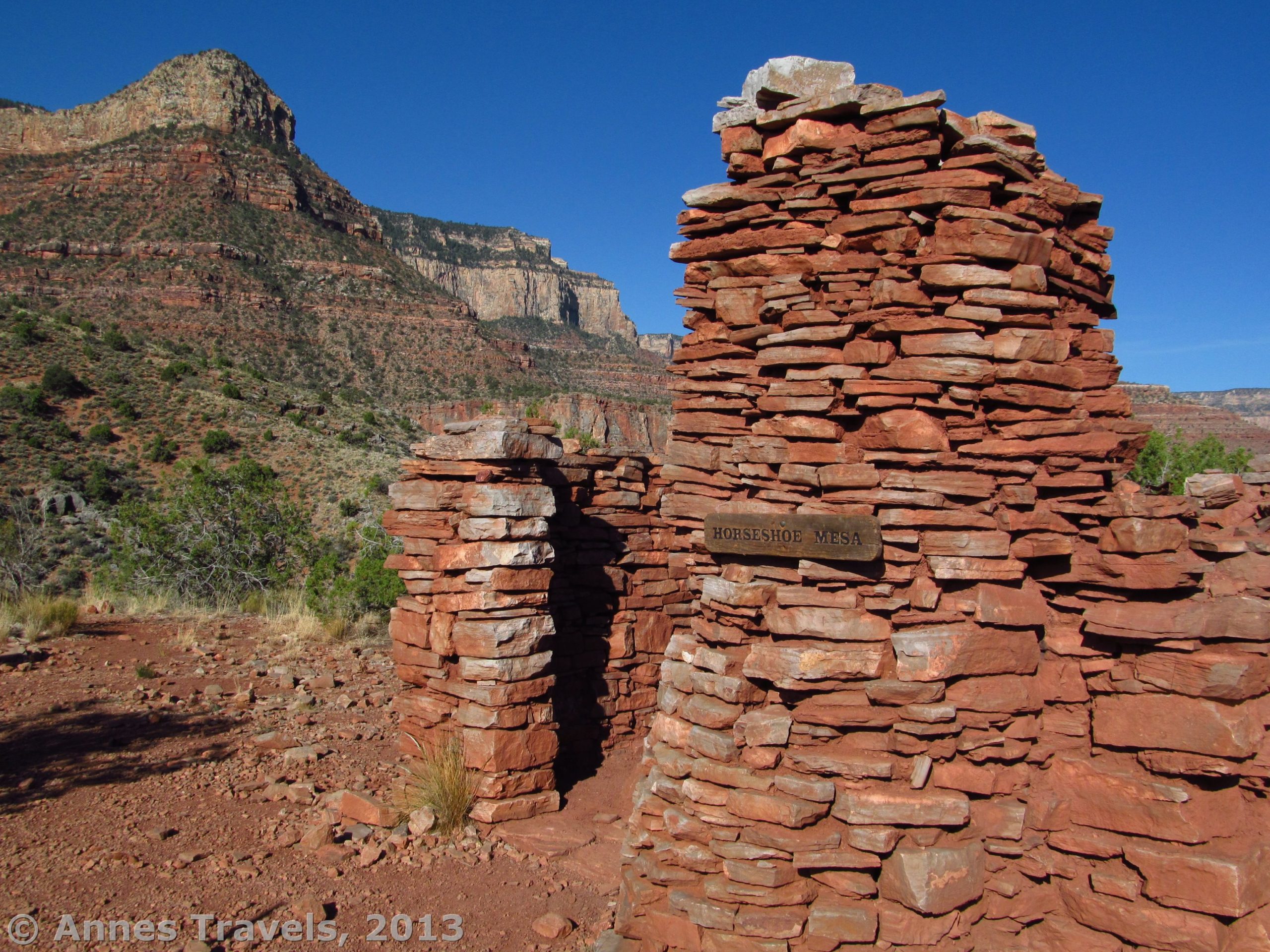
In my last post, I talked about hiking down the Grandview Trail. Within a hundred feet (30 km) or so of arriving at the Cottonwood Canyon Trail Junction (go straight here), we walked up a small incline and found ourselves standing next to an old stone building. This is one of the remains of the buildings that once stood next to the Last Chance Mine. The building was interesting enough; the chimney is still in place and several metal objects are lying around. The structure also offers some fun photo opportunities.
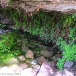
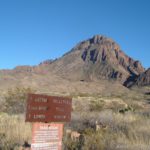
If you’re spending the night here, follow the trail across from the door of the stone building. A sign for toilets marks this junction. We used these; they are extremely primitive but a welcome reprieve from “private bushes”. The trail to the toilets is about 200 feet (60 m) long, but it is not difficult to follow so keep walking to the end of the trail (past all the campsites) and you’ll find them.
We sat in the shade of the building for a few minutes to slap on some sunscreen (now that it was nearly 8am, I guess we decided the sun was becoming hot enough to burn). Then we packed up again and headed out across the Mesa. (Note: the gpx file below follows my route; however, for some reason it stopped tracking during this section of the trail. The rest of the Horseshoe Mesa Loop should be intact.)
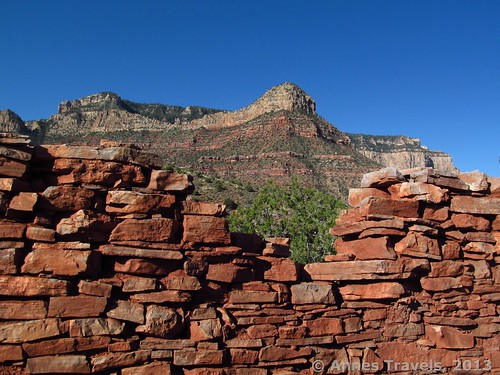
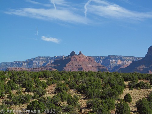
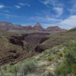
The trail is fairly flat as it winds its way across the mesa. From almost the first, the views begin to improve, especially the cliffs across Cottonwood Canyon (on the left). I was constantly behind the others in this section because I kept stopping to take pictures or to enjoy the view!

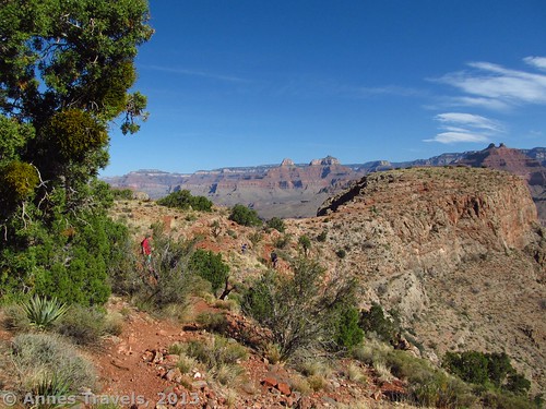
The trail became a bit more rolling toward the middle of the mesa; a few social trails go off, but we didn’t have much trouble finding the real trail. In general, you just want to keep heading toward the main canyon and slightly west (left). After about 2 miles (3.2 km), we came to a small, unmarked trail junction on the very edge of a side canyon. Go left; turning right will take you down 500 ft. in 1 mile (1.6 km) to the Tonto Trail. You are now on the pink section of the trail on the map. The trail hugs the side of the canyon for a hundred feet (30 m) or so, then makes a sharp right turn to cross a narrow bridge of rock to the west arm of Horseshoe Mesa. The views from here are amazing, but better is to come. Actually, the rock bridge reminds me of The Causeway in Colorado, except that the views are extremely different!
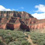
From the rock bridge, the trail runs near the cliff edge, hugging close to the side of the mesa arm. I tried not to look over the edge; it’s a very long way down! I also felt for another member of my group who doesn’t care much for heights. However, she’d gone ahead of me, so I guess she must have made it all right. We continued to walk as the trail made its way around the arm until we’d almost gone all the way around the end and had nearly started back toward the South Rim. Here the trail seems to end at a set of rocks. We found these great to sit on to enjoy the view and to eat lunch. It was only 9am, but since we were still living on EDT, it felt like noon to us!
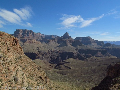
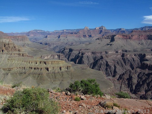
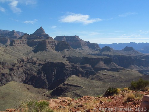
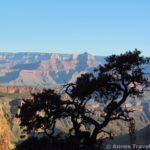
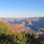
The views as we came around the arm got better and better, and finally culminated at the end of the trail. Oh, the views! I still dream about them! They’re so spectacular; so awe-inspiring I never know how to describe it. We were sitting on the edge of a cliff with the Grand Canyon only feet (a meter) away. Newberry Butte was right across the canyon; Krishna Shrine, Hawkins Butte, and Dunn Butte are also visible, along with other formations. The buttes and cliffs across Cottonwood Canyon are also spectacular. It’s a place I could just sit and look for a very long time. As I said above, the view is quite different than what I had seen on the South Kaibab Trail because this is a different section of the canyon.
If you’re doing this as a dayhike, I highly recommend that you turn around here and return to your vehicle the way you came for a 10-mile (16 km) RT hike. However, if you’re doing this as a backpacking trip and you have a couple more days, you can descend to the Tonto Trail and see some more great scenery – I’ll get more into that in my next post!
Key GPS Coordinates for Grandview Trail
Grandview Trail beginning: 35. 99846N / 111.98764W (5:07am)
Grandview/Trail to Page Spring Junction: 36.01831N / 111.97578W (7:35am)
Grandview Trail/Cottonwood Trail Junction: 36.02014N / 111.97576W (7:40am)
Cabin on Horseshoe Mesa: 36.02033N / 111. 97594 (7:45am)
Grandview Trail Junction with Path to Tonto Trail: 36.03136N / 111.98270W (8:40am)
End Grandview Trail and End Horseshoe Mesa (great views!): 36. 03569N / 111.98386W (8:50am)
The gpx file for the Horseshoe Mesa Loop can be downloaded.
Download GPS File File size: 382.1 KB Downloaded 943 times
(Note: I do my best to ensure that all downloads, the webpage, etc. are virus-free and accurate; however, I cannot be held responsible for any damage that might result, including but not limited to loss of data, damages to hardware, harm to users, from use of files, information, etc. from this website. Thanks!)
Getting to Horseshoe Mesa
From the west end of the Rim Drive (just south of the Grand Canyon Visitor Center), drive 8.7 miles (14 km) to the Grandview Point Road, on your left. Turn down this road; drive to its end and park as best as you can. This parking lot fills up quickly during the day and you are expected to park in a legal parking space. Overnight hikers are supposed to park on the far side of the loop at the end of the road, but dayhikers and sightseers also use this parking area. Hike down the Grandview Trail to Horseshoe Mesa (directions can be accessed here).
Round Trip Trail Length: 10 miles (16 km) from Grandview Point to the end of Horseshoe Mesa and back again; 17.5 miles (28.2 km) if you do the entire loop
Facilities: Primitive toilets at the trailhead (no water; make sure to fill up at the visitor center or Desert View before attempting a hike); extremely primitive toilets near the Last Chance Mine
Fees: $25 fee to enter Grand Canyon National Park, valid 7 days. America the Beautiful (Interagency), Senior (Golden Age), Access (Golden Access), Volunteer, Military, and Grand Canyon Annual Passes also accepted.
Trail 
![]()
![]()
Road
Signs ![]()
![]()
Scenery
Would I go 100 miles out of my way for this?
Overall Rating: ![]()
Note: If I could give this hike a 6 star rating for “Would I go 100 miles out of my way for this?”, I’d do so.
This Week’s Featured Product!
“Hiking Grand Canyon National Park” Falcon Guide is one of the best hiking guides I’ve found for Grand Canyon National Park. This isn’t because it details every trail available, but because it goes into great detail on several known and unknown trails on the south and north rims. Its maps are also fairly good – in it, I found one of the best maps of the Horseshoe Mesa Loop I’d seen to that date (it finally made all the internet descriptions make sense). The guide details many different hikes for both dayhikers and backpackers (though the book is aimed at the latter). The length of the loop around Horseshoe Mesa is longer than the authors estimate, but otherwise it’s a great resource that I’ll be using again!
9 responses to “Horseshoe Mesa Loop, pt. 2: Horseshoe Mesa”
[…] Not much further beyond the Page Spring Junction, and 3 miles (4.8 km) from the Grandview Trailhead, we came to the Cottonwood Creek Trail Junction. Those wanting to walk all the way around Horseshoe Mesa would turn left here. However, if they want to see some old mine buildings or use a (very primitive) toilet, they can keep going straight for another few hundred feet (100 m) or so out onto Horseshoe Mesa. I’ll talk more about these mine buildings, toilet, and the awesome views beyond in my next post! […]
[…] arm of the mesa. The views from the arm are spectacular (a few pictures are near the bottom of this post), so I highly recommend walking out on the arm and then returning to the trail […]
[…] one last segment to go: the trail that connects the Tonto Trail to the Grandview Trail near the Last Chance Mine on Horseshoe Mesa, sometimes known as the East Horseshoe Mesa Trail. Although the views from this trail aren’t as […]
[…] don’t mind getting up early (like, before 7am Eastern Time) for a trail or really good view like hiking Horseshoe Mesa in the Grand Canyon or Mt. Elbert in Colorado. At the Cloud Camp Campground on the side of Mt. Hood, though, I […]
[…] Horseshoe Mesa Trail. This isn’t an official trail; it’s more like a shortcut for those wishing to hike the Tonto Trail around only half of Horseshoe Mesa. However, the scenery is stunning, especially from the western arm at the end of the plateau, so who cares if the trail is a bit vague or eroded in places? 10 miles RT (access is via the Grandview Trail, then across Horseshoe Mesa) […]
[…] Horseshoe Mesa. Looking for a new-and-different view of the Grand Canyon? I can highly recommend the nearly deserted trail to the end of Horseshoe Mesa. The views here are quite different from the corridor trails like the South Kaibab and Bright Angel, but they’re still jaw-dropping of the canyon. 10 miles RT. […]
[…] Horseshoe Mesa, Grand Canyon National Park, Arizona. […]
[…] Trail / Horseshoe Mesa Loop, Grand Canyon National Park, […]
[…] Views from the end of Horseshoe Mesa […]