
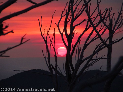
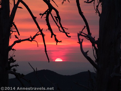
The sun rises though the dead trees around the Cloud Cap Inn for a stunning presentation
What’s worth getting up very early in the morning for? A sight worth seeing, I’d say. A sight that can only be seen early in the morning or that take so long to get to, you’ll have to get an early start. I usually don’t mind getting up early (like, before 7am Eastern Time) for a trail or really good view like hiking Horseshoe Mesa in the Grand Canyon or Mt. Elbert in Colorado. At the Cloud Camp Campground on the side of Mt. Hood, though, I didn’t expect to get up “early”. I knew we were heading home and so we’d probably get up as normal, have breakfast, and hit the road. So I was a little surprised when one of my group members woke everyone up with a simple statement: “If anyone wants to see the sunrise on Mt. Hood, now’s the time to do it.”
Quick Stats
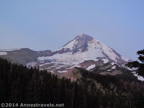
Mt. Hood in the predawn
The van literally came alive. Sleeping bags, blankets, and pillows went flying as several of us grabbed shoes, coats, and cameras, sometimes hopping on one foot in the parking area as we struggled to get the second sneaker on, before scrambling up the hillside (instead of taking the longer – but easier – route up the road and past the Cloud Cap Inn) to the top of the hill overlooking the parking area – and with a gorgeous view of Mt. Hood in the predawn.
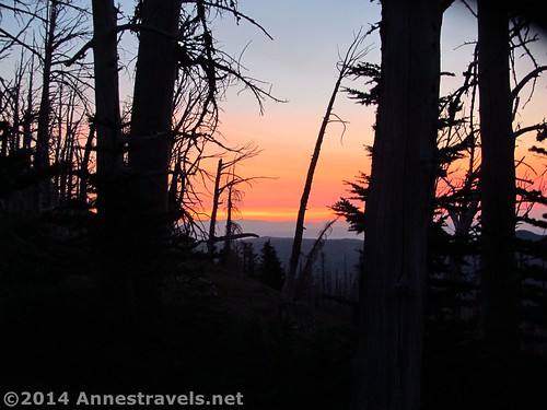
The sun’s glow as I climbed up the hillside
The sun hadn’t risen yet, so we crouched on rocks on the hilltop, chilly even in our sweatshirts, waiting…waiting…waiting.
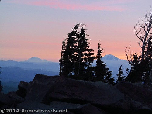
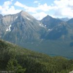
Early morning light on Mt. Rainier and Mt. Adams over a hazy Columbia River Gorge
Finally, a small ball of fire came over the eastern hills…and immediately disappeared behind some low-hanging clouds.
The sun climbs above the horizon
So much for early sun on Mt. Hood! But even so, the views to the east and north were so good, we really didn’t mind the fact that Hood wasn’t as good as it could have been. Here are some of the pictures we took that morning…enjoy!
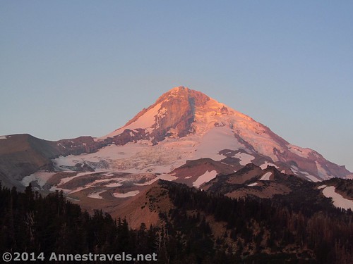
The best of Mt. Hood that morning. Usually it is pure gold.
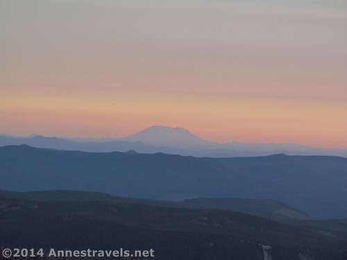
Mt. St. Helens
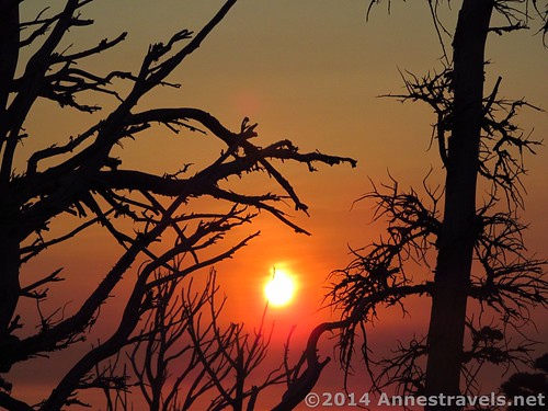
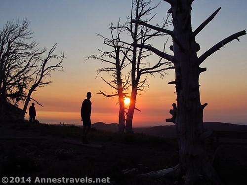
The sun though the dead trees
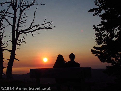
A companion and I enjoy the sunrise
Round Trip Trail Length: About 0.5 miles if you walk up the road and back
Facilities: Water spigot, pit toilet, campground ($10/night), picnic tables
Fees: $5/day, waived with the Northwest Forest Service Pass, Interagency (America the Beautiful) Pass, Senior (Golden Age) Pass, and Access (Golden Access) Pass.
Trail 
![]()
Road ![]()
![]()
Signs ![]()
![]()
![]()
Scenery
Would I go 100 miles out of my way for this? ![]()
Overall Rating: 
![]()
Key GPS Coordinates
Cloud Cap Parking: 45.40240N / -121.65494W (45° 24′ 8.64″ / -121° 39′ 17.7834″) (5,743ft.)
Cloud Cap View (top of the hill): 45.40316N / -121.65514W (45° 24′ 11.3754″ / -121° 39′ 18.504″) (5,848ft.)
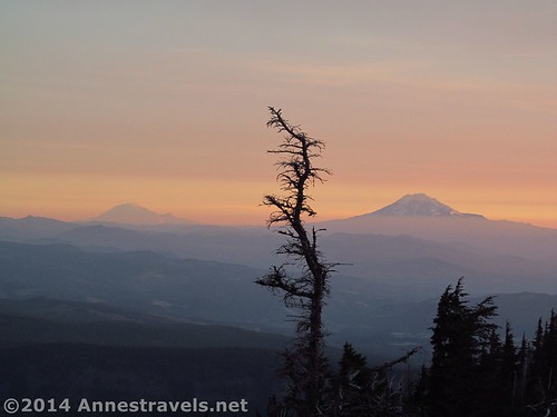
Mt. Rainier and Mt. Adams in the early morning light
Getting to the Trailhead
Take Highway 35 south of Hood River (or North from US-26 and Government Camp) and turn onto a road with a sign pointing towards the Cooper Spur Ski Resort. From here you will drive the road for 9 miles up to the Cloud Cap Trailhead (just below the historic Cloud Cap Inn, which is now closed to the public except when tours of the facility are given). The road is paved for the first 3 miles, and after that it’s a dirt road, although it would not be impassible for low clearance vehicles (as long as they took it carefully). Along the way, you will cross a total of 21 “waterbars”; gravel that has been put in drainages along the road. These require caution, as they could do a real number on a vehicle that was going too fast. After 18 of the waterbars, you will see a turn-off for Tilly Jane Canyon. Turn right here to go to the Cloud Cap Parking area, a mile or so later.
Some of my companions enjoy the sunrise
Zoom map out to browse nearby hikes & places of interest
This Week’s Featured Product!
Looking for more in the Portland area? This book covers the Columbia Gorge and Mt. St. Helens, as well as Mt. Hood and the surrounding area.


Pingback: Cooper Spur: Snow, Ice, and Rocks - Anne's Travels
Pingback: Isaiah 40 - Anne's Travels