
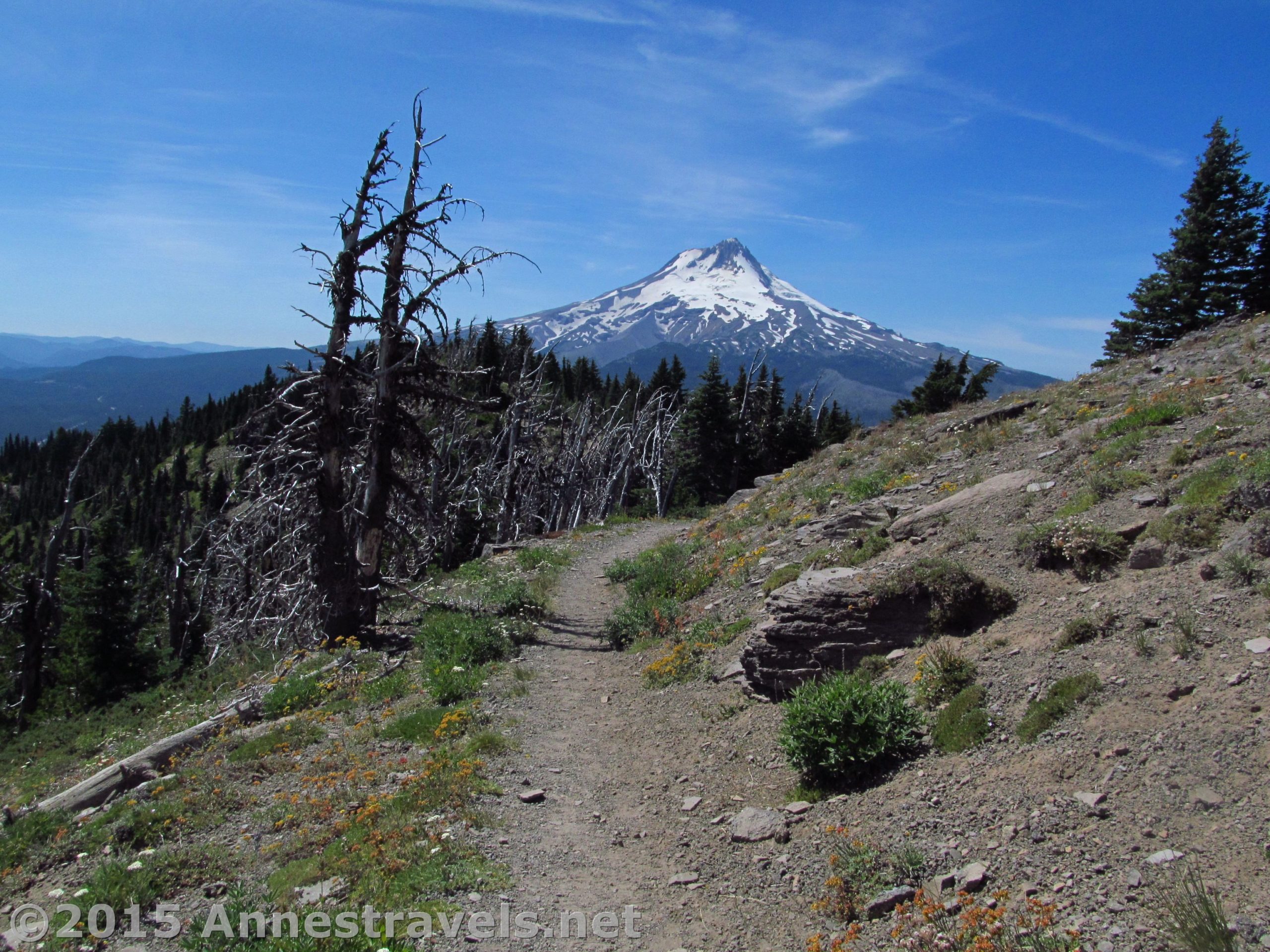
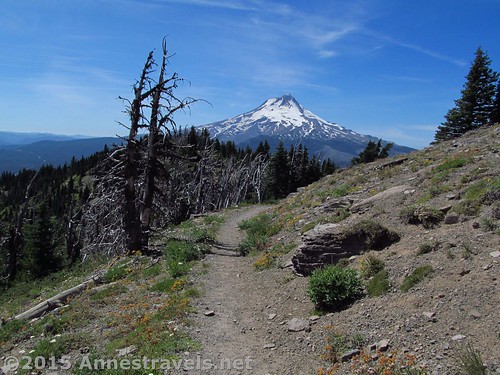
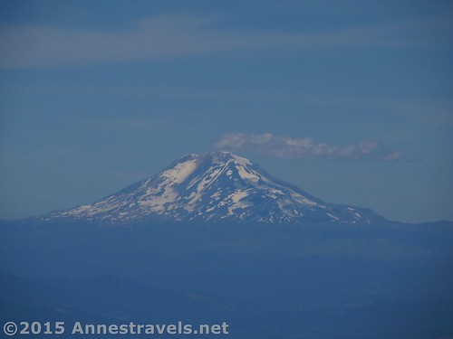
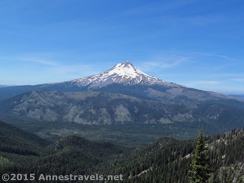
The views of Mt. Hood from Lookout Mountain are downright stunning. And I don’t say that lightly…it’s true! So often, it’s difficult to get far enough away from the unique mountains that you can actually enjoy their splendor. But here, on this high hill that once boasted a fire lookout, you get to see not only Mt. Hood, but the surrounding hills and lakes making for quite the worthwhile 3 mile hike!
Quick Stats
(Affiliate links are present on this page.)
I first found information about Lookout Mountain in 2010 when we were planning a trip to the greater Mt. Hood area. We didn’t end up hiking a quarter of the trails I’d found, so it wasn’t hard last summer, when we found ourselves with an extra half day, to pull out all that old information and say, “Well, let’s see, we need a short hike with good afternoon views not too far from Cooper Spur…” One way or another, Lookout Mountain found its way to the top of all those trail descriptions, pictures, and other data!
The road up is none too swift. One of my group, who hasn’t driven many dirt roads yet, had the joy of making the drive and promptly called it “Definitely the worst dirt road I’ve ever driven.” It’s not that it’s that horrible – it’s nothing compared to driving up to Mt. Rearguard – but it’s also not a stroll in the park. High clearance is probably required, and 4×4 might be necessary when it’s wet.
The trail (signed “High Prairie Trail #493”) begins across the road from the parking area. Almost immediately, a trail branches off on the right. We took this; the trail is a loop, so technically you could go either way. We figured we’d take the scenic trail (right) on the way up and then take the old fire road (straight) on the way down. It worked out great, so that’s the way I’d recommend it.

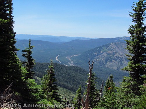
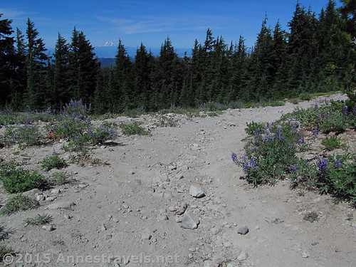
The trail works its way through meadows and stands of pine trees, then turns into the woods proper. There are a fair number of side trails, but it’s quite easy to stay on the main trail.
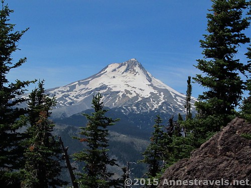
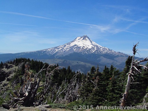
At 0.9 miles, a viewpoint opens up on the right. Enjoy the view here, or continue up the trail 0.1 miles to another viewpoint atop some volcanic rocks. Mt. Hood is directly across the valley in all its unique, shapely volcanicness. Wow! This is one of the best views on the entire hike of Mt. Hood, rivaled only by the views from the top of Lookout Mountain.
The trail continues upward for a short distance, then rounds the side of the hill. At 1.1 miles, the trail splits; you want to turn left at the marked junction (keep your eyes open, though, as the junction would be easy enough to miss if you aren’t looking for it). The trail from here looks almost like a social trail, winding through a dead forest along the top of the ridge. However, just 0.3 miles later, the trail comes out on the old fire road. Turn right and hike another 0.1 miles to the top of Lookout Mountain!
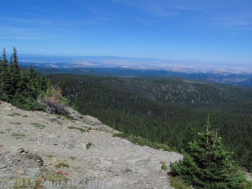
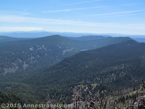
From the peak, the views are quite nice in all directions except toward Mt. Hood. For the best views of this closest mountain, continue over the top and slightly down so as to see around the stand of trees or two that would like to block the best of the views where the old fire tower once stood.
Enjoy the view and then return the way you came. Or, follow the fire road back to the trailhead (it’s not hard at all to follow and has a more-or-less smoother surface where gullies haven’t washed out the middle of the road – the edges tend to be just fine).

We arrived back at the parking in just enough time to pack up and drive to our next hiking expedition basecamp (post coming soon!) before dark…in fact early enough to eat supper, too!
Round Trip Trail Length: 3 miles
Lowest Elevation (Trailhead): 5,913ft.
Highest Elevation (Lookout Mountain Peak): 6,499ft.
Net Elevation Change: 586ft.
Facilities: Primitive restroom at the trailhead (bring your own TP)
Fees: $5/day. Alternatively, America the Beautiful (Interagency), Senior (Golden Age), Access (Golden Access), Volunteer, Military, and Northwest Forest Service Annual Passes can be displayed. Discovery Passes not accepted!
Trail 
![]()
![]()
Road ![]()
![]()
Signs ![]()
Scenery
Would I go 100 miles out of my way for this? ![]()
Overall Rating: ![]()
Key GPS Coordinates for Lookout Mountain
Lookout Mountain Parking: 45.35243N / -121.53131W (45° 21′ 8.7474″ / -121° 31′ 52.716″) (5,913ft.)
Trail beginning: 45.35202N / -121.53115W (45° 21′ 7.272″ / -121° 31′ 52.1394″) (5,923ft.) (ended 3.0)
Trail / Road Junction: 45.35189N / -121.53115W (45° 21′ 6.8034″ / -121° 31′ 52.1394″) (5,931ft.) (10 ft.)
Mount Hood View #1: 45.34334N / -121.53085W (45° 20′ 36.0234″ / -121° 31′ 51.06″) (6,247ft.) (0.9)
Mount Hood View #2: 45.34300N / -121.53101W (45° 20′ 34.8″ / -121° 31′ 51.6354″) (6,274ft.) (1.00)
Two trails junction: 45.34163N / -121.53001W (45° 20′ 29.868″ / -121° 31′ 48.036″) (6,364ft.) (1.1)
Junction with road: 45.34248N / -121.52580W (45° 20′ 32.928″ / -121° 31′ 32.88″) (6,411ft.) (1.4)
Mountain top (site of lookout): 45.34251N / -121.52422W (45° 20′ 33.0354″ / -121° 31′ 27.1914″) (6,499ft.) (1.5)
The gpx file for Lookout Mountain can be downloaded – please note that this and the GPS Coordinates are for reference only and should not be used as a sole resource when hiking this trail.
Download File size: 54.9 KB Downloaded 466 times
(Note: I do my best to ensure that all downloads, the webpage, etc. are virus-free and accurate; however, I cannot be held responsible for any damage that might result, including but not limited to loss of data, damages to hardware, harm to users, from use of files, information, etc. from this website. Thanks!)

Getting to the Lookout Mountain Trailhead
From Hood River, OR, drive south on OR-35 S for 25 miles. Turn left onto Brooks Mountain Road / NF 44 and drive 3.8 miles. Turn right onto Lookout Mountain Road (this is where the road begins to get worse) and drive just over 4.5 miles. Turn left; the parking area is a few hundred feet further, on left and below the level of the road.
Alternately, from Government Camp, OR, travel east on US-26 2.5 miles and merge onto OR 35 N. Drive 13.5 miles; then take a right onto Brooks Mountain Road / NF 44 and follow the directions (above) to the parking area.
Zoom map out to browse nearby hikes & places of interest

This Week’s Featured Product!
Haven’t had enough hiking yet? This book covers a wide variety of trails around Portland, OR, from Mt. Hood (including Lookout Mountain) and Mt. St. Helens to beach walks and the Columbia Gorge.


3 responses to “Lookout Mountain – Fabulous Views of Mt. Hood!”
[…] found out about Lookout Mountain on the Oregon Hikers’ […]
[…] Lookout Mountain Trail, Mt. Hood National Forest, Oregon. With spectacular views of Mt. Hood, and its short length, it’s a wonder more people don’t know about and hike this trail. Or maybe it’s because of the miles of winding dirt roads you have to take to get to it that turn people off? 3 miles with 586 ft. elevation gain. […]
[…] Lookout Mountain. Most people in the Pacific Northwest are likely familiar with Mt. Hood’s profile as seen from Portland. But by traveling to its other side and hiking up Lookout Mountain, the peak takes on new character. 3 miles RT. […]