Well, I just got back from a fantastic trip to California! We saw the desert, and we saw snow (lots of snow!), not to mention some truly fabulous views of mountains, cliffs, slot canyons, salt flats, and the beautiful NorCal coast. Below I’ll try to outline the trip and give you a taste of what we saw (not to mention a foretaste of what you’ll be seeing on the blog over the next year or so!)
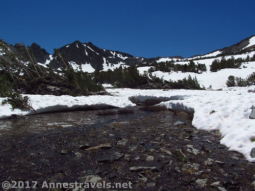
One of the benefits of traveling early in the season is that you get to see snow on the mountains. That sounds great, but get out on the trail, and the trail looks like this:
Or like this:
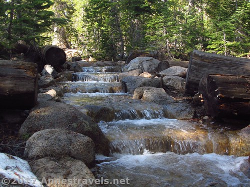
It got to the point where group members were joking that if they saw flowing water, it must be the trail!
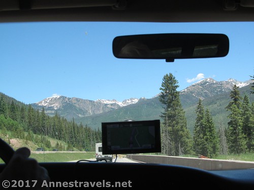
But the first part of the trip wasn’t snowy; in fact, it was over 100F most of the time. We started by crossing I-70 via The Pass over the Rockies from Denver and down through Glenwood Canyon.
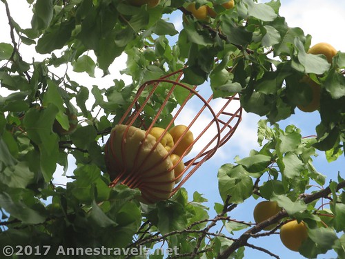
Later that afternoon, it was so much fun to stop in Capitol Reef where they had just begun picking apricots. How many years has it been since I’ve eaten an apricot, fresh and juicy, let alone right off of the tree?
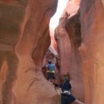
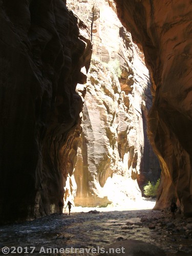
The reason we took the south route was because I’ve long wanted to hike the Zion Narrows. I know, I know, it’s one of those classic hikes everyone has done. About 20 years ago, we did go around the first bend, but with young children (7 to 3) and strong currents, it just wasn’t going to work. But this year, we braved 105F temps, crowds of tourists, and the slots… and it was amazing!
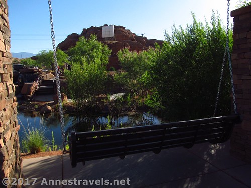
The next morning we stopped by Pioneer Park for breakfast, but found to our delighted surprise a new area of the park – the Red Hills Desert Garden – with about 5,000 water efficient plants, an aquarium, a waterfall, porch swings, and a real, honest-to-goodness fake slot canyon!
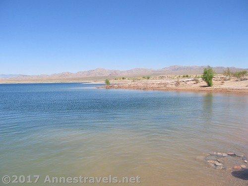
From there we stopped at Echo Bay on Lake Mead to take a little dip (I’ve always heard Nevada in the summer is hot, and they are right!) then drove in our wet bathing suits over to Death Valley (any cool is great!)
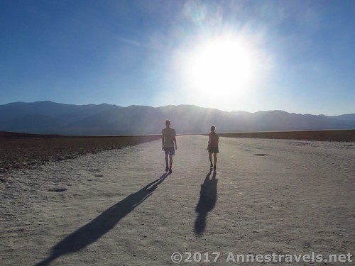
I know, it’s totally not a good idea to stop at Badwater in June. The air felt… not quite like an oven, but like every breath of wind was trying to roast us alive.
So then of course we had to stop by the visitor center to see what the temperature was.

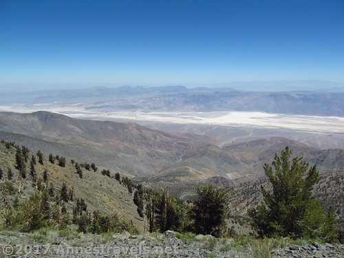
The whole reason we were in Death Valley was because we wanted to climb Telescope Peak, highest point in the park. So we slept at about 8,000ft. above sea level which was so much cooler than the valley! The next day we climbed the peak (along with nearby Rogers Peak and Bennett Peak), and while it’s a stiff hike, it wasn’t too bad, and the views were phenomenal!
Then it was off to our real destination: Yosemite! We began with a snowy hike up to the Virginia Lakes. Beautiful!
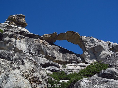
We took the freshly opened Tioga Pass Road into the park, with our first hike being to North Dome. Talk about a fascinating hike – first to the barely-known Indian Rock:
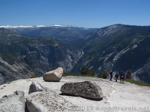
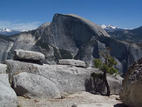
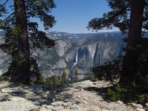
Then to North Dome, where you’re only 1.5 miles from Half Dome and there are also views of the Valley and Vernal Falls!
The next day we braved the more popular parts of the park, and it really takes some bravery. Sentinel Dome was outstanding, and not too crowded.
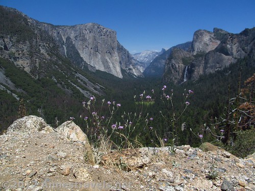
But the Valley was somewhere between a madhouse, a traffic jam, and a stampede. Never again if I can get away with it! Still, Artist Point (we came up the carriage road rather than down from Tunnel View) was nearly deserted.
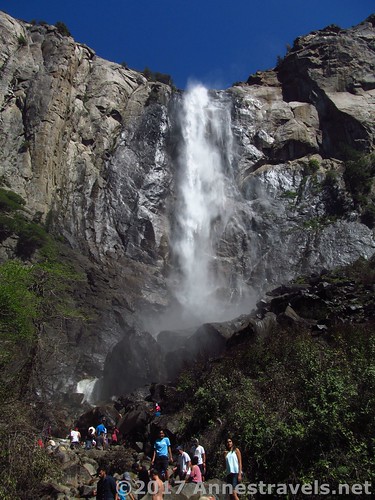
But Bridal Veil Falls was definitely not deserted.
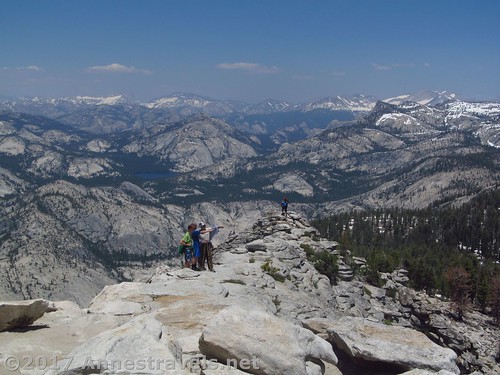
After that madhouse, we forewent any further explorations into the valley and opted for the waist-deep lake outlet crossing to get to the trail up Clouds Rest. It was snowy, it was steep, I got plenty of lovely waterfall pictures out of what was supposed to be the trail, but it was amazing. I’ve never seen a view like that!
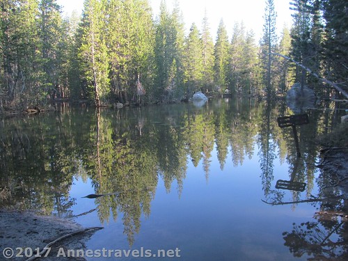
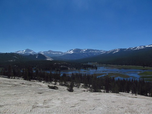
We figured we’d pretty much done the best that could be had in Yosemite after that hike, so we took in Pothole Dome over (a very flooded) Tuolumne Meadows on the way out of the park.
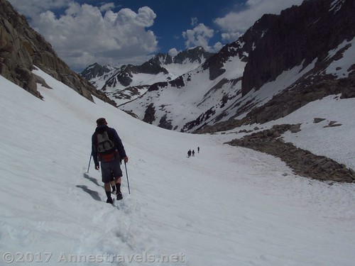
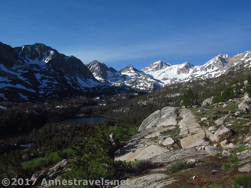
I had read about a Mono Pass south Yosemite; after the third blog said – of their own accord – that this was the most spectacular view they had seen in their life, I began to get suspicious. It was worth checking out. And all I can say is that while Mosquito Flats Trailhead is aptly named, the views are far and above worth the hike. Sure, the trail was so snowy we couldn’t find it, Ruby Lake was still iced over, and a thunderstorm forced us into the shelter of overhanging rocks while in the pass. But I wouldn’t have traded it. The lakes make it jaw-dropping, but the peaks are like the Andes, Sierras, and northern Canada / Alaska rolled into one. Spectacular doesn’t do it justice!
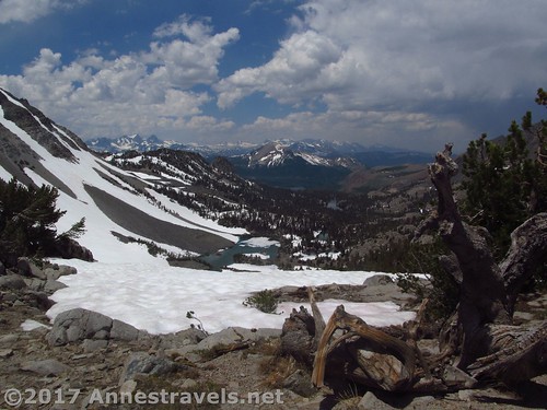
Unfortunately, the snow had closed some trailheads, namely, Minaret Summit, where I had hoped to hike San Joaquin Mountain. So we opted for Duck Pass, just west of Mammoth Lakes. Again, the trail was obscured by snow, but we made it to the pass and views expansively over the Sierras and out over the 222 acre skating rink usually known as Duck Lake.
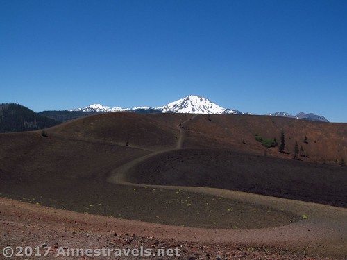
With closed trailheads, snowy trails, and waning weather, we figured heading somewhere else would be a good idea. So on our way up to Redding we stopped at Lassen National Park for an afternoon of hiking the cinder cone (more shapely than I remembered it)…
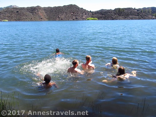
And swimming in nearby Butte Lake.
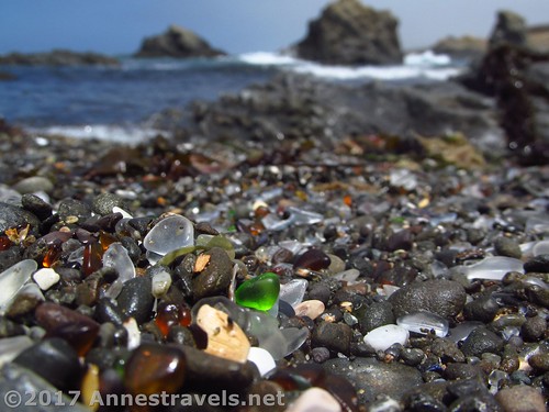
After Redding, it was time to head for the coast for the last leg of our trip. We started out in Fort Bragg at Glass Beach. I heard that the glass was receding, but really, it was still beautiful.
We also took a couple hikes along the headlands to the south…
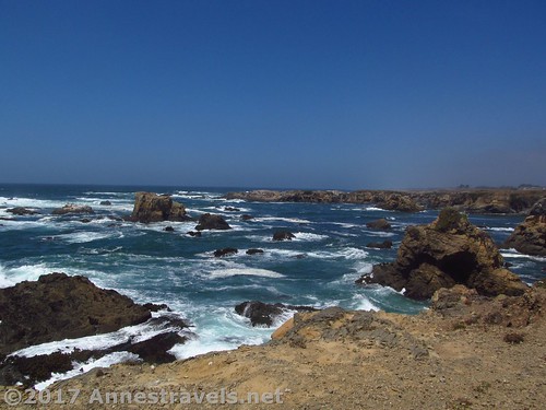
And to the north of the beach. Both are official trails, and both are beautiful!
We even stumbled into an old train / truck trestle (Wesley Chesbro Pudding Creek Trestle) that has been restored for hikers and bikers. Very cool!

The next day we took in little Manchester State Park for breakfast. It was fun to wander the dunes with the Point Arena Lighthouse not so far away.
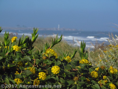
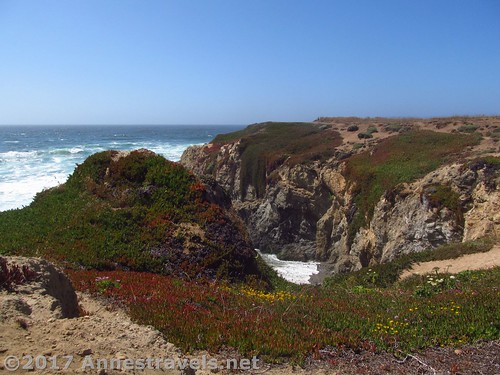
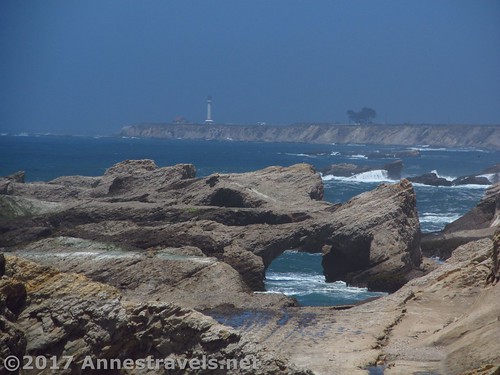
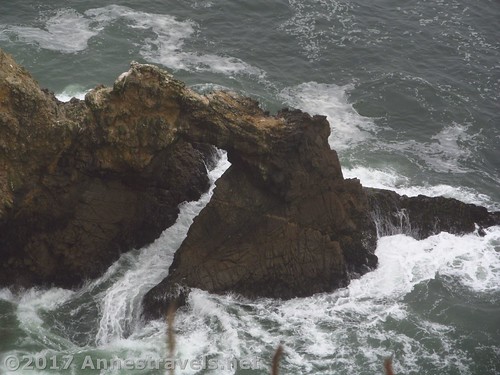
Our real destination that day was a very new national monument, Point Arena-Stornetta. All I can say is that I doubt there is a more beautiful section of the California coast. Grassy headlands, sea stacks, cliffs, a distant lighthouse, sea arches galore, pelicans, harbor seals, oh my, oh wow! (One of my group members later told me that when I posted about it on the blog, I shouldn’t say it was worth going 100 miles out of your way for; it was worth going 1,000 miles out your way to see!)
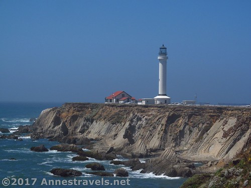
We also wanted to stop at the lighthouse, but you had to pay to even get onto the grounds, and because it was per person, and not covered by our park pass, that wasn’t going to happen. So we – and plenty of others – stopped right outside the gate to take in the lighthouse and nearby cliffs.
And supper at a little viewpoint with a trail to “Vista Point” was also fun.
The next day we were supposed to go down to Point Reyes for our final trip destination, but about five minutes into our morning drive, the serpentine belt on the van snapped. We wandered up US-1 to find cell service, then waited about 45 minutes for the tow truck. He could only take most of the passengers as far as the next town (complicated safety regulations that doesn’t allow for people stranded on a highway, but also doesn’t allow for passengers in a towed vehicle) but it “just happened” that the one greyhound bus through the town was running an hour late and “just happened” to pull in at the same moment we were being dropped off. So we all got down to Sebastopol and hung out in the local library for a couple hours until the van was ready to go. Then it was down to Point Reyes Lighthouse – closed that day, and so foggy you couldn’t even see the lighthouse from the viewing area! Still, I was happy to have done the lighthouse area, including a nearby viewpoint…

And also a viewpoint (not) overlooking Chimney Rock and the old lifesaving station. Very nice, even if it was so foggy. I hear that’s not all that uncommon.
Overall, it was an amazing trip, with so much variety. We did stop for a midnight swim at Hobo Pool on the trip home, which I highly recommend…
Zoom map out to browse nearby hikes & places of interest