
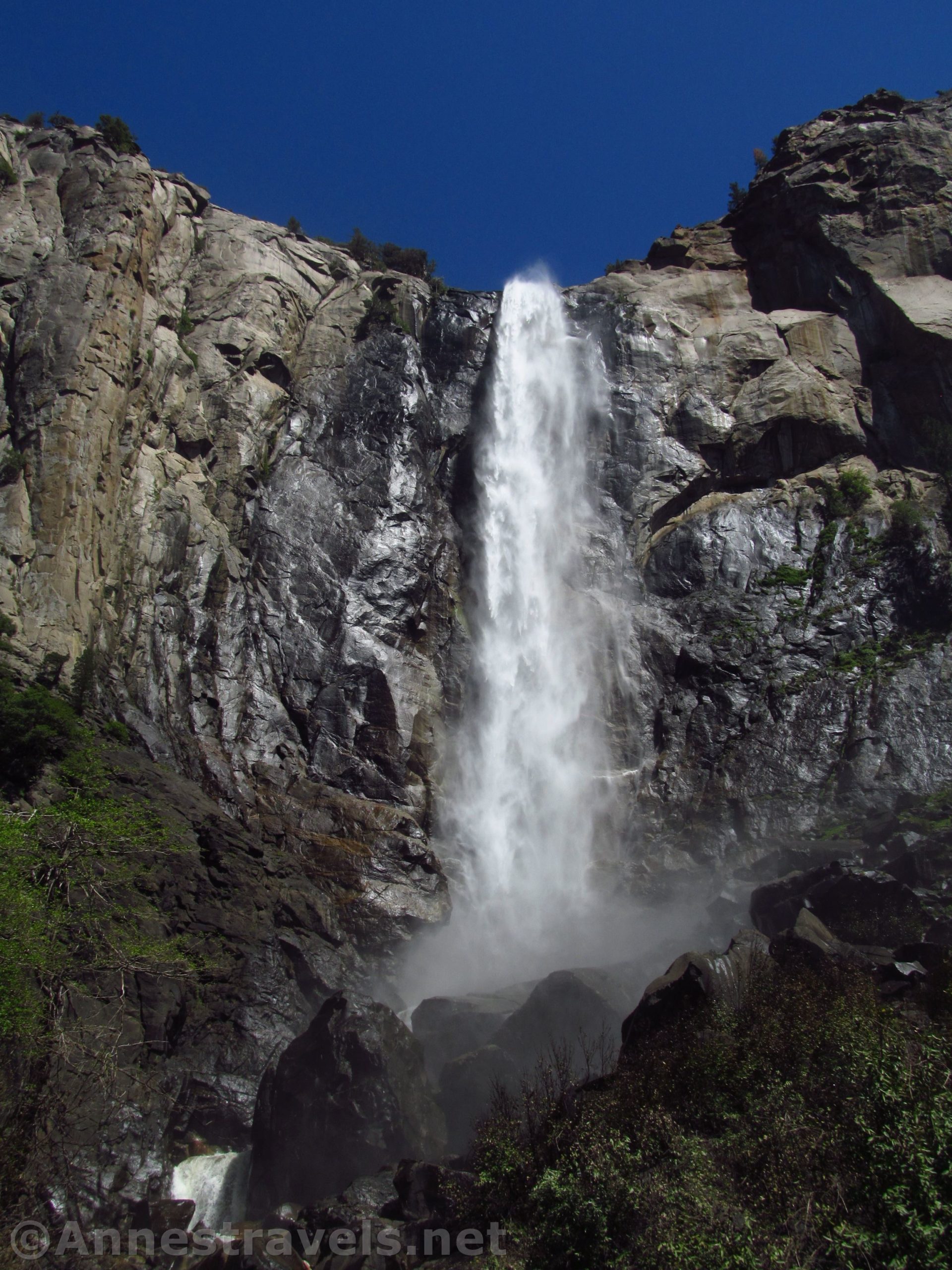

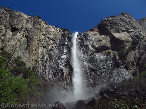
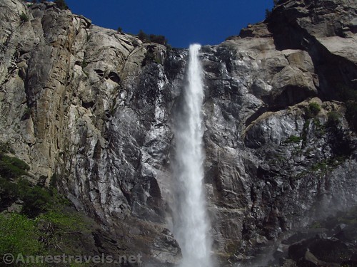
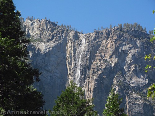
One of the great things about Bridal Veil Falls in Yosemite is that it flows all year (unlike Yosemite Falls, which turns into Yosemite Fell about the middle of July or early August). Another great thing about Bridal Veil Falls is that it’s very beautiful from places like Tunnel View and Artist Point. If you want to get close to the falls, it’s not all that long a walk to its base – only 0.6 miles RT.
Quick Stats
But that’s also Bridal Veil Falls’ greatest downfall: it’s too close to the trailhead, too close to the valley, and there is no shuttle service. This means that in the summer there is no parking to be had, and the place is literally crawling with people. I don’t mind that they want to see the falls, just like I do, but it’s best avoided during the summer months unless you visit very early in the morning (though the falls will be shadow until closer to afternoon).

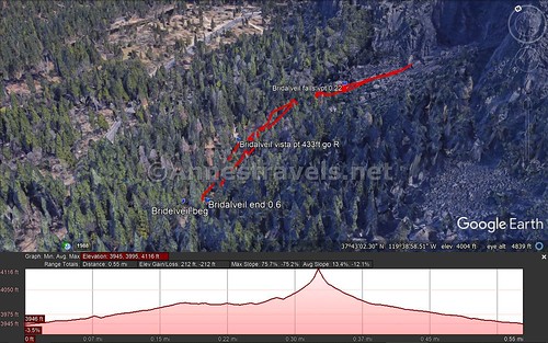
The paved trail leaves the parking area, then turns right about 450ft. down the trail. Note that no sign actually points to the falls. The one sign at the trail junction indicates the direction of “Vista Point”. Helpful, right?
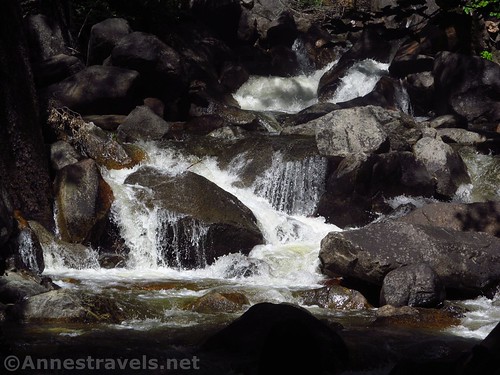
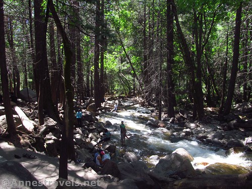
From here, it’s about 0.2 miles to the falls viewpoint, the slightly narrower paved path winding its way along the river. The river rages in the spring, but by summer it’s a fairly nice creek, and many family let the children wade in it, despite signs to the contrary.
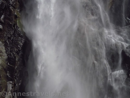
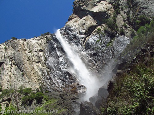
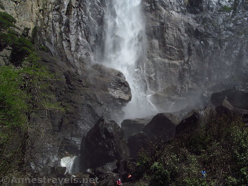
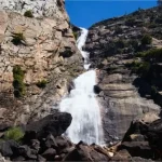
The viewpoint is a small concrete platform. In spring, this place is a soaker with the mist (“veil”) from Bridal Veil Falls falling on the viewpoint and hikers alike – even the hikers quite a ways from the falls. By fall, the viewpoint is probably dry – depending on what the wind is up to!
Despite the signs telling hikers not to go beyond the viewpoint, plenty of people do, risking their necks on the slippery rocks below the falls. I can’t say I haven’t done it, myself, but I didn’t this time; mostly I just tried to get photos of the falls without too many crowds in them. It takes creative photography in these situations!
Overall, it’s a quick little hike to a beautiful falls. Just be prepared to spend the hike and viewpoint with a few hundred others in the summer!
Round Trip Trail Length: About 0.6 miles (out & back)
Net Elevation Change: About 70ft. (3,973ft. at the trailhead to 4,043ft. at the viewpoint below the falls)
Facilities: Restrooms at the trailhead, but they can be extremely busy (like, the line goes across the road and cars can’t get through kind of busy)
Fees: $35/vehicle, valid 7 days. Yosemite Annual and National Parks & Federal Recreational Lands Passes accepted.
Trail Notes: The sun is on the falls in the afternoon, but if you visit in the summer, you might as well plan on spending an hour or more to get a parking space, then share the falls with a few hundred others. Well, maybe only one hundred and one. You get the idea. Otherwise, it’s a great little walk with a pretty falls at the end.
Trail 
![]()
Road ![]()
Signs ![]()
![]()
Scenery ![]()
![]()
Would I go 100 miles out of my way for this? ![]()
![]()
Overall Rating: 
![]()
GPS Coordinates for Bridal Veil Falls
Parking area: 37.7165917°, -119.6519667° (37°42.99550′, -119°39.11800′ / 37°42’59.73″N, -119°39’7.08″W (3,988ft.)
Trailhead: 37.7168944°, -119.6509972° (37°43.01367′, -119°39.05983′ / 37°43’0.82″N, -119°39’3.59″W) (3,973ft.) (0.0; ended 0.6)
Vista Point Junction: 37.7174083°, -119.6499972° (37°43.04450′, -119°38.99983′ / 37°43’2.67″N, -119°38’59.99″W (3,985ft.) (433ft.)
Fall Viewpoint: 37.7176222°, -119.6482111° (37°43.05733′, -119°38.89267′ / 37°43’3.44″N, -119°38’53.56″W (4,043ft.) (0.22)
The gpx file for Bridal Veil Falls can be downloaded – please note that this and the GPS Coordinates are for reference only and should not be used as a sole resource when hiking this trail.
Download GPX File size: 12.0 KB Downloaded 612 times
(Note: I do my best to ensure that all downloads, the webpage, etc. are virus-free and accurate; however, I cannot be held responsible for any damage that might result, including but not limited to loss of data, damages to hardware, harm to users, from use of files, information, etc. from this website. Thanks!)
Getting to Bridal Veil Falls
From the El Portal Road, take the Southside Drive almost 1 mile; turn right onto the Wawona Road, following signs for Wawona and Fresno. Park in the parking area for Bridal Veil Falls.
From Yosemite Valley, take the Northside Drive to its junction with the El Portal Road; turn right onto the Southside Drive (singed for Wawona and Fresno) and follow the directions above.
From Wawona, take the Wawona Road 21 miles to the trailhead.
Zoom map out to browse nearby hikes & places of interest
This Week’s Featured Product!
Looking for more easy hikes in Yosemite? Try this book filled with almost 25 hiking options across the park to views of giant trees, massive domes, iconic waterfalls, and more.
3 responses to “Yosemite’s Bridal Veil Falls in Midsummer”
[…] Bridal Veil Falls in Yosemite National Park, California […]
[…] Bridal Veil Falls was definitely not […]
[…] For an updated account of hiking this trail, with a map and GPS coordinates, visit this page. […]