

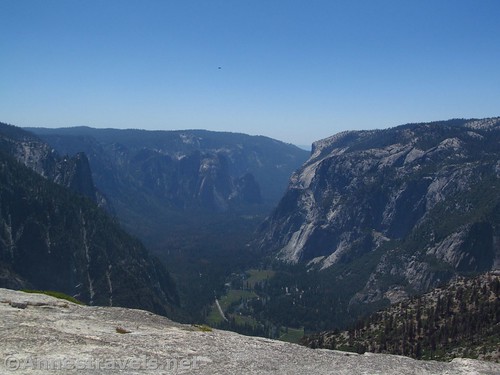
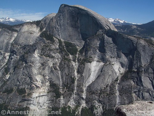
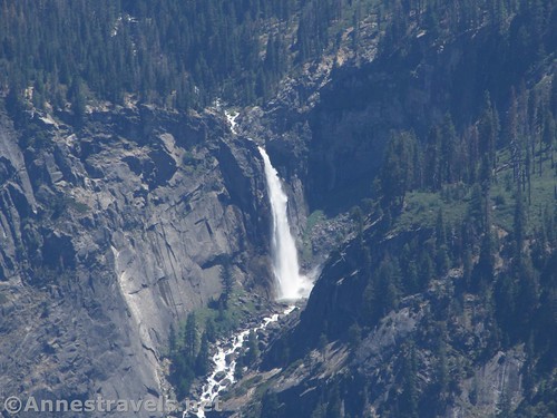
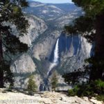
Last week I posted about hiking to Indian Rock, which happens to be Yosemite National Park’s “only” arch. Not so very much further down the trail (and it really is down!) is North Dome. It’s a great place to look down on the valley, not to mention one of the few places where you’re just about level with Half Dome, which is less than 1.5 miles away (as the crow flies). With the view of Vernal Falls and Clouds Rest, this is quite a spectacular view!
Quick Stats for the Trail to North Dome
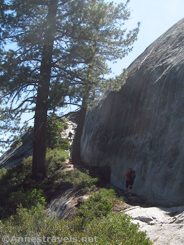
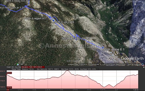
From the junction with the Indian Rock Trail, continue straight rather than turning toward Indian Rock (or if you’re coming down from the arch, turn left instead of right back toward the parking lot). The trail meanders, mostly flat, for 0.6 miles along the ridgeline; at this point it looks like the trail splits. Actually, the official trail goes left, while there is a very nice viewpoint out on the classic Yosemite curving rock to the right.
(Affiliate links are present on this page.)
Now you have a choice – well, you really should look at the view no matter what, but you have a choice on how you want to hike from here down to the next trail junction. First, you could take the official trail (about 0.25 miles longer, but you have a trail and are more in the forest).
Second, you could simply walk down the rock from the viewpoint (shorter, but totally exposed and with a better view). The choice is really up to you. I went down the trail and up the rock.
Whichever way you go, end up at a trail junction signed for Yosemite Valley 0.9 (0.7) miles later, in a lone stand of trees. Turn left to follow the trail sidewise across the rock and down a kind of crack in the rock and into a pine forest.
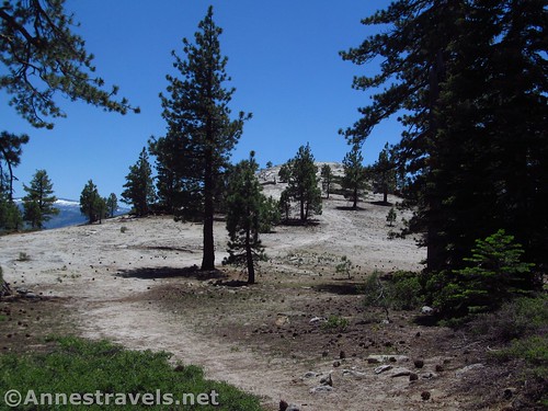
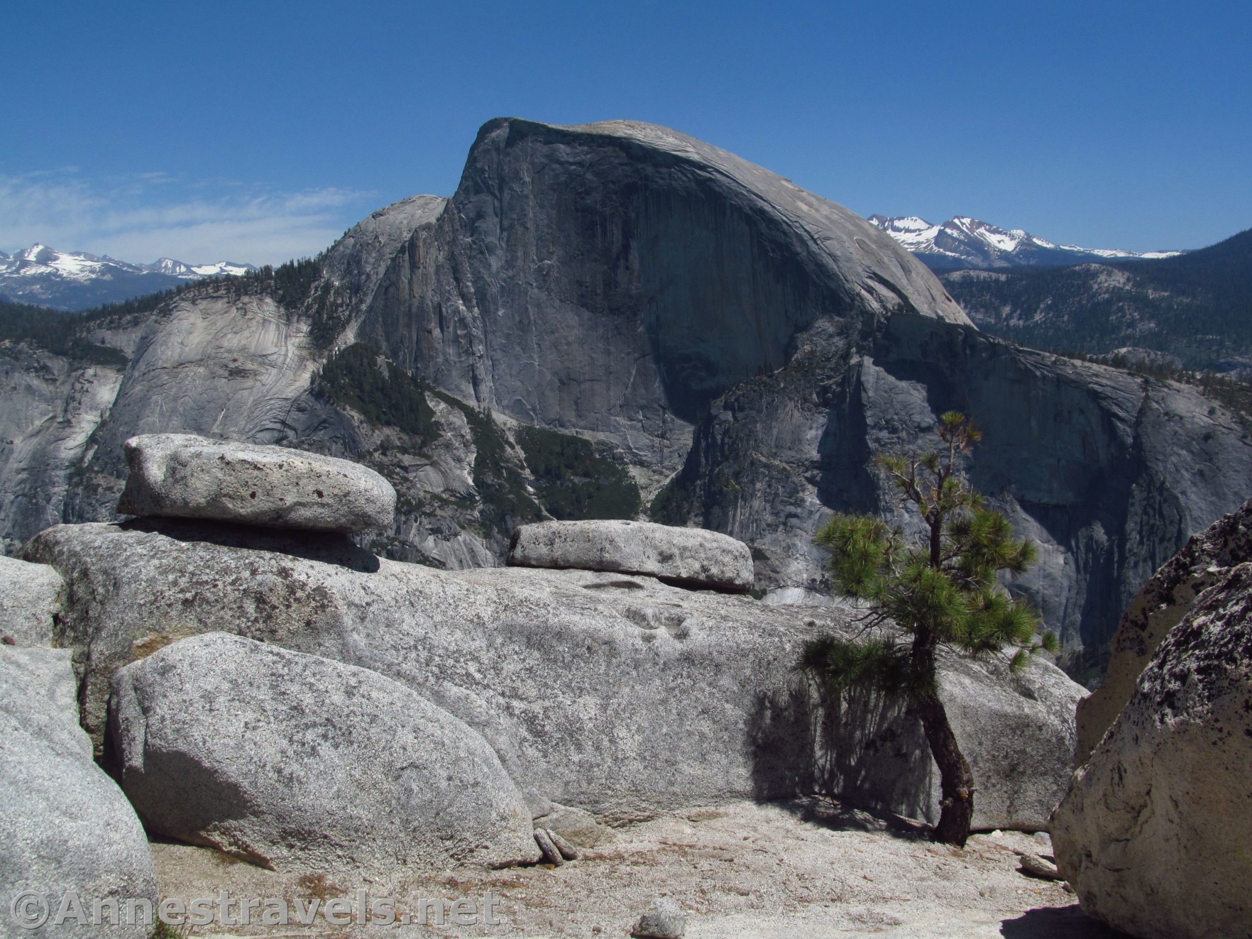
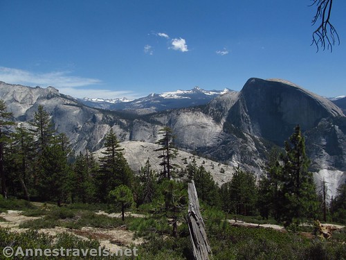
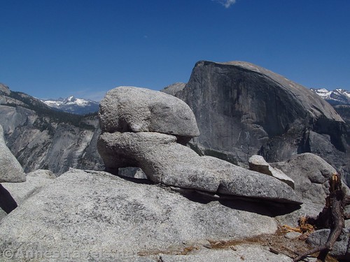
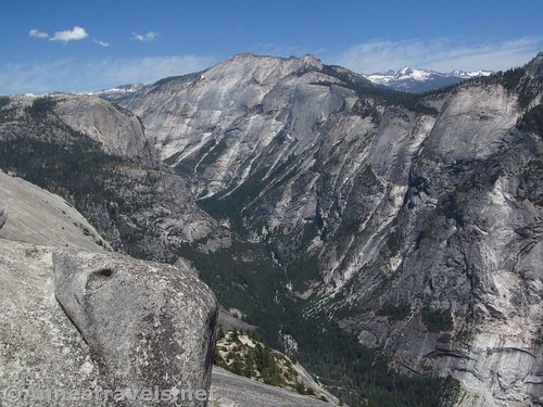
Except for slight rock scrambles, the next excitement comes about a half mile later, when the trail suddenly starts uphill. You’re now climbing North Dome Proper, and views of Half Dome open up on the left.
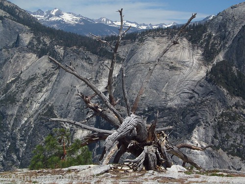
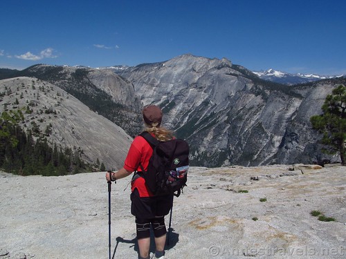
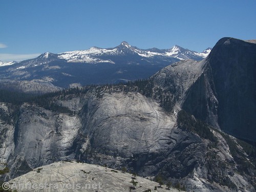
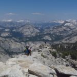
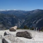
At about 2.1 miles from the Indian Rock Junction, arrive at the top of North Dome. Views from here are spectacular of Half Dome, Clouds Rest, and the Sierras. We wandered a bit further down the dome and discovered fantastic views toward Vernal Falls, Half Dome (even more!), and down into the valley. It’s the kind of view I can stare at for hours!
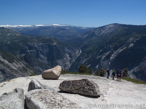
But we had to get back to the trailhead (ah, the problems with day hikes), so all too soon we ate a snack and headed back via the rock slope up to the viewpoint. I’d guess it was an easier hike up than via the trail, but it’s really up to you…

Round Trip Trail Length: 11 miles with Indian Rock, closer to 10.4 miles without the side trail to the arch
Net Elevation Gain: 581ft.
Facilities: Primitive restrooms at the trailhead
Fees: $30 per vehicle, valid 7 days. Yosemite Annual and America the Beautiful Interagency Passes (Annual, Access, Senior, Military, 4th Grader, Volunteer) also accepted.
Trail Notes: The trail is down, down, down, then up, up, up, then down, down, down. So while none of it is terribly steep, be ready for a calf-buster. Many people backpack to North Dome and vicinity.
Trail 
![]()
![]()
Road ![]()
Signs ![]()
Scenery
Would I go 100 miles out of my way for this?
Overall Rating: ![]()
Key GPS Coordinates for North Dome
Indian Rock Trail Junction: 37.7755778°, -119.5565000°W (37°46’32.08″N, -119°33’23.40″W / 37°46.53467’N, -119°33.39000’W) (8,108ft.) (3.31; return 3.97) (Left to Indian Rock)
Viewpoint #2: 37.7670389°, -119.5583917°W (37°46’1.34″N, -119°33’30.21″W (8,042ft.) (4.6)
Yosemite Valley Junction: 37.7670389°N, -119.5583917°W (37°45’41.10″N, -119°33’36.91″W / 37°46.02233’N, -119°33.50350’W) (7,637ft.) (5.5) (Go left)
North Dome: 37.7567972°N, -119.5599583°W (37°45’24.47″N, -119°33’35.85″W / 37°45.40783’N, -119°33.59750’W) (7,552ft.) (Arrived 6.1, left 6.4)
Regain Trail: 37.7682750°N, -119.5576583°W (37°46’5.79″N, -119°33’27.57″W / 37°46.09650’N, -119°33.45950’W) (8,006ft.) (7.7)
The gpx file for Indian Rock and North Dome can be downloaded – please note that this and the GPS Coordinates are for reference only and should not be used as a sole resource when hiking this trail.
Download GPX File size: 234.0 KB Downloaded 716 times
(Note: I do my best to ensure that all downloads, the webpage, etc. are virus-free and accurate; however, I cannot be held responsible for any damage that might result, including but not limited to loss of data, damages to hardware, harm to users, from use of files, information, etc. from this website. Thanks!)
Getting to the North Dome Trailhead
From Lee Vining (US-395 on the east side of the park), turn west onto the road into Yosemite, more technically known as the Tioga Pass Road. Signs should point toward Tioga Pass and Yosemite National Park. Drive 33.7 miles to the trailhead for Porcupine Creek, on left.
From the El Portal Road in the Valley or coming from El Portal, turn onto Big Flat Road toward CA-120 and Tioga Pass. After 9.5 miles, turn right in Crain Flat, following signs for Tuolumne Meadows and Tioga Pass. Drive 24.9 miles to the Porcupine Creek Trailhead, on right.
The parking area is none too large. I recommend getting their fairly early during the summer months (I think we pulled in about 8am on a Saturday of a holiday weekend, and there were still parking spaces, which there weren’t when we returned about 5pm).
Zoom map out to browse nearby hikes & places of interest
This Week’s Featured Product!
I used this book to plan my trip to Yosemite – as well as on the trail – and it covers a wide variety of trails, including Indian Rock and North Dome. It’s one of the best national park hiking guides I’ve run across.

2 responses to “Spectacular Views from North Dome”
[…] atop North Dome, Yosemite National Park, […]
[…] took the freshly opened Tioga Pass Road into the park, with our first hike being to North Dome. Talk about a fascinating hike – first to the barely-known Indian […]