

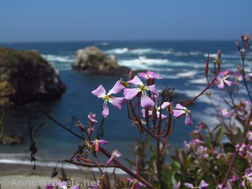
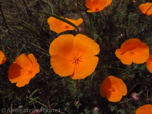
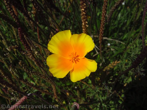
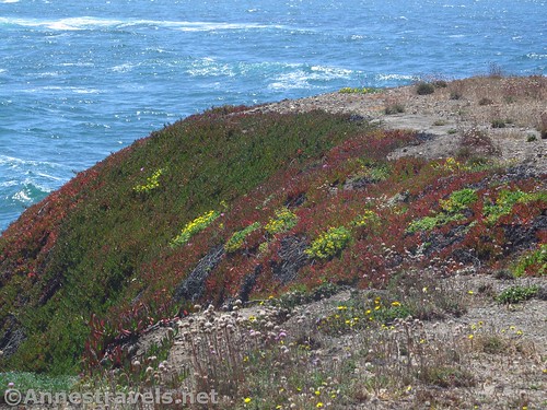
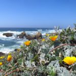
Two sections of trail currently strike off from Glass Beach in the town of Fort Bragg, California. After you’ve seen the glass on the beach, you might as well take the “Hard Trail” south along the top of the headlands (the second trail heads north in a more rustic environment). The trail was constructed in 2015 and is in excellent condition, paved, and with views to sea stacks, a sea arch or two, and over headlands, bays, and beaches. You might even see some California Poppies or other wildflowers along the way!
Quick Stats for Glass Beach Trail (South)
(Affiliate links are present on this page.)
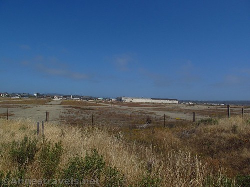
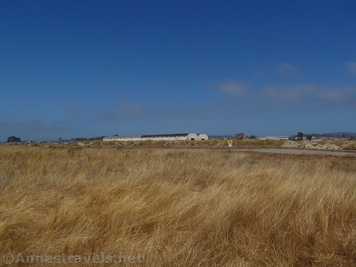
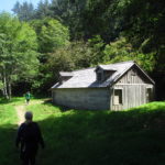
Also along the trail are views are of the old logging sheds and logging lots that once bustled with activity. Today, they’re empty, the concrete cracked and lined with weeds. But the decaying industry is pretty easy to ignore for most of the trail if it’s not your thing.
From the Glass Beach parking area, walk along the wide path (the path splits next to the parking area; take the left / wider of the two trails). A short distance down the path, a sign will indicate the “Easy” trail and the “Hard” trail. Turn left, following the signs for the “Hard” trail.
Now, if you actually follow the trails, going right is much harder than going left. But for now, comfort yourself with how easy this hard trail is to walk on.
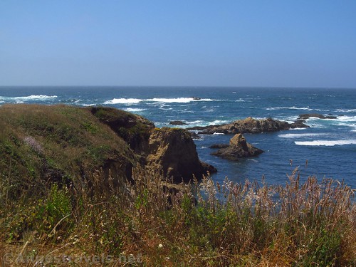
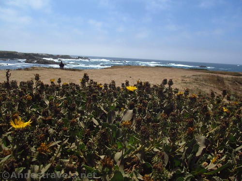
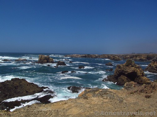
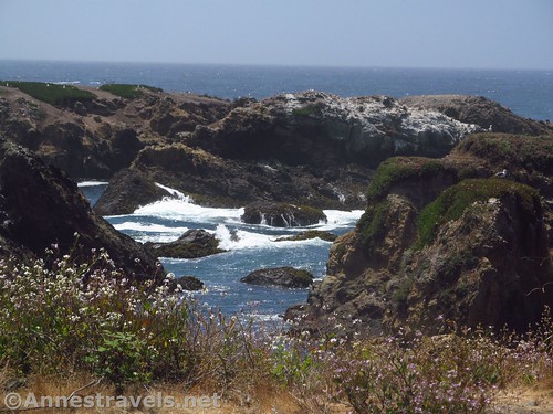
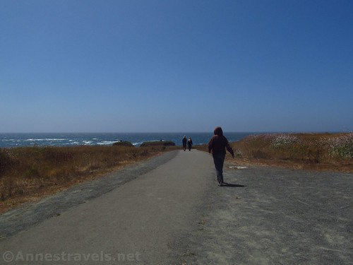
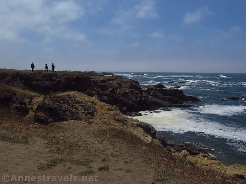
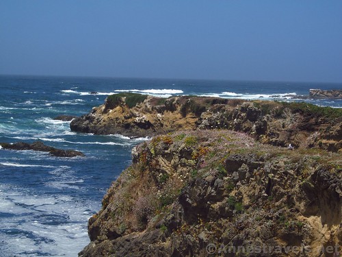
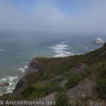
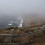
The paved trail wanders along the headland. Fences have been installed to keep you off the fragile headlands (ok, to keep visitors safe and help the wild grass, etc., grow back). The pity of this is that it’s hard to really get a good look at the ocean or the nearby sea stacks. A few small overlooks offer some views.
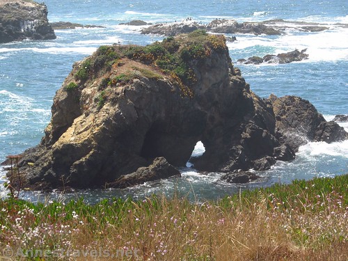
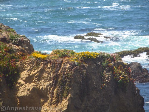
About a half mile from the parking area, a short loop offers some nice views over a couple sea arches. Quite nice!
Another 0.3 miles down the trail, a viewpoint strikes off to a tip of the headland. This is apparently the premier view along the trail.
About this point, the main trail turns left with the coastline. It’s not too long after this that the trail dead ends at a broken bench and a sign about the logging industry and how the trail was made. At some point, the trail will extend from here to Noyo Headlands State Park on the next large headland across Fort Bragg Landing.
Turn around to return to the parking area. Or follow the “Easy Trail” for a more rustic, more difficult, but so much more beautiful trek along coves and headlands north of Glass Beach. But that’s a post for another week!
Round Trip Trail Length: About 2 miles, not including Glass Beach
Net Elevation Change: 10ft. (36ft. to 26ft.)
Facilities: Restrooms in the parking area; picnic tables on the opposite end of the parking area; other facilities available in Fort Bragg
Fees: None
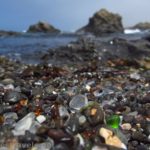
Trail Notes: Because of size constraints, no RVs are allowed in the parking area for Glass Beach. Do not collect or remove glass (obvious, but I have to say it). The wildflowers along the trail may be hard to spot, but they are beautiful!
Trail 
Road ![]()
Signs ![]()
![]()
Scenery ![]()
Would I go 100 miles out of my way for this? ![]()
Overall Rating: ![]()
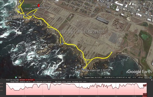
Key GPS Coordinates for the Coastal Trail South of Glass Beach
Trailhead: 39.4519306°N, -123.8109583°W (39°27’6.95″N, -123°48’39.45″W (39°27.11583’N, -123°48.65750’W) (22ft.) (0.0; ended 4.2 overall)
Easy vs. Difficult Trail Junction: 39.4518917°N, -123.8123583°W (39°27’6.81″N, -123°48’44.49″W / 39°27.11350’N, -123°48.74150’W) (34ft.) (0.6; returned 2.2)
Arch Viewpoint: 39.4476111°N, -123.8145083°W (39°26’51.40″N, -123°48’52.23″W / 39°26.85667’N, -123°48.87050’W) (36ft.) (1.02)
Main Viewpoint: 39.4450417°N, -123.8161167°W (39°26’42.15″N, -123°48’58.02″W / 39°26.70250’N, -123°48.96700’W) (26ft.) (1.32)
Trestle Beginning: 39.4580083°N, -123.8078528°W (39°27’28.83″N, -123°48’28.27″W / 39°27.48050’N, -123°48.47117’W) (43ft.) (3.1)
Trestle End: 39.4594694°N, -123.8072333°W (39°27’34.09″N, -123°48’26.04″W / 39°27.56817’N, -123°48.43400’W) (42ft.) (3.3)
The gpx file for Glass Beach and surrounding trails can be downloaded – please note that this and the GPS Coordinates are for reference only and should not be used as a sole resource when hiking this trail.
File size: 79.0 KB Downloaded 390 times
(Note: I do my best to ensure that all downloads, the webpage, etc. are virus-free and accurate; however, I cannot be held responsible for any damage that might result, including but not limited to loss of data, damages to hardware, harm to users, from use of files, information, etc. from this website. Thanks!)
Getting to the Coastal Trail South of Glass Beach
From the town of Fort Bragg, drive toward the north end of town on CA-1. Turn left on W Elm Street for 0.2 miles. Here the road will turn sharply to the right; turn left into the good-sized parking area for Glass Beach.
If you’re coming from the north, cross over Pudding Creek (the trestle will be very visible to the right before you get to the bridge over the creek), then turn right on W Elm Street and follow the directions (above) to the trailhead.
Zoom map out to browse nearby hikes & places of interest
This Week’s Featured Product!
For even more hikes in California’s state parks, check out this book!

2 responses to “The “Hard” Trail from Glass Beach”
[…] feeling pretty tired – and so we went back up on the bluff. There we did two other trails, one south along the blufftops, paved, known as the “Hard Trail”. The second looked almost like a social trail and rambled north along the top of the bluffs, […]
[…] We also took a couple hikes along the headlands to the south… […]