Back in 1999, on my first visit to the Pacific Northwest, we stopped in Redwood National Park. In general, I was a bit disappointed with the park overall, but one part of the park left a lasting impression on me. Along the coast we saw “The Farm that Wasn’t”, an old World War II era structure set to look like an innocent seaside farm. However, it was only a farm on the outside. Inside were all kinds of radar and power equipment; nearby were pits with anti-aircraft guns.
Quick Stats for the Klamath River Radar Station
So when I happened to be driving through Redwood on a trip last summer, I made sure we stopped by the “farm” again. It’s in quite a bit worse repair than I recall (17 years will do that in a coastal environment), but it’s still very much there and is worth a 10 minute stop if you’re driving US-101 (ok, 30 minute, because you’ll have to drive down to it and back up to US-101 via a decent dirt road).
There’s barely even a parking area for the site – park in the wide spot along the side of the road, near the signs. If you miss this, it’s not surprising, but you’ll have to go all the way around again, because the road is one way. Scramble down the steep but stable path from the roadway to the buildings below.
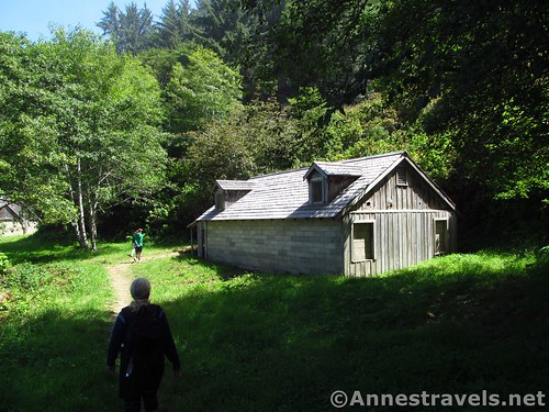
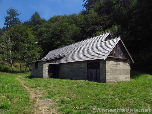
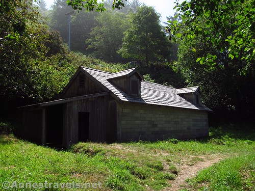
The first building – it looks like the farmhouse, complete with gable windows – was the power building, housing the equipment to power the radar station, which is in a building that looks like a barn a few feet to the north. You can walk around both buildings, but not inside them.
Also in the area once stood a wooden privy (I hear the rotted remains still exist, but I didn’t note it). Three anti-aircraft guns were also hidden in pits nearby. Unfortunately, no one is quite sure where the guns stood.
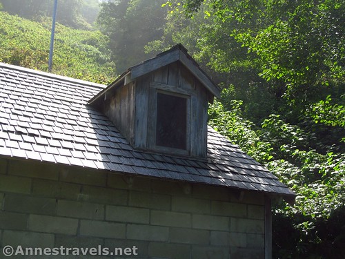
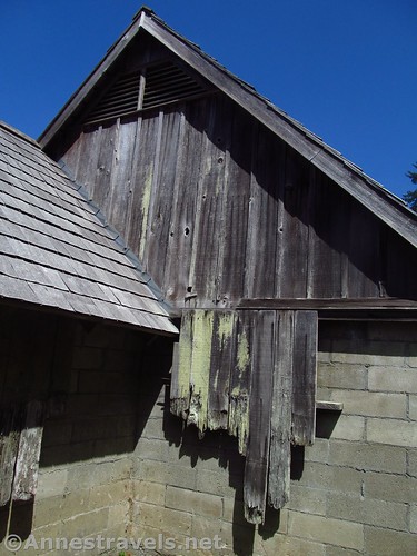
The walls of the concrete buildings were covered with wood, and the roofs were shingled (I would say the roofs have been reshingled, while the wood on the walls has been mostly left to time). Be sure to look up at the gables – they’re totally fake; you can see the shingles of the roof inside the windows!
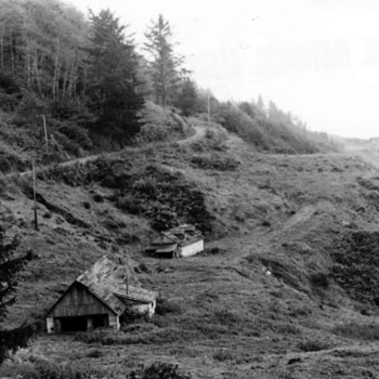
At the time it was in operation, this site was known as “Trinidad”, or the “Klamath River Radar Station”. It was the northernmost of such stations in California. At the time, the forest was cut down, so there was a clear view not only out to sea, but also up to the road above the “farm”. Today, it’s mostly wooded.
We wandered around for a few minutes, then went back up to the van. It doesn’t take long to see, but I find it a fascinating look into history.
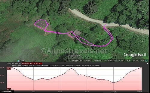
Round Trip Trail Length: About 0.2 miles
Net Elevation Gain / Loss: About 130ft.
Facilities: None
Fees: None
Trail Notes: You can’t go inside the structures. Please leave this site as you found it. Also, before you get to this site on the Coastal Drive, take the short but very steep road down to High Bluff Overlook for views of sea stacks and the coast. If you want to know more about the Klamath River Radar Station, check out https://www.nps.gov/places/redwoodradarstation.htm
Trail 


Road 


Signs 


Scenery 


Would I go 100 miles out of my way for this? 


Overall Rating: 


Key GPS Coordinates for the Klamath River Radar Station
Parking / Beginning: 41.52134N / -124.07853W (41° 31′ 16.8240″ / -124° 4′ 42.7080″) (328ft.) (ended 0.2)
The gpx file for the Klamath River Radar Station can be downloaded – please note that this and the GPS Coordinates are for reference only and should not be used as a sole resource when hiking this trail.
Download GPX File size: 6.9 KB Downloaded 171 times
(Note: I do my best to ensure that all downloads, the webpage, etc. are virus-free and accurate; however, I cannot be held responsible for any damage that might result, including but not limited to loss of data, damages to hardware, harm to users, from use of files, information, etc. from this website. Thanks!)
Getting to the Klamath River Radar Station
From Brookings, OR, drive south on US-101S 19 miles. Take the exit toward Klamath Beach Road and turn left 1.4 miles; turn left onto Coastal Drive (a sign will point out that Coastal Drive goes both directions; be sure to turn left as the road is one-way to get to the WWII Radar Station – the NPS’s official name for the Klamath River Radar Station). After 2.0 miles turn right (a sign will point toward High Bluff among other sites). A short distance later, continue straight / right when the road to the left descends to High Bluff Overlook. About 0.75 miles later, pull over into the wide spot in the road near the signs for the WWII Radar Station. Note that this road is unpaved and is not suitable for motor homes or trailers.
From the southern part of Redwood National Park (for example, the Lady Bird Johnson Grove), drive north on US-101 N 18 or 20 miles; take the exit for Klamath Beach Road, turn left, and follow the directions above to the parking area.
Zoom map out to browse nearby hikes & places of interest
This Week’s Featured Product!
Looking for even more trails in Redwood National Park? Check out this book with 64 hikes in the park and surrounding area.


That is pretty cool. I’ll definitely stop there next time we’re in the area. I’m a sucker for historical sites.
So am I, Kelly, as long as it’s not too gory 🙂 This kind – so remote, so unknown – is just about perfect!
Pingback: Sneak Peak: A Land of Volcanos and Oceans - Anne's Travels